Flying photos: Scenery 7 - Mt. Saint Helens
Home
Prev
Next
<info@primetab.com>
The first four photos on this page were taken in 2004 and are repeats from a previous
page. The next eight photos were taken a year later in 2005. The next four photos
were taken two years later in 2007Note the difference in the snow pack and the crater.
 |
 |
 |
 |
| Mt.St.Helens,WA,2004 | Mt.St.Helens,WA,2004 | Mt.St.Helens WA,2004 | Mt.St.Helens,WA,2004 |
 |
 |
 |
 |
| Mt.St.Helens,WA,2005 | Mt.St.Helens,WA,2005 | Mt.St.Helens WA,2005 | Mt.St.Helens,WA,2005 |
 |
 |
 |
 |
| Mt.St.Helens,WA,2005 | Mt.St.Helens,WA,2005 | Mt.St.Helens WA,2005 | Mt.St.Helens,WA,2005 |
 |
 |
 |
 |
| Mt.St.Helens,WA,2007 | Mt.St.Helens,WA,2007 | Mt.St.Helens WA,2007 | Mt.St.Helens,WA,2007 |
 |
 |
 |
 |
| Mt.St.Helens,WA,2014 | Mt.St.Helens,WA,2014 | Mt.St.Helens WA,2014 | Mt.St.Helens,WA,2014 |
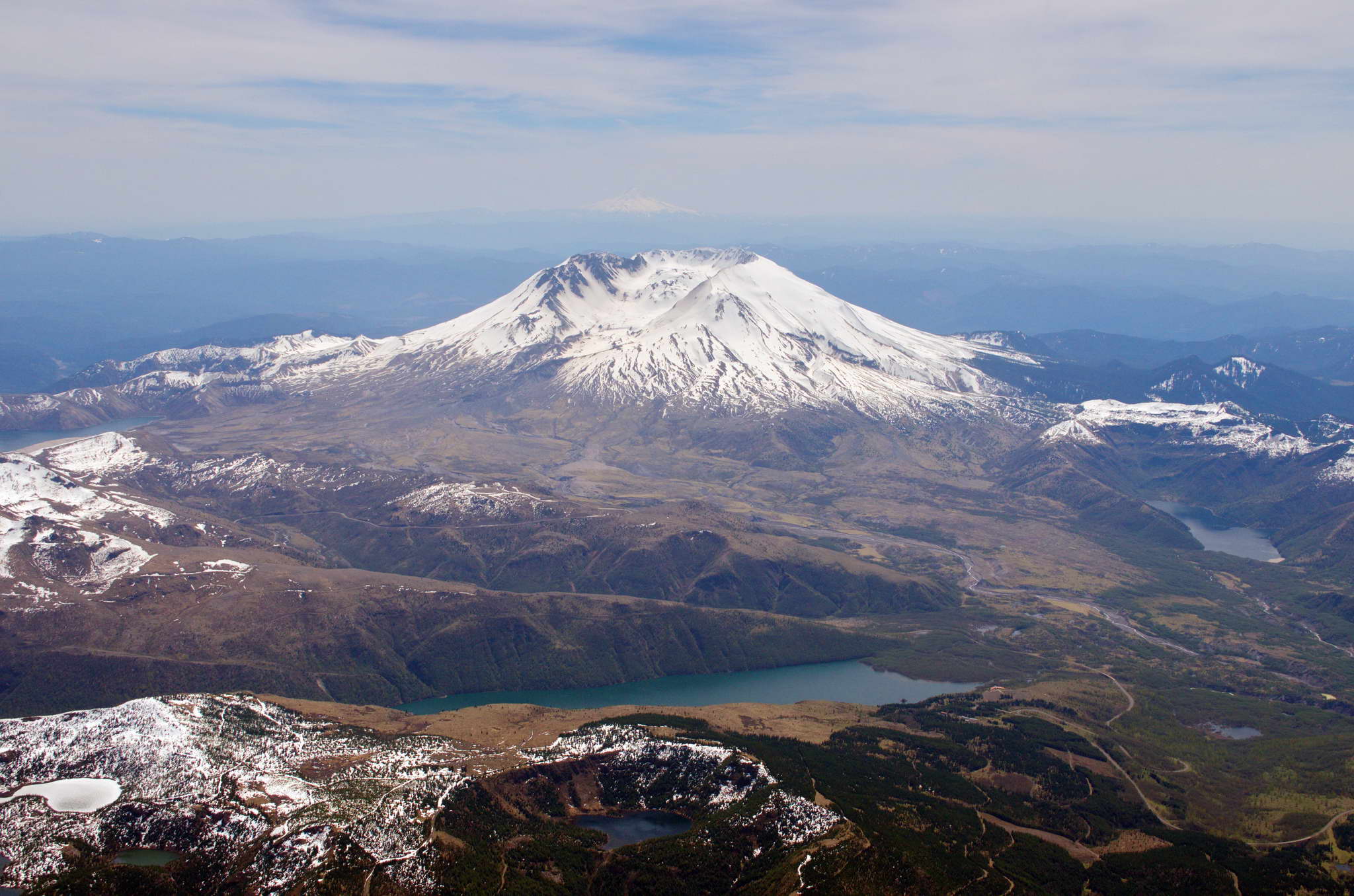
2004-02-12. Spirit Lake is left frame. Saint Helens Lake
is center foreground. Note the dome in the center of crater.
2004-02-12. A bit closer up on the crater. The ash erosion
has stained the snow at forground right. Mount Hood, across the Columbia
River is on the left horizon.
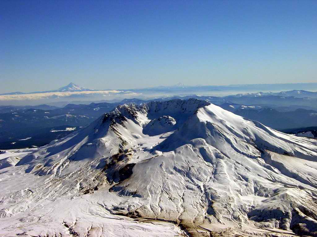
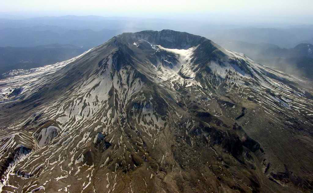
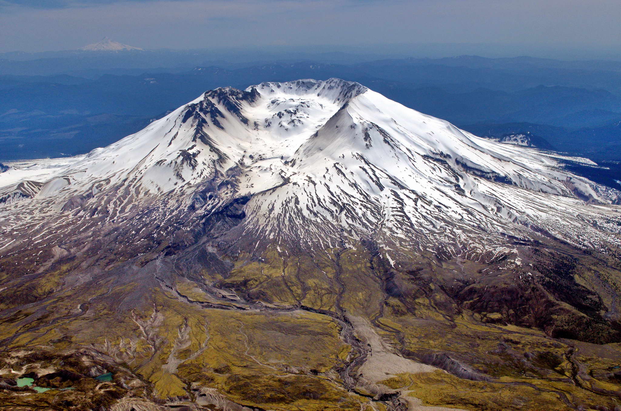
2004-02-12. Closer still. It's starting to get interesting. Mt. Hood on the
left horizon and Mt. Jefferson, even deeper in Oregon, on the extreme right
horizon. Mt. Jefferson is 90 NM south of St. Helens. Erosion is evident on
the lower lip of the crater. Note the absence of any steam. The mountain is
resting, keeping its own counsel, its own timetable - tick, tick, tick.
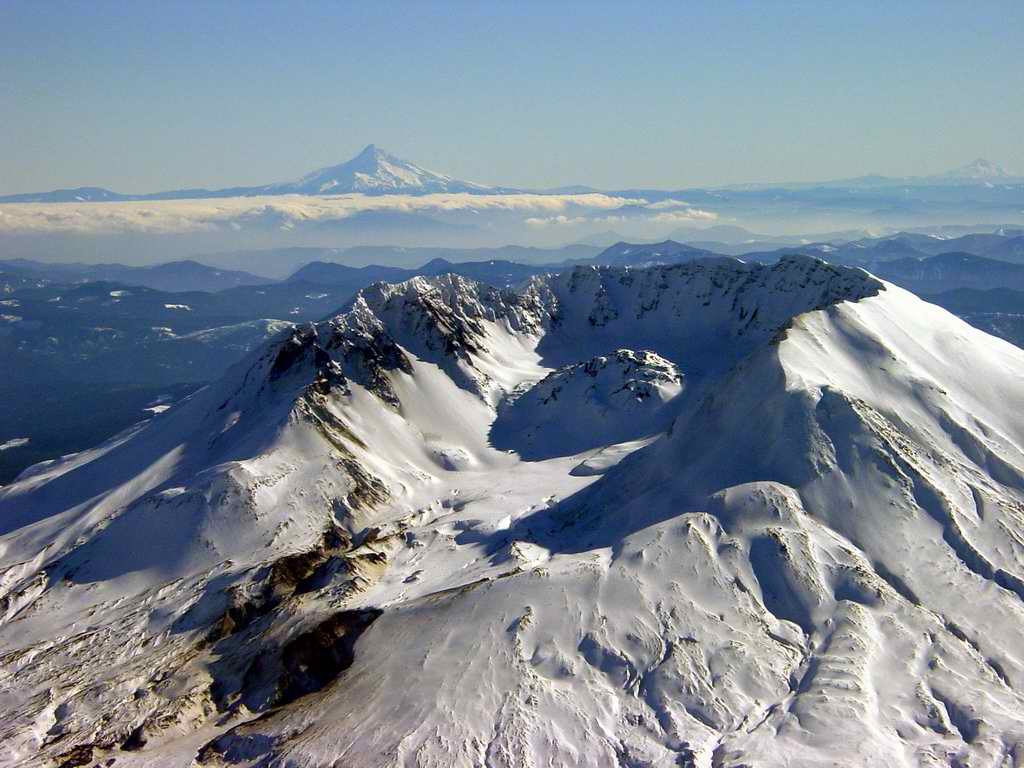
2004-02-12. Up close and personal with the originating site of a 10 megaton
explosion. One cubic mile of mountain was vaporized at 08:32, Sunday,
May 18, 1980. 230 square miles of forest was flattened. If my memory serves
61 people were killed. I heard and felt the explosion in bed, 80 NM north. I
thought it was an 18 wheeler passing the house - looked out - no truck.
The lava dome is currently 900 feet thick.
2005-03-13. Looking SW from about 10,000'. Note the ash stain on west side
of the mountain. This
is ashfall from the 2005-03-03 erruptive event. Note too the lack of snow.
These photos were taken exactly 13 months after the previous photos.
2005-03-13. This is a close up of the ashfall.
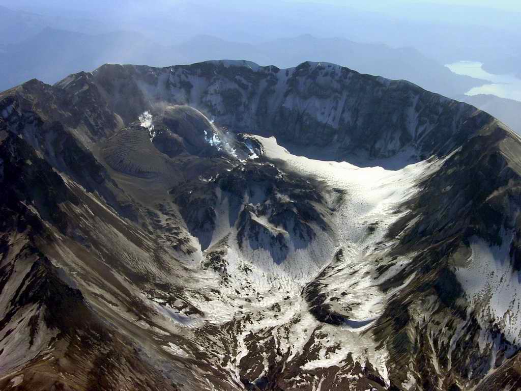
2005-03-13. We are spiraling toward the mountain in a counter-clockwise direction.
This is a slightly more southward view. Note the new structure inside the crater
along the west wall.
2005-03-13. A more closeup of the crater. The previous dome is in the
center of the crater.
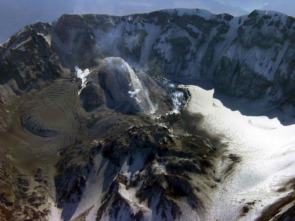
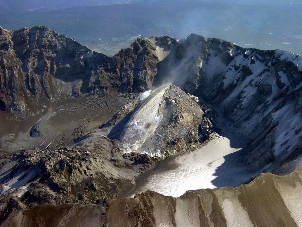
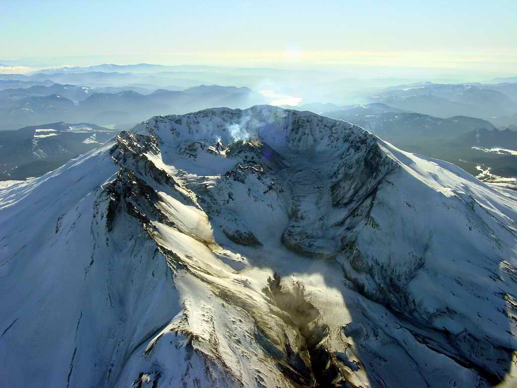
2005-03-13. Closer still. Note the oozing mass to the left. The smooth rock
is called the whaleback. Note the smoke and steam in various locations. The
powdering of new ash is also apparent.
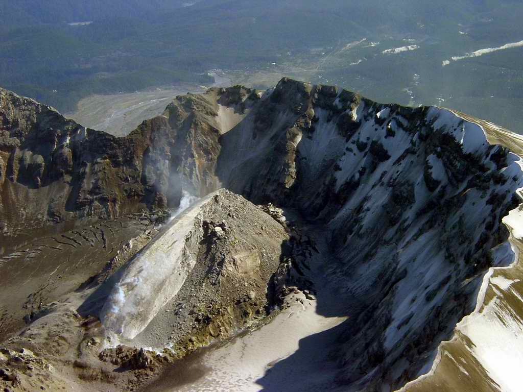
2005-03-13. We have moved to the west of the crater opening and are looking south.
2005-03-13. Here a plume of ash, smoke, and steam can be seen streaming off the
whaleback.
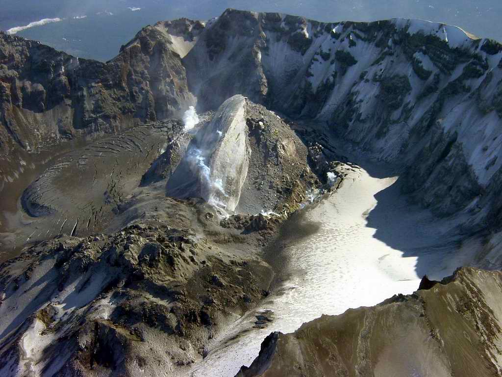
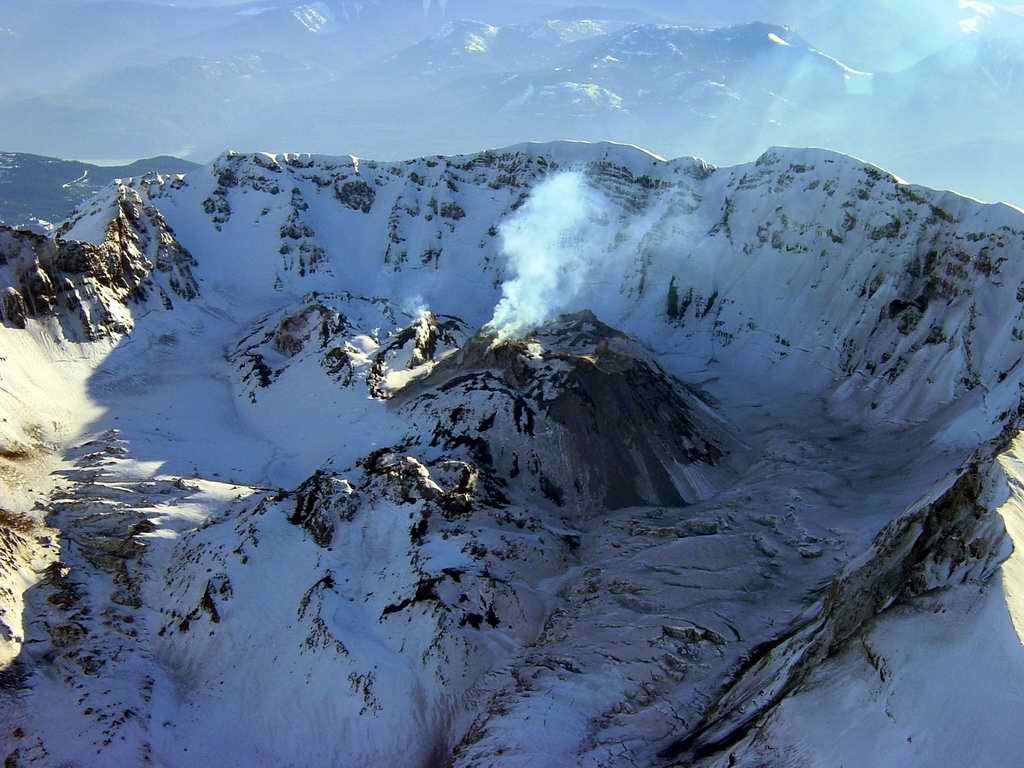
2005-03-13. The whaleback seems to be crumbling from the righthand side creating
a talus slope. Also note the sharp edge of the crater rim. At this point it felt
like I was flying around a bomb, and I pointed the nose west, throttled back a bit,
pitched down a bit and exited the area swiftly.
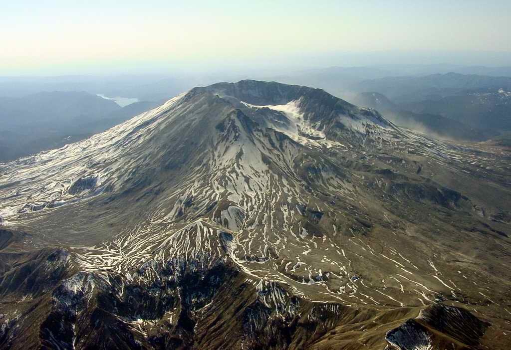
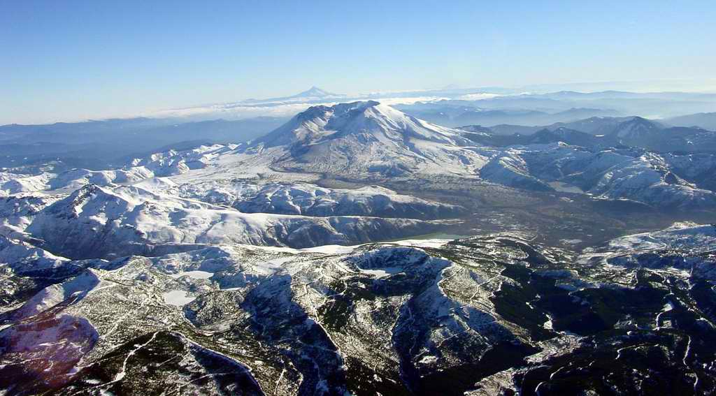
2007-01-30. These series of photos were shot from an altitude of 10,500' at about
2PM in the afternoon. The crater rim is about 8,300' high. This is a long
establishing shot looking southwest. Mt. Hood, OR is directly behind the
crater and Mt. Jefferson, OR is on the horizon to the right of the crater.
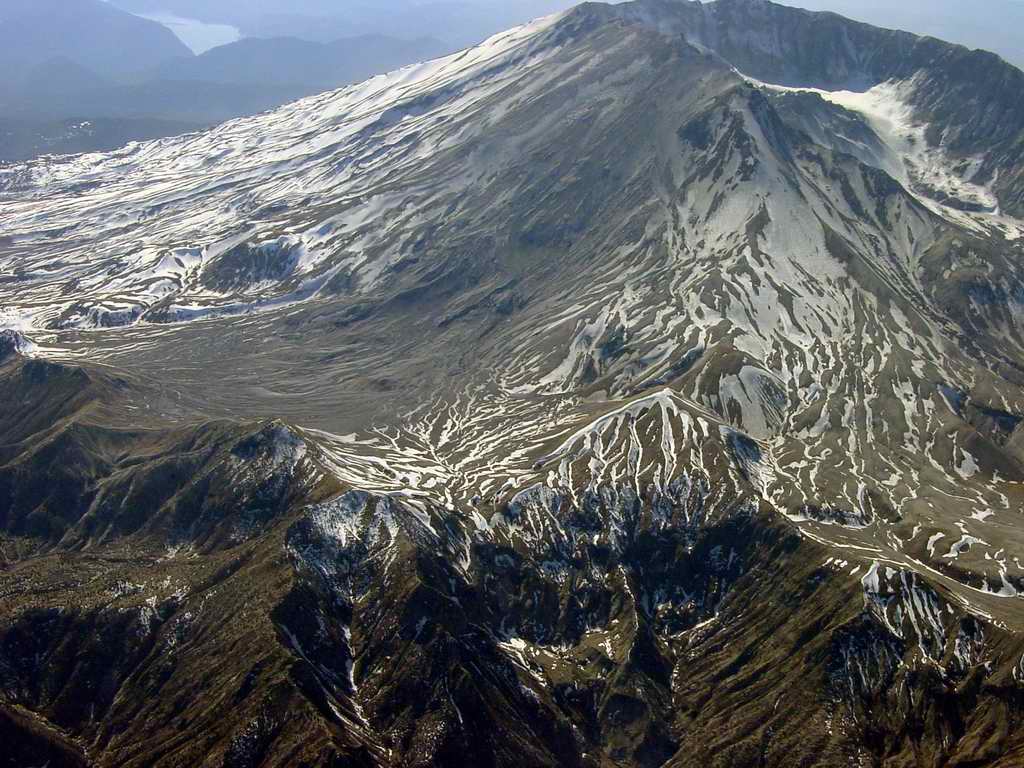
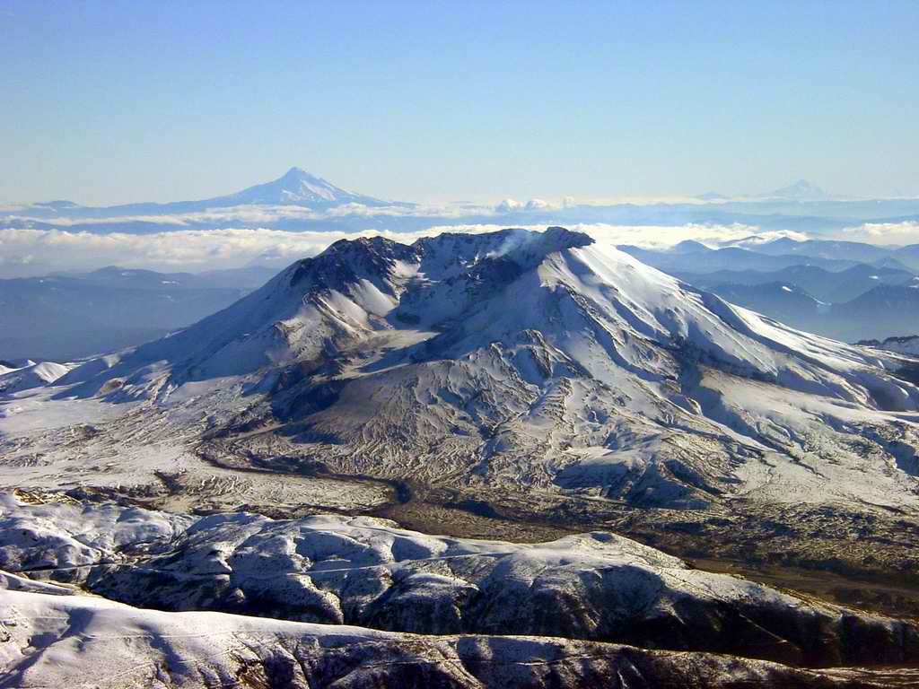
2007-01-30. A closer shot. A very small plume of steam/ash is visible coming
from the rubble in the crater. The remnants of the mud flow down the Toutle River
is still plainly visible in the foreground.
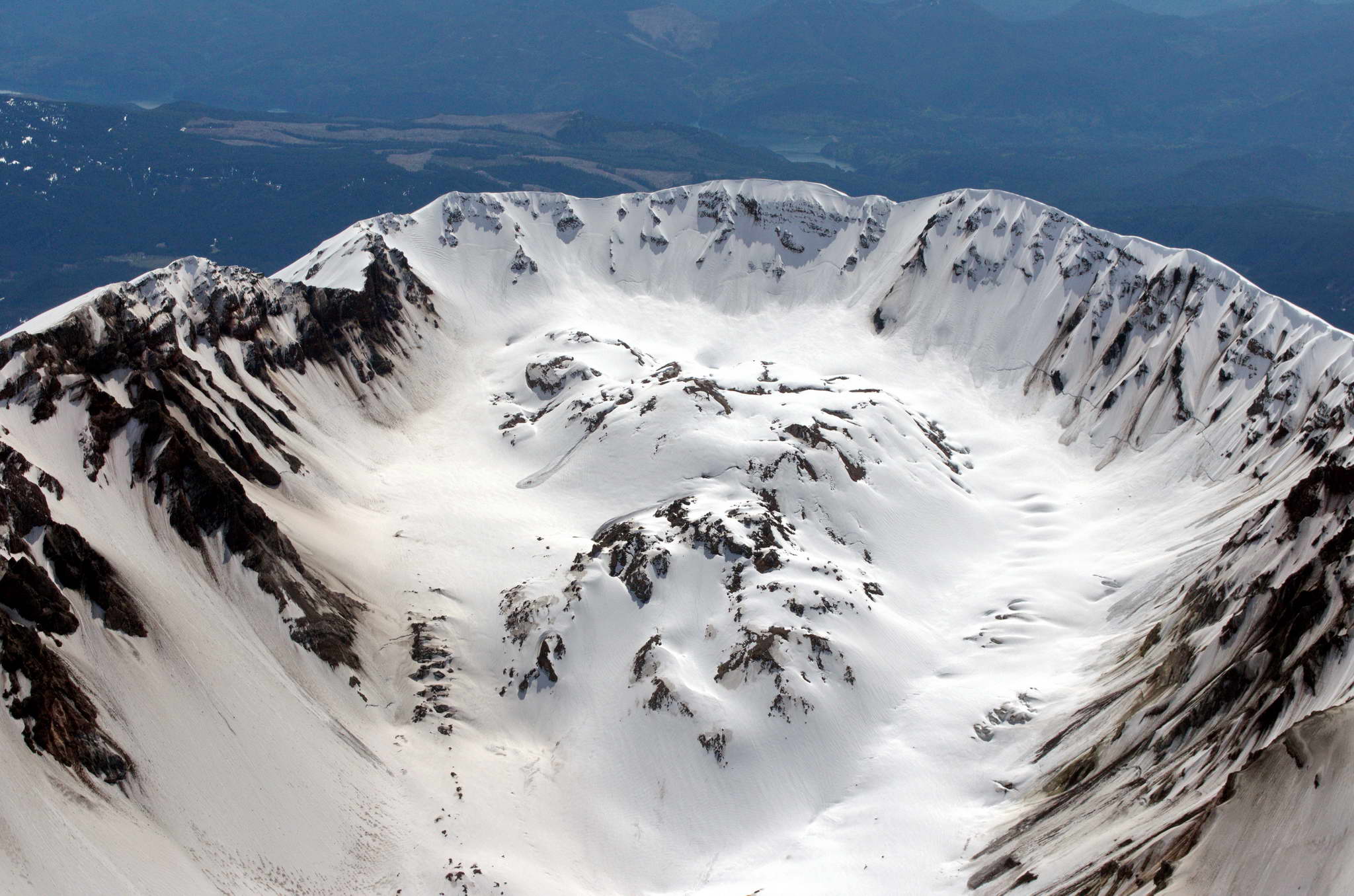
2007-01-30. A close up of the crater. The whaleback seems to have collapsed into
rubble with steam and ash rising from what was once the ridge of the whaleback.
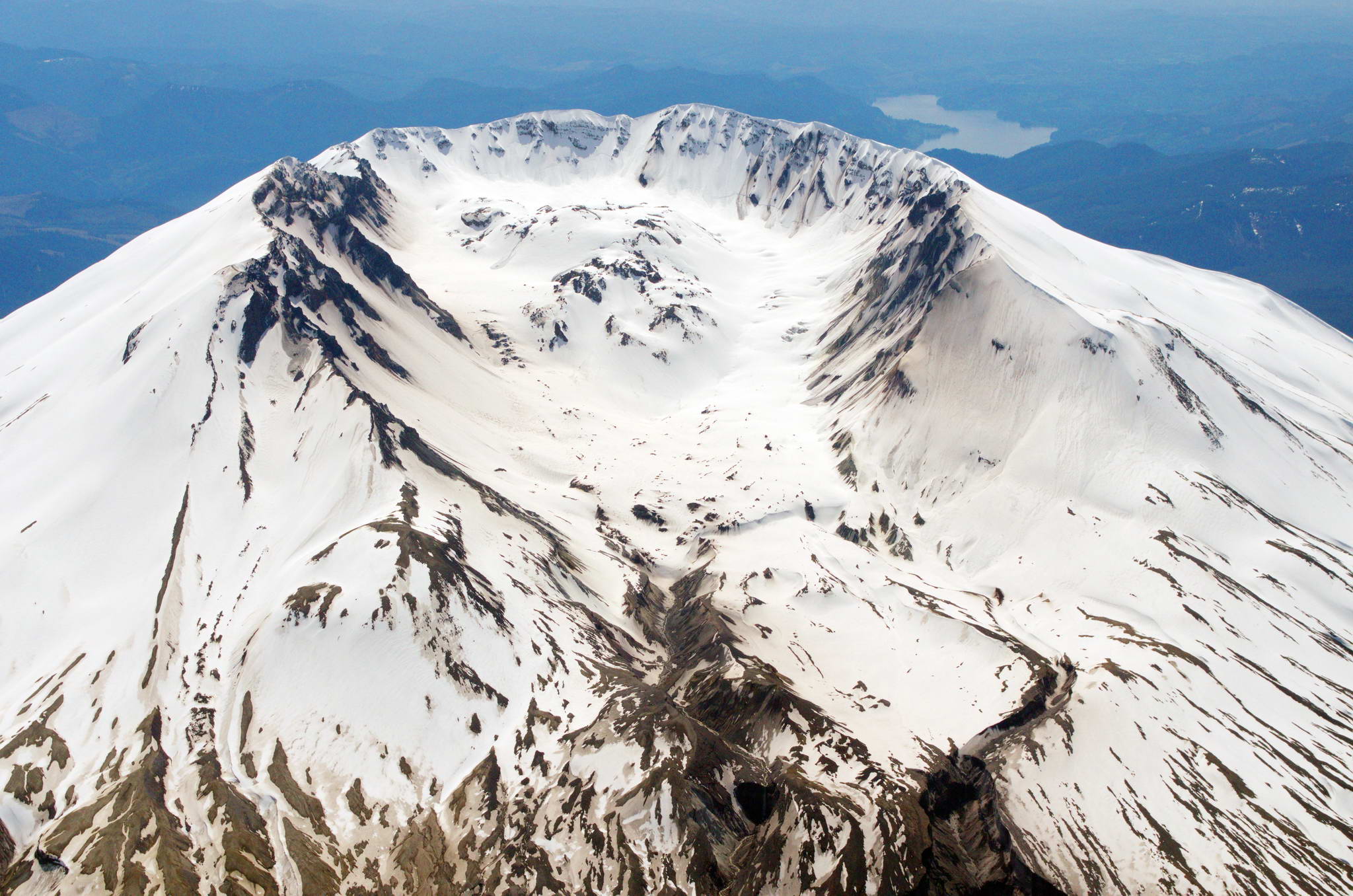
2007-01-30. Extreme closeup of the crater. Note that what was more or less
discrete crater features in 2004, has since grown and collapsed into rubble.
2014-05-01. These series of photos were shot on Colleen Diane Flannery's birthday while I sprinkled a portion of her ashes over the mountain.
2014-05-01.
2014-05-01.
2014-05-01.