|
|---|
2004-02-09. Mt. Si, 20 NM east of Seattle, rises to 4060'. This photo was
taken from about 5000'. The valley to the right of the mountain is the
route that I-90 takes over Snoqualmie Pass. This is the easiest route
across the Cascades. It can be done at 5500', but I prefer 7500'. Below is
a 4 lane highway and 3 lakes. The crossing is only about 40 miles and takes
about 30 minutes.
|
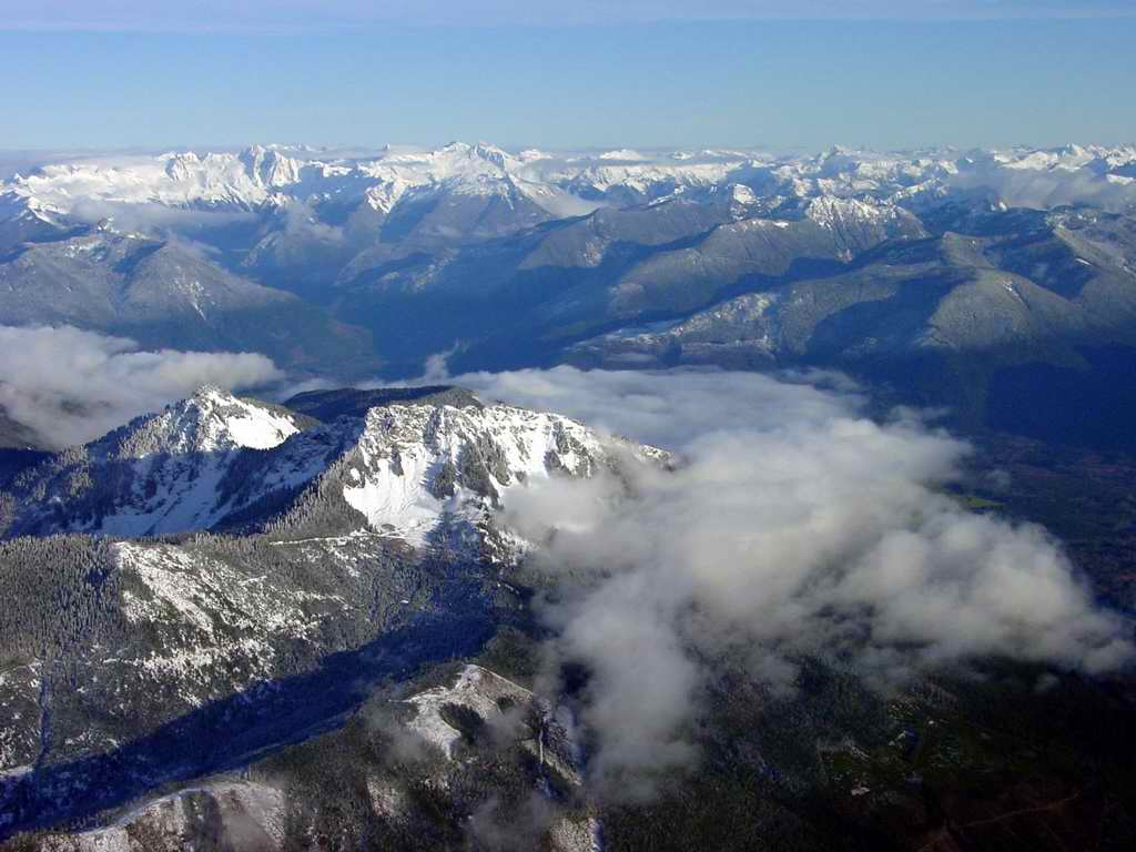
|
|---|
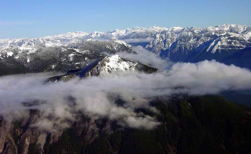
2004-02-09. Islands in the mist. Looking north. Out of frame to the left of the
center ridge is Mount Pilchuck. The snow capped peaks beyond the ridgeline are
Three Fingers, topping out at 6700'. In the far left background is Mt. Baker.
To the right of Mt. Baker in center background is Mt. Shuksan.
|

|
|---|
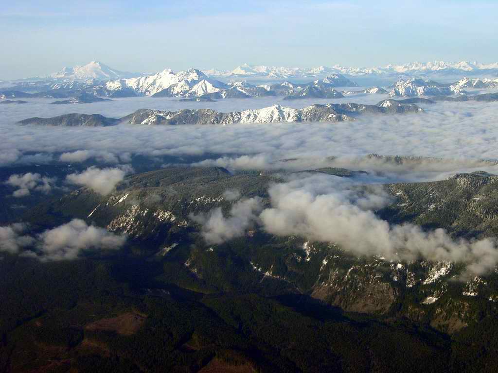
2004-02-09. Mt. Pilchuck and Three Fingers. Pilchuck is 16 NM northeast of
Everett, WA. Three Fingers are 18 NM true east of Arlington, WA. Photo is
taken from about 4500'.
|
|
|---|
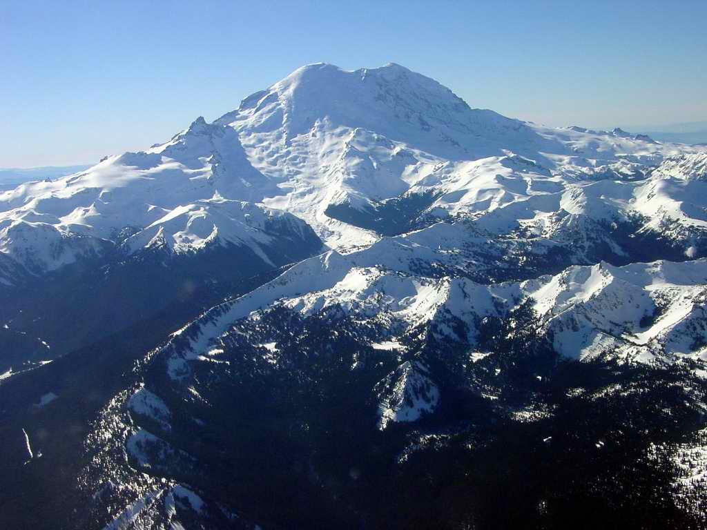
2004-02-12. Mt. Rainier, 14,410 feet high, taken from 10,000 feet looking
southwest. The original Native American name for the mountain was Tahoma.
The small peak to the left retains its original name of Little Tahoma. Little
Tahoma is 11,138 feet high. The wedge shaped ridge in center frame is peaked
at Mt. Ruth, and Emmons glacier runs down on either side of Mt. Ruth.
|
|
|---|
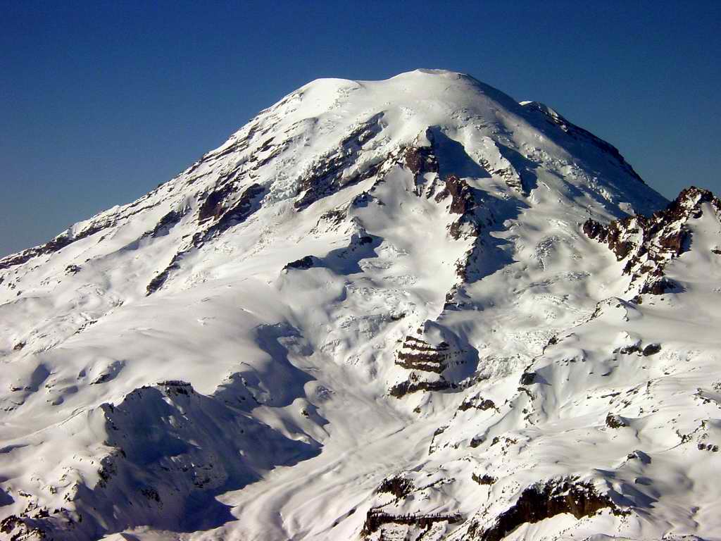
2004-02-12. Not a view of Mt. Rainier often seen - taken looking true north
at 10,000 feet. To the
right is Little Tahoma. Center frame, slightly higher than Little Tahoma
the formation is topped by Point Success. The round horizontally striped rock
just below center frame is McClure Rock.
|
|
|---|
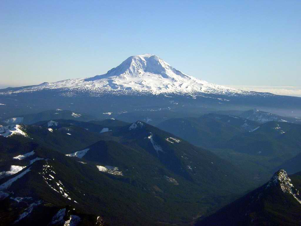
2004-02-12. Mount Adams looking southeast at 10,000 feet. The peak
in the lower right hand corner is Tongue Mountain. 41 NM separates the
peaks of Mt. Rainier and Mt. Adams. The glacier on the top right side
of the peak is Lava Glacier. Mt. Adams is 12,276 feet high. The glacier
in the center cleft is the appropriately named Adams Glacier. Note that
Adams is not really in a mountain range, but separated and alone.
|
|
|---|
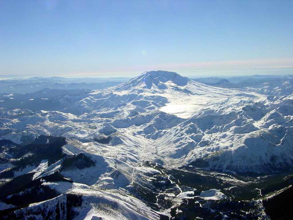
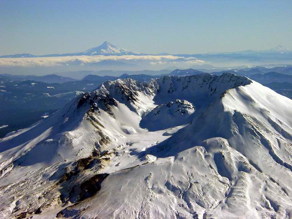
2004-02-12. Probably the most famous volcano in North America, Mt. Saint
Helens. Taken looking southwest from 10,000'. Note all the white. Note
the edge of the snow at left center frame, and left foreground and right
foreground. Note too, that where there is snow there are no trees. The
snow highlights the original blast zone. One can see a few places where
a ridge sheltered the trees on the leeward side and they survived. The
flat white spot just right of center is Spirit Lake - the NEW
Spirit Lake.
|
|
|---|
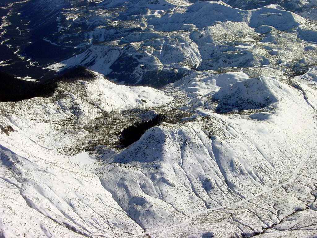
2004-02-12. In the previous photo there are some protected stands of trees
along the left edge. This is a closeup of the most center frame of them. I
wonder if survival was possible hunkered down in the trees, or would you have
suffocated?
|

|
|---|
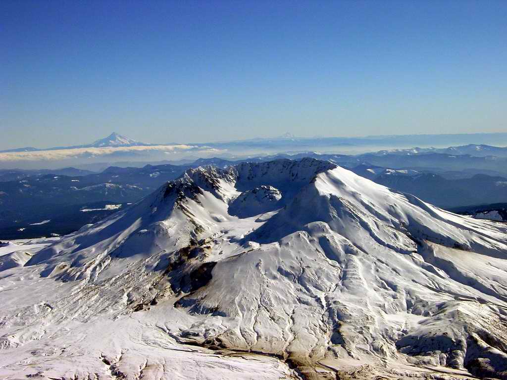
2004-02-12. Spirit Lake is left frame. Saint Helens Lake is center
foreground. Note the dome in the center of crater.
|
|
|---|
2004-02-12. A bit closer up on the crater. The ash erosion
has stained the snow at forground right. Mount Hood, across the Columbia
River is on the left horizon.
|
|
|---|
2004-02-12. Closer still. It's starting to get interesting. Mt. Hood on the
left horizon and Mt. Jefferson, even deeper in Oregon, on the extreme right
horizon. Mt. Jefferson is 90 NM south of St. Helens. Erosion is evident on
the lower lip of the crater. Note the absence of any steam. The mountain is
resting, keeping its own counsel, its own timetable - tick, tick, tick.
|

|
|---|
2004-02-12. Up close and personal with the originating site of a 10 megaton
explosion. One cubic mile of mountain was vaporized at 08:32, Sunday,
May 18, 1980. 230 square miles of forest was flattened. If my memory serves
61 people were killed. I heard and felt the explosion in bed, 80 NM north. I
thought it was an 18 wheeler passing the house - looked out - no truck.
The lava dome is currently 900 feet thick.
|
|
|---|
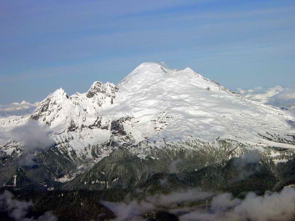
2004-11-28. The 10,781 foot summit of Mt. Baker is only about 15 miles from
the Canadian border. This mountain is the third highest summit in Washington
state behind Mt. Rainier and Mt. Adam. Taken from the southwest.
|
|
|---|
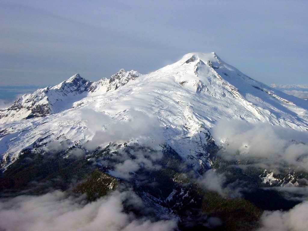
2004-11-28. Mt. Baker from the south. First climbed in 1868 by Edmund
Coleman, Thomas Stratton, John Tennant, and David Ogilvy. Mt. Baker has
steamed since the 1800s and has erupted several times in the last century.
|
|
|---|
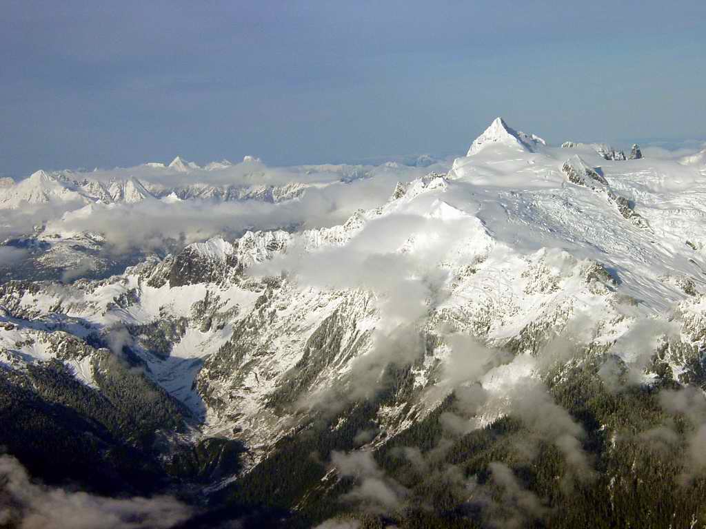
2004-11-28. Mt. Shuksan is a 9131 feet high, glaciated massif and about
11 miles east northeast of the summit of Mt. Baker. Not volcanic in
origin but the result of tectonic uplift. First climbed in 1906 by
W. Montelius Price, Asahel Curtis.
|
|
|---|
2004-11-28. Looking northeast from Marblemount toward Diablo and Ross Lake.
Ross Lake is formed by the Seattle City Light Ross Dam. This is the route
that the North Cascades Highway, state highway 20, takes linking north western
Washington to north eastern Washington.
|