Flying photos: Scenery I
Home
Prev
Next
<info@primetab.com>
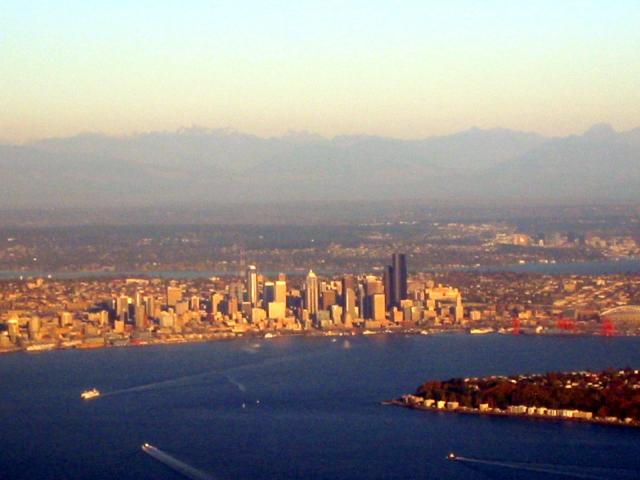
Seattle, WA looking east. Taken in the late afternoon. Alki Point
is visible in the foreground, as is a Washington State Ferry.
Behind the Seattle skyline is Lake Washington, and in
the right background is the skyline of Bellevue. Alki Point is
at N 47.5758, W 122.4143.
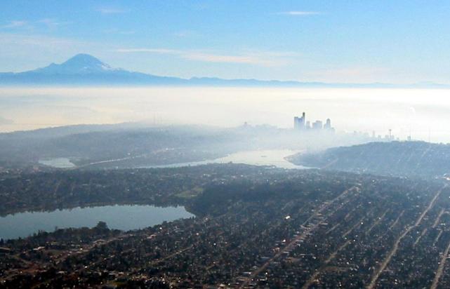
A "mood" photo of Seattle looking southeast. Left foreground is
the putrid urban Green Lake - very nice city park, but DO NOT SWIM!
The green area on the southwest side of Green Lake is the Woodland
Park Zoo ontop of the yuppie Phinney Ridge.
In the center is Lake Union, home to 2 thriving seaplane businesses.
Lake Union trails off to the left, turning into a ship canal and
eventually passing through the Chittenham Locks into Puget Sound.
Lake Union trails off to the left under the freeway, whereupon it
becomes Portage Bay. Portage Bay is contiguous with Lake Washington
through the Montlake Cut (cut through in 1917) which passes along
side the University of Washington. Seattle rises through the fog.
The Space Needle is to the right. Queen Anne hill is to the center
far right, and in the left background is
Mt. Rainier, a huge dormant volcano destined to someday give
arrogant, self-absorbed, self-important Seattle a come-uppance.
Green Lake is at N 47.6796, W 122.3374.
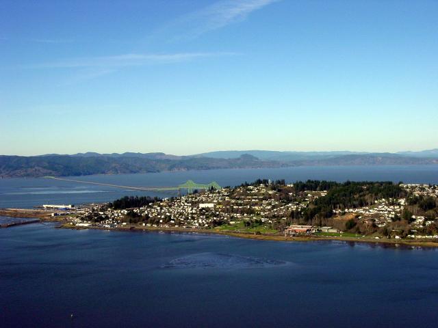
Astoria, OR looking northest. This quaint Oregon coastal town sits
just inside the
mouth of the mighty Columbia River. The land in the background is
Washington State, the water is the Columbia. Astoria sits on a
penninsula jutting out into the river. The bridge in the center
left crosses the Columbia proper, and the bridge on the far left
crosses the bay in the foreground. The near end of the bridge is at
N 46.1942, W 123.8507.
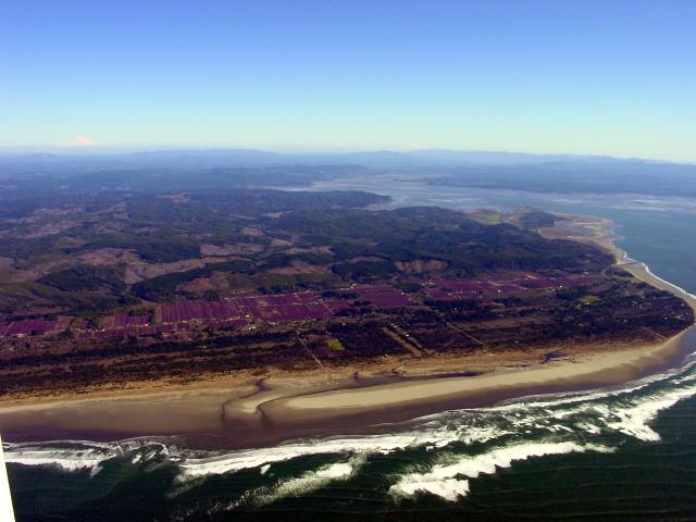
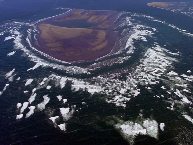
South of Grays Harbor, WA and north of the Long Beach penninsula is
the Cranberry Bog capital of the Northwest. The purple areas are
cranberry bogs. In the background is Willipa Bay, and just to the
right out of frame is Leadbetter Channel, the mouth of Willipa Bay.
The south bogs are at N 46.7609, W 124.0727.
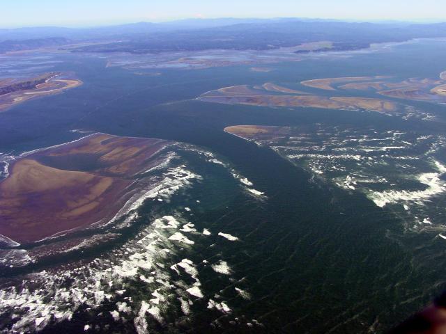
Here is Leadbetter Channel, taken just a couple miles south of the
previous photo. In fact the small penninsula at the back, center,
right in the previous photo is at the back left in this photo.
Sandbars and surf. The actual mouth of the bay is directly under us
out of frame. The center of the channel is at N 46.6769, W 124.0490.
This is a close-up of the sandbar and surf to the left in the
previous photo. Kind of arty, heh?
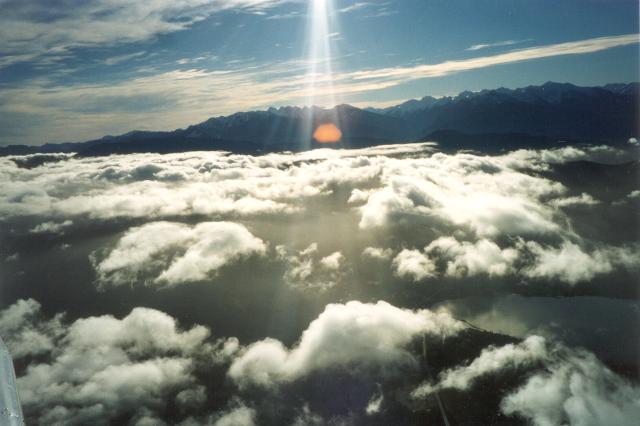
More art. I have a fascination with clouds and have lots of cloud
pictures which most people find boring. The Olympic Mountains of
Washington state form the background. The water in the lower right
is Port Ludlow. The actual city of Port Ludlow is out of frame to
the right on the far shore of the water. Note the reflection of
the clouds in the water. The water is at N 47.9185, W 122.6837.
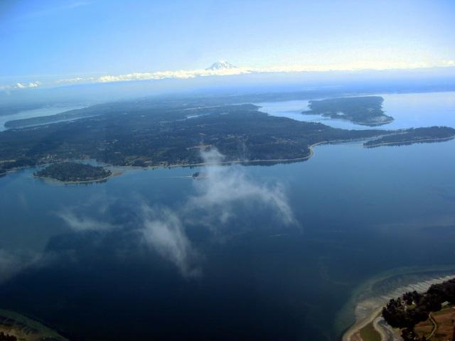
Okay, indulge me another cloud photo. This one's a cutey! It was
taken over southern Puget Sound looking southeast. Mt. Rainier
again adorns the horizon. The tiny island at center left is Raft
Island. The point at center extreme right is Green Point. The
penninsula pointing left from Green point is Forest Beach. The
land mass is not an island but part of the mainland. In the upper
right is Fox Island. Sharp eyes might discern the Fox Island Bridge.
Raft Island is at N 47.3294, W 122.6669.
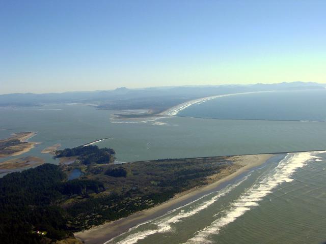
This is where the Mighty Columbia rolls on to, the mouth, where it
meets the Pacific Ocean which is mostly out of frame to the right.
We are looking south into Oregon. The foreground ground is
Washington. Note the long breakwaters and great expanse of
undeveloped beach. Astoria is at the far left on the penninsula.
The center of mouth is at N 46.2483, W 124.0740.
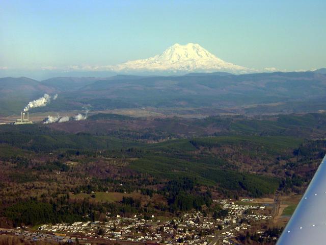
Centralia coal fired power plant and Mt. Rainier looking east. In
the foreground is the eastern tail of Centralia, Seminary Hill. 8
miles east-northeast of Centralia is a coal fired power plant which
sits in the middle of its own coal mine, the Black Prince Mine.
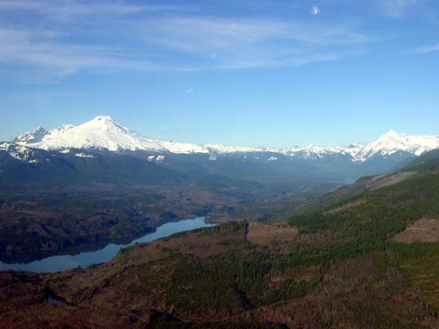
We are bouncing all over the state. Mt. Baker is on the left. Mt.
Shuksan is on the right. Lake Shannon is in the foreground. Baker
Lake is just visible in the back right.
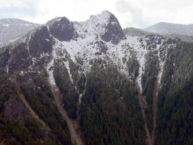
Mt. Si near North Bend, WA. Light dusting of new snow. Obvious
avalanche tracks. I climbed this sucker a few times in my youth.
Right to the top of the haystack (bare rock outcropping on top).
Josiah Merrit ("Uncle Si") built a cabin at the base of a local peak in 1862 (the peak
became known as Uncle Si's mountain -- now Mount Si). He raised vegetables and hogs and
kept an orchard. According to local historians, he was a rugged man who sometimes hauled
bacon to the large settlements Seattle and Everett. To do so necessitated hauling the load
on a sled to the river, canoeing downstream, strapping the load to his back and climbing
down the 268-foot falls, hiking several miles, and then canoeing the rest of the way to
Everett or Seattle.
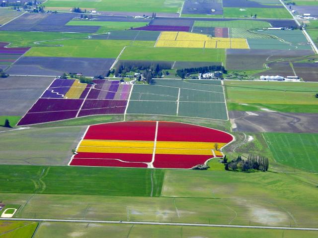
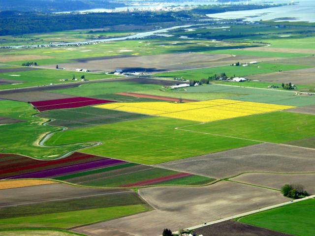
The Skagit Valley is home to the largest number of bulb growers in
the U.S. The reason is that the land and climate closely approximates that of
semi-submerged Holland. Every spring a Tulip Festival is thrown near the
height of the bloom. Though it is termed a "Tulip" festival it includes many
different spring-blooming bulb plants, like narcissus and daffodils. This
photo and those that follow were taken from 2500 to 1500' high.