Home Prev Next <info@primetab.com> Best viewed full screen
|
|
|
|
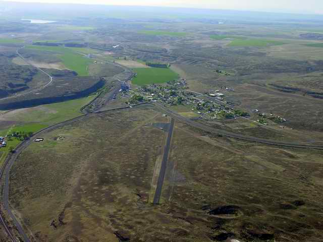
| Ritzville, WA | Ritzville, WA | Othello, WA | Moses Lake, WA |
|
|
|
|
| Jefferson County, WA | Diamond Point, WA | Pullman, WA | Mansfield, WA |
|
|
|
|
| Wenatchee, WA | Anderson, WA | Wilbur, WA | Davenport, WA |
|
|
|
|
| Odessa, WA | Wilson Creek, WA | Ocean Shores, WA | Ocean Shores, WA |
|
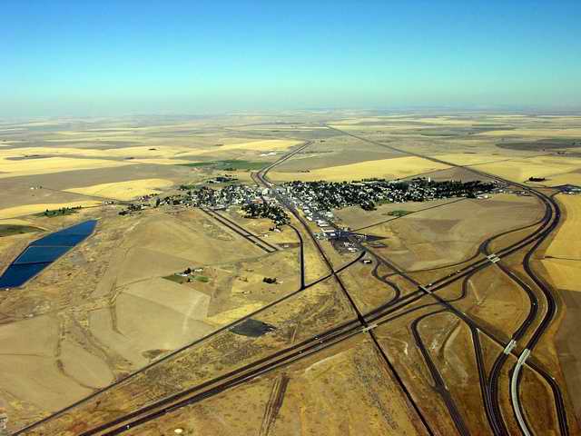
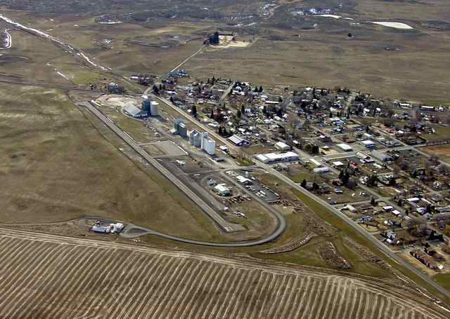
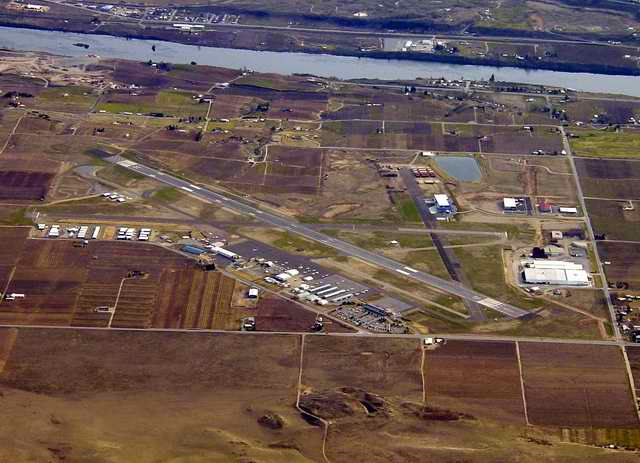
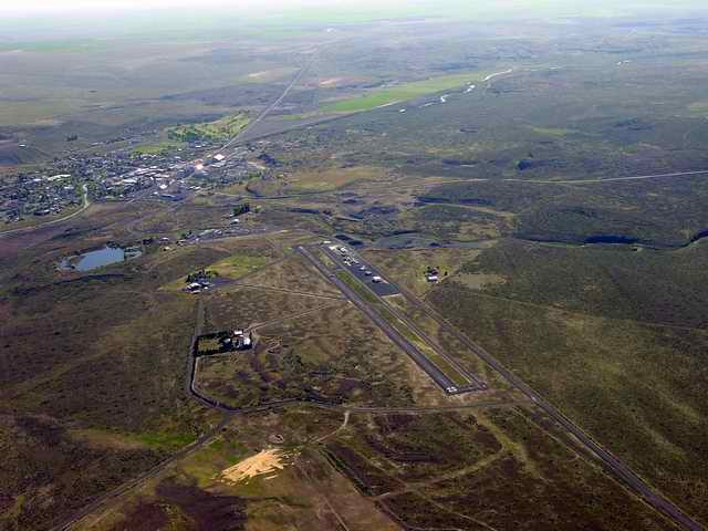
Ritzville, WA holds a special place in my heart. 30 years ago in my wandering days I spent the night in the city park while chaperoning a group of high school kids on a bird watching expedition to Turnbull Wildlife Refuge. On this trip I met and took home a girlfriend, Yasmin. 30 years later I landed, taxied back around, and took off, trailing memories in my wake. As the first photo shows Ritzville is a small town in the middle of a great expanse of farm land. Ritzville pre-dates the freeway interchange. |
|---|---|
|
Yasmin walked out of my life about a year later while I was hitch-hiking to and from northern Utah. When I finally made it back home, I found her terrarium empty. A four foot bull snake is stronger and smarter than you think. She worked the rock on top of the lid off and vanished. I never saw her again. |
|
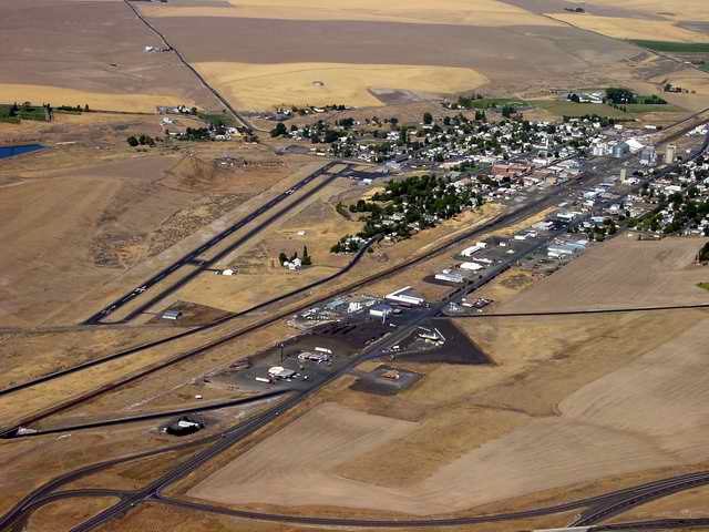
I was the only thing moving on the Sunday I landed at Othello. This field is used a lot for agricultural services. |
|---|
|
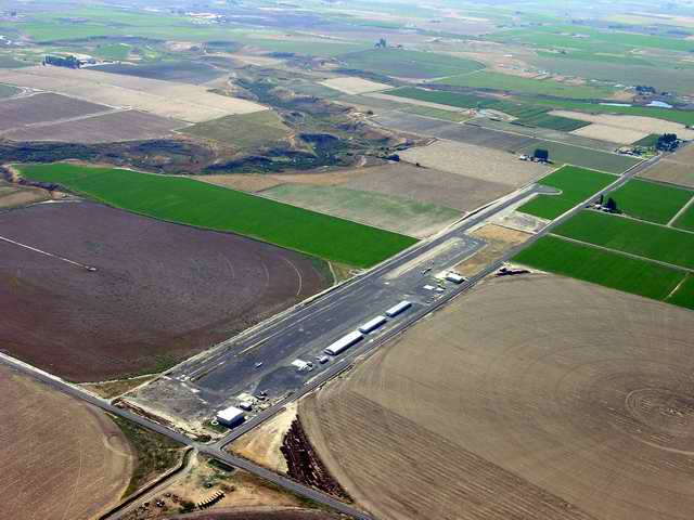
This airport is in a notch in the class C of Grant County International, MWH. |
|---|
|
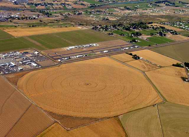
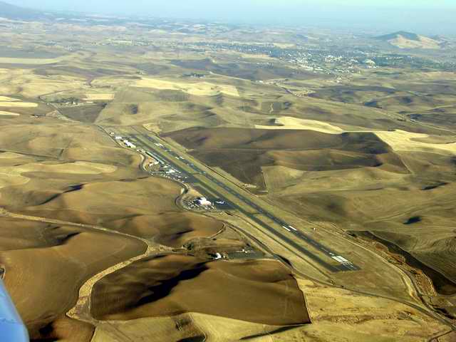
This is an International airport. There are scheduled flights to and from British Columbia. |
|---|
|
Diamond Point is a private airstrip. |
|---|
|
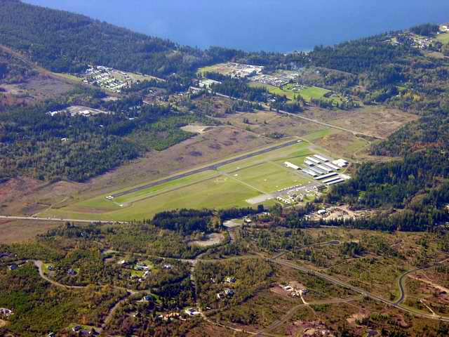
Absolutely gorgeous country with rolling hills covered with grain fields. Through a deep canyon 15 miles to the southwest flows the Washington portion of the Snake River. Moscow, ID can be seen in the right background. This is a long wide runway used by turboprop airline service - loud suckers. I touched down on the '5' at the near end and pulled off on the first taxiway. I am looking forward to visting Pullman in the green spring and summer. |
|---|
|
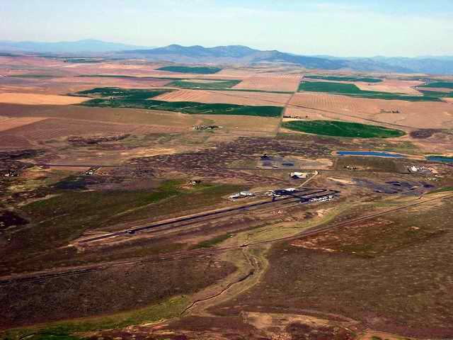
Much like Ritzville and Waterville and numerous other small town eastern Washington airports. Note the grain and feed elevators on the field. I love these airports and when the days get longer a short walk to town for lunch. |
|---|
|
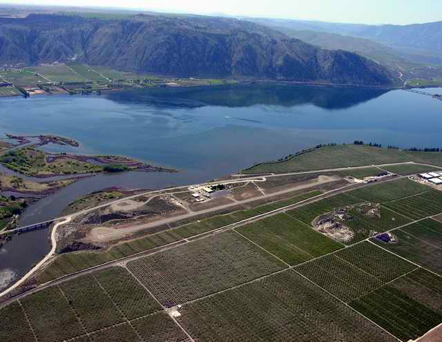
The Columbia River is at the top of the frame. |
|---|
|
The Columbia River with Timber Peak in the background. Very nice, pretty well maintained airport. It was VERY quiet on the Sunday I was there. Looks like some Agriculture operations may work out of the field. I actually know one of the Andersons. The grandson of the field's namesake. |
|---|
|
On Sunday, there were lots of agriculture operations. In the higher resolution photo you can see a bright yellow ag-plane about 1/3 down the runway traveling to the left. In the background, 15 miles distant is Mica Mt. which is on the other side of the Columbia river. The town of Wilbur is to the right well out of frame. |
|---|
|
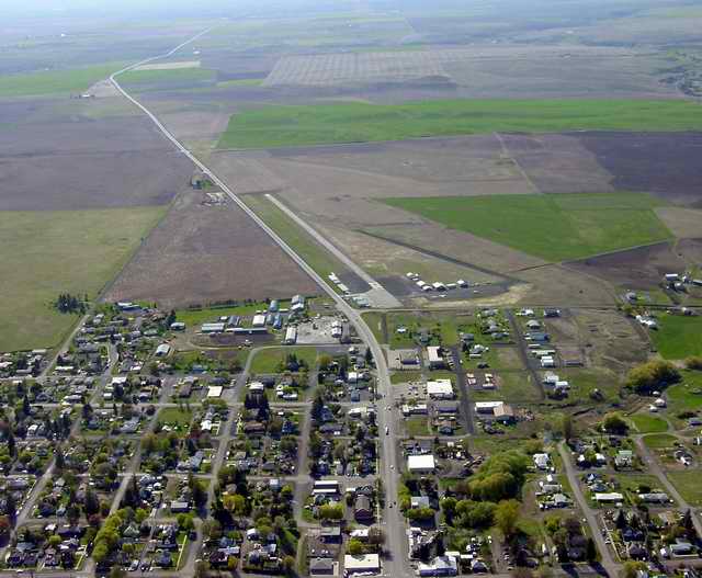
This is not the best picture of the field that I have, but I like that it shows the relationship to the town. On the frame-left side of the runway is an agricultural operation, and on the right side of the runway are private hangars and a jump school. The people at the jump school were extremely friendly. Note that there are two runways. The more small towns I land at, the more I would like a home in each one. |
|---|
|
Again, not the best photo of the field, but it shows the town of Odessa in the background. Lots of agricultural operations. Note that there is an ag-plane coming toward us about 1/4 of the way down the runway. |
|---|
|
Not much on the field except a sani-kan. I never got out of the plane. The surface was pretty poor. There is a car parked off the asphalt to the left. When I landed someone got out and started slowly walking toward the plane. I was rather rude in that I waved, whipped the plane around and took off in the direction opposite to my landing. The town of Wilson Creek is down a steep bank and across the road from the airport. There appears to be a ghost of another runway to the right of the existing one. |
|---|
|
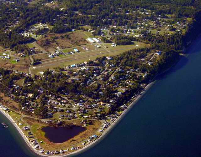
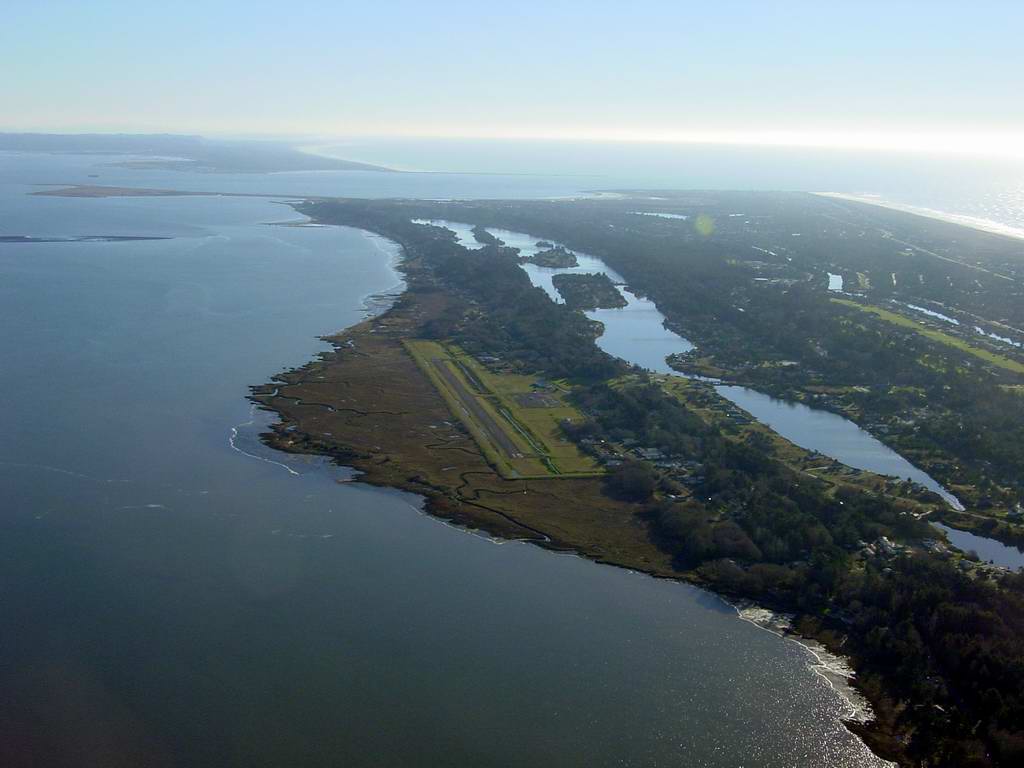
Ocean Shores is on a long southward pointing peninsula. On the left is Gray's Harbor, where the Chehalis River meets the Pacific ocean. The long lake west of the runway is Duck Lake. The mouth of the river is in the center background. 1973 "McQ," a John Wayne movie, with a 75-member crew of Batjac Productions which was stationed in Ocean Shores motels for 28 days, beginning July 2 with producer Michael Wayne. The leading stars were Coleen Dewherst, Diana Muldaur, and Eddie Albert. |
|---|---|
|
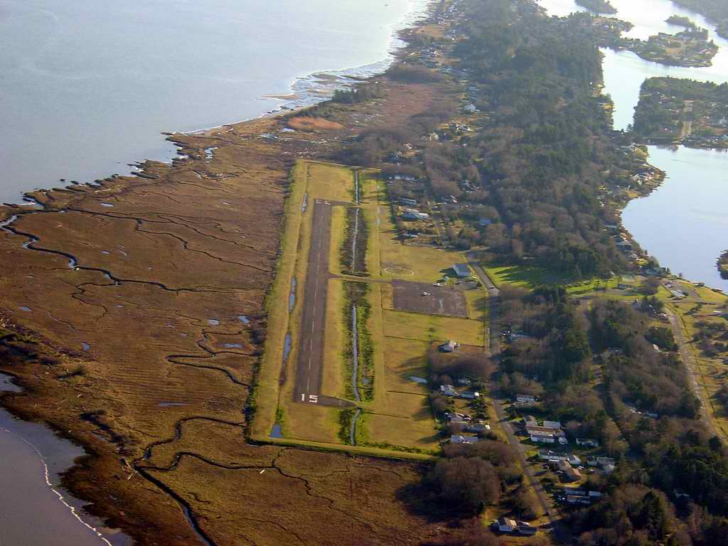
A closer view of the runway. Note the very nice segmented circle, the parking area and a couple of buildings. |