
Home Prev Next <info@primetab.com> Best viewed full screen
|
|
|
|
| Pemberton, BC | Pemberton, BC | Twisp, WA | Methow, WA |
|
|
|
|
| Cashmere, WA | Cashmere, WA | Gooding, ID | Payette, ID |
|
|
|
|
| Oroville, WA | Oroville, WA | Omak, WA | Ferry County, WA |
|
|
|
|
| Ferry County, WA | Anderson, WA | Tonasket, WA | Sequim Valley, WA |
|
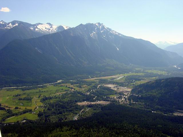
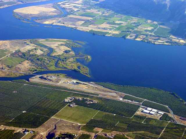
Pemberton, BC is about 20 miles north of Whistler, BC on the same highway. Whereas Whislter is at about 2200 elevation, Pemberton airport is only at 670 feet. A huge mountain looms 8000 feet high just south of the runway. At the field there are 3 businesses, Pemberton Soaring Center, Coastal Mountain Air, and Pemberton Helicopters. The route we took to Pemberton was up the centre of Lake Harrison, then up the centre of Lake Lillooet. Beautiful 8000 foot glaciered peaks rise from the lakes' shorelines. |
|---|---|
|
Here is a closer view. Note that the river splits on the east side of the airfield and goes down both sides. The hay fields at the ends, and along the runway are baled and large round bales litter the grass. |
|
Did not land. The Twisp airport is about 4 miles south of the Methow airport. |
|---|
|
Methow Valley State Airport is the regional home of the U.S. Forest Service smoke jumpers. The folk who bail out of perfectly good airplanes to fight forest fires in godawful terrain with their bare hands. This airport is also the site of the birth of smoke jumping in 1937. |
|---|
|
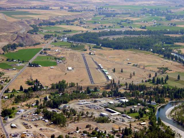
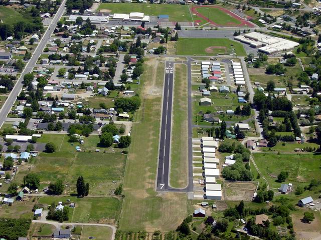
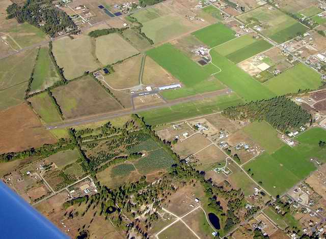
Another short field, but unobstructed at both ends. This is a small field, but in the second photo note how many hangers line the field. I count about 35! It's a short field but active, and populated by enthusiasts. Right in the heart of fruit country, cherries, peaches, plums, apples, and more. Note the fruit orchards to the right and center. Top center is the city of Wenatchee and out of sight just beyond where the highway passes between the ends of the two ridges is the Columbia River. Landed here and had a pleasant conversation with a gentleman who had retired from Boeing after 35 years. |
|---|---|
|
Note all the hangers and the high school and baseball field off the 25 end of the runway. Note also, the displaced threshold of 182' at the 25 end, effectively making the runway 1618' for landing on 25. I was greatly impressed with this airport. |
|
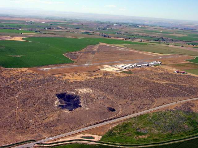
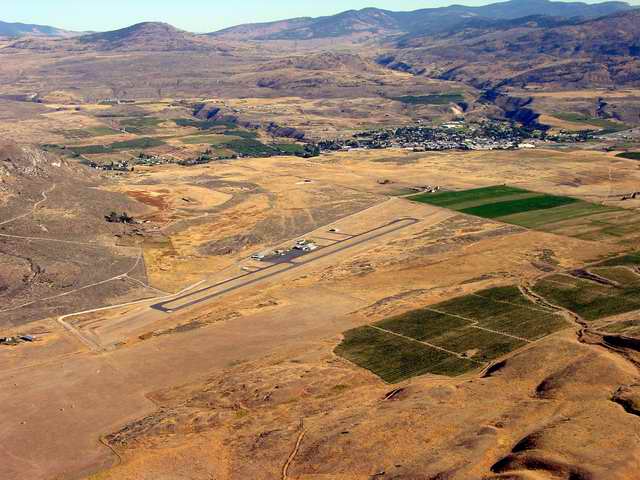
Gooding Municipl airport is well tended and in good condition. Avgas is available. It can get VERY hot in and about Gooding. Luckily, when we were there in late August 2003, it had rained hard the day before our arrival, so we were greeted by only about 85 F temperature. The day we left it was destined to get much higher. Gooding, ID is a small, rural town of about 3400, and is the county seat of Gooding County. It is a nice town of hard working people. |
|---|
|
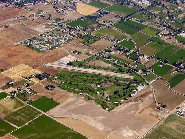
Did not land here, but overflew, saw the golf course, and snapped the photo. |
|---|
|
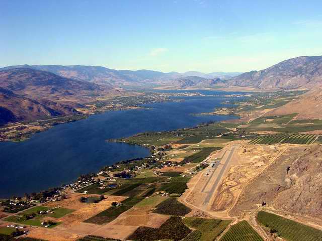
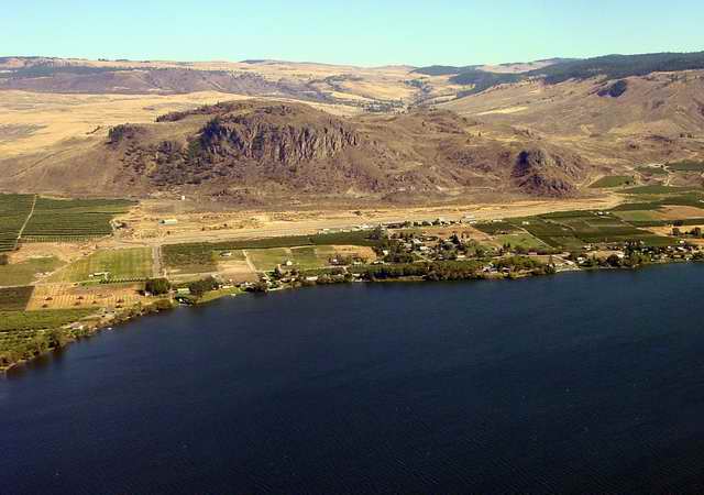
Another stunning location. The airport, on the east shore of Osoyoos Lake is named after Dorothy F. Scott. Born, Feb. 16, 1920, Dorothy and her twin brother grew up and went to school in Oroville, WA. While enrolled at the University of Washington, Dorothy learned to fly float planes on Lake Union. Her father was learning to fly at the same time, but Dorothy soloed first. Later while in the Women's Airforce Service Pilots (WASP), her picture appeared in Look Magazine. Dorothy was one of the original members of the Womens Auxillary Ferrying Squadron (WAFs) She started out at New Castle Army Air Base in Wilimington, DE and then went to the 5th Ferrying Group at Love Field in Dallas, TX. While stationed at Love, she was sent to Palm Springs Army Air Field, CA for pursuit plane training for the P-39, P-40, and P-47. Initial training started from the rear seat of an AT-6 or BC-1, which simulated the view from a pursuit plane cockpit. On Dec. 3, 1943, there were several trainers and pursuits in the air. Dorothy had just been cleared to make her final landing. The tower had also cleared a P-39 to come in second. However, the P-39 was faster than the BC-1. The P-39 caught up with it, and without seeing it, came down on it without warning. Dorothy and her flight instructor were killed. She was 23 years old. |
|---|---|
|
Here is a view from over the lake looking east. In the above photo the U.S.-Canadian border transects the lake in the background at a bridge. The airfield lies at the base of a long mountain, and from easterly approaches the airfield is not visible until you are on top of it. We took a short walk and availed ourselves of 4 red delicious apples off an orchard tree. They were indeed delicious. To our credit we spent some time trying to find someone to ask, before we pinched the fruit. |
|
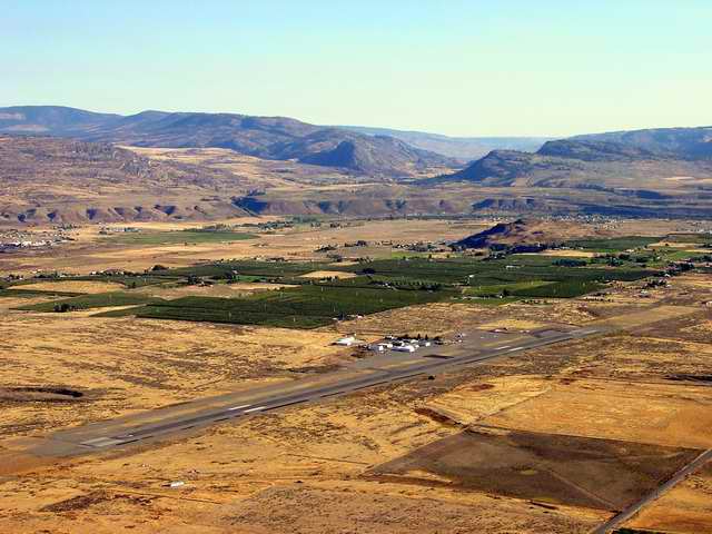
A very big runway, in the middle of very little. The canyon containing the Okanogan River is in the background. Part of the city of Omak can be seen along the canyon on the right side. |
|---|
|
|
|---|---|
|
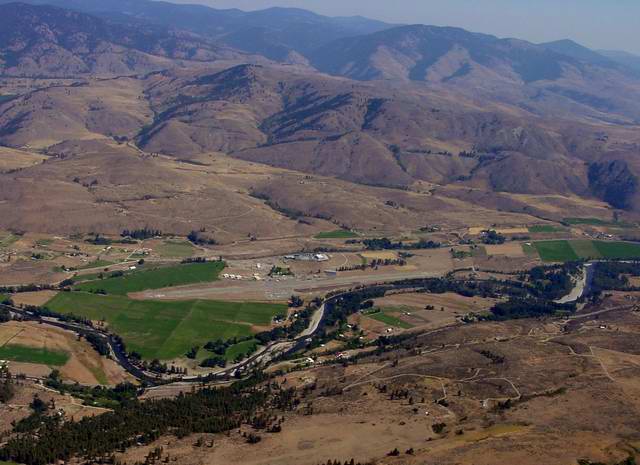
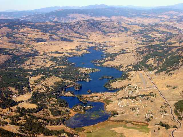
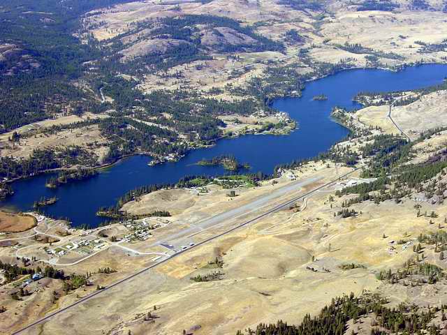
The airport lies on the east shore of Lake Curlew, on the water side of the very black road on the right side of the first photo. Curlews sre very long-billed, long-legged speckled, brown water birds. This area is pretty high. The lake is at 2500 feet and everything else is higher. Can you say "cold in the winter?" |
|
Anderson Field is on the Columbia River at the mouth of the Okanogan River which joins from the left in this photo. This is the middle of fruit country. Note the many orchards. |
|---|
|
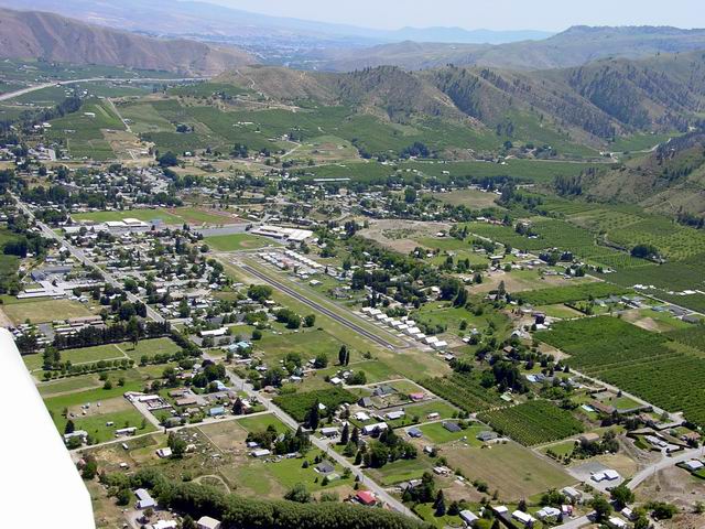
Very nice airport. The city of Tonasket is in the background. |
|---|
|
The turf runway is not readily apparent. In this photo it does not even appear contiguous, though it may be. |
|---|