Home Prev Next <info@primetab.com> Best viewed full screen
|
|
|
|
| Oak Harbor, WA | Blaine, WA | Blaine, WA | Blaine, WA |
|
|
|
|
| Pt. Roberts, WA | Pt. Roberts, WA | Pt. Roberts, WA | Eatonville, WA |
|
|
|
|
| Toledo, WA | Cle Elum, WA | Ellensburg, WA | Waterville, WA |
|
|
|
|
| Chelan, WA | Electric City, WA | Hood River, OR | Anacortes, WA |
|
|
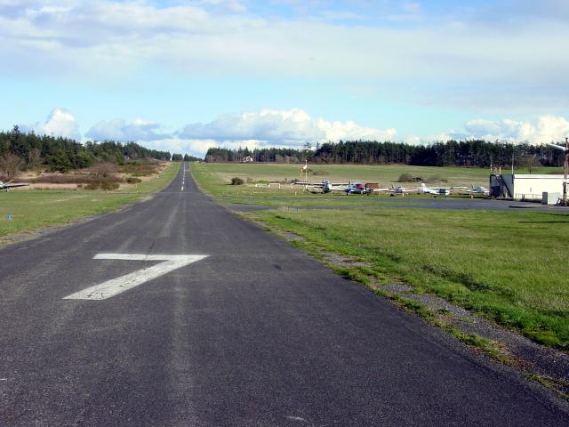
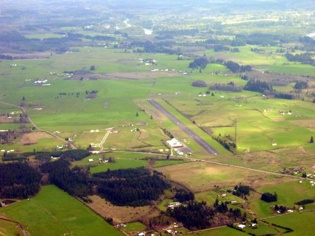
Wes Lupien was a retired NAVY flight Officer that made 76S out of a cow pasture, and started Whidbey Flying Service in 1964, later to be renamed Harbor Air. He passed away from Alzheimers disease in 1999(?). The runway is interesting. Elevation between the 07 and 25 ends differs by 100 feet, 110 MSL and 210 MSL respectively. The downslope starts about 700 feet from the 25 end, extends 1000 to 1500 feet then flattens out again. In general one lands uphill and takes off downhill. Note the runway width, 25 feet. If landing at my home field which is 35 feet wide is like landing on a driveway, then landing at Lupien is like landing on a sidewalk. However, as my CFI once said, "Wide or narrow, the centerline is still in the same place." Watch the wind sheer over the cliffs to the east and watch for a number of bald eagles that nest and roost in the area.
|
|---|
|
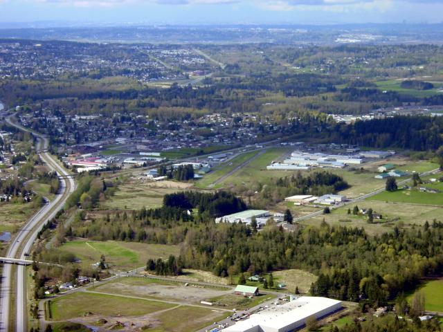
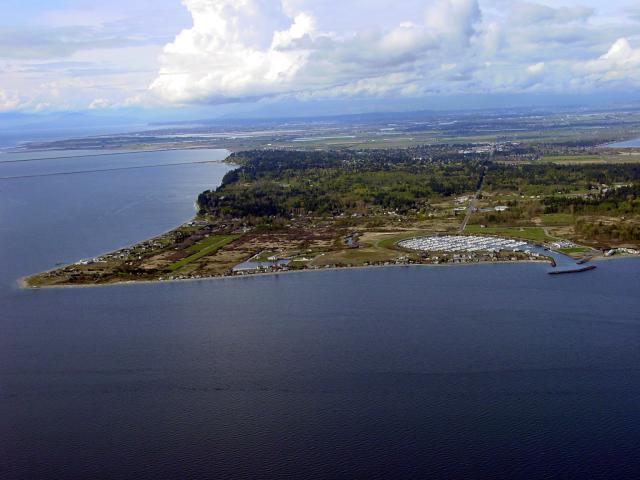
The U.S./Canadian border is about 3300' north of the end of the runway, so the background is Canada. To the left is Interstate 5. The traffic pattern probably extends into Canadian airspace, but no F-16s came up to greet me. The Peace Arch can be seen at the extreme left where I-5 appears to end. |
|---|---|
|
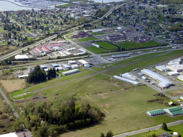
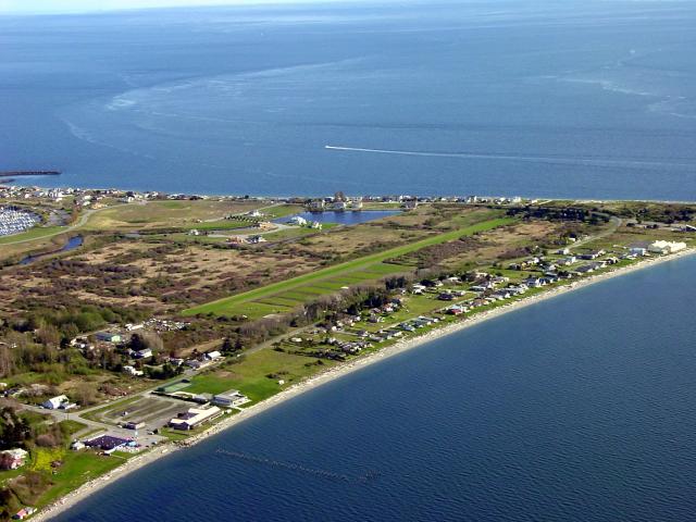
Here is the view closer and looking more westerly. Note the oval race track, the bay and marina in the upper left, and the label in the middle of the runway. |
|
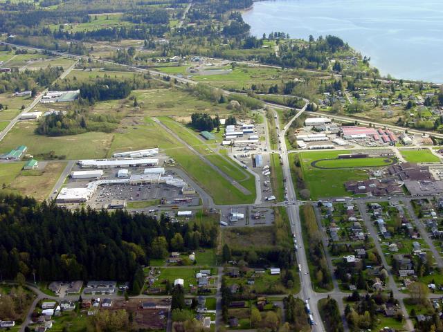
Taken from the Canadian side of the border looking south. A bigger chunk of the bay is in the upper right. |
|
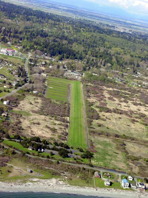
This field was rumored to exist. Some sources indicate that it is a private field and some sources indicate that it is a public field. The first step in the determination of the truth was proof of existence. Point Roberts is a small penninsula 2 nm wide and 15 nm west of Blaine, WA that juts out south from Canada and extends 2 nm into the U.S. That makes it just 4 nm square. The only way in to Pt. Roberts by road is through Canada. The round marina on the right is obvious. The field is on the left, a grass strip running north/south. |
|---|---|
|
From the west side looking southeast. Edge of the marina is at left. |
|
Looking north up runway 34. I ran a pattern on runway 16 and made a low pass over the field. It looks to be in excellent shape, well maintained, and well drained. I would have liked to land, but it's still the rainy season here (until July 5th), and without checking the surface condition with a phone call to the field manager I didn't want to risk a landing into potential mud. Not to mention it is still unclear whether this is a private or public field. |
|
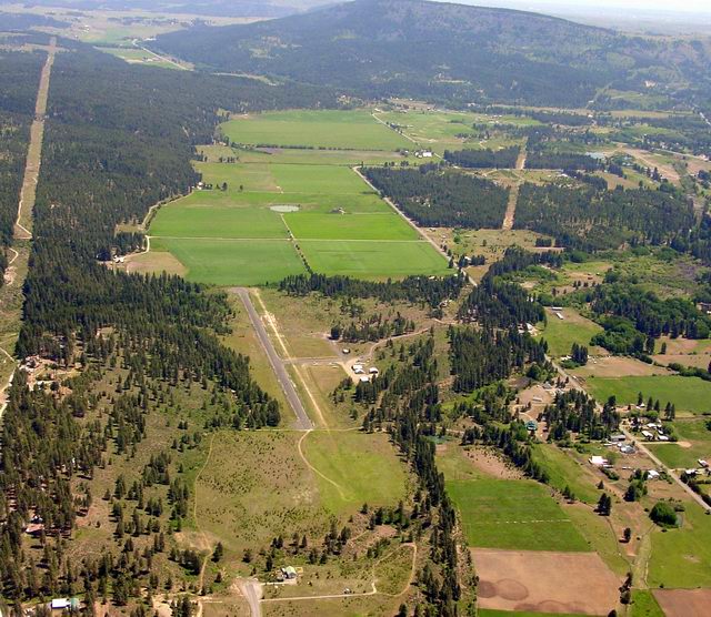
Nicely maintained, quiet country airport. Tall trees just below the glidepath for runway 16 - they better not grow much more. |
|---|
|
Fairly active parachute operations from the field. The runway is listed at 150' wide, but the cracks and weeds have claimed 50 feet on both sides. Land in the center strip. I like this field a lot, but it could use some maintenance. |
|---|
|
Kind of a lonely, forlorn airport. The asphalt surface is spalling and not in good shape. The markings are faded. Do not expect any facilities to be available, i.e., not a good place for a bathroom break unless you are comfortable in the bushes. Some glider activity. Check current information before planning a stop. The rumor is that the state of WA is planning on dropping some bucks to spruce up the place. I hope so. |
|---|
|
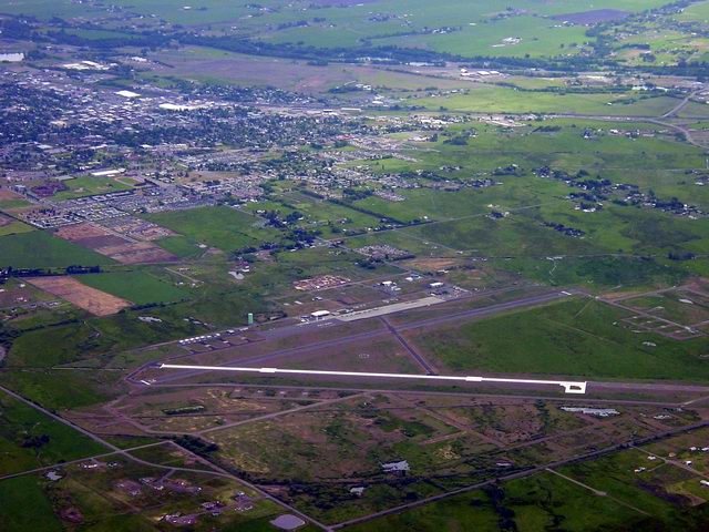
The glowing white concrete runway 11/29 at Ellensburg is visible many, many miles away. ELN is a popular bathroom break after crossing the Cascade Mountains over Snoqualmie pass. It can get hot. |
|---|
|
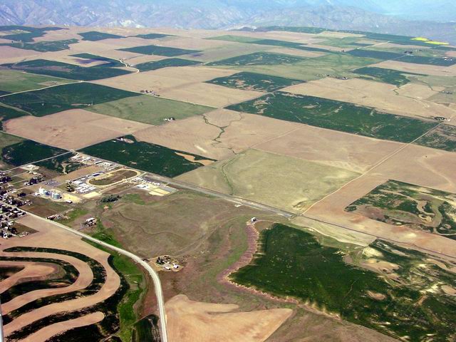
Note the Columbia River Canyon in the background. You really get the sense that the center of the state is a vast flat central high plain surrounded by river canyons. I didn't land here but just overflew on the way to Chelan. |
|---|
|
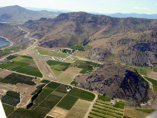
Great little airport. Extremely well maintained with thriving businesses on the field. The Lake Chelan resorts help bring in the bucks. The strip sits on a shelf in the Columbia river canyon, and the traffic pattern is below the canyon rim. It's interesting to see dirt above you on all sides during the approach. Can not see the lake from the airport, though you will get a good view as you fly in and/or out. The airport is surrounded by fruit orchards. |
|---|
|
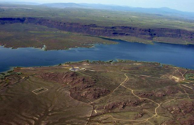
Airport is about 5 miles southeast of the dam. It is sited on a bleb of lava jutting out into Banks Lake. Don't expect to walk to civilization after landing. A bike could get you to Electric City easily, but it can get HOT. There is camping on the field. |
|---|
|
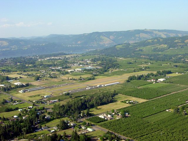
Beautiful location in a bowl on a shelf above the Columbia River gorge which can be seen in the background. The field is surrounded by fruit orchards, bounded by the Hood River to the east and Mt. Hood to the south. Hood River is the wind surfing capital of the continental U.S. It can get hot and the wind blows most of the time. |
|---|
|
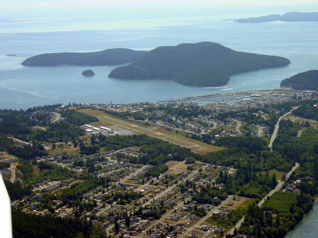
Anacortes is the "Gateway to the San Juan Islands", because this is where you pick up the WA state ferry servicing the picturesque island group. The major islands, San Juan, Lopez, Orcas, all have at least one airport, and seaplane runways dot the area. Anacortes airport is well maintained. It's a LONG walk to town, but a short cab ride. Watch the winds. |
|---|