Home Prev Next <info@primetab.com> Last updated Mon 2013-11-04 Best viewed full screen
|
|
|
|
| Harvey, WA | Arlington, WA | Sekiu, WA | Sekiu, WA |
|
|
|
|
| NOW, WA | Port Angeles, WA | Crest, WA | Tacoma Narrows, WA |
|
|
|
|
| Shelton, WA | Westport, WA | Chehalis, WA | Darrington, WA |
|
|
|
|
| Concrete, WA | Concrete, WA | Morton, WA | Morton, WA |
|
|
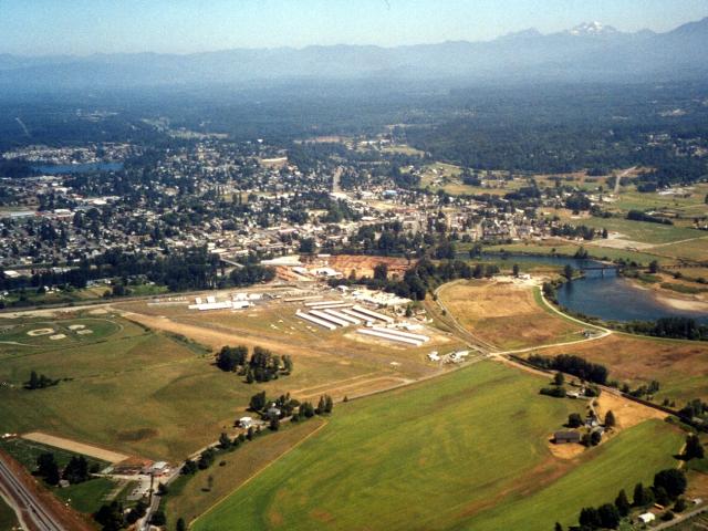
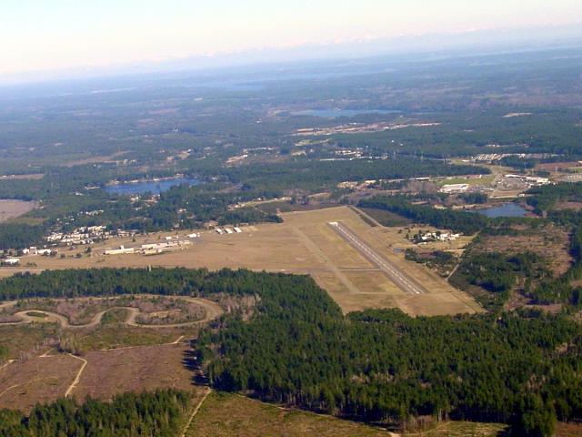
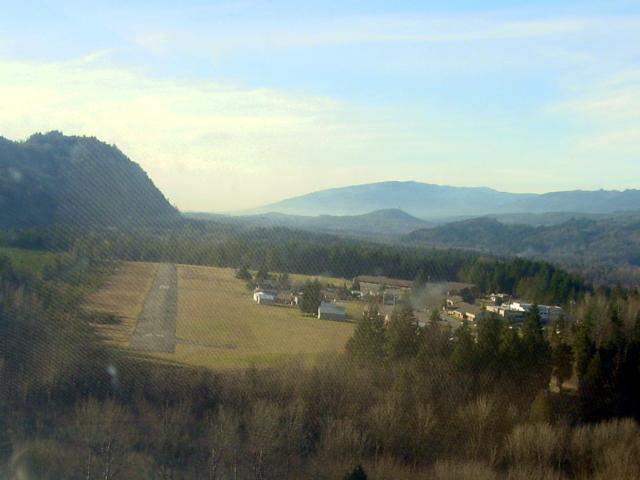
This is my home field. To the north is the quaint city of Snohomish. To the west and north is the Snohomish River. Narrow asphalt runway. The runway may not be easy to see. It extends from the left center to the lower center. For its size this is a VERY active airport with a successful FBO and Flight school. |
|---|
|
|
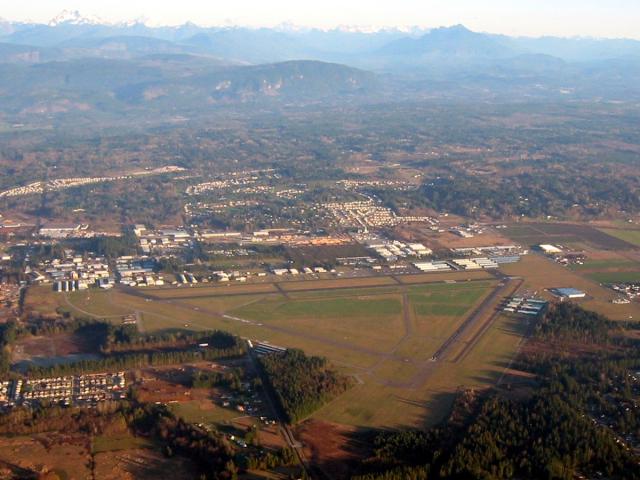
This airfield is about 15 nm north of my home field. Some rather colorful characters fly out of Arlington and one must be careful when transiting their airspace. I tend to give the field a wide berth to the east or west. |
|---|
|
|
|---|---|
|
|
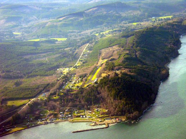
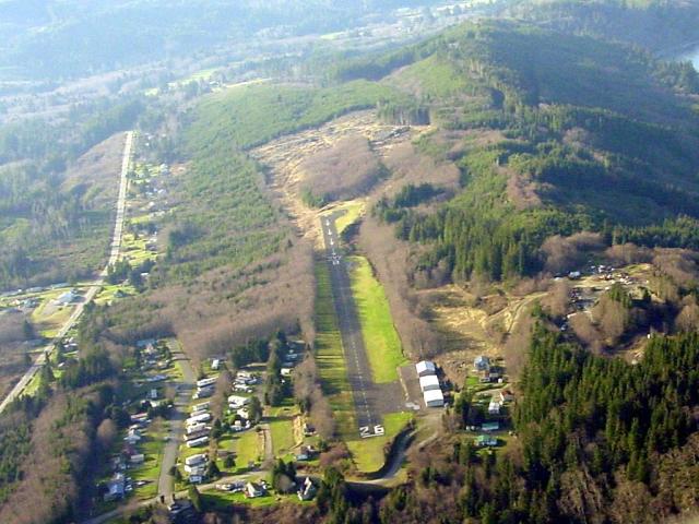
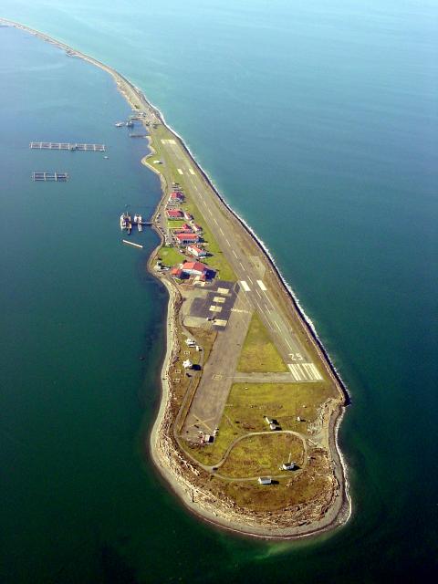
Sekiu is a fun little field. It slopes up from the west, so runway 08 slopes up and 26 slopes down quite a bit. Note the long displaced threshold on 08. Watch out for deer. Taking off on 08 launches you out over Clallum bay, so once you clear the runway you are instantly 400 feet over the water. Just 20 nm to the west is the tip of the Olympic Penninsula, Cape Flattery. |
|
|
> Pretty wild. Note the aquaculture in the upper left. The road gently curves around until it meets the Port Angeles waterfront. I would love to land here, but then I'd have ALOT of explaining to do, as this is off limits to the likes of me. |
|---|
|
|
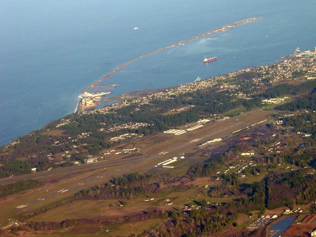
The airfield in the previous photo, NOW, is on the tip of the penninsula in the upper right of this photo. The city of Port Angeles is on the shoreline and to the right in this photo. |
|---|
|
|
|---|
|
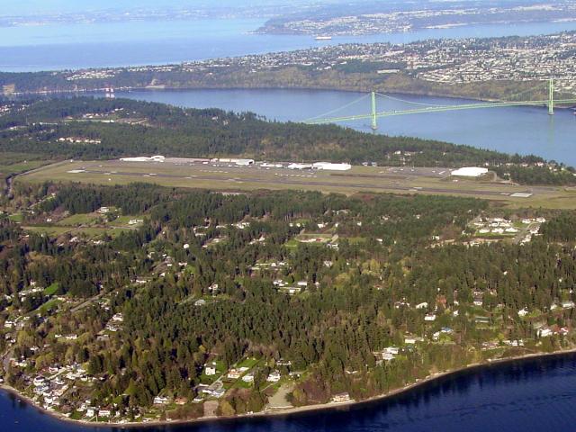
Very nice airport with a tower. Good place to practice airspace awareness and tower communications. I had a particularly pleasant experience with Mike Pickett of PAVCO, the flight center on the field. One of my magnetos failed the runup and leaning did not clear it. Mike graciously offered to give it a try, and in the process taught me a thing or two about my own aircraft. Thank you, Mike. There is some glare on the window in the close shot. The long shot is more picturesque, with the majestic Tacoma Narrows suspension bridge in the background. This is actually the second Tacoma Narrows suspension bridge. The first, finished 01 July 1940, and at the time the 3rd longest in the U.S., gained the nickname, Galloping Gurdy, when on 07 November 1940 it oscillated for hours in a 42 mph wind before collapsing into the water. |
|---|
|
|
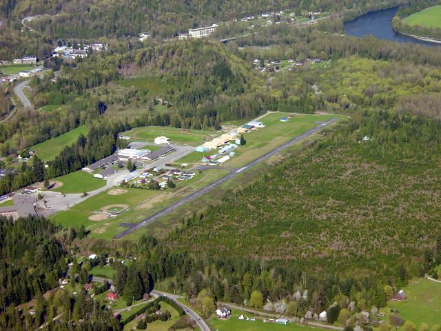
Shelton is a pretty cool field. Long and wide, it often has a nice crosswind for landing practice. The buildings to the right (south) of the runway are not part of the working airfield. The airport services and FBO are on the left side (north) of the runway. |
|---|
|
|
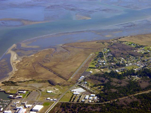
Small airport on Grays Harbor. Also within a few miles is Hoquiam, HQM, and Ocean Shores, W04. The winds can really whip through here, and it is often socked in with fog. |
|---|
|
|
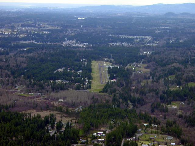
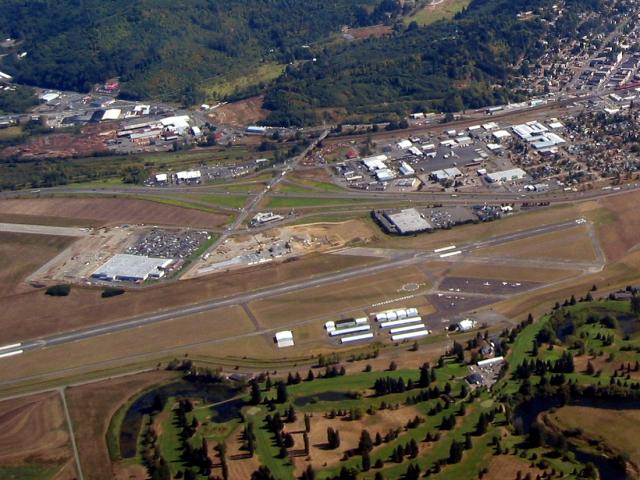
CLS is right along I-5 at the NW Chambers Way exit. Golf course to the west. A bit of a taxi from the runway to the FBO. Note the very nice segmented circle. |
|---|
|
|
This shot was taken through the windscreen so there is some reflections on the plexiglas. Darrington is an interesting little airport. Note that at the east end is a mountain. Not a place to blow a go-around, or try a long downwind for runway 28. Also, note the group of people in the lower right. What are they doing? Unfortunately, the Darrington Cemetery is right at the end of the runway and my little plane noisily disturbed the somber proceedings. I apopogize. May they rest in peace. I apologize for the intial go-around on runway 28 because the mountain was looming large in my windscreen. I apologize for the second go-around on runway 10 because I was too high. I apologize for the final landing on 10 and the subsequent takeoff from 28 - takeoffs are loud. |
|---|
|
|
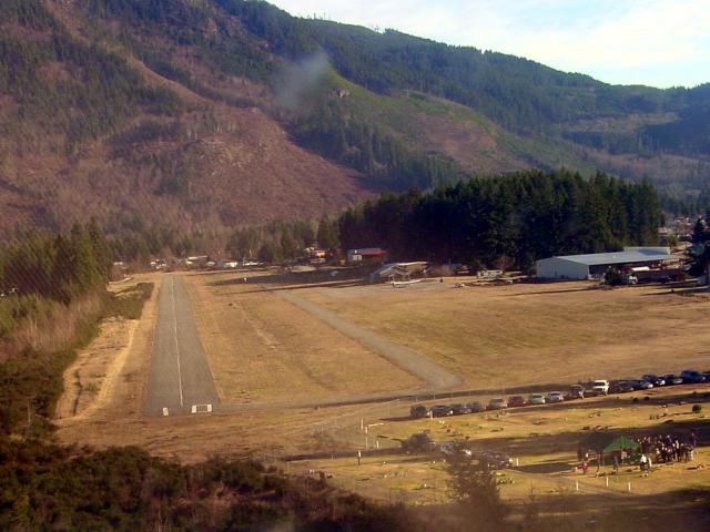
Much reflection of the faded glareshield on the windscreen. The runway is listed as being 60 feet wide. I don't think so. 40 maybe. Note the houses on the field. It was a nice mid-winter day and a guy was sitting on his deck, his feet up on the rail, a brew in his hand watching the activity, of which there was little. After my landing I expected him to hold up a score card with a number on it. No taxiway, but turnouts. Downwind drops down over the mountain in the back left, then short final over a small river gorge with squirrelly winds. Fun stuff. |
|---|---|
|
|
Here is another shot of Concrete. Note the river to the right and the line of storage silos in the center background. Concrete has a nice website. |
|
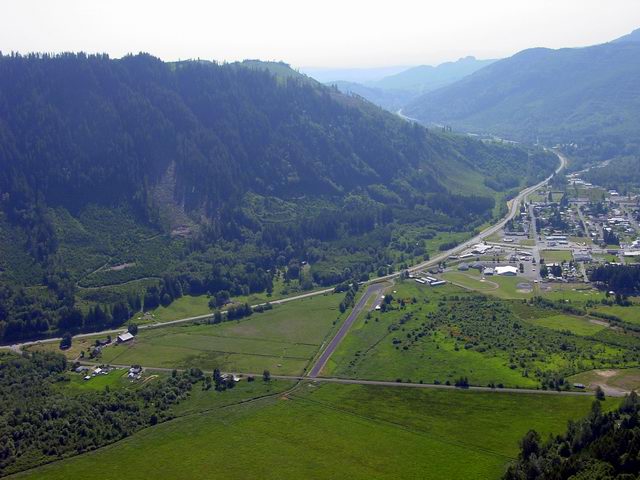
A short field - a very short field. Morton is situated in a quaint little valley separated from Riffe Lake by a 2700 foot mountain. Mount Rainier dominates the landscape 30 miles to the northeast. The east end of this airfield is unobstructed, but the west end has the aforementioned mountain and high powerlines to make a pilot nervous. It was a windy day with winds out of the west. This meant that whereas the landing would be over the unobstructed runway end, the takeoff would be into the mountain and over the powerlines. I decided to come back on a calm day, so for my first operations at Strom I could land on 25 and takeoff on 07. We made a low, slow pass over the runway for a look, but had no intention to land. |
|---|---|
|
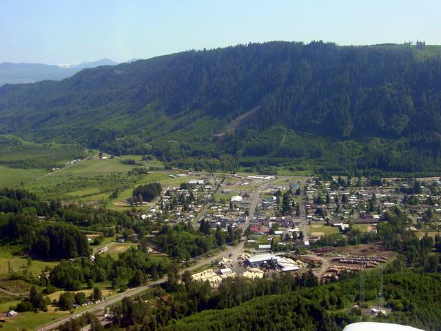
The airfield is left-center in this photo. The foreground is the city of Morton. Note the hazed ridge upper-left. Behind the center mountain and the hazed ridge lies 12 mile long Riffe Lake. |