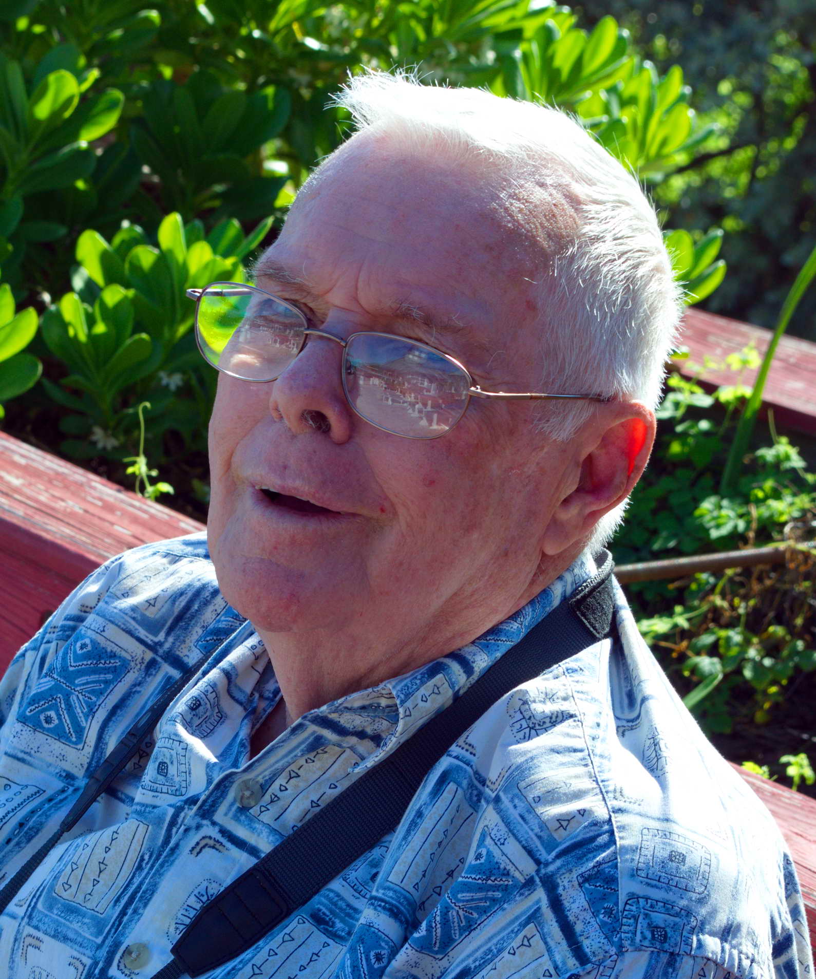
I knew him about 20 years. We met on line on the USENET homebrewing forum, rec.crafts.brewing, and also on the Home Brew Digest (HBD). At the time Dick lived in Brookings, OR, fished the Rogue River, and was learning to homebrew. In a series of long emails I helped teach him to homebrew. Some years after he moved to Silverdale, WA, then in year 2000 to Port St. Lucie, FL where he experienced 5 hurricanes the first 5 years he lived there, Barry in 2001, Charley and Frances and Jeanne in 2004, and Wilma in 2005. We only personally met about 5 times, and yet we maintained email correspondence and shared much through the years. In the past few years as his health declined and as he cared for his wife, his world contracted and he was very interested in the minutia of my escapades working, flying, fishing, and brewing. We corresponded often and this year I created a series of webpages for him. He loved to learn.
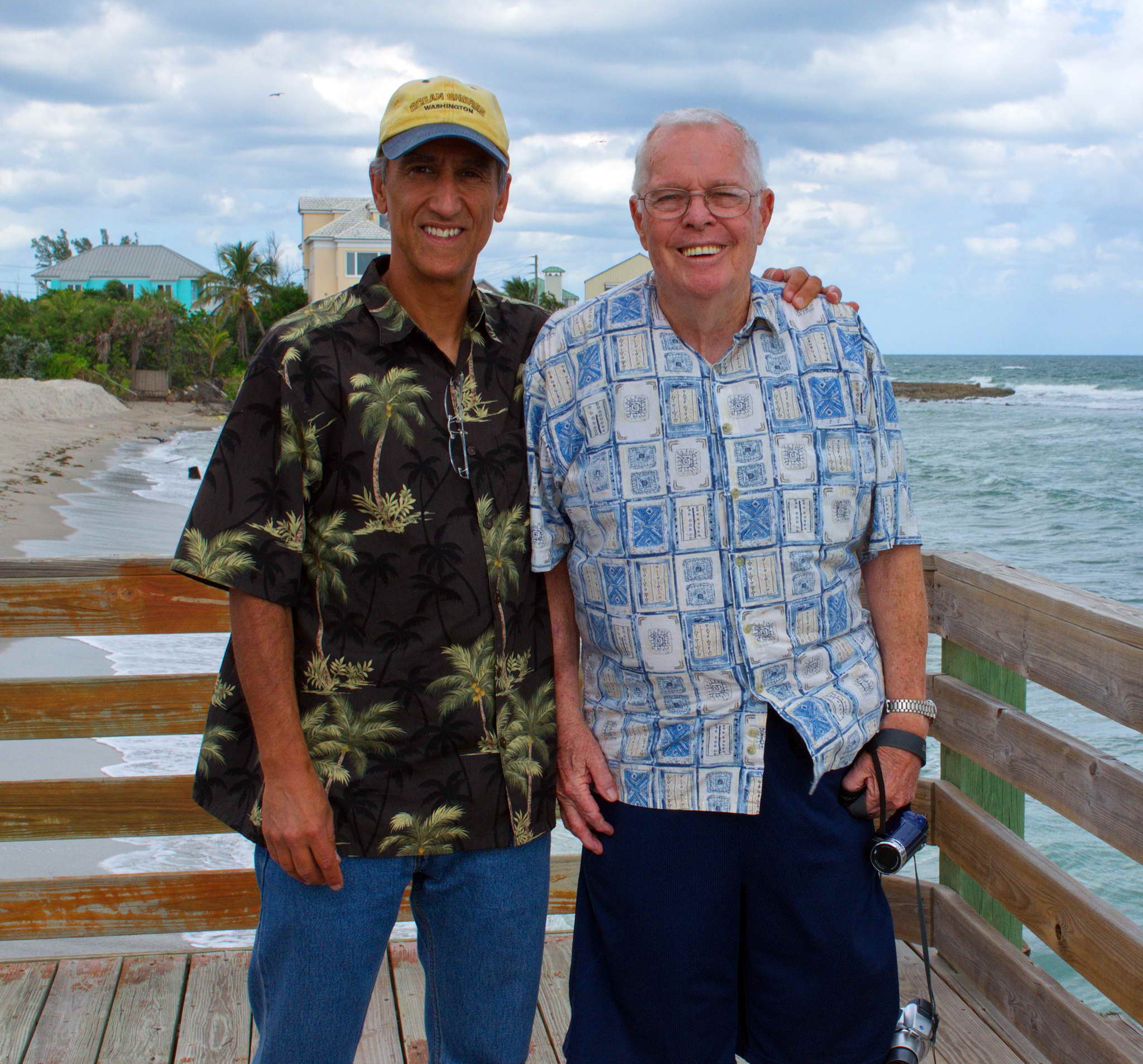
Regrettably, I never got to fly with my father, but I did get to fly with Dick. He and Pierrette never had any children and when we were together for those few days in Florida said he thought of me as a son.
I will miss him.
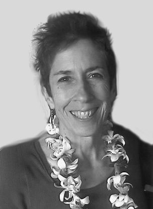
There are important people in our lives. And that importance is not necessarily measured in how much time was spent together, nor even how many words were shared. Their importance can only be measured with time and the realization of the impact which they had on our lives. For me, Colleen was one such person.
We met in the summer of 1969 when she was visiting her aunt and uncle for the birth of their daughter. The first time I got drunk was on the night of the first moon landing, 20-21 July 1969. Colleen and I and others drank rum and cokes from a thermos and ate chocolate chip cookies in the apartment of a friend's parent. I was so hung over the next day I couldn't look at a chocolate chip cookie for a year. A few weeks later she returned to her home in Logan, UT.
By mail we shared the typical teenage angst. A couple of years later, just before I was to start at the UofW I hitchhiked to Logan and visited her. Colleen's father, John, a professor at Utah State, was not impressed with the hippie who had showed up on his lawn. Her mother, Kit, was more accepting. The hitchhike home included the single most frightening car ride in my life, plus being harrassed by some local cop somewhere in Oregon and made to walk miles opposing traffic on a divided highway while he drove a 10 mile circuit between exits. The next summer I worked on her uncle's father's ranch in Independence, OR, Ray Ogle. At nineteen it was a turning point in my life. Away from the folks for the first extended time, working dawn to dark, day after day after day. I was a ranch/farm hand working with/for Colleen's cousin Johnny, a true redneck with a healthy skepticism concerning this long-haired suburban hippie. The hair went within the first week. Not practical - got in the way and got filthy. I did earn Johnny's respect which meant more to me than I could have imagined. A lot happened that summer besides gaining an appreciation of just how damned hard ranchers and farmers worked. I dragged a breech birth calf out of a braying cow with a rope and bare hands. Slaughtered a sheep, and puked, but gutted it out. Helped BBQ and eat it the next day on the Fourth of July. Delicious. Bailed tons and tons and tons of hay. Colleen visited a few times and the one image I have of her from that summer, was coddling the fuzzy newborn calf in her lap and feeding it a bottle.
When I got back home, I lasted less than a week into my third year at the UofW. I came home, told my mother I had quit school and I would be moving out. Shortly, thereafter I did, and so started my life as an adult. I owe it to Colleen and her family. Yes, I did eventually finish college - twice.
We saw each other rarely over the years. Colleen traveled the world widely and eventually landed in Alexandria, VA. I attended her first husband's wake/party in Logan, UT after he was stabbed to death over a parking place in Washington DC.
We kept in touch over the ensuing decades. She worked at the US. Census Bureau for decades, met and married a great guy, Jerry Caldwell from Knoxville, TN. They lived in Alexandria, VA. Colleen came to Seattle to attend my father's funeral in 2000. Occasionally we shared personal triumphs and tragedies by email. We would have a drink or lunch if her travels brought her through Seattle. Jerry retired, she retired, she was diagnosed, and they moved to Knoxville, TN.
And now she is gone. Thankfully she had Jerry by her side. I am lucky to have known her, and lucky to have met Jerry after a couple of decades of marriage. The world is diminished by her passing.
Here is her obituary written by her mother, Kit.
 HYDE PARK, UT � Colleen Flannery, Hyde Park, Utah and lately Knoxville, TN, returned to stardust from which she was created on October 26, 2013.
Twinkle in her parents� eyes in Europe, Colleen was conceived under a hot-tin-roof in Mississippi, born in Alabama on March 1, 1955 to peripatetic parents Kit and John Flannery. She spent most of 30 years in Utah; gradeschool in Park City when it was still a ghost town, 2 years in SanFran, and in 1973 was voted MostLikelyToDisagree by Logan High School, followed by USU degrees.
Then with backpack and boyfriend, off she went exploring Papua New Guinea and Australia. That was supposed to become her book, but life got in the way: a move to Virginia in a surplus schoolbus full of �stuff� with a cat named Dog, Government jobs, marriage to Michael Dalton, and widowhood.
She burned the candle at both ends, double-booked, multi-tasked, with always much more on her dance card than was possible. Colleen was family mediator with her humor and patience, caring for her paternal nonagenarian Opa. For her 100 year old maternal grandmother, she created a laughing funeral in the Military�s allotted 10 minutes. She and Jerry Caldwell were married under cherryblossoms at Jefferson Memorial. She �caught� the family tree obsession from her mother. They visited, personally or virtually, shirt-tail cousins, �our� 1632 tobacco plantation, triple-dunker churches, civil and revolutionary war archives, logging sites and eroding cemeteries in America, Luxembourg and Switzerland. She traced her Irish famine emigrants and added her name to the family gravestone in Baltimore.
Colleen and Kit traveled also to Istanbul, Thailand, Curacao and AngkorWat; and lastly Hilo for her 58th birthday to visit a nephew she�d mentored years ago.
Her favorite things: out-West/ red wine/ long tub soaks/ John�s dog, Kit�s cats/ books/ parties/ nick-names/ crossword puzzles/ yoga/ travel/ her cowgirl boots!
Colleen was a consummate volunteer: for cancer funding, on tall-ships, aerial censusing wildlife in Kenya, co-designing National Park in India, humanitarian clowning for HIV-orphans in Romania with Patch Adams, and in eastern West Virginia, fostering/releasing 6 generations of blackbear cubs, whistlepigs, racketycoons and other road casualties. Rehabilitating was her after-retirement passion. She hoped to live out her last days in those remote Allegheny Mountains. It is where her remains will be.
Her life was not about length, but of depth and breadth. While beset by Dengue fever, EMFs, LymeDisease, it was rare cancer that shortened her life. She is survived by we friends and relatives, by husband Jerry and his family, especially uber-cool granddaughter Ruby in Knoxville. Also surviving is mother Kit Flannery, Hyde Park, Utah and father John of Truth or Consequences, NM. And BFF Liz, boss Joel, cousins Samantha and Tristan. And her cancer support group. Create your own esoteric fare-thee-well. Toast our splendid diva with irish/ red wine/ breakfastbeer/ smoothie. Honor her memory by donating to or adopting from a pet shelter. Sing-along to her favorite, huge IZ and his tiny uke �Somewhere Over The Rainbow�. Be glad we knew her.
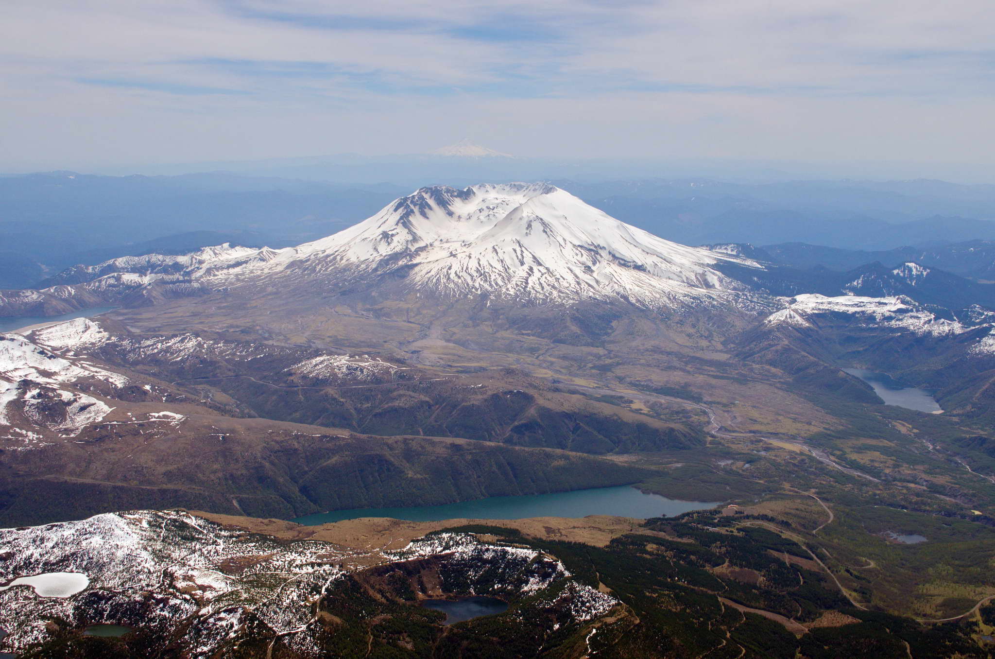
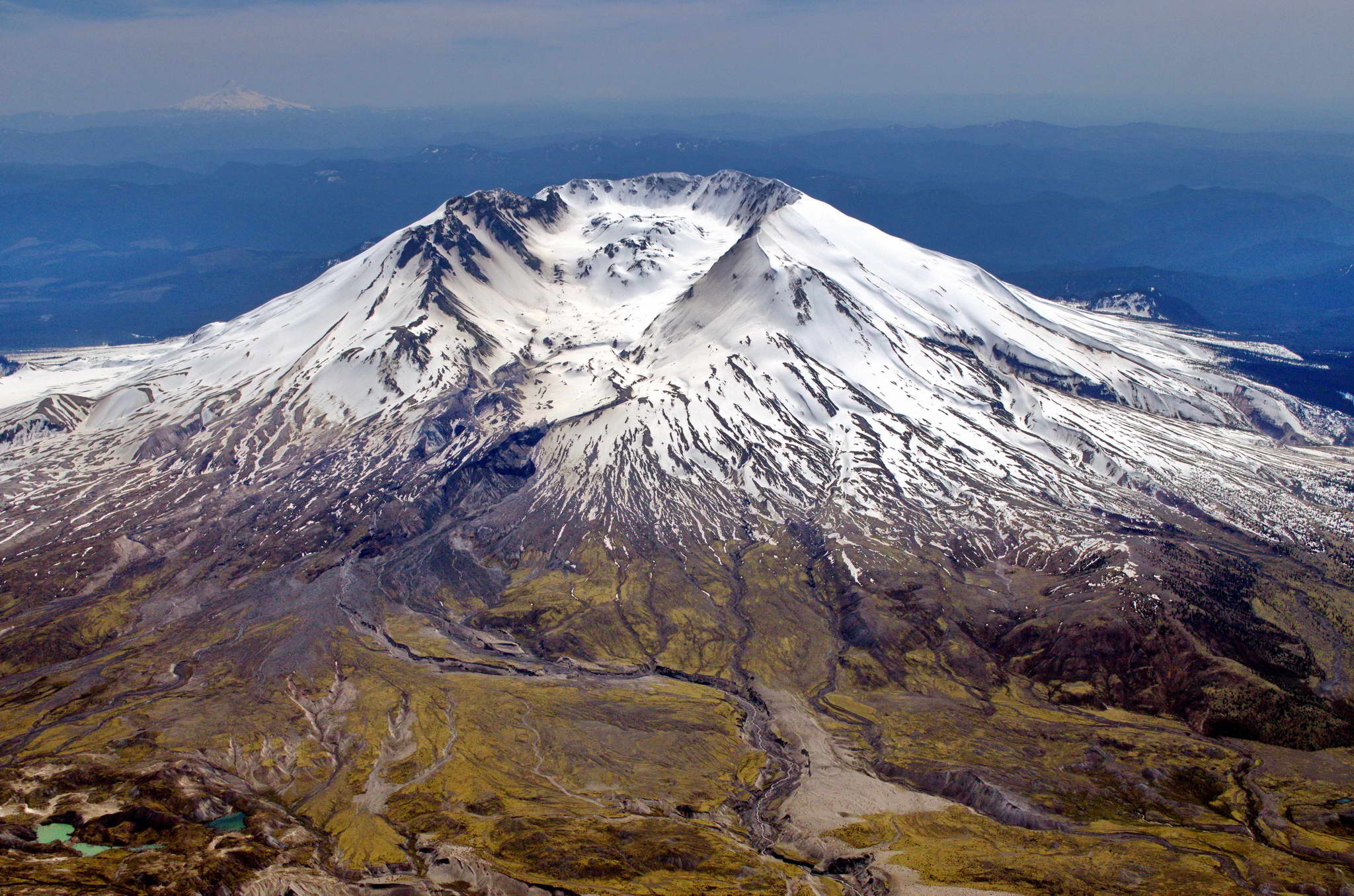
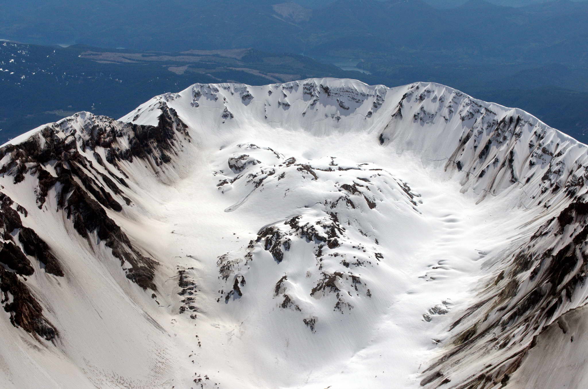
Colleen was cremated and her ashes distributed to friends and family. Parts of her are scattered about, the Grand Canyon, Red Rock Pet Cemetary in Kanab,UT, the family plot in Baltimore, adrift in the Atlantic, and pushing up crocuses in a Tennessee yard where her granddaughter sprinkled her. As of 01 May 2014 she is also now a resident of the crater of Mt. St. Helens. I took the plane up on a beautiful day and buzzed the crater, dropping her in a small paper lunch sack and making a bullseye.
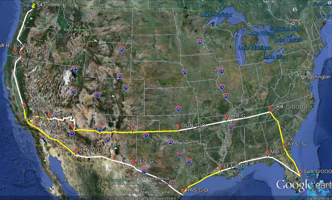
Many private pilots fantasize about a very long cross country flight, but few actually undertake the endeavor. I had had similar fantasies and had in fact taken one fairly long trip in the same plane. In 2005 my plane partner flew the plane to Chicago, then onto New Orleans, where I was visiting a business friend for a few weeks. My partner flew commercially home, and I and another friend flew the plane from New Orleans Lakefront Airport (NEW) to my home base of Harvey Field (S43), Snohomish, WA. This trip proved to me the old adage that a long cross-country flight is just a series of shorter cross-country flights.
At first this Seattle to Tennessee to Florida flight was just an inkling of an idea, and I told people who asked that I had not made up my mind. I did not even discuss the idea with the friends I would be visiting. My flight planning started in the summer of 2012, and still my story was that I had not made up my mind. Never under estimate the capacity for self-delusion.
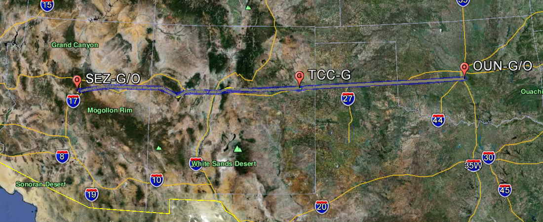
From these considerations the route materialized. Basically, south around the end of the Sierra Nevada Mountains, east across the Mojave desert to overfly the Grand Canyon, south to Sedona, AZ, then east to Knoxville, TN where I would spend a few days. Depart TN southward to Port St. Lucie, FL where I would also spend a few days. From Port St. Lucie, FL, I would travel northwest up the peninsula, west across the panhandle and along the Gulf Coast, then southwest to Corpus Christie, TX where I would spend a few days fishing. Depart Corpus Christi to northwest across southwest TX and southern NM, pass over Tucson and continue northwest along the southern Mojave to re-enter the Central Valley of CA the way I had left. Then back up north to home. Though it was still just a game, with this rough plan I ordered 18 sectional charts and the Grand Canyon Special Flight Rules Area chart (GCSFRA). I also downloaded all the latest digital sectional charts and Terminal Area Charts for the entire nation.
Sectional charts are published by the Federal Aviation Administration (FAA), cover about 350 NM east to west and 250 NM north to south, and are named for the biggest city they cover. There are 37 somewhat overlapping sectionals that cover the 48 contiguous states, 1 that covers the Hawaiian Islands, and 16 that cover Alaska. Remember these are lofty CHARTS not pedestrian MAPS.
As a young boy I LOVED maps. When other young boys were looking through National Geographic for photos of bare-breasted native girls, I was collecting the inserted maps and mounting them on my wall. As a point of information, National Geographic was an actual hard-copy magazine for 113 years before it was a television channel in the USA.
Physically these aviation sectional charts are big and unwieldy, about 5 feet by 2 feet, more precisely 59-1/2" x 21", and printed on both sides, generally the north half on one side and the south half on the other. Imagine unfolding and refolding such a beast in the front seat of your car while driving. Now, imagine doing it while trying to fly an airplane. They have a scale of 1:500,000 and are crammed with color-coded information including airports, airspace, communications frequencies, navigational aids, landmarks, urban areas, rivers, roads, railways, antennas, and more, and more, and more. Various schemes have been developed for folding these charts to ease usage. The scheme I use makes one side easily accessible and one side virtually inaccessible. The charts arrive folded like a typical automotive map, first they fold along their length in 12 accordian like sections. Then the long thin result is folded in half resulting in a product 5" x 10-1/2". I completely unfold the chart with the side I want accessible down, then fold it lengthwise in half making it 5' long and 1' wide. Then follow the 12 sections of accordian folds along the length. The result is the same size as the stock chart, but it opens like a book. I solve the problem that only one side is accssible by buying 2 copies of my local Seattle chart and refolding each.
I did not buy two copies of each of the charts I was to carry. Most of my flying was generally eastward or westward and the paper charts were backups to my GPS system described below. I refolded those charts on which I would only be traveling on one side, and the others I left as they came.
You can see these charts at SkyVector.com. The first chart to load should be based on the domain controller's best guess at your location based on your Internet routing. Or you can choose your chart from the Charts icon on the top toolbar.
With the charts ordered I got down to more detailed flight planning.
My flight planning guidelines were simple.
From these considerations I developed the following flight plan.
The estimate was 10 flight days, 6000+ NM, 60+ hours of flight time, and $2880+ fuel cost.
It kind of happened that way.
In summary, by days, and listing all the stops by airport abbreviations:
Below is the entire planned route. Each day's flight is either white or yellow. I had built in the option of staying at Jean, NV in case the afternoon weather over the Grand Canyon was looking turbulent - mornings tend to yield smoother air.
If you have Google Earth installed, then simply click on this planned route and stops link and it will load into Google Earth. In the folder you will find subfolders, Planned.Legs and Planned.Waypoints.
Likewise click on this actual route and stops link and it will load into Google Earth. As the name implies it is my actual flight path.
The Saturday before was a day to weigh everything and calculate the plane's weight & balance.
Weight and balance is important for a number of reasons. Too heavy and the wings might have trouble creating the lift needed to safely stay aloft. Poorly balanced right to left might make one wing heavy increasing drag and the yoke effort required to keep the plane level. Poorly balanced fore and aft might create a situation where the elevator control did not have enough authority to either keep the nose or tail up. This could cause issues in all phases of flight.
Sunday was a day to pack up the plane and finalize the Weight and Balance. Monday was a day to relax, second guess, and provided a buffer for any missed and/or forgotten issues.
I was traveling alone and I brought too much clothing. Nearly all the Best Western, Holiday Inns, and their class of lodging have self-service laundry facilities. I only wore about 1/4 of what I brought. I could have easily gotten away much less. Consideration must be made for travel from plane to lodging. If I were to do it again I would make sure I could carry everything on my back. As it was I had a medium pack to which I could attach a small pack (camera, chargers for gizmos) with carabiners, then slip the laptop case over my shoulder. The other luggage was a small rolling suitcase. On simple overnights I would transfer the clothing I wanted from the suitcase to the medium pack and so leave the suitcase in the plane. I'd ditch the suitcase and substitute a larger pack for the medium and might try to cram the laptop in the pack.
Due to weather and time I had adjusted my planned flight route from basically one of following I-5 south all the way to southern California, to one in which I crossed the Cascades along I-90 then turned south over Ellensburg, WA and continued south along the east slope of the Cascades to Klamath Falls, OR.
For a number of reasons, Snoqualmie Pass is my preferred route acoss the Cascade Mountains. The major northern east-west interstate highway, I-90 follows this route. The highest peak along the route is less than 5200'. There are runways every 20 NM along the entire route (Fall City (pvt), Bandera (4W0), Easton (ESW), Cle Elum (S93), and the crossing is only about 40 NM, and only about 25 minutes even in a slow plane like mine.
The term "follow" when applied to roads and highways is an approximate thing. To me it means to "generally follow the course of", and not "literally follow the path of". There are those who believe the acronym "IFR" means "I Follow Roads", and in bad weather and low ceilings they do just that. This is a dangerous thing, particularly on Snoqualmie pass, because just before the summit there is an hairpin turn. If one misses it one either follows the wrong valley into the lonely heart of the mountain range, or one makes a headfirst granite landing. In neither sense, the legal definition of "Instrument Flight Rules", and the "I Follow Roads" definition, do I engage in IFR flight.
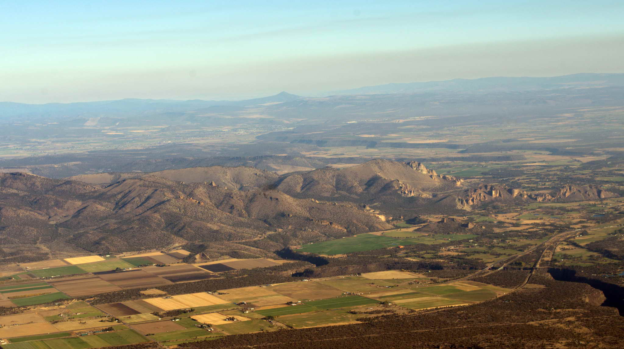
The air over the Cascades was smooth and the sun was a welcome relief after 3 days of low, unbroken overcast. Once out of the radar shadow of the green and still barely snow-capped Cascade Mountains I started a long slow turn to the southwest and initiated flight following around Ellenburg. Air Traffic Control (ATC) handed me off seamlessly from center to center all the way to Klamath Falls. My original route had me overflying Crater Lake for a photo run, but the late start created some anxiety concerning arriving at Klamath Falls before sunset, and I adjustment my route to bypass the lake. I also cut some corners on my route and ran at high RPM, 2550, to save time. By the time I was approaching Bend, OR it was clear I would easily make Klamath Falls before dark and I was able to relax and enjoy the rest of the flight.
The air was hazy from forest fires in the WA and OR Cascades. There were many fires to the west along the east slope of the Cascades spewing straight columns of smoke between Mt. Hood, Mt. Jefferson, the Sisters, and west of Bend, OR. The smoke stopped rising at about 8500' when it impacted the top of the inversion layer, creating southward trailing anvil tops.
Aviation is filled with hundreds if not thousands of acronyms. There are two kinds of altitude used in aviation, "MSL" and "AGL". "MSL", stands for "Mean Sea Level", and "AGL" for "Above Ground Level", so we can measure our altitude as above sea level or above the ground. Mostly, altitude is reported as MSL, but in reality the important number is AGL - and it better be greater than zero.
Much of my flight planning was routing from VOR to VOR. VHF Omnidirectional Range is a navigational beacon. Through the magic of directional radio signal and phase modulation a VOR receiver can determine the direction to the transmitter. With the use of a companion technology, DME (Distance Measuring Equipment), one can also determine the distance from the transmitter. This hopping from VOR to VOR provided a navigational backup should my GPS system fail. The route to Klamath Falls was planned to overfly the Ellensburg (ELN) VOR, the Yakima (YKM) VOR, the Klickitat (LTJ), (Dalles) VOR, divert slightly to the west and overfly Crater Lake, to finally the Klamath Falls (LMT) VOR. This VOR-VOR routing was used whenever the VOR stations were dense enough to make it practical, but the routing was advisory and often corners were cut to shorten both distance and time on the planned routes.
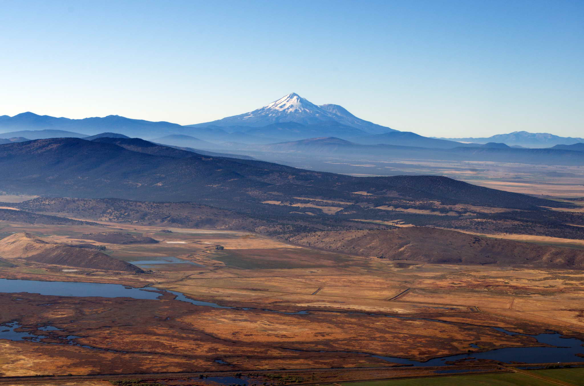
My approach to Klamath Falls took me over some interesting terrain. In addition to Crater Lake and Mt. Shasta, the greater Klamath Falls area has another notable feature, the huge Upper Klamath Lake, a major migratory water fowl stop on the Pacific Flyway. When I was in my early 20s I had spent a few weeks during one fall, car camping out of a 1960 Rambler station wagon in an old quarry, counting migrating geese, and adding other birds to my life list. In the area are dried bogs and flood plans as well as low hills and valleys spotted with yellow tamarack.
Redmond/Terrebonne, OR
Williamson River Ditch, OR - dry lake bed.

Landed at Klamath Falls after a straight in approach to runway 14 about 17:45 PDT which was only 5 minutes less than the predicted 3:44 flight time. Parked, tied down, put on the cowl plugs and plane cover. The receptionist at the FBO called her recommended hotel, the Cimarron Inn which sent a shuttle to take me into town.
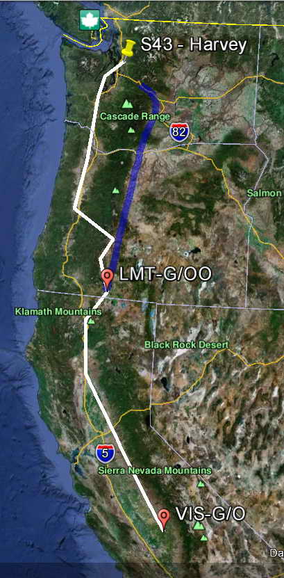 The planned route for the day is in white, and the actual route for the day is in blue. Only made about half my distance and went down the eastside of the Cascades rather than the west side. So much for flight planning.
I loaded all my luggage, medium pack, small pack, laptop, and rolling suitcase into the Cimarron shuttle van and rode into town with Raul, a taciturn hispanic gentlemen, who seemed to be the handyman for the Inn. The sky was clear and crisp being over 4000' in elevation. The sun was low on the horizon and lit the surrounding hills with a rosy hue.
The Cimarron Inn is a remodeled older style "motor inn". Basically a two story walk up L-shaped facility with all room doors outward facing to the railing ringed walkways. Clean, adequate, and inexpensive with free wireless Internet access and on demand shuttle service to the airport. My room was on the second floor. This is when I realized I had planned my luggage poorly. Managing 4 separate pieces was a bit like juggling bowling balls.
The Inn shares a parking lot and some sort of arangement with Elmer's, a Denny's like diner. After the sun had set and the sky was quickly darkening I walked over and had a light chicken salad and a beer for dinner. At one point the waitress, asked me an odd question, "do you have your Inn door key?" For a moment I thought it was a come-on, but then I hesitantly said yes, and she walked off.
I went back to my room and started checking on the next day's weather, when the plan was to leave about 9 or 10AM, fly to Visalia, CA (VIS) for fuel, then if time/weather allowed continue on to Jean, NV (0L7) for the night and stay at the Golden Nugget Casino which is on the airport grounds at Jean. Total distance Klamath Falls, OR to Jean, NV is 600 NM and 6:30 flight time. 10 AM was my takeoff deadline, adding an hour for gas at VIS, I should arrive at 0L7 by 5:30PM 30 minutes before local sundown.
By now you've probably asked, "what's an "NM"", and probably surmised it is a "nautical mile". This begs the question of, "what the hell is a nautical mile?" Technically an NM is one minute of arc at the equator (or any great circle). Since there are 60 minutes in each degree and 360 degrees in a circle, the earth's circumference is 21,600 nautical miles. The punchline is that a nautical mile is 6076 feet or 1.151 statute miles (the familiar "mile" of 5280 feet). Then, speed and distance in nautical miles is 15% more than in statute miles. For example 100 kts airspeed is 115 mph.
Got a ride on the Cimarron shuttle with Raul out to the airport at about 0730 PDT. Raul was a bit more talkative during our second ride. His answers to my questions and comments were at times a couple of words. The skies were clear and blue and I had a few spots of frost on the wings. It was a bright, brisk autumn morning - invigorating. The day's route would take me direct to Weed, CA, just northwest of Mt. Shasta, then south along a mountain pass with peaks 3000-5000 feet, leading into the north end of the CA Central Valley, Redding, Red Bluff, and Chico.
Redding was reporting overcast at 4000, but I was fueled up, the skies were clear and beckoning, so I launched at 0905 to see what I could see. The tower gave me runway 7 with a south turnout rather than 14 to avoid having to clear some work trucks off a taxiway.
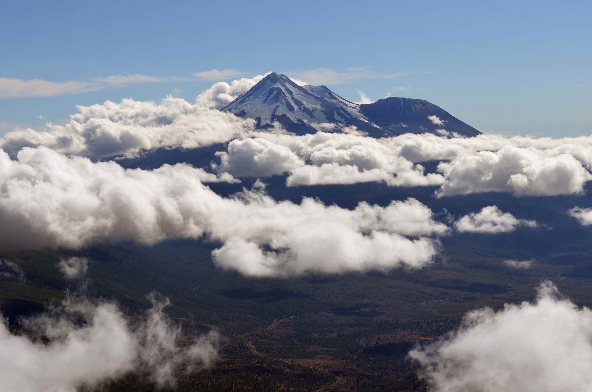
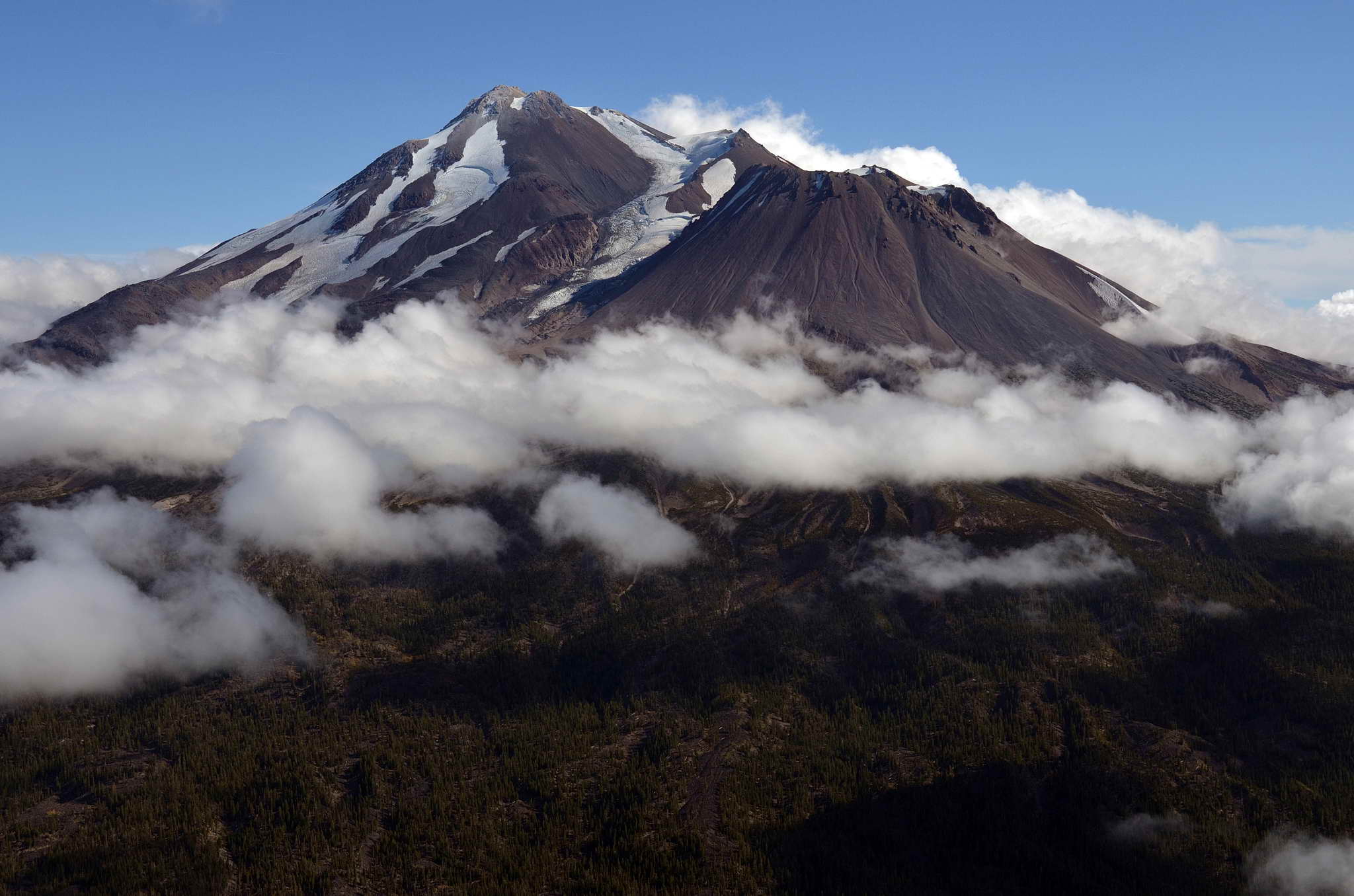
Climbed to 8500 and proceeded the 50 NM direct to Weed, CA. The hills, buttes, and cinder cones glowed orange in the low morning sun. Mt. Shasta loomed gray with a white hat to the left of my course. Approaching Weed, CA I could see a cottony layer of clouds clinging to the ground from Weed to the south and west without a break as far as I could see, probably all the way to the Pacific Coast Range of mountains. My route was socked in. I looked for some space between the ground and the floor of the cottony layer, but couldn't see anything. It was like a huge white snow rug laid under a Christmas tree. Tentrils of cloud where falling around the sides of the black cinder cone, Black Butte, which sticks up just 3 NM south of Weed. It was beautiful, but impassable. I could go over the top and hope that once in the Central Valley I would find a hole through which to descend, but I don't like "over the top" operations. Should the engine quit or the plane is forced to descend for some other reason one is flying blind through a cloud layer. No thank you.
I turned around and returned to Klamath Falls, landing long (with permission) on 32 so I did not have to taxi a mile to the FBO parking. I tied up and started waiting and watching the hourly METARs at Redding, OR the northmost airport of the CA central valley.
Mt. Shasta from a distance.
The Mather family, mom, dad, and son, in a Piper Archer bound along the same route as me had arrived while I was gone. They too had flown to Weed and turned around. Snowbirds from Bend, OR who winter in Tucson, AZ.
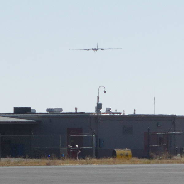
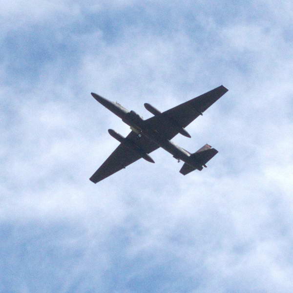
Klamath Falls airport is home to the 173rd Fighter Wing, 114th Fighter Squadron. About a dozen F-15s and all the required support and maintenance staff. My plane was parked 100 yards from the line of these big dogs. They were taxiing 50 yards past my plane all day, and flying high and low level ops on and around the airport. It was our own little air show. At one point in the day a straight winged U-2 Spy Plane requested a low pass on 32 and of course the tower agreed. With its massive wingspan it leveled off 100 feet above the runway and traveled halfway, a mile, then went to full power and pitched up. The air and ground shook, the windows rattled.
114th Fighter Squadron, Oregon Air National Guard, Klamath Falls, OR
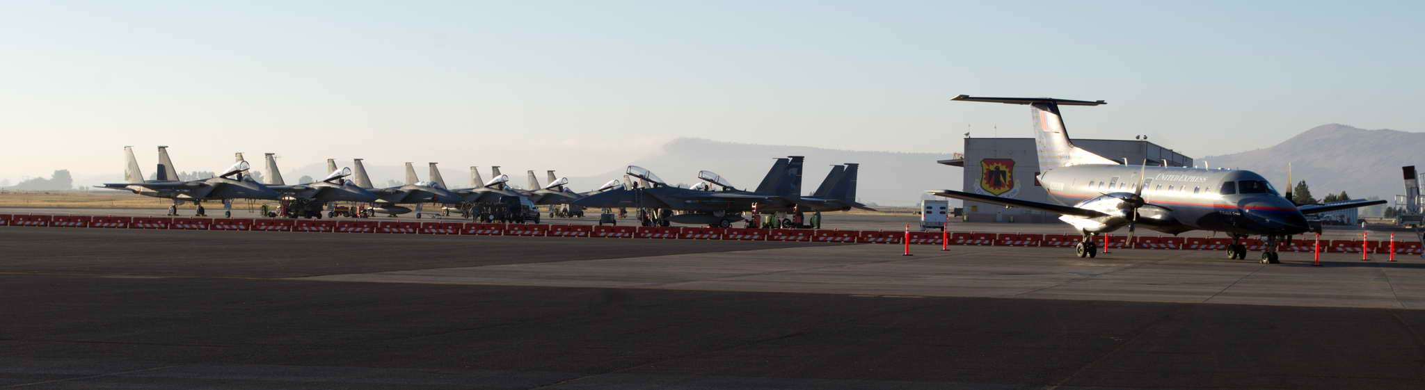
U-2 Spy plane on approach and departure. This is the "Dragon Lady" based at Beale Air Force Base north of Sacramento, CA. The U-2 is 63' long with a wingspan of 103', and an acknowledged service ceiling of over 70,000 feet. Actual service ceiling is suspected to be about 85,000 feet. Here is a nice link describing NASA's U-2
I took the opportunity of the waiting to repack my suitcase and backpack so I did not need to take my suitcase to lodging. I could simply transfer the clean clothes I needed to the backpack.
I chatted with the Mathers, Bob, Donna, and perpetually smiling and quiet son Ken. He was in the middle of his flight training juggling the interruptions of 6 month residences in Bend, OR, and Tucson, AZ. My own takeoff deadlines came and went. 1400 PDT was my deadline to take off and make Visalia, CA before dark. 1600 PDT was my deadline to take off and make Red Bluff, CA just 133 NM and 1:19 away. They all passed, so it was time to bed down the bird - tie-downs, chocks, cowl plugs, and cover.
Back to the Cimarron Inn with comparatively chatty Raul. I asked about snow in the winter, and he answered. I asked about the railway workers staying at the Inn and he answered. Riding back into town I noticed that KFalls was doing okay economically as there were few empty store fronts, and traffic was brisk. Again, I ate dinner at Elmer's and smuggled out a half-finished beer to take back to the room. The motel lobby provides a pot of chicken noodle soup, chocolate chip cookies, tea and coffee. While I was choosing a cookie to accompany my beer, I noticed a sign which said "10% off at Elmer's with a Cimarron Inn door key". Well, that explains the inexplicable waitress. The Cimarron Inn was growing on me.
Went back to the room to obsess about the next day's weather. The forecast did not look good.
If I had left on my original schedule, Monday 8 October, I'd be in Knoxville, or damn close by now. Weather at Klamath Falls airport at 6AM was reported by METAR as:
KLMT 131301Z 16007KT 7SM -RA SCT014 BKN023 OVC032 08/07 A3028 RMK AO2 RAB01 P0000
Decoded this means, 13th of the month, 1301Z time, winds 160 degrees at 07 kts, horizontal visibility 7 statute miles, light rain, ceiling scattered at 1400 AGL, broken at 2300 AGL, and overcast at 3200 AGL, temp 8C/dewpoint 7C, altimeter 30.28
The important bit of information is the sky conditions, scattered at 1400 above ground level (AGL), broken at 2300 AGL, and overcast at 3200 AGL. The forecast predicts it will break up between 11AM and 2PM. I should have gone back to bed. KFalls is at 4100' of altitude, and some of the granite that sticks up around there is 3000 to 4000 feet above ground level. I'd need a couple thousand foot clearance above the tops of the granite to comfortably make the 50 NM from Weed, CA to Redding, CA. At the least I'd need a stable ceiling of 5000 AGL to follow I-5, which is forecast for sometime between 11AM and 2PM. I should have gone back to bed.
The good news was the plane was getting a somewhat needed bath, and the next day's forecast for KFalls was sunny and clear.
If I could get out by 2PM I could make Visalia, CA. If lift off time progressed beyond 2PM, I would target Fresno, Merced, Chico, and Red Bluff. I needed just 90 minutes to make Red Bluff and the near perpetual VFR weather of the Central CA Valley.
Spent the morning napping, reading, and watching the weather. The entire central CA valley was clear all day, but Klamath Falls was socked in good. The rain fell until about 11AM, and the forecast called for it to clear by 2PM.
Around 1PM I rode with downright chatty Raul to the airport in the Cimarron Inn Shuttle to find the Mather's Archer warming up, getting ready to depart. We were both going to Visalia. Said, "Adios, Amigo" to Raul who was splattered with eggshell colored paint from his handyman tasks, paid the fuel bill, and woke up the plane. The sky was obviously clearing though still in process.
The terms, "broken" and "scattered", which I have been using with abandon to describe the cloud cover have precise meteorological definitions. There are 6 categories of cloud cover reported by aviation weather, SKC (SKy Clear), CLR, FEW, SCT (scattered), BKN (broken), and OVC (overcast). SKC is a cloudless sky to infinity and beyond. CLR is cloudless below 12,000'. FEW is up to 1/4 of the sky's area obscured by clouds. SCT is 1/4 to 1/2 obscured. BKN is 5/8 to 7/8 obscured. OVC is fully obscured. I am not sure what they call the lost eighth between 1/2 and 5/8. It is the government after all, and only losing 1/8th is probably the best we can ever hope for.
When all was ready I was given runway 7 for takeoff with instructions to stay east (left) of the other runway, 15/32, to allow a couple of F-15s to pass and land. When they passed me I was about 1000 feet higher and was able to turn in behind them and watch them land as I climbed to the southwest. The cloud layer was scattered to broken (in that lost 1/8th) and I climbed to 9500 to clear the last line of puffy clouds just before Mt. Shasta. Called ATC and initiated flight following. Shot some pics of Mt. Shasta from 9500, descended to 8500 and turned south near Weed, CA to follow the I-5 pass into the central valley.
I maintained 8500 until I was handed off to NorCal approach when they politely suggested, that since I was headed southeast perhaps I wanted to climb to 9500 or descend to 7500 to follow the VFR altitude rules (odd thousands plus 500 if course has an easterly component, and even thousands plus 500 if a westerly component). My course from KFalls was southwest so I had chosen 9500, but upon entry to the CA Central Valley I had turned southeast. I chose to descend to 7500.
The flight down the valley was unevental. The haze was annoying and became more dense the farther south I flew. It seemed the valley was home to a persistent inversion layer which topped out at about 4500. Flying southeast the late afternoon sun was coming from my 2 o'clock position lighting up the haze with forward scattering. Annoying.
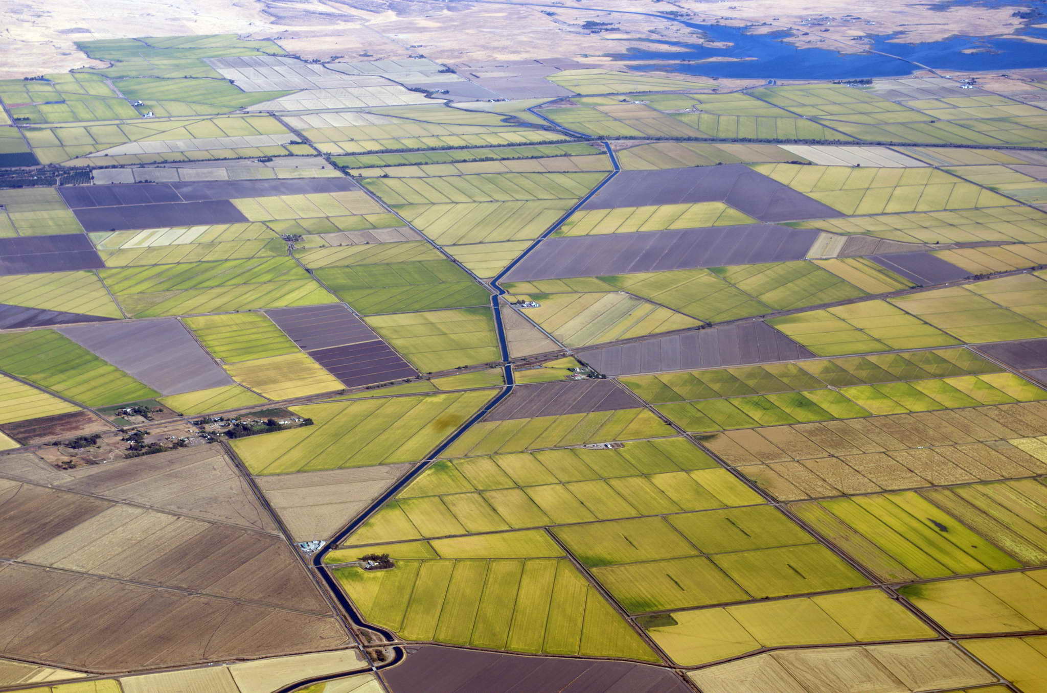
Agriculture near Durham, CA
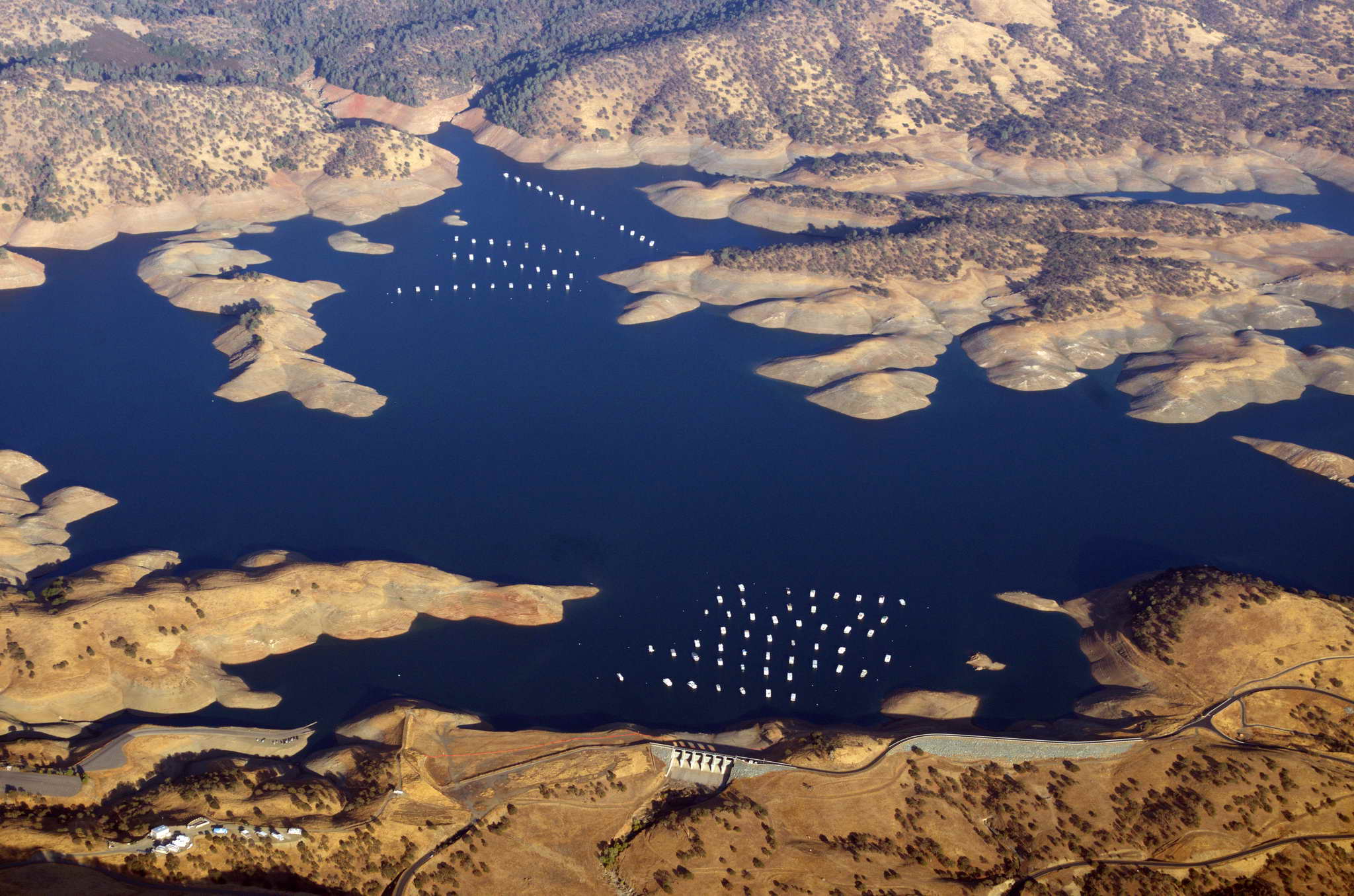
House boats on Lake McClure, northeast of Merced, CA
The only non-routine portion of the leg was a small diversion to the west to avoid a common Temporary Flight Restriction (TFR) over Beale Airforce base (BAB) which extended from the top of their airspace at 4100 MSL to infinity and beyond. Well, not actually infinity, but 18,000 is as good as infinity for my little plane. Some research on Beale AFB reveals it is the home of the 9th Reconnaissance Wing which hosts the U-2 spy plane "Dragon Lady" as well as RQ-4 Global Hawk remote intelligence vehicles. My guess is the TFR is to protect one or the other from prying eyes.
As I began my descent about 20 NM north of Visalia, CA I heard a familiar voice call his landing intentions. It was the Mather's in their Piper Archer. Shortly after, I made my first radio call on the Visalia Common Traffic Advisory Frequency (CTAF), and Bob responded with the question, "Is that Domenick in the Warrior?" When I answered affirmative, he began to chat on the traffic frequency and I had to impolitely cut him off by saying we could talk on the ground. The CTAF is not the frequency on which to hold personal conversations.
The winds were calm and I had planned a straight in on runway 12, but it was so hazy at 4500 I didn't actually sight the runway until I was only about 5 miles away. I started a side slip to descend quickly, but wasn't going to be able to dump enough altitude and arrive at the runway slow enough for a comfortable landing, so I swung into a left downwind for the opposite runway, 30, instead. This was fortuitous as I landed purposefully long at 1815 PDT (just about sunset) on the 6000+ runway to avoid a long taxi to the self-serve gas at the north end.
Let me explain runway numbers. They are not random. They are the closest 10 degree heading to the runway's magnetic heading when landing or taking off. This means runways can only have numbers ranging from 36 to 1, corresponding to headings of 360 (0) to 10 on the compass. As one may imagine this numbering scheme is very handy. One always knows the direction of landing based on the runway number, and opposite ends of the same runway have numbers 18 apart (think about it). As the earth's magnetic pole is constantly migrating northward at 10-40 NM per year runway numbers change over time. For example, when I started my flight training 12 years ago my home runway at Harvey Field (S43), Snohomish, WA was designated 16/34. Two years ago it was re-christened 15/33 and of course had to be repainted. There is one exception to this numbering scheme, aircraft carriers. The runway numbers on an aircraft carrier are the same as the ships registry number, e.g., USS Nimitz, CVN-68, uses the runway number 68.
When you see a movie and a plane lands on a runway with a number higher than 36 you know the writer is an idiot, or lazy, or both.
One more thing about runways. They have traffic patterns, either left or right. Left is the standard and if the traffic pattern in not noted in documentation then it is assumed to be left. A traffic pattern is a rectangle with one of the long sides being the runway. For a left pattern all the aircraft pattern turns are to the left. For a right pattern all the turns are to the right. What this means is if both ends of a runway have left patterns then the aircraft are operating on opposite sides of the runway. On the other hand traffic patterns may be determined by obstacles or issues on the ground. My own home field has right traffic for runway 15 and left traffic for runway 33. This keeps all traffic west of the airport. I believe this is for two reasons. First, most of the city of Snohomish, WA is to the northeast of the airport and these patterns keep planes from overflying the most densely developed parts of the city. Second, the airfield sports an active parachute jumping operation and their landing field is 1-2 NM to the east of the field.
Now, back to our story ...
Bob, Donna, and happy son Ken, were at the semi-circular gas island pumps. I shut down, and when they had finished I started up and pulled up nose first to the fuel island. Filled up both sides, then pulled into a nearby tie-down spot, and put the plane to bed.
The FBO was closed, but thankfully, there was an external restroom open. 4 hours in a vibrating plane is a long time.
There are two hotels just off the airport grounds within easy walking distance. Easy that is, if you can get off the well-fenced, well-gated grounds. The 4 of us walked past a FedEx facility looking for a way out and I mentioned that we might have to steal a van to activate the gate to escape the grounds. Ken ran ahead to reconnoiter. He found a couple of gates, but no way to get them open. We were stymied and walking toward a vehicle gate, when a large white pickup drove up on the outside, swiped its card key, and passed into the airport. Both Ken and I took off for the gate hoping to keep it open, but we were too late. Ken continued in pursuit of the truck.
At many airports a keypad is on both sides of the door or gate. The inside keypad has the code posted so if you are leaving you can read the gate code for your return. There was not an inside keypad for the gate, and there were three strands of barbed wire on the top of the fence. I didn't think Bob and Donna could climb anyway. It was a vehicle gate only. The magnetic sensor loop was in front of the gate, and I thought about ripping a sign off the fence and waving it over the sensor, but the signs were aluminum. As I was looking at the signs I saw a small utility access cover, like those over residential water meters. LIGHT BULB! I pulled it up and dragged it over the sensor loop in the asphalt and the gate rolled opened. I had performed a miracle. We were free! I replaced the cover then ran off to find Ken while his folks blocked the electric eye holding the gate open. It didn't really matter as I could perform my trick again. After 5 minutes of jogging around the hangars and not finding Ken, I decided to leave him to his fate and headed back to the gate, where I found him with the white pickup which was now exiting.
The four of us walked to the Comfort Inn and checked in. The Comfort Inn does not have a restaurant, but the large Holiday Inn and conference center next door does. I had a quick bite and retired for the night.
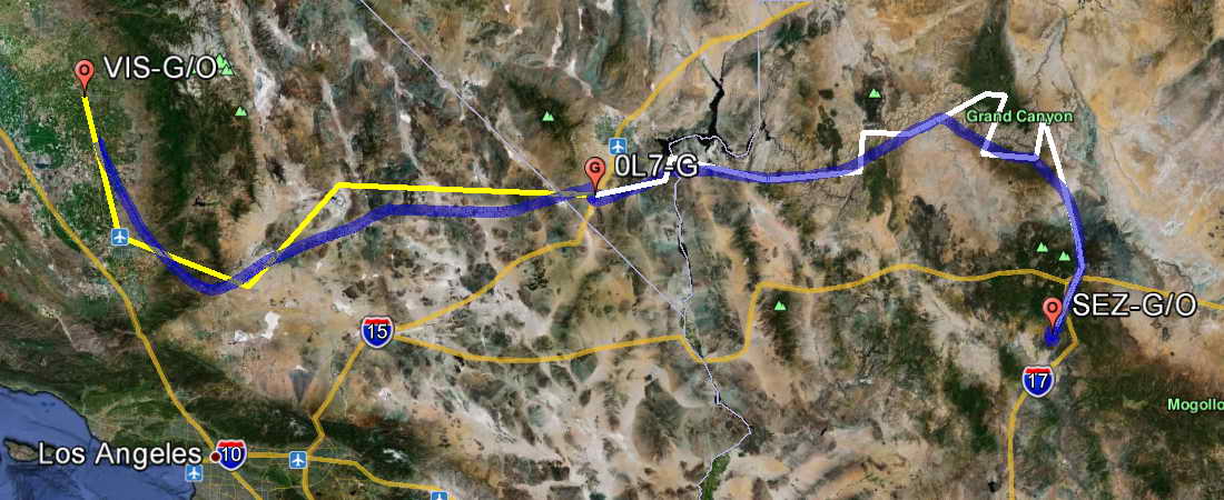
The flightplan for the day had me heading southwest around the southern end of the Sierra Nevada Mountains, turning east-northeast across the Mojave Desert and Death Valley to fuel up 20 NM south of Las Vegas, NV at Jean, NV (0L7). Then continuing east-northeast overflying the Grand Canyon, then turning south to overnight at Sedona, AZ (SEZ). The weather forecast was for clear skies and warm temperatures. Below, the planned route is in white and yellow and the actual flight path is in blue.
After breakfast I packed up my gear and hoofed it back to the airport around 9AM. The Mathers were in their last preparations for departure to Tucson, and we said our goodbyes. Nice folks. Preflighted, added oil, took a last bio-break and took off about 10AM from runway 12. The skies were cloudless and blue yet forward visibility was only 5 miles until one was above the thick hazy inversion layer at about 4500. I climbed to 7500, leaned the engine mixture, and settled back into cruise mode.
Headed south-southwest toward Bakersfield to the confusion of air traffic control (ATC) since my destination was east-northeast to Jean, NV (0L7). When asked to verify my destination for the second time, I mentioned that unlike real airplanes I was going AROUND the Sierra Nevada mountains. That got a laugh. Crossed the southern extent of the Sierra Nevadas along the highway 58 pass through Tehachapi, CA, then turned northeast and out across the Mojave Desert and Death Valley.
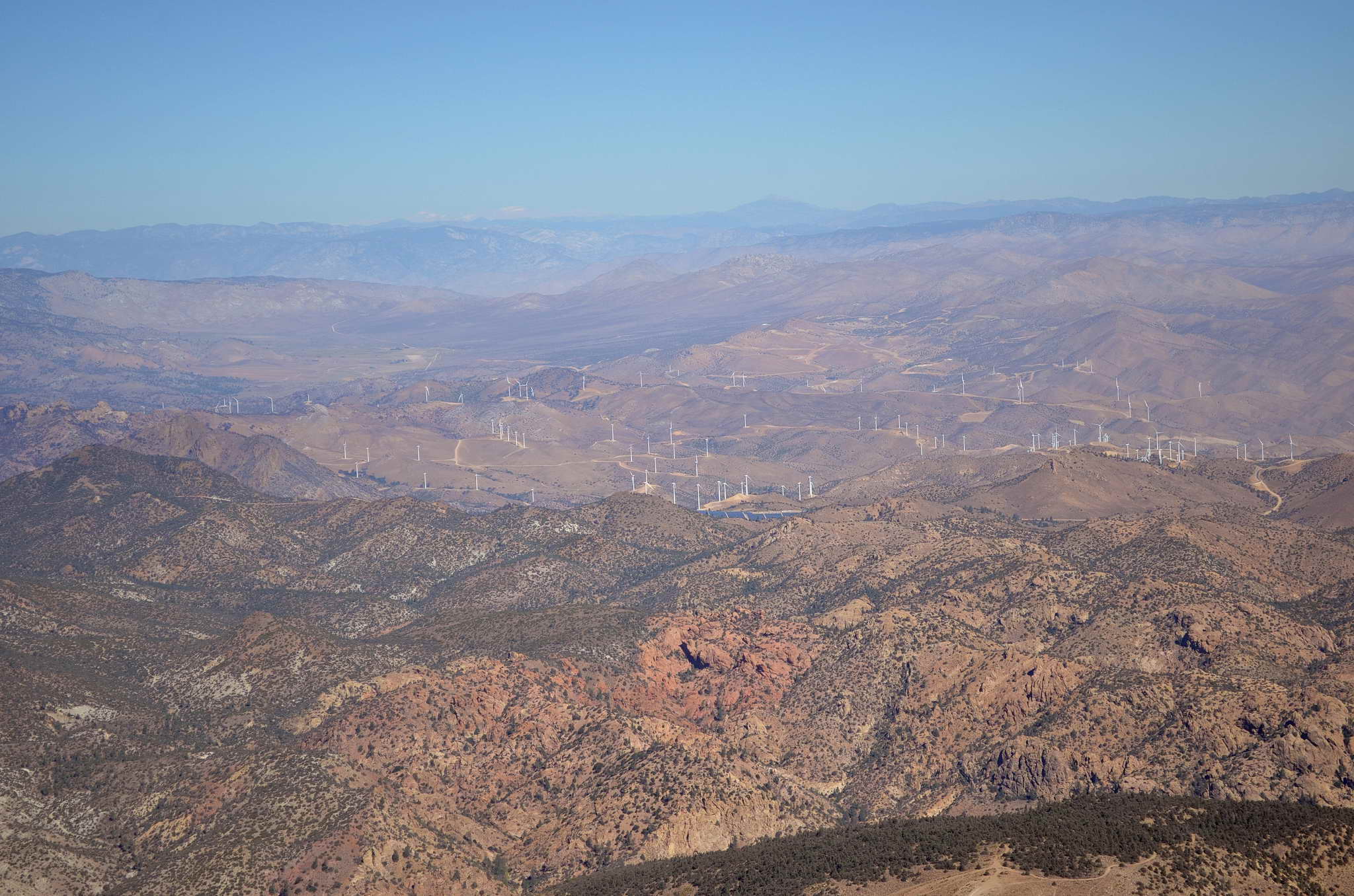
Passed a couple large wind farms in the hills around Tehachapi. What a great scam - if you are General Electric. These "farms" tear up 50 square miles of pristine terrain, cutting erosion prone dirt roads across the hill crests to hundreds of towers each sitting on a football field sized patch scraped clean of all life. The whole "farm" generates less power, less consistently than a medium sized fossil fuel power plant, tears up a 100 times more land, and requires an army of maintenance personnel. Not a single fossil fuel power plant is retired because the wind is inconsistent and power must be consistent, so in the end, these "farms" do absolutely nothing. It is simply a scam to funnel our tax dollars as "green subsidies" to GE (Jeffrey Immelt) so they can manufactuer more turbines in China. Political payoffs. Since these economically infeasible projects are funded by our tax dollars and "green energy" production mandated by law in many states (like WA), these scams are all over the country.
Don't get me started on the ethanol mandates.
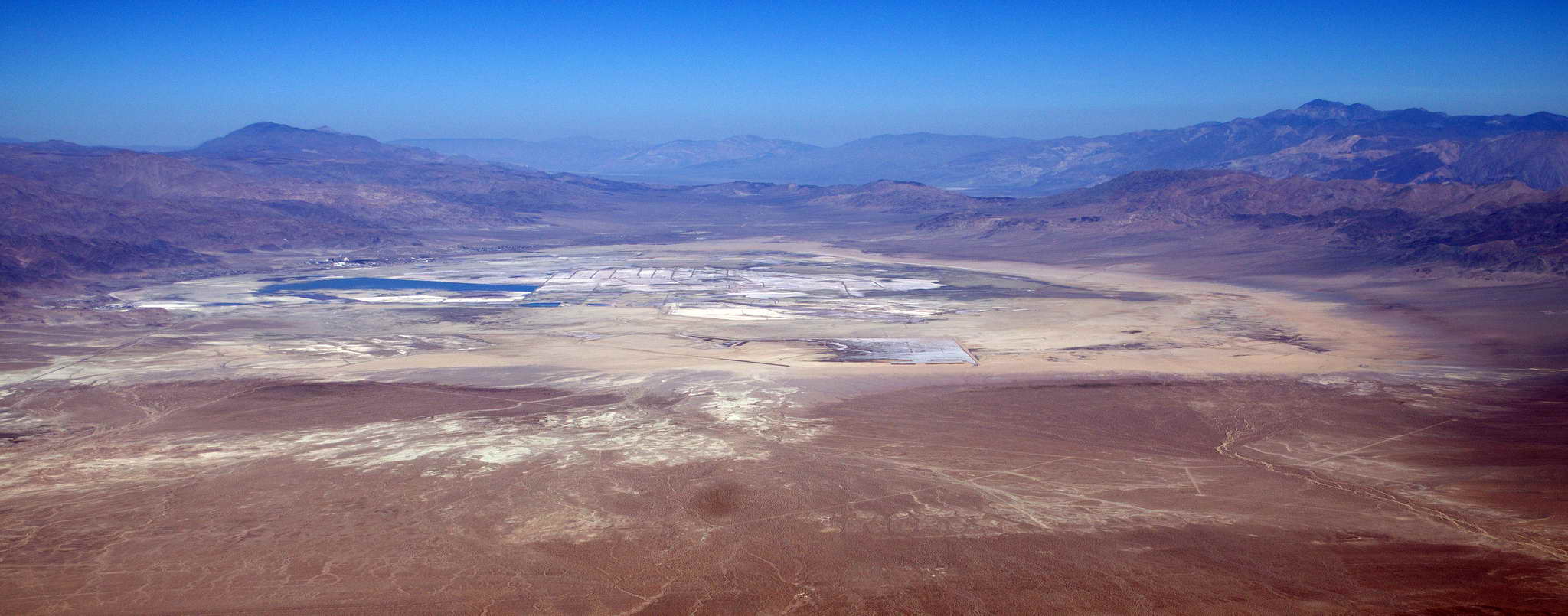
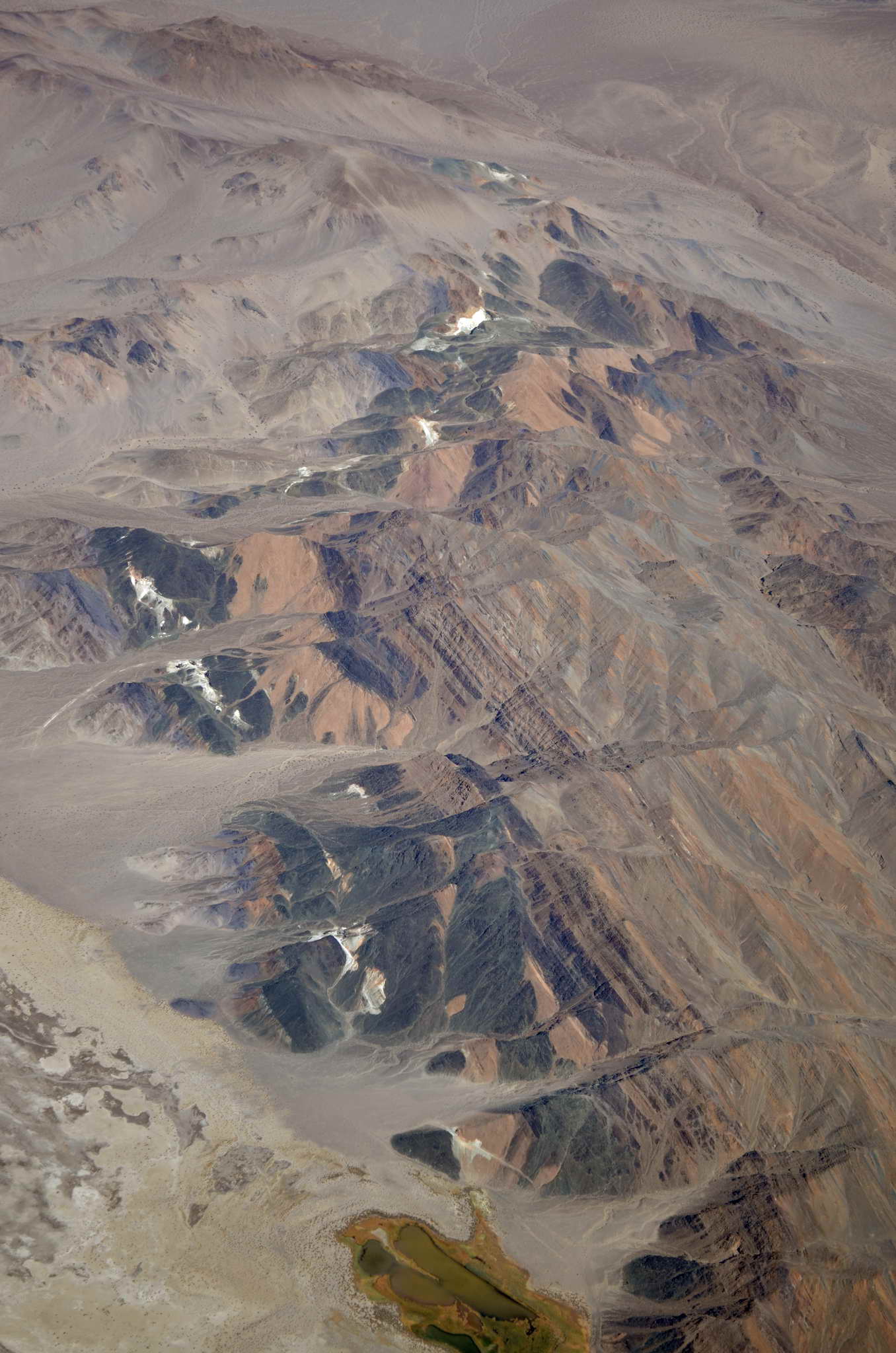
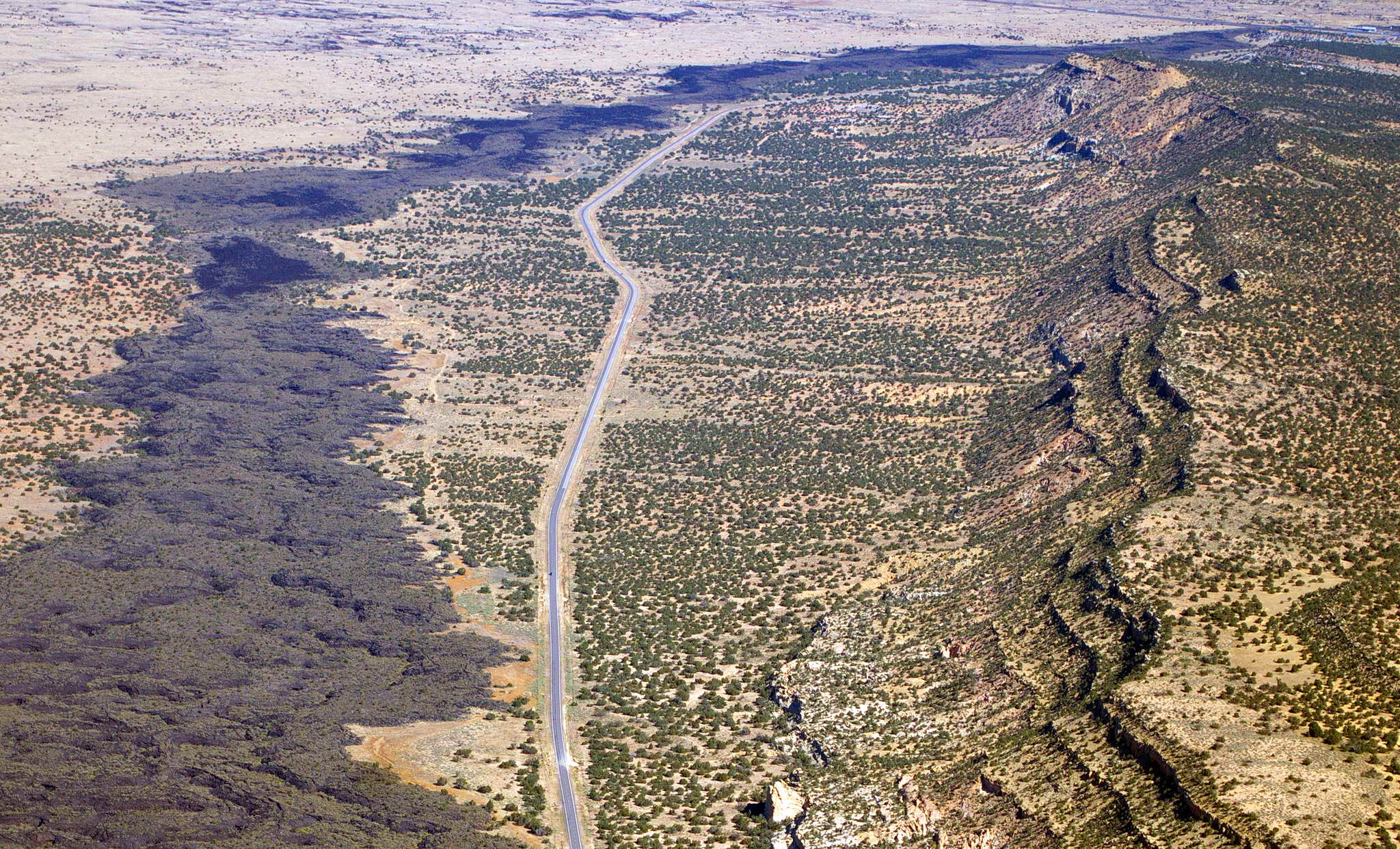
My planned route across the Mojave Desert had me weaving between Restricted Zones, over a salt flat just south of Trona, CA (L72), an overfly of Trona, a turn out to the east and an overfly of Shoshone, CA (L61). Luckily at the time, Restricted Zone R-2524, had a ceiling of 5000 MSL so ATC allowed me to overfly it, saving a fair bit of time. The Mojave Desert from Lancaster, CA at the south all the way to Las Vegas, 150 nm to the east-northeast, is pretty desolate. The landscape is painted with blotches of various grays, reds, and yellows. At one point there was a vein of something white extending 50 miles or more crossing a number of hills and valleys.
From time to time I would see pinpoint flashes of bright reflection in the hills. It took me a few minutes to realize I was seeing the corrugated roofs of desert shacks. Some of the hills sparkled like glitter as I passed by.
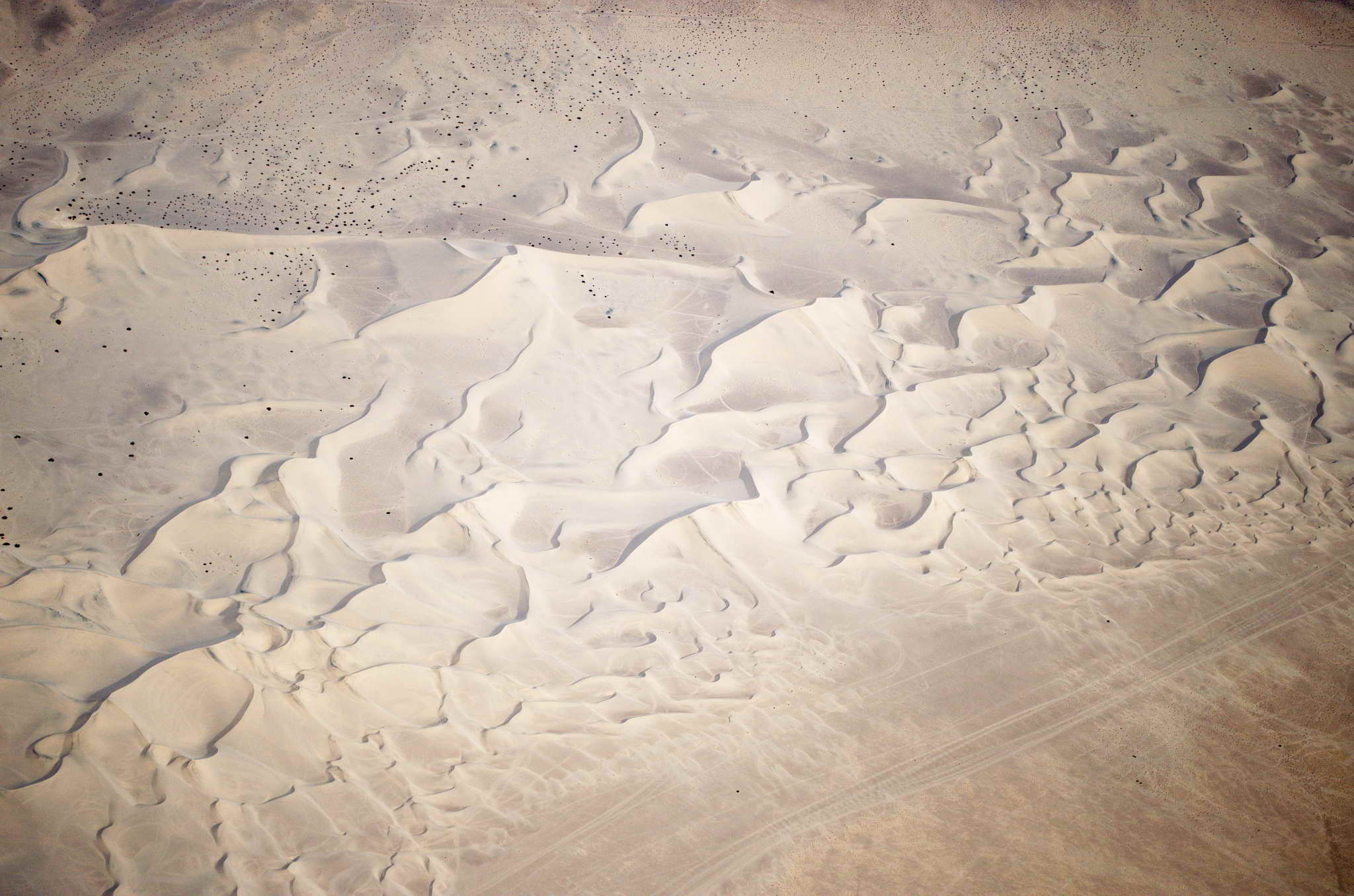
I cruised at 7500 above craggy hills and ridges, black, white, ochre and everything in between. Everything seemed very DISTINCT. The hills simply popped out of the sand with distinct outlines. Highways cut straight black lines across the valley floors, and wound up into the hills. Dry lake beds shone white, baked in the relentless sun. The Dumont Sand Dunes wove tun-colored snaking lines across their valley floor. There is a monster race track about 10 miles north of California City (35� 16.267'N 117� 57.522'W). It is the Honda Proving Center of California, an oval track about 3 miles across and 7.5 miles around. There were plenty of flat places to put down should the engine quit.
The place names I overflew tell colorful, old west tales like, Hardcash Gulch, Last Chance Canyon, Indian Wells, Robber's Mountain, Horse Thief Springs, and Deadman's Canyon.
Tehachapi wind farm scam
Red Rock Canyon and highway 14
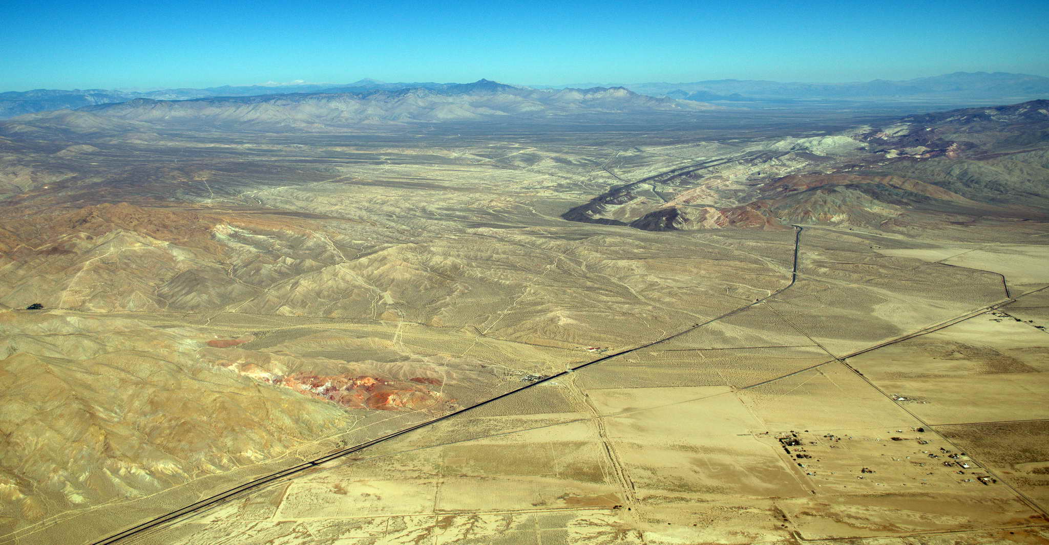
Searles Dry Lake with salt wells, evaporators, and the town of Trona to the north.
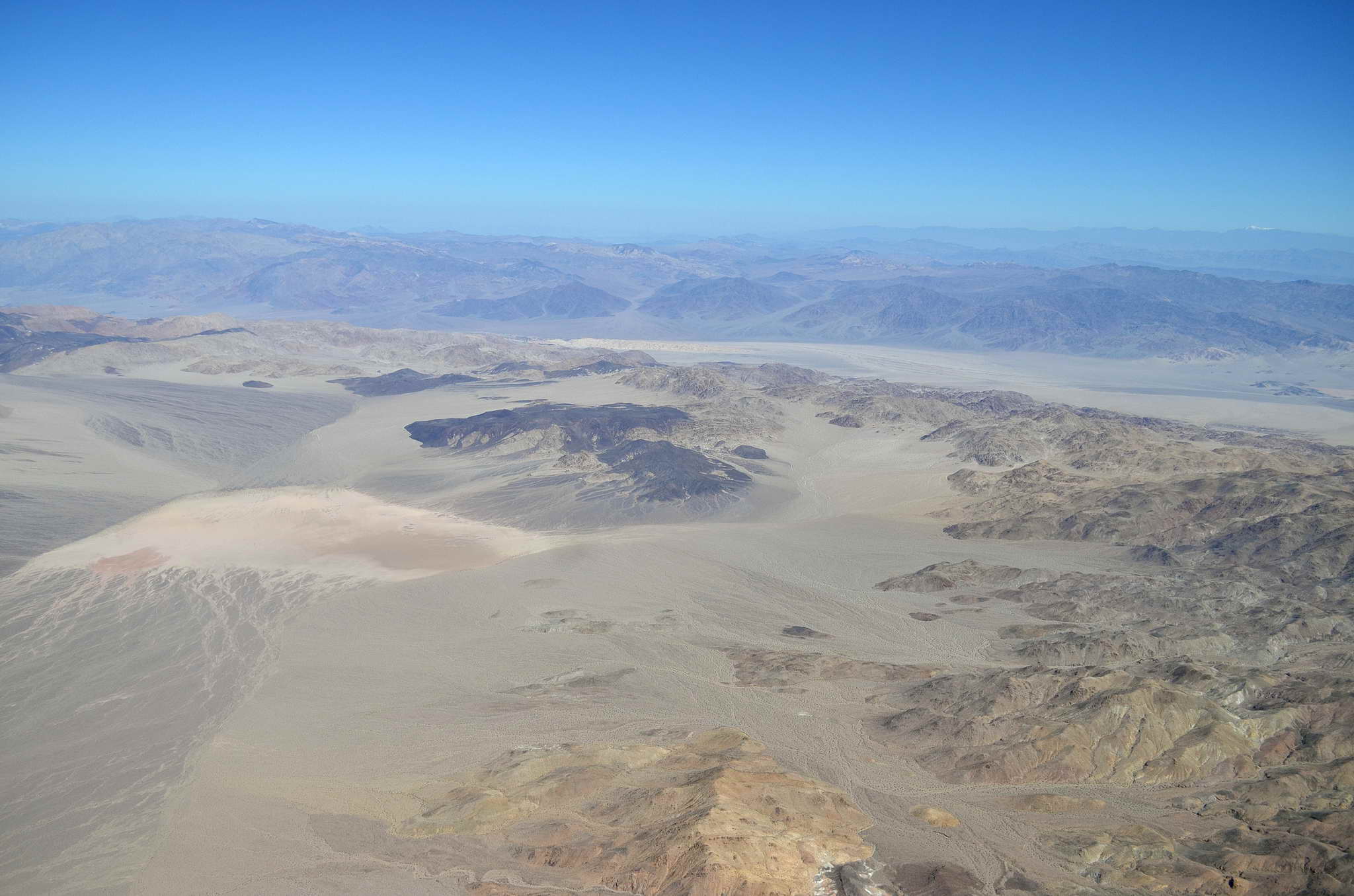
Death Valley, CA
Saddle Peak Hills showing a vein of something white
Dumont Sand Dunes, CA
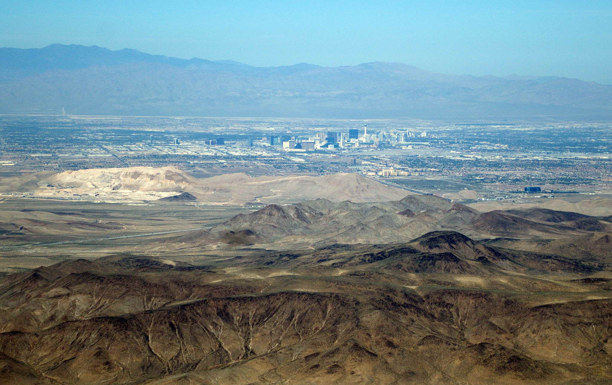
The approach to Jean, NV took me over the first agriculture I had seen in 130 NM, Sandy Valley, separated from Jean by the Goodspring, Mts. My route over the Goodsprings passed over Table Mountain, a 5000 foot high, 3 NM long flat spot in the Goodsprings Mts. Once over the mountains the valley opens up ahead to the east, and I began a steep descent from 7500 to a pattern altitude of 3600 for landing at Jean, NV (0L7). The glass and steel spires of Las Vegas could be seen 20 NM to the north beyond a patch of low hills.
I entered a 45 degree approach for a left downwind to runway 2L and landed at 1PM. Jean is 20 miles south of Las Vegas in a desolate 30 NM north-south valley it shares with 3 dry lakebeds and the casino town Primm, 10 NM south. Taking a lesson from "Field of Dreams" the county built a beautiful airport with 2 parallel runways, very well maintained. All that came was the Golden Nugget Casino, right next to the airport, and a prison, just up the hill. The airport lies along a ridgeline rising about 1500 above the valley. The prevailing winds strike the ridgeline and flow up, creating an almost perpetual updraft, and Jean hosts a large squad of gliders, tow planes, and jumpers.
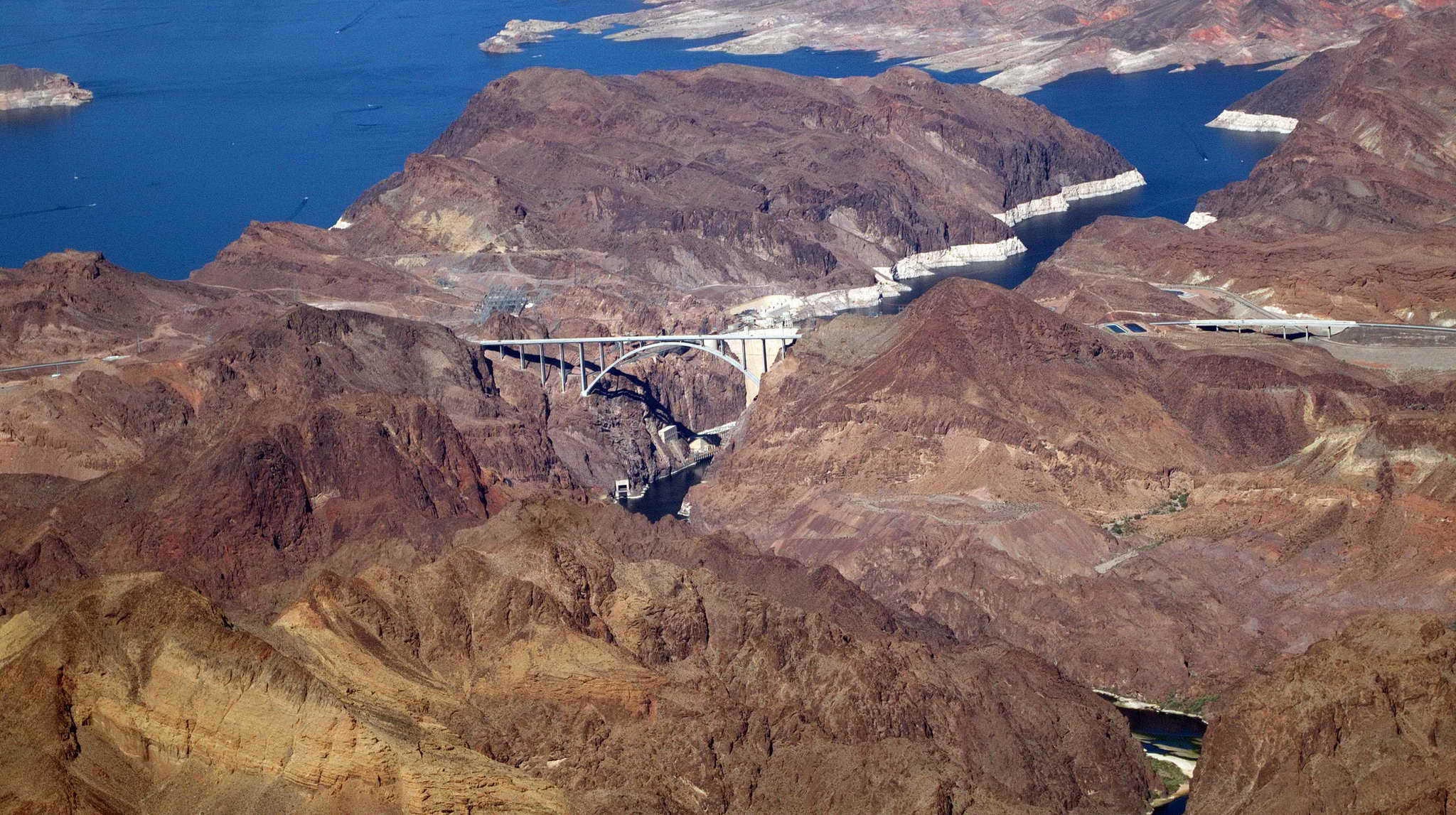
I gassed up at the self-serve fuel, took a bio break, and pressed on off runway 2L at about 1:30 local time, climbing out of a left downwind and turning east just south of Jean's adjacent mountain through a gap in the ridgeline. After climbing and crossing the ridgeline I headed toward Hoover Dam. It was on my list of wonders to see, but I cut the corner when it was apparent Hoover Dam was not that interesting. I'm sure there is an impressive photo possible of Hoover Dam and the steel highway bridge looking northward down the canyon, but at 7500 and climbing, not so much.
Hoover Dam
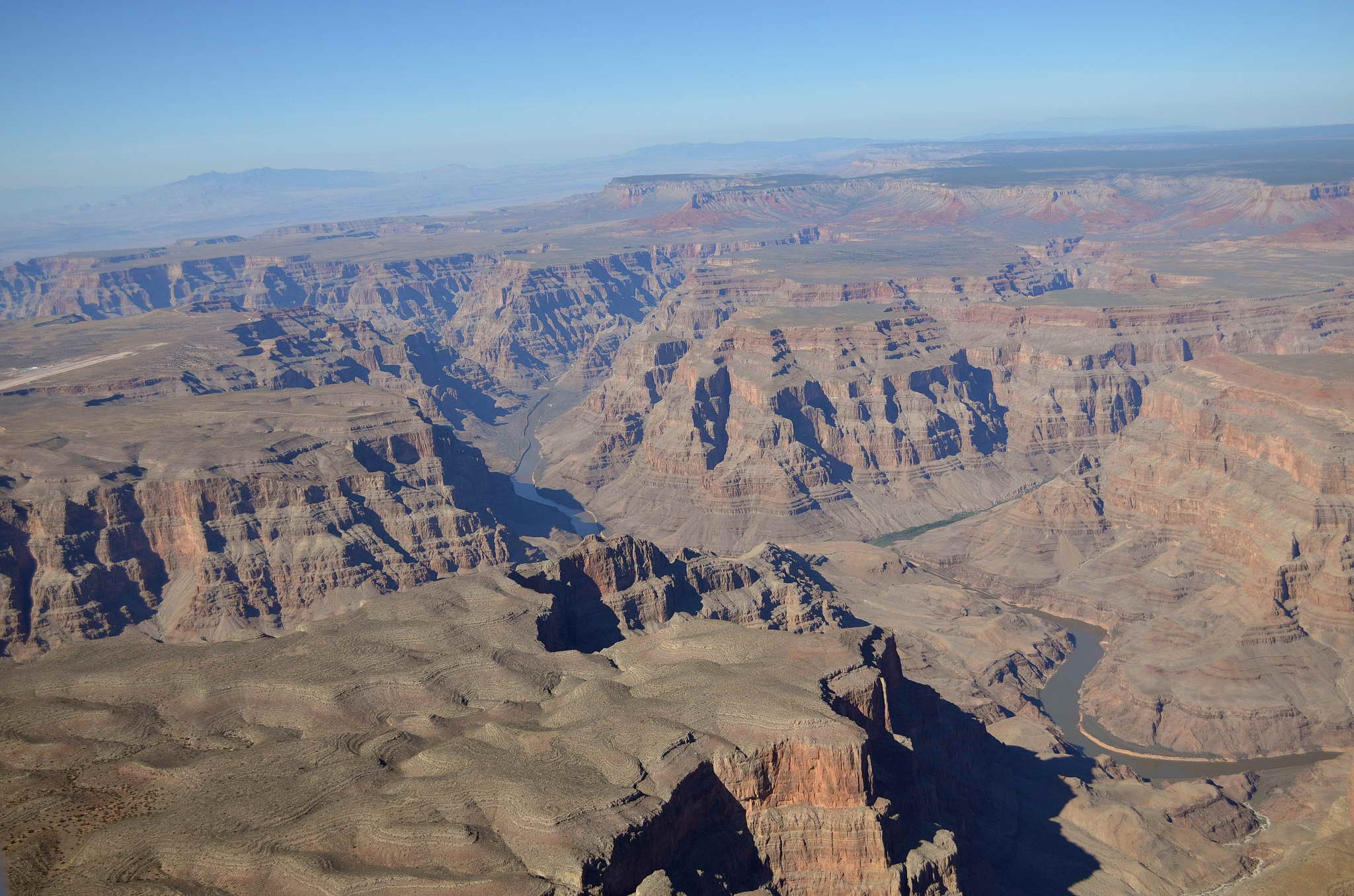
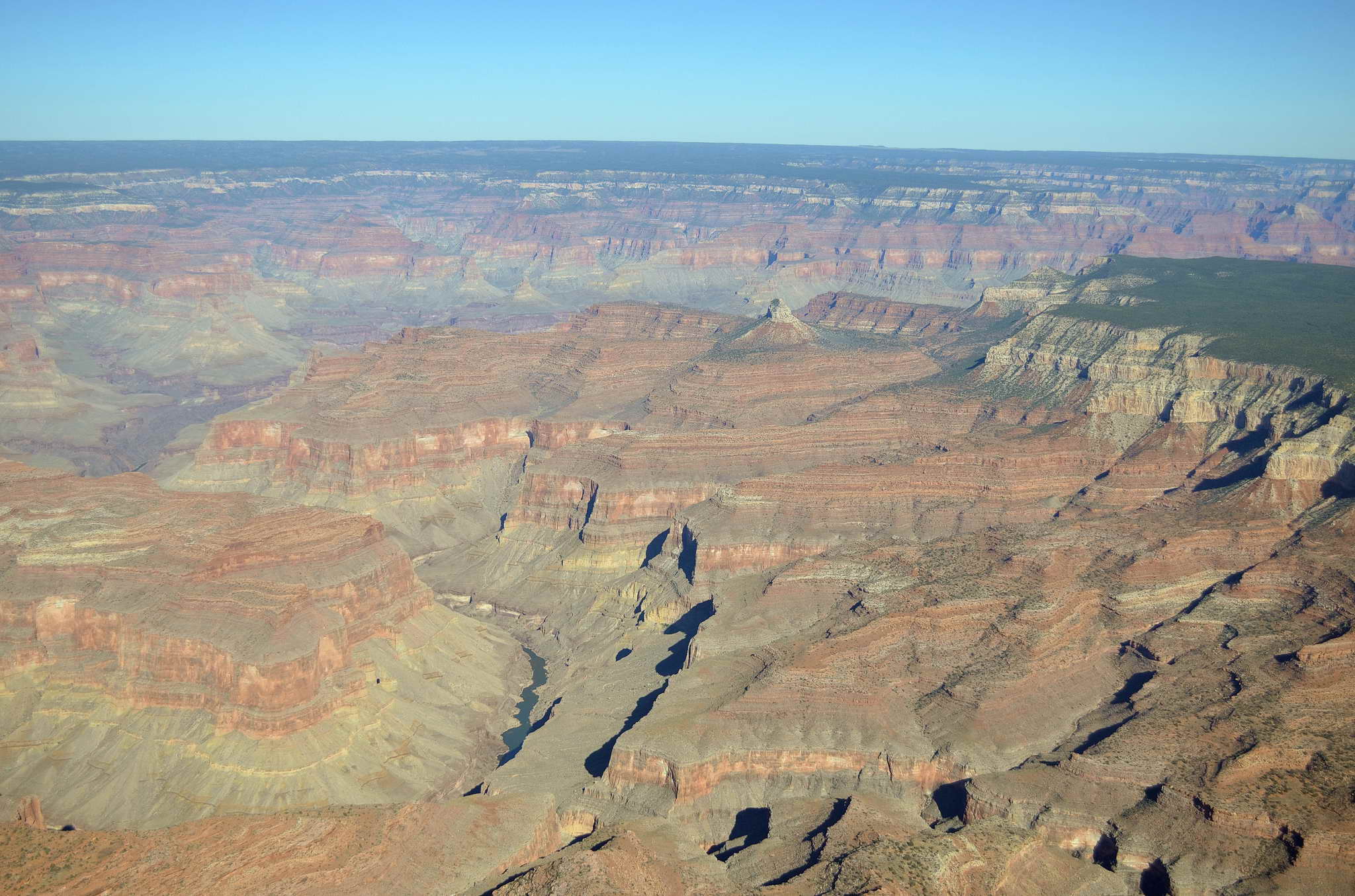
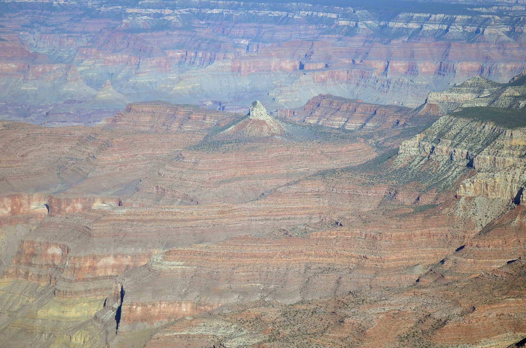
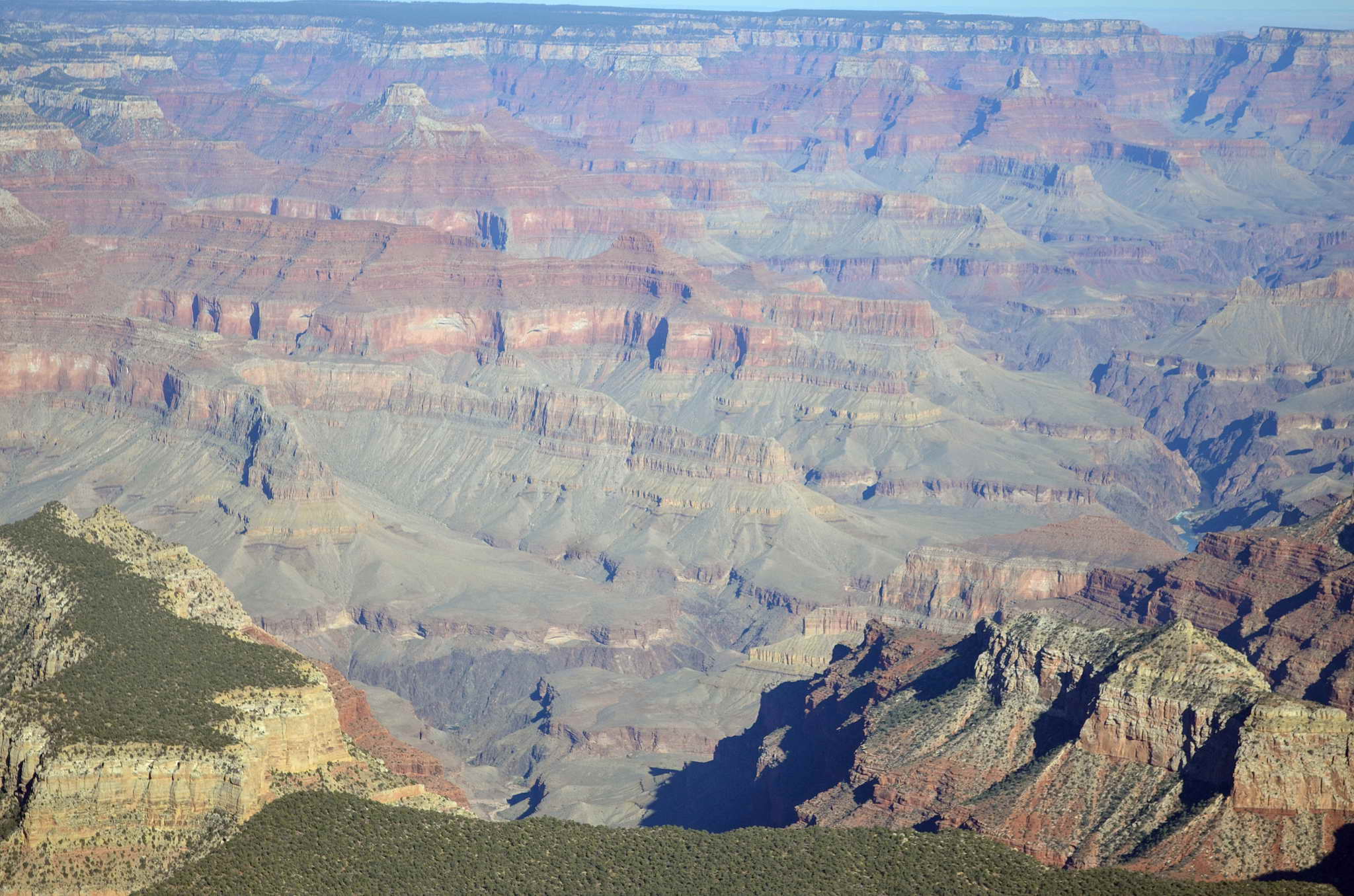
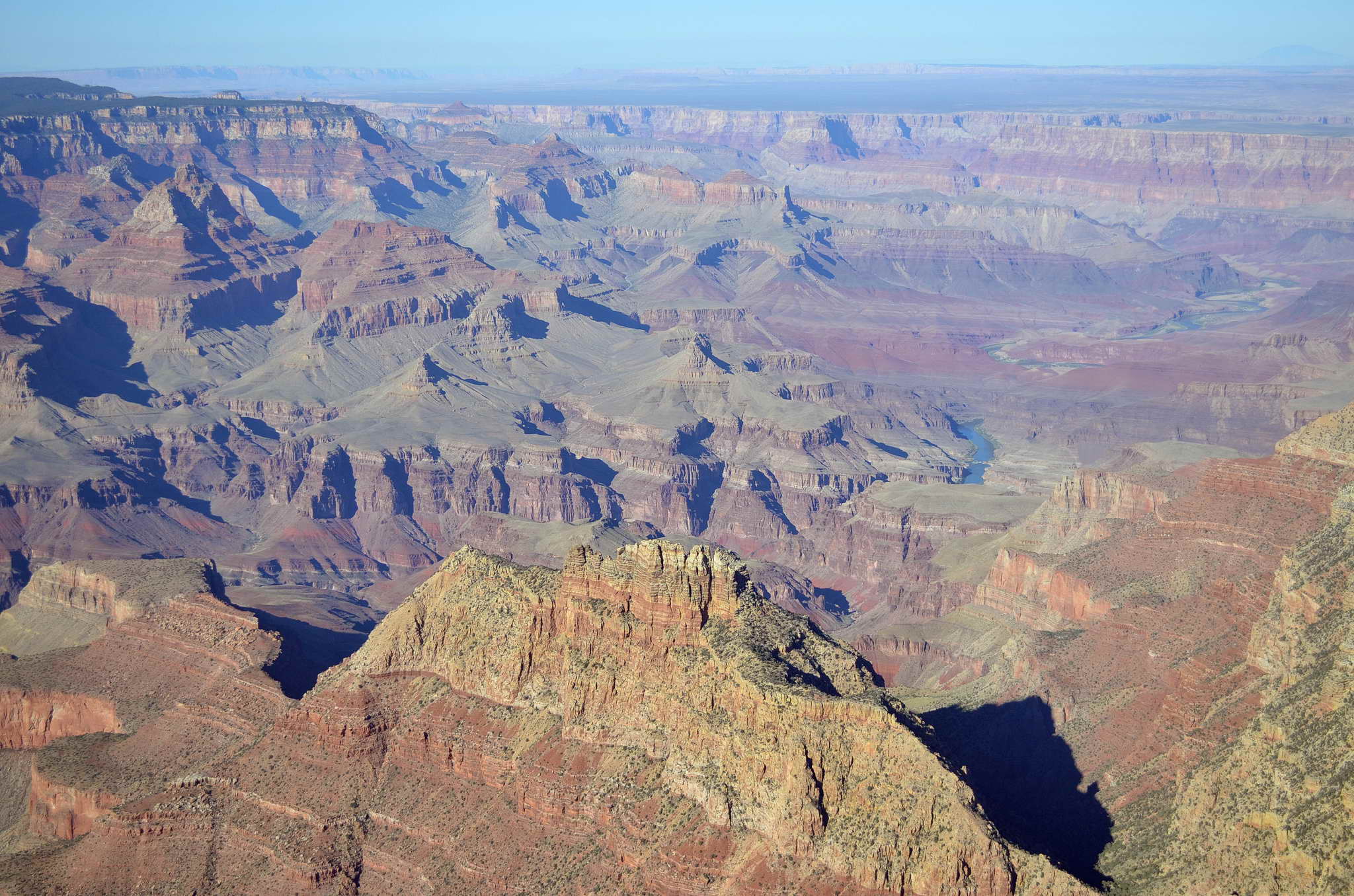
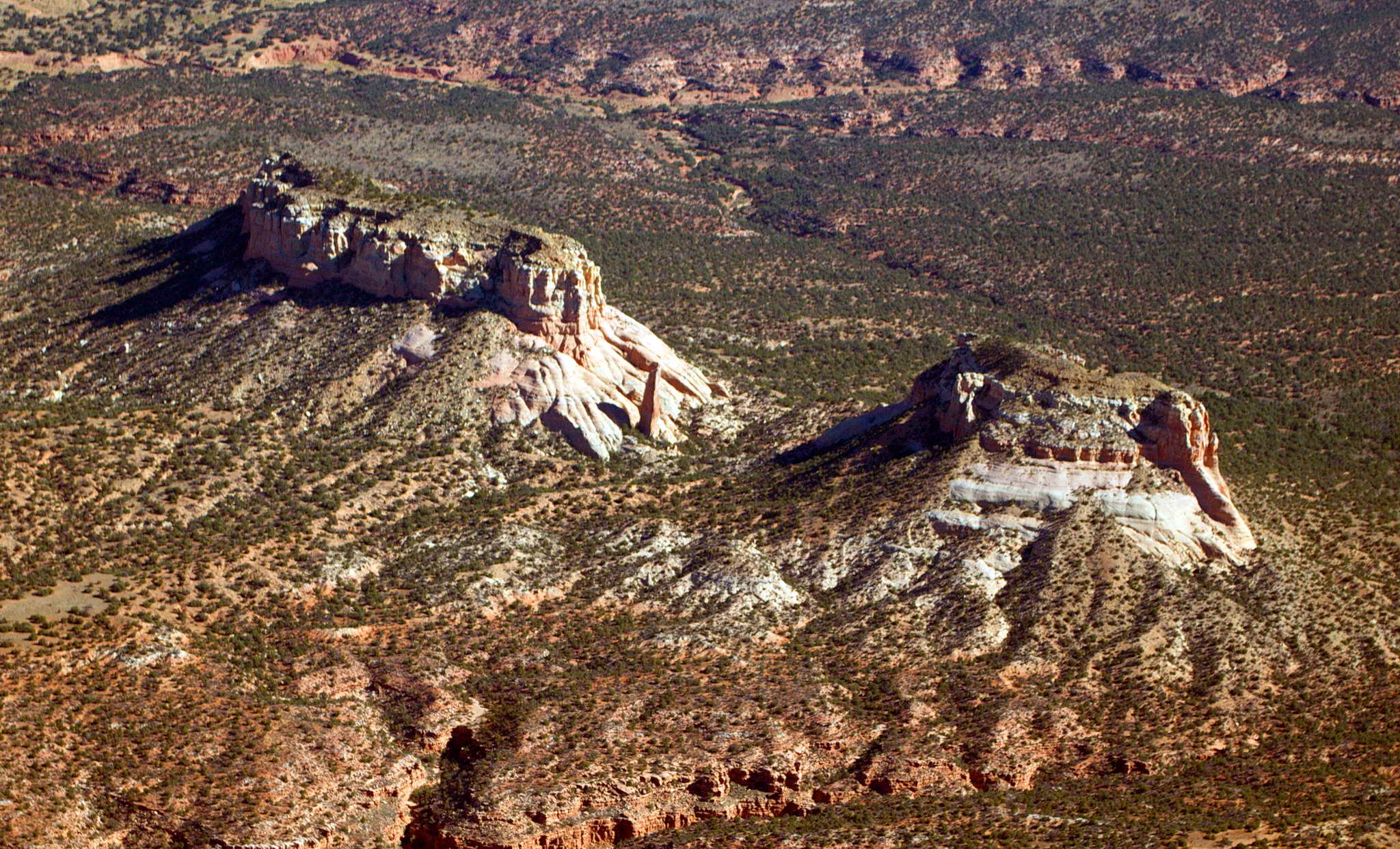
Turned east toward the Grand Canyon and its Grand Canyon Special Flight Rules Area (GCSFRA). The GCSFRA, has, as can be imagined from the name, a strict set of special rules. There are only a few specified corridors just a few miles wide over which the canyon can be crossed. In the northerly direction the specified altitude is 10,500 and in the southerly direction 11,500. My plan was to cross the canyon 3 times, but because the air at altitude was quite warm, I was running out of climb performance at about 10,500 so I modified my route, overflew as much of the western portion as I could, then skimmed the south rim all at 9500 MSL. The altitude of the south rim of the canyon starts to the west at about 6000 MSL, and rises to just over 7000 MSL at the eastern end. So even flying at 9500 MSL means you are only between 3500' and 2500' above ground level (AGL).
The Grand Canyon is indeed grand. It's not just grand, but deep, and it's damn big. It's not just damn big. It's huge, covering well over a thousand square nautical miles. There was a moment, over the western area where one can actually fly over a portion of the lesser canyon at 9500 MSL, when it suddenly hit me that there was no flat land anywhere within gliding distance. Pilots are always somewhat aware of what they would do if the big fan quit, and there was not a single flat spot to put down. At 3500 AGL there was no time to glide to any level ground. Looking around the only option was to glide into the canyon and ditch in the river. There were a few unnerving moments where I questioned my mechanical abilities in installing the new engine. Shortly thereafter my GPS flight application became computationally confused because I was missing all my pre-programmed waypoints and it started reporting my arrival time at Sedona as NEVER. That seemed ominous. It shortly recovered its wits. I took many photos. There was intermittent light turbulence as the air burbled and swirled through and over the canyon.
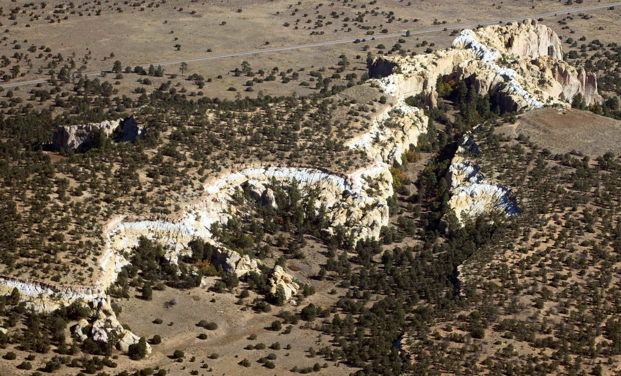
Here's a western part of the Grand Canyon.
In the Grand Canyon every little bump or peak or turn in the river has a name. Devils Slide Rapids, Surprise Rapids, Suicide Point, Hell's Hollow, Tip Over Canyon, seem to commemorate calamities long past. Solomon Temple, Rama Shrine, The Tabernacle, Jupiter Temple, The Colonnade, Point Sublime, speak to the grandeur of the terrain.
The Dome, Grand Canyon
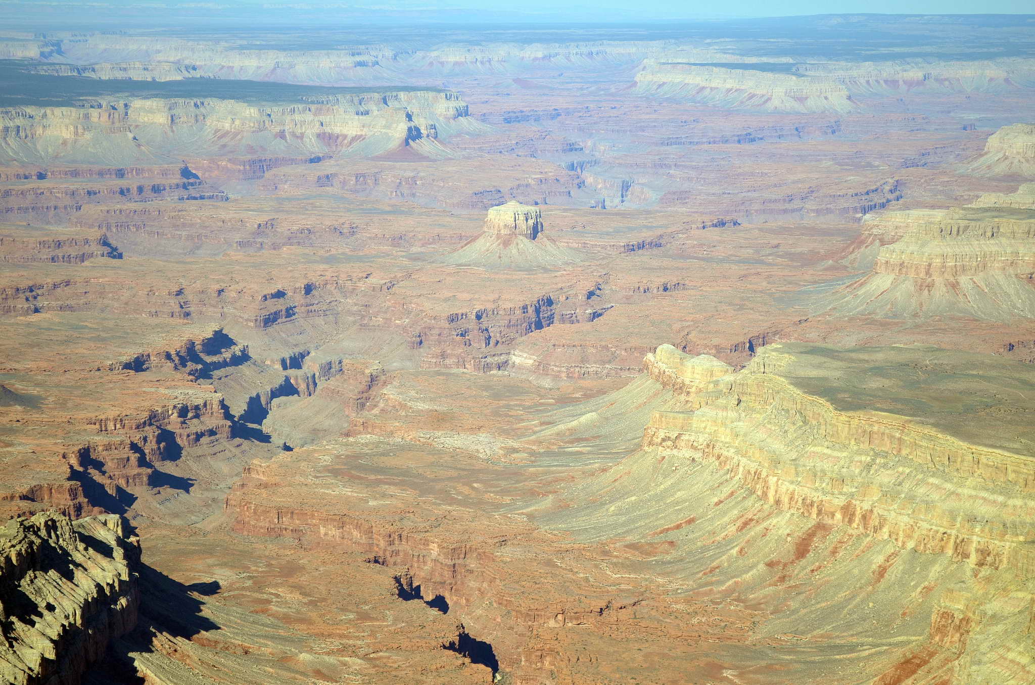
Mt. Sinyala, Grand Canyon
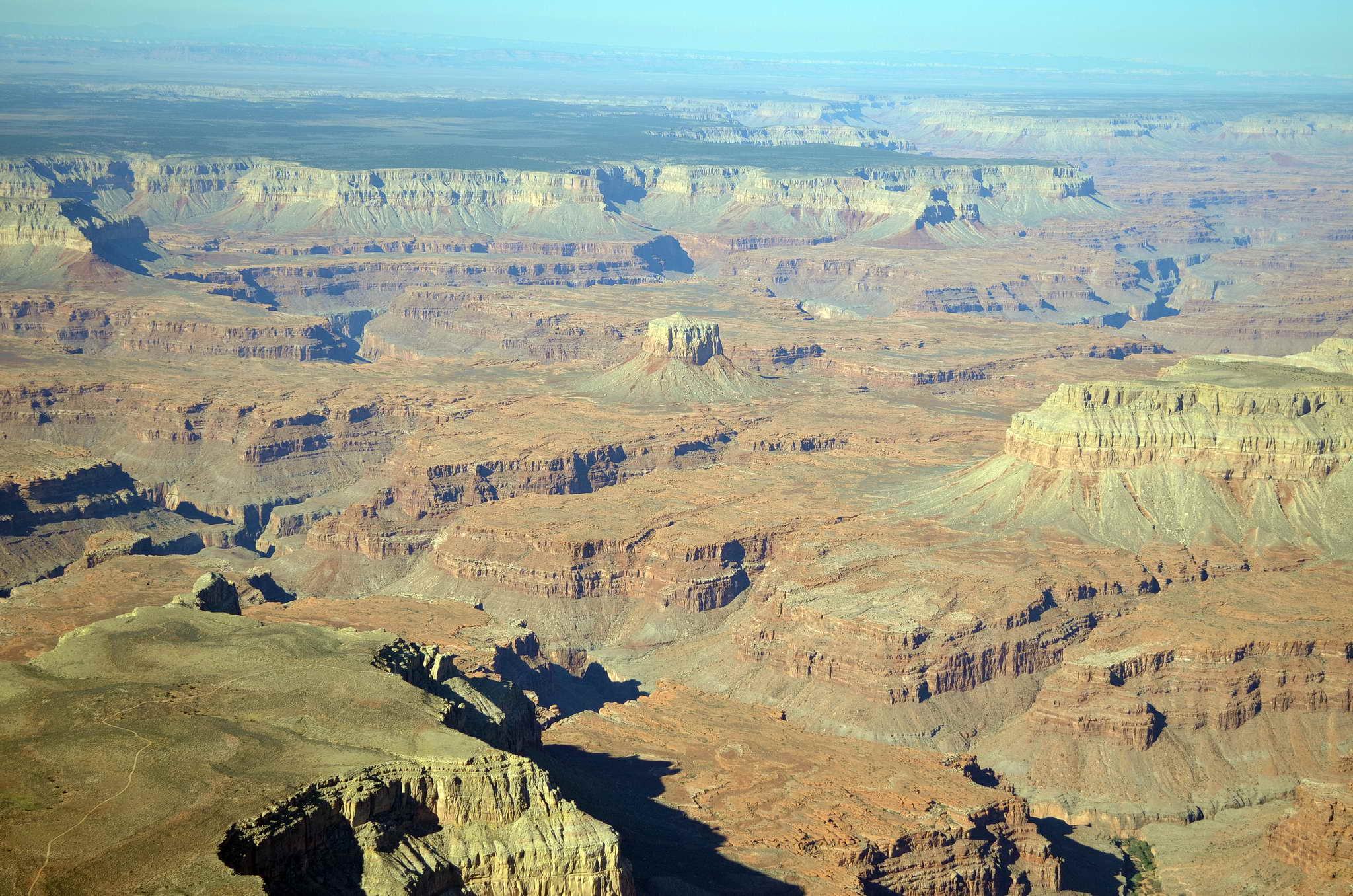
Another Dome in the Grand Canyon
Another Dome in the Grand Canyon
East of Grand Canyon National Airport just south of the Zuni corridor I turned south for the high terrain near Flagstaff and Sedona only 60 NM away.
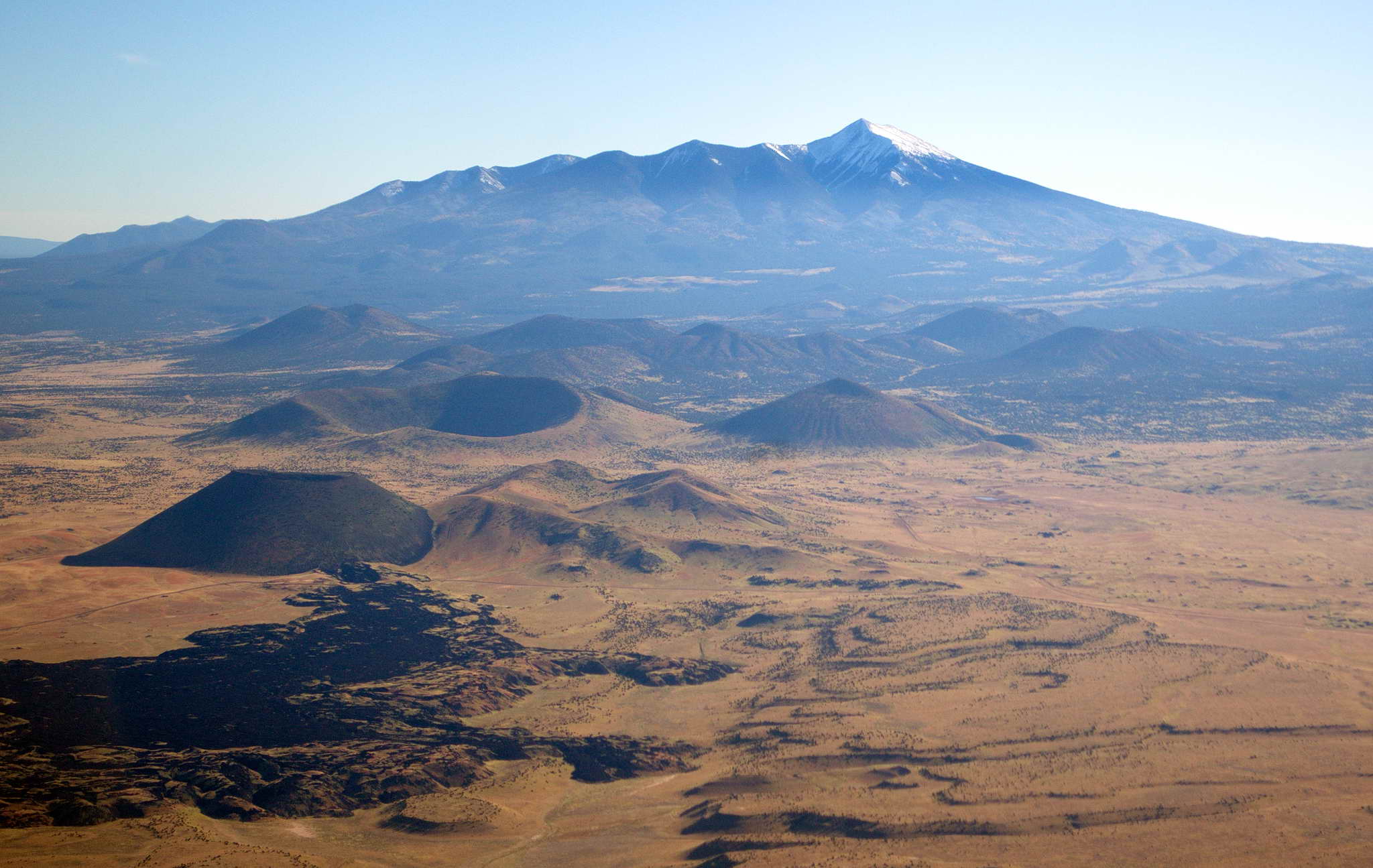
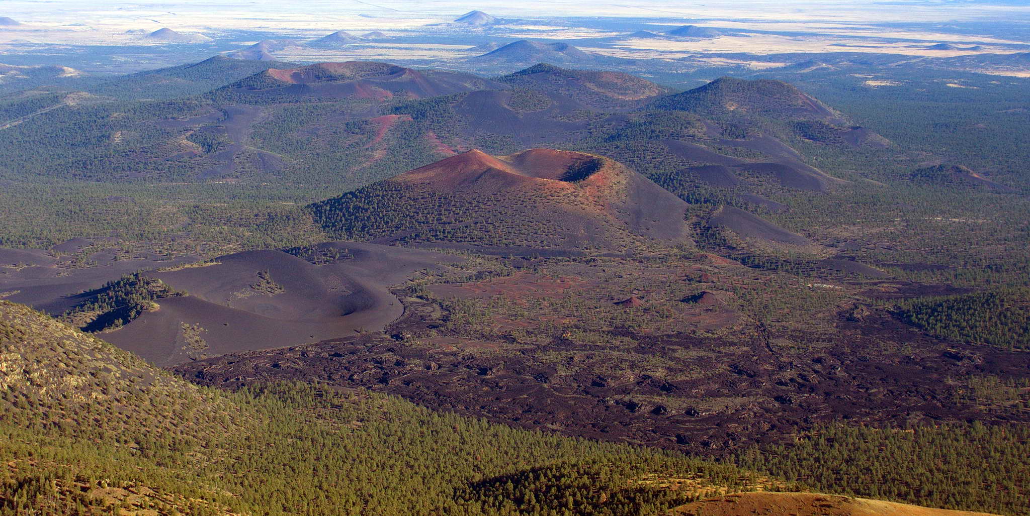
Halfway to Flagstaff 20 NM north of extinct volcano Humphrey peak, there is a patch of black and red cinder cones, one with an obvious ancient lava flow in the lower left. This area reminded me of the crater of Haleakala on Maui. Humphrey Peak at 12,500 looks like a weathered, eroded Mt. St. Helens. The crater rim has eroded into 4 peaks, and one side is blown out similar to Mt. St. Helens. I passed just east of Humphrey peak following highway 89 and to the east was another large patch of cinder cones. This place must have been hot and smokey some millions of years ago. My flight planning was right on and I passed by the mountain along the highway pass, and flew almost directly over Flagstaff airport.
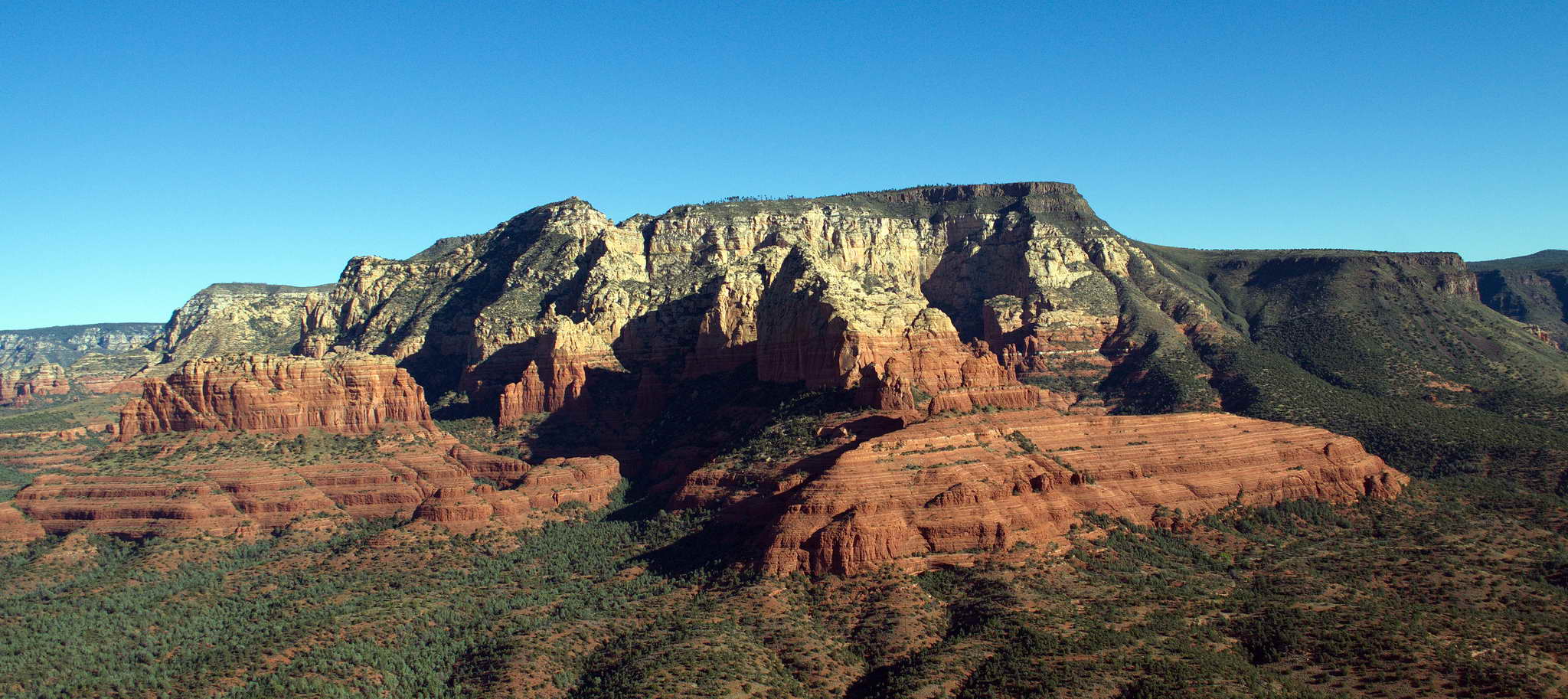
The mesa on which the Sedona airport sits is itself in a crag-lined valley, and from the north the airport is not visible until your sight line goes over the valley rim. The craggy valley is stunningly beautiful with red rock spires and tall cliffs. The airport was busier than I expected. I confused left and right and set up on the wrong side of runway 03, so I got a tour of the valley as I corrected. Landed at 4:25 local (2325Z) to the north on runway 03 in gusting winds. The airport overlooks the city to the north.
Approach to Sedona, AZ (SEZ)
More approach to Sedona, AZ (SEZ)
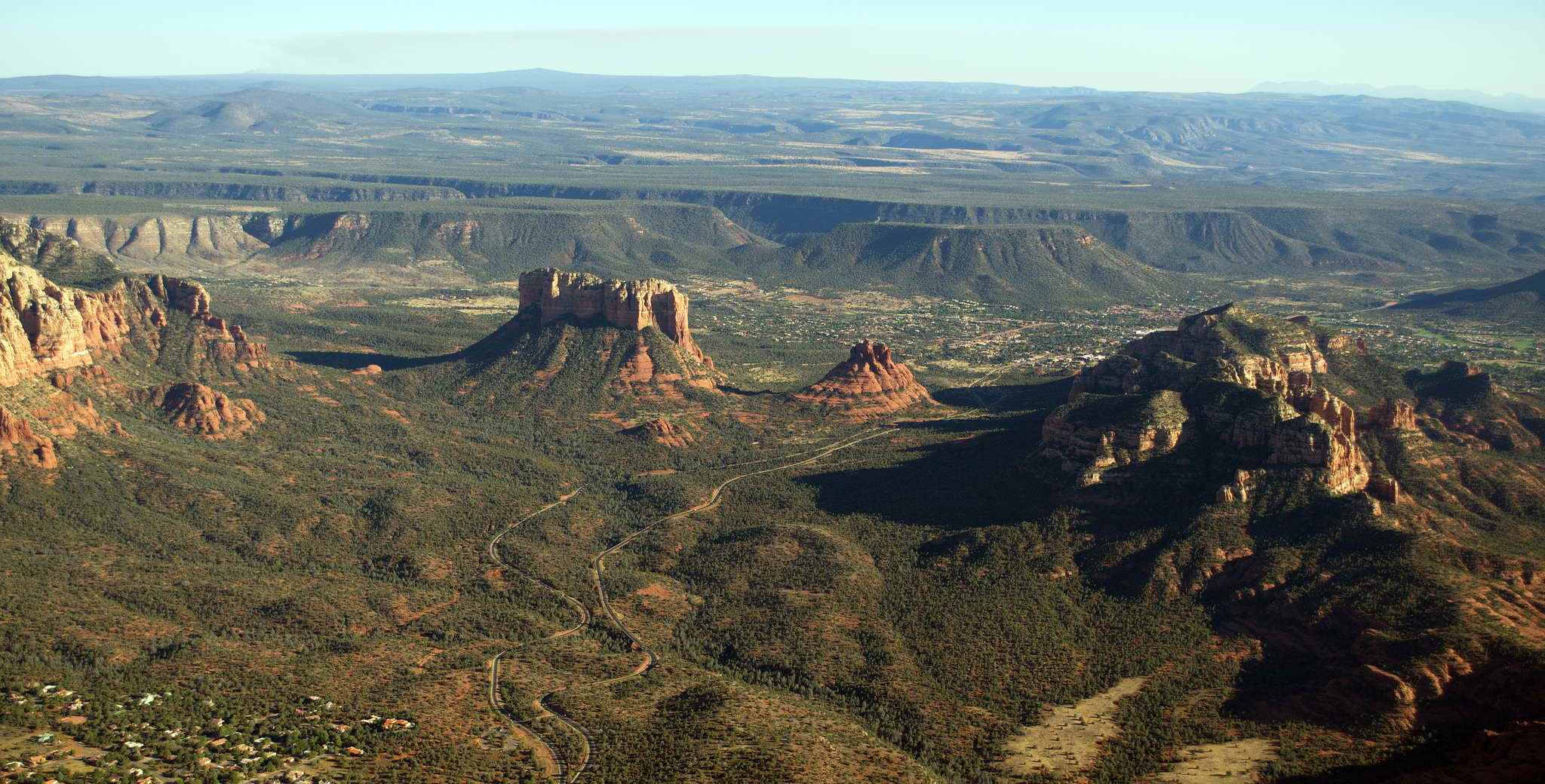
The Sedona, AZ (SEZ) airport perched on the top of a mesa.
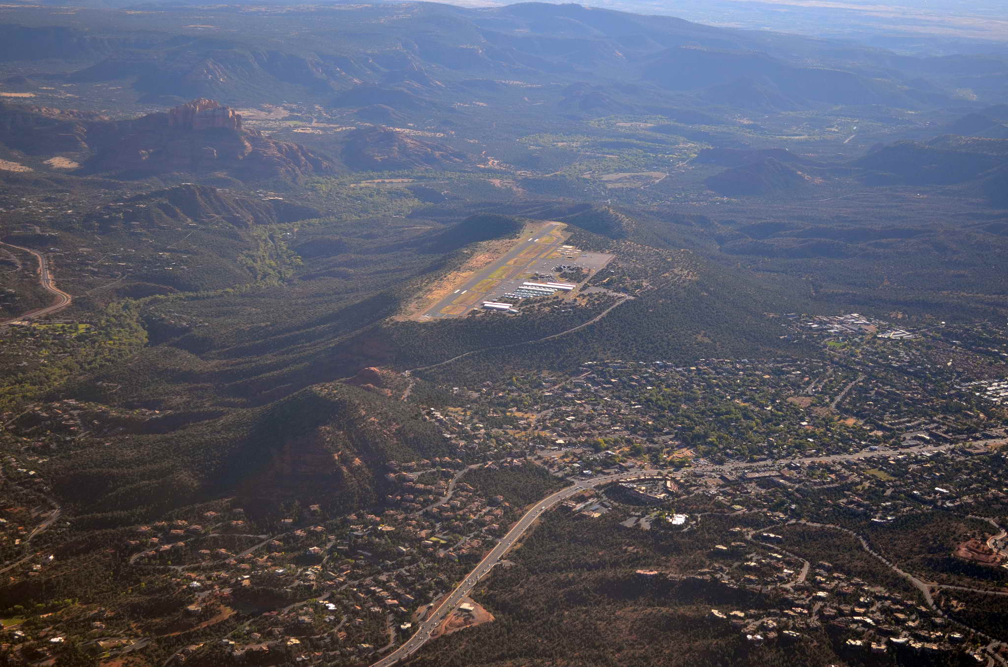
I stayed at the Sky Ranch Lodge just off the airport property to the north. Unpretentious and perfectly sited with views over the town. I wanted to stay another day, but was racing a cold front east. No self-serve gas. Airport staff was very nice and helpful.
The elevation is 4800' and the air feels thin and as the sun sets a chill follows closely behind.
I reluctantly left Sedona, AZ about 8:30 in the morning after a single night due to weather issues in the coming days on my route ahead. A cold front was coming up behind me and I needed to leave before it caught up with me. Cold fronts move along the ground (colder air is heavier) and push an outflow of warmer air ahead of it. Another day in Sedona risked the cold front catching me and getting stuck in Norman, OK.
The climb out off runway 3 through the crag-lined valley in the gentle yellow morning light was magical and mystical. I think I saw a vortex swirl by. After passing the valley rim and gaining some altitude I turned east to come onto my cruise course. My route for the day took me east-northeast for about 50 NM where I met major interstate highway I-40 and roughly followed it due true east over high, but relatively flat country with a slight diversion for higher terrain between Pescado and Acomita, NM.
The day's flight plan - go east.
About 35 NM out of Sedona I passed Meteor Crater, AZ, site of the world's best preserved meteorite impact site, Barringer Crater. Dated to about 50,000 years ago, the impact of the 150 foot long nickel-iron Diablo Canyon meteorite was equivalent to a 20 megaton nuclear bomb. Blast winds close to the impact hit 2000 mph and were still hurricane force 25 miles away. Vegatation was completely destroyed up to 20 miles away. Large critters up to 15 miles away were killed.
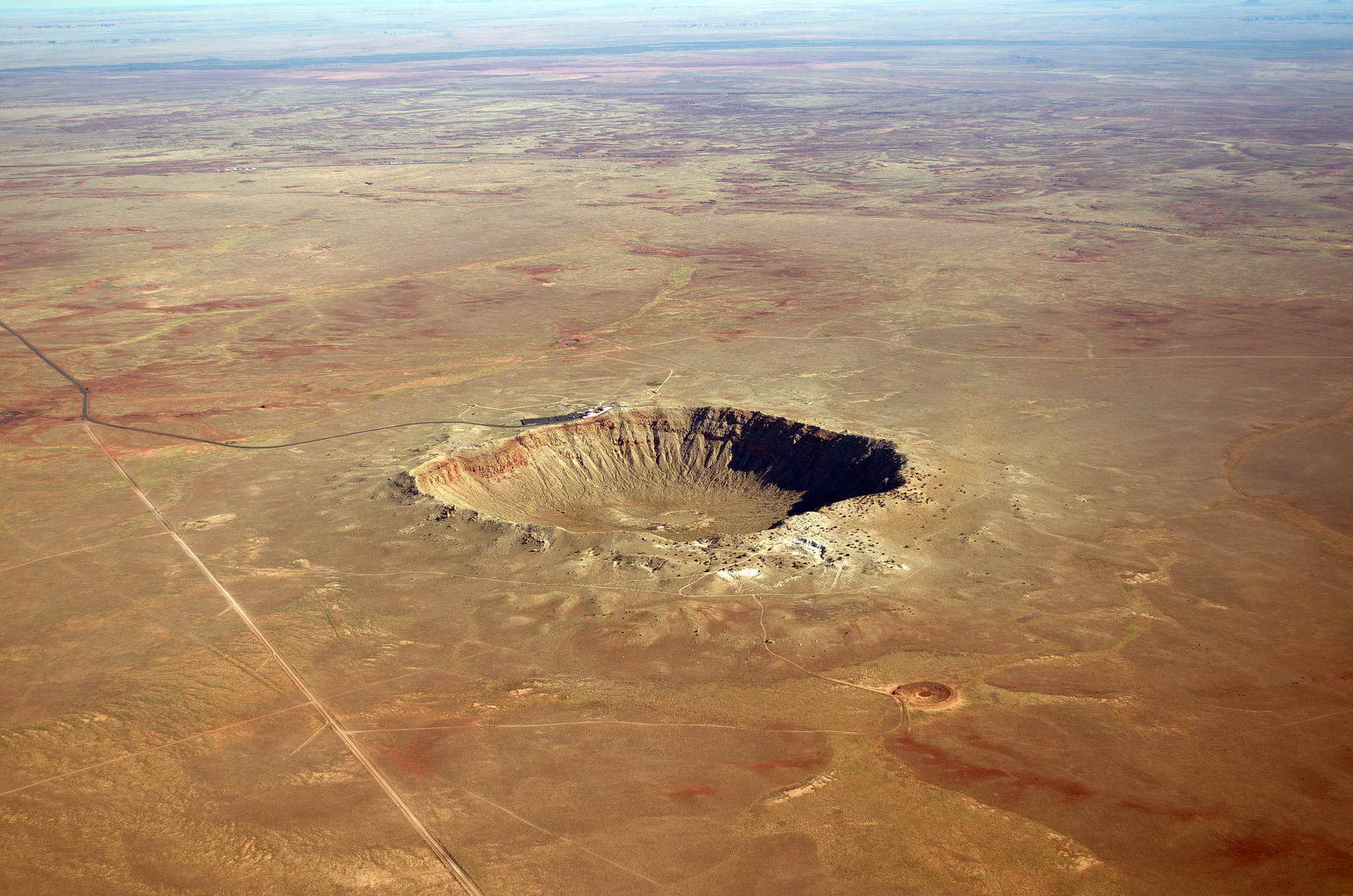
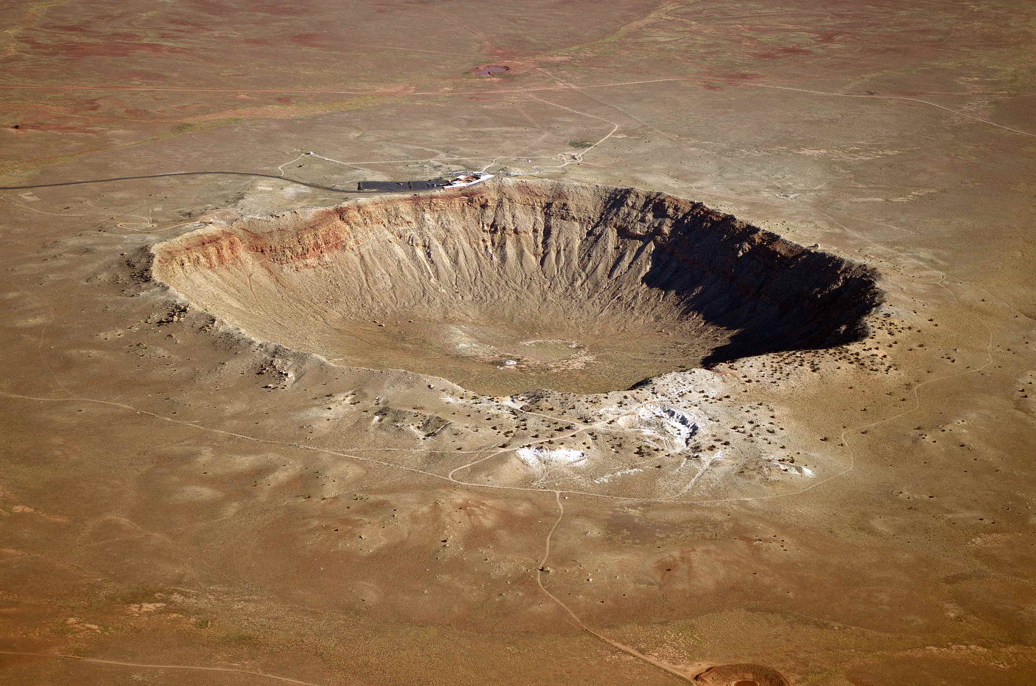
There are a number of large fragments of this meteorite, the largest, found at the impact site, the Holsinger Meteorite, is housed at the Meteor Crater Visitor Center and weighs 1409 lbs. Other large fragments range from 220 lbs to 1069 lbs. Some of the fragments were found in native American dwellings 60 miles away. The Camp Verde meteorite was one such and it weighs 130 lbs. Early man invested much in hauling this rock home. More details on this meteorite.
Leaving Meteor Crater I passed much interesting geology. Red streaked black cinder cones dotted the otherwise flat plain. Weird erosion patterns created fields of "blobs" which looked like red limpets encrusting a beach rock.
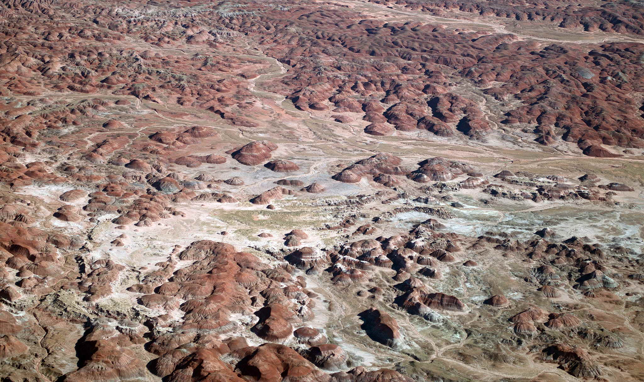
Past Meteor Crater my flight planning was confirmed when the higher terrain matched expectations quite well, and being "up close and personal" allowed me to cut some corners and save some time. The desolate geology was clearly volcanic with layers upon layers of lava flows piled on top of each other and cut through with steeply eroded canyons colored in browns, whites, and yellow. Rising from fully eroded flat plains were isolated mesas with bare rocky cliffs topped with sparse, dusky green, open pine forest. Well eroded cinder cones and lava flows studded the area with rivers and splashes of darker reds and grays. Not surprisingly there was some light turbulence over this geology. Once back on an easterly course there where only a few more ridgelines to cross before entering the 25 NM wide flat plain upon which sits Albuquerque on the eastern edge.
Mesas and buttes dotted the landscape - what's the difference between a "mesa" and a "butte"?
The painted terrain
A long thin lava flow along a cliff face.
The only significant terrain lying between me and the flatland of the lower midwest was the Sandia Mountains a 15 NM long north-south ridge featuring the 10,600 foot Sandia Crest and ski area at its center and Albuquerque spread along its western flank and extending westward to and beyond the green water of the north-south Rio Grande.
The Sandia Mts. with Albuquerque at their base
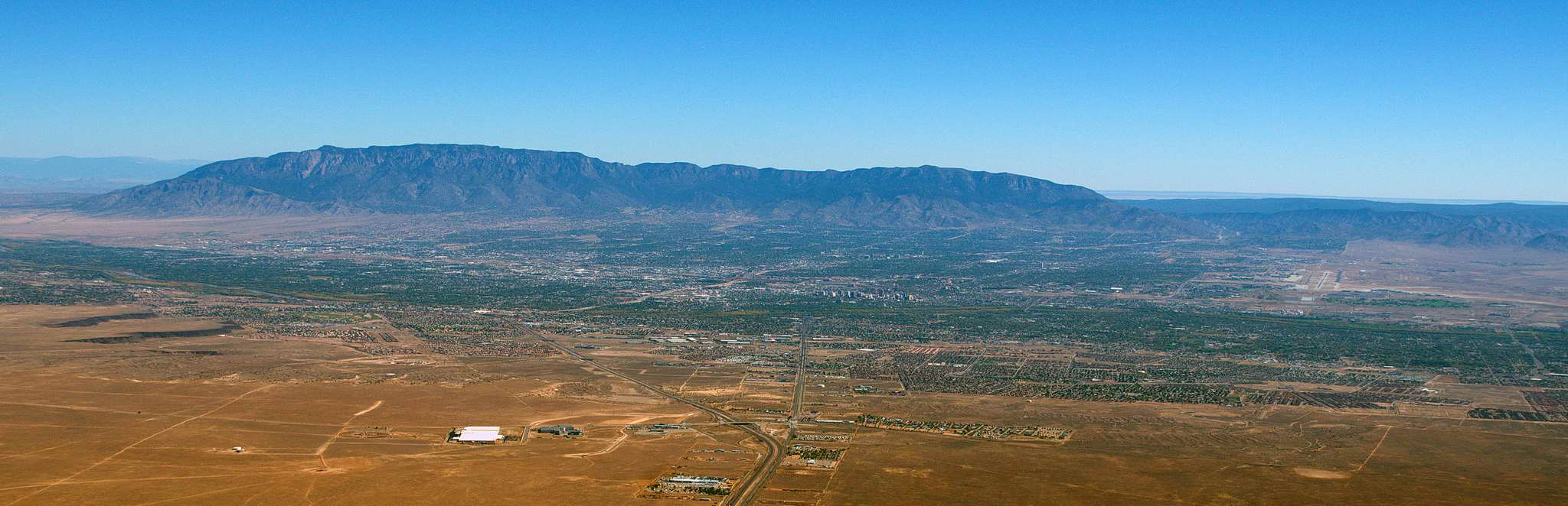
Albuquerque
The Sandia Mountains are joined by another lower range extending 50 NM south of Albuquerque. These mountains form a step up from the 5000 foot altitude of Albuquerque to the west to 100 miles of 6500 foot terrain to the east. The I-40 highway pass across the ridgeline passes in the shadow of towering 9800 foot South Sandia Peak. A harbinger of turbulence was encountered while passing along this mountain route. And then one enters the flatland, 800 NM of flat, lush farmland extending eastward from Albuquerque through the top hat of TX, the body of OK, north AR, and the length of TN until reaching the west slope of the Appalachian Mountain range.
At 9500 with an indicated airspeed (IAS) of 110 kts, my true airspeed was about 130 kts and at times my ground speed (GS) was well over 130 kts so the cold front was pushing air ahead of it providing a bit of a tailwind. Of course, with the high terrain and my low altitude above ground level, I paid for the tailwind with some moderate turbulence. The flat terrain had been descending very slowly from 7000 feet from just east of Albuquerque to 4000 at Tucumcari, NM. As the land descended and my AGL increased from an uncomfortable 2500 to a much relaxed 5500 the turbulence had thankfully gone from moderate to light.
All things in aviation have official definitions. Turbulence is no exception with light, moderate, severe, and extreme. Beyond extreme would be fatal. I've experienced something close to extreme turbulence only once. I rented a plane on Maui and along the south side of the island and on approach to the Kahului airport the aircraft was barely controlable. My scalp was bruised from the headset banging into the headliner. Not fun. The Navy has a pretty good explanation of the categories of turbulence.
Landed on runway 21 at Tucumcari, NM (TCC) in 20G27 winds aligned pretty well with the runway after precisely 4 hours of flight. The landing was a bit rough in the active gusty conditions. When I arrived at the "in-the-round" self-service fuel station another small plane was just finishing up and taxiing out. A large single engine passenger plane, perhaps a Pilatus, was performing training touch and goes on runway 21. Technicians, a young, slender girl in jeans and boots, her long blonde hair blowing in the gale, and an older guy with a few yellow teeth, a few wisps of thin hair, and suspenders holding up his pants from the assault by his gut, were certifying the accuracy of the self-serve pumps. This odd couple graciously delayed shutting down the pump to allow me to fuel up. I fueled up, took a bio-beak, and pressed on. There was a lot less at TCC than at 0L7, a whole lot less, though the airport was well maintained and well appointed. Like Jean, NV which was a hub of activity compared to Tucumcari, there was a nearby isolated mountain just 5 NM west-southwest which I had passed on my approach. Seems with the perpetual winds across the plains TCC would be a natural launching point for glider ops with just a short tow to which ever side of the round 1000 AGL Tucumcari Mt. was providing uplift.
Took off on runway 21 climbed slowly to 9500 and again picked up the tailwind and the light turbulence. Cruised at that altitude all day, over thousands of small farm towns surrounded by tens of thousands of square miles of agriculture. The land is flat and green, water is plentiful, and the land seems highly productive. It looks the same in every direction. I followed the same east-west section line for a hundred miles.
On thing I did notice was the logical, clean highway design with larger towns all having truck bypases. It seemed that unlike the far left upper corner of the states the goal was to move the most amount of traffic in the least time as possible. WA state needs to import some of these highway designers. Somehow WA state highway designers have gotten the idea that their job is to make traffic so bad it will force acceptance of slow, inefficient, inconvenient bus and rail political boondoggles. Unfortunately, it is working.
50 NM from Norman, OK (OUN) I started a long slow descent from 9500' to pattern altitude of 2200'. OUN Westheimer Tower cleared me to a right downwind and landing on runway 21 with winds 19012G15 (winds out of 190 degrees 12 kts sustained with gusts to 15 kts) about 5:30 PM local time. At least I think that was the local time. I had skipped a few time zones, and Arizona does not honor daylight saving time, so I had been working in Zulu time. The important part was that I had landed at Norman with about 2 hours of daylight remaining, ..., perhaps it was 4:30 PM local.
'Z' time is termed "Zulu" time. It is a constant time across the globe and goes by a number of different and perhaps familiar names like, Greenwich Mean time (GMT) and Coordinated Universal Time (UTC). When it is noon Zulu time it is noon Zulu time across the globe. Sounds simple. However, in humankind's attempt to make all thing complex, there are actually at least 5 versions of universal time, UTC, UT0, UT1, UT2, and UT1R. What are the differences? We don't care. It's a question for the nerdiest and geekiest among us to ponder. Zulu time is used in aviation because local time changes as you travel east/west and calculating flight times and daylight hours with local time is difficult, misleading, and potentially dangerous. Using a constant global time reference gets by all the local time vagaries. Zulu time is so named because it is "time Zero", which begs the question as to why it's not named "Zero time". In aviation all the letters of the alphabet have word designators. This helps with radio and other voice communication to distinguish similar sounding letters such as, bee, see, dee, ee, gee, pee, tee, vee, and zee. For example when a pilot announces their tail number they use the words rather than letters, for those letters above - alpha, bravo, charlie, delta, echo, golf, papa, tango, victor, and zulu. My tail number is voiced as, "two one seven five november". Generally the leading 'N' is left off since all US registered aircraft start with 'N'. Canadian registered aircraft start with 'C'. Great Britain with 'G'. And other countries with other letters. The word for zee is Zulu, hence "Zulu time".
Bedded down the plane, and having learned from earlier lessons, simply transferred a change of clothes from the suitcase to the pack, and walked the tarmac to the services office. I could see my target, the Embassy Suites on the other side of the runways, a mere half mile from the plane. Unfortunately, one does not simply saunter across the runways.
The University of Oklahoma is home to one of the finest Colleges of Aviation in the world and is just one of 28 such schools recognized by The Aviation Accreditation Board. OU operates the University of Oklahoma Westheimer Airport (OUN) commonly known as Max Westheimer Airport named after a prominent turn-of-the-century merchant and oil man. It also is home to a fine meteorology program including an advanced doppler weather radar facility operated by OU's Atmospheric Radar Research Center.
At the tiny services office I found 3 students and arranged to have the plane fueled. I asked about the food in the airport diner (I was starving) and they warned me off. I found a restroom, freshened up for the trek around the airport to the hotel, and started off with my medium pack, small pack, and laptop case. After about half mile later I realized I was getting farther and farther from the the hotel and would have to continue to do so for a couple of miles. At that point I walked back toward the terminal figuring at the worst I could crash on a couch. I found a place to sit and reassess my planned walk. Decided to call a cab, so I walked back to the services office and asked if they had the number for a cab. I was met with blank stares. In retrospect at that point I should have offered $20 to whoever wanted to drive me to the hotel. Instead I walked back outside, and enjoyed the warm evening and rehydrated while using the browser on my phone to find a cab.
The cab picked me up, and took me to the hotel. I suspect the driver drove me around some as the bill was about $20 and from Google Earth the route should have been only 3 miles. I get it - I drove a cab in college.
The Embassy Suites Conference Center was a couple of notches above the places I had been targeting to stay. The lobby was a huge central open area with a cluster of exposed glass elevators rising along one side. Restaurants, lounges, shops, and services lined the perimeter of the atrium lobby. Clumps of leather upholstered chairs dotted the place amid large potted plants. Looking up, the central cavity rose 10 floors of balistraded walkways with room doors facing toward the central atrium lobby.
I was not exactly dressed the part - baggy jeans for comfort in the cramped cockpit, sweaty tee-shirt from the warm weather and the exertions of trying to get to the hotel, baseball cap with a sweat soaked ring above the bill, and carrying nothing that resembled typical luggage of the business class. I was definitely not conference going material.
They were out of rooms.
However, the nice, painfully young man at reception did find a couple of reserved rooms under the manager's control and went off to ask permission to let one. It is not unusual for a hotel to hold back a few rooms, or perhaps the manager's girlfriend had cancelled. In any case I got a nice room. Actually, all the rooms at this Embassy Suites were nice. They were, after all, all suites, bedroom, bath, wetbar, and a large sitting room. Bedroom and bath with 32" flat panel TVs. At $200 a night one would think they would throw in free Internet, but no, another $10 a day, and I needed it.
After a day of intermittent then constant light to moderate turbulence I was tired, a bit beat up, and in serious need of a shower. After freshening up, I headed down to the atrium in search of food, libation, and playoff baseball.
Two out of three was not bad. This is FOOTBALL COUNTRY. Of the 10 or so TVs in various restaurants, lounges, and sitting areas not a single one was tuned to the baseball playoffs. They were all tuned to football. Unbelievable. Un-American. I had a leisurely salad, a horrible domestic beer (Michelob something), and retired to my room to check weather and watch baseball.
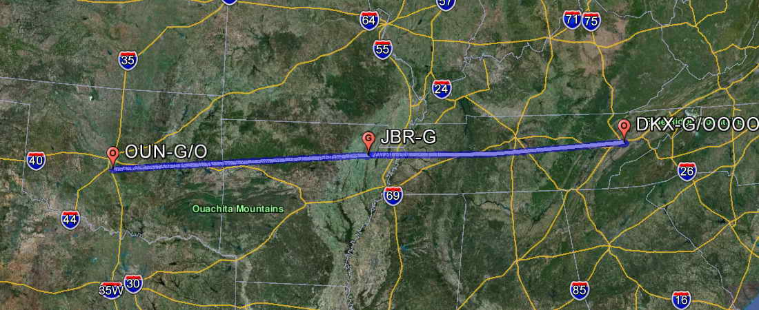
Sunrise at Norman occurred at 12:39Z (7:39 CDT). Sunset at Knoxville, TN was expected at 22:58Z (6:58PM EDT). This was 10.5 hours of daylight in which I had to fit 6.5 hours of flight time and a fuel stop. Today would be the last leg before a 3-4 night stay and rest in Knoxville visiting a long, long-time friend.
Of interest to west coast pilots, during this leg I was transitioning from a negative (eastern) magnetic variation to a positive (western) magnetic variation, and my fuel stop at Jonesboro, AR (JBR) was at a location with zero magnetic variation. This is notable in that at my home field in WA state the difference between true north and magnetic north is -17 degrees (M = T - 17). As one travels east the variation decreases until it crosses zero, then rises in the positive direction where magnetic north is greater than true north. These are important differences to keep track of since compass navigation and GPS navigation use different standards.
The cab driver on the way to the airport was driving for his second to last day. He had been training as an EMT, had completed his training, and had secured a position. Very nice guy and I wish him luck. Also, he took an honest route from the hotel to the airport.
I stopped by the services office and paid for the fuel. Made the long 250 yard walk across the tarmac to wake up the plane and prepare for the day's flight. As previously mentioned, OU at Norman has an outstanding aviation and aeronautical program. They own a fleet of Piper planes and graduate highly qualified pilots and aeronautical engineers. They also leave their doors unlocked making easy access to restrooms.
I took off on runway 21 from Westheimer Airport at the University of Oklahoma about 9:15 CDT (1415Z), climbing into a very hazy sky, under a very high overcast. The inversion haze lasted all day for the entire route, yielding generally about 35 nm of visibility. Visibility in WA state is generally hundreds of miles. Consider that Mt. Rainier is 50 NM from Seattle and the mountain is often crystal clear. Also consider that Mt. Rainier and Mt. Baker are about 115 NM apart and during nice weather they are easily visible from each other. With such limited visibility it feels like one is flying in a fish bowl.
The day's route - GO EAST
Since the terrain was so much lower over today's route than the terrain over the last two days' routes, I cruised almost due east at 7500 MSL. Today the air was smooth except for an occasional bump while crossing what passes for mountains in these parts. "Mountains" here are tall if they are more than 2000'. Flat. Thousands of small towns studded the green agricultural landscape. Section lines following the cardinal compass directions made a checkerboard of the earth with round irrigated fields providing the pieces on the squares. It all looks pretty much the same in every direction. Hard place for dead reckoning.
Lots of water - Lake Fort Smith Dam, AR
More water - the winding Black River near Cord, AR
The fuel stop at Jonesboro, AR (JBR) was uneventful landing at 1715Z on runway 23 and taking off on the same. Fueled quickly by truck. Very nice, well-maintained airport.
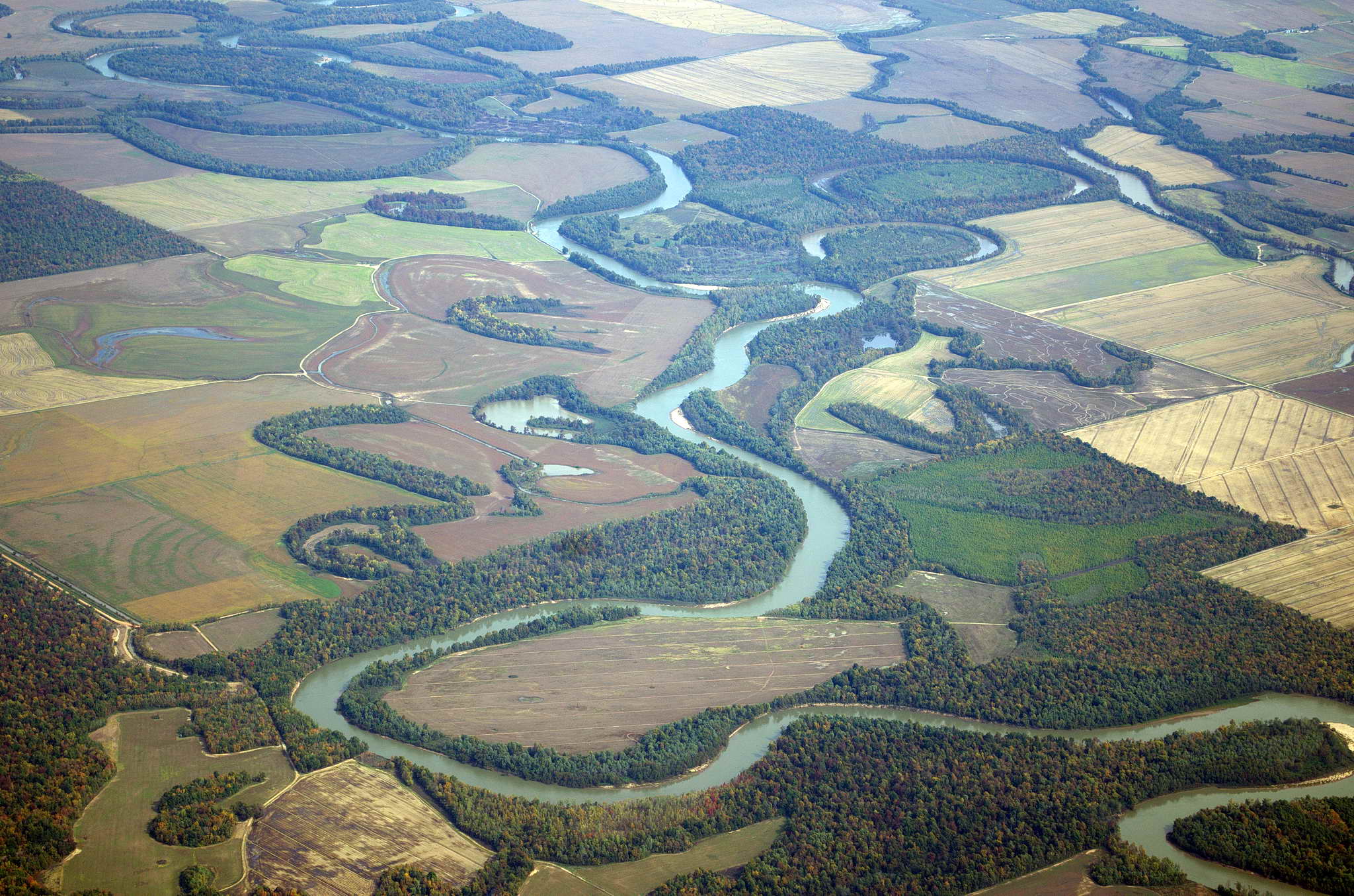
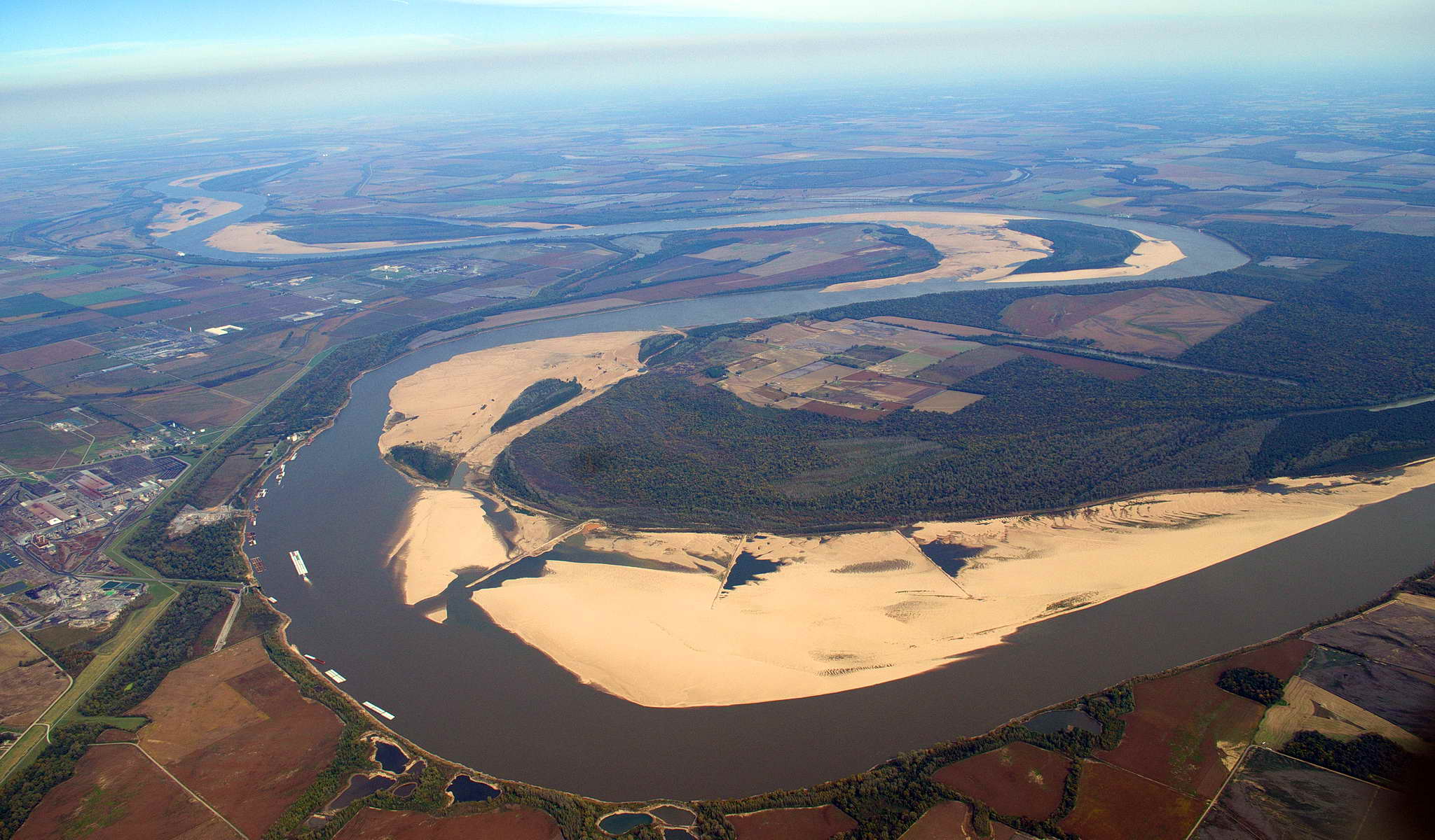
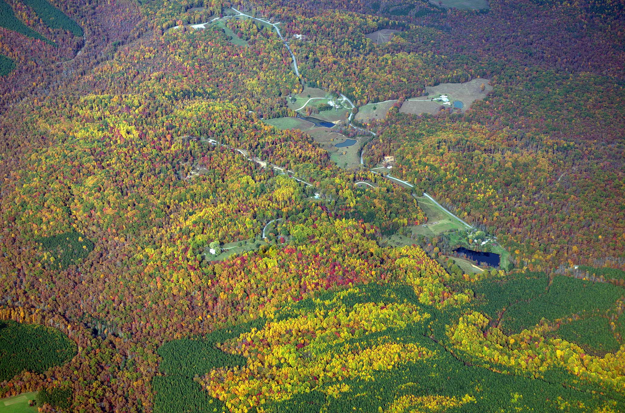
Besides looking forward to my stay in Knoxville, the day's excitment consisted of crossing the serpentine Mighty Mississippi River - Big Muddy, Old Man River, Old Blue, Moon River. Although flowing north to south it rarely flows directly in either direction. The River lazily snakes its way across the landscape in long loops and coils, leaving behind a trail of oxbow lakes where the capricious river has changed its course over and over through the eons. Another highlight was seeing the first obvious signs of autumn in large yellow blotches on the forested hills west of Knoxville.
Ol' Man River
Te yellows and reds of autumn come to Tennessee
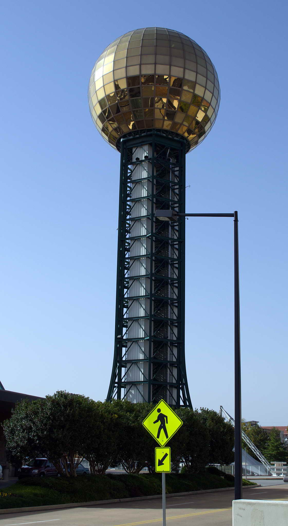
The approach to Knoxville involved some surprising turbulence over the low Oak Ridge Mts. The Oak Ridge Mountains are a part of the 600+ NM long, linear crustal folding which forms the west slope of the Appalachian Mountains. It took me longer than ATC expected for me to recognize the Downtown Island airport at Knoxville. The airport occupies the entire helmet-shaped Dickinson Island just across the Tennessee River 2 NM east of downtown Knoxville. In my defense I was distracted and blinded by a giant golden disco mirrored ball as big as a water tower left over from the 1982 World's Fair. Check it out from a street view in Google Earth at 35� 57.686'N 83� 55.502'W.
Sunsphere, Knoxville, TN
I was setup for a 3 NM straight-in on runway 8, but traffic at the time was "not permitting" so instead I turned out to the SE, away from the city, to make a crosswind entry to a left downwind for the same runway. Landed at 2047Z (4:47PM EDT).
Like a good cowboy, I fed and bedded down the trusty steed before seeing to my own needs. The Holiday Inn will pickup and deliver within 3 miles and the airport was within their radius. This made the trip to the World's Fair Park Holiday Inn, shower, food, water, and sheets very easy.
About the only interpersonal interactions I'd been having for almost a week have been with Air Traffic Controllers (ATC) and hotel clerks. I'd been arising at 5:30am, getting to the airport about 8am, awakening the plane, and taking off, fueling up somewhere mid-afternoon, and landing in the late afternoon or evening somewhere else, then it took an hour to bed down the plane. Once I got to the lodgings, shower, and had some food, I've have about 1/2 hour before needing to get to bed to start all over the next day. I'd lost track of the days, the time zone, and the local time. A couple of days breakfast was a few trailmix bars. Lunch was in the air, turkey jerky, crunchy cashew squares, trail mix bars, and dried dates and coconut. It would be good to see the same people for a few days and converse over things other then radio frequencies, traffic advisories, fuel, hotel rooms, and meal orders.
After 5 flight days and 8 days elapsed, I had arrived in Knoxville.
Spent 4 nights in Knoxville. Colleen was up in West Virginia visiting her bears, and was driving back Wednesday morning. I met up with husband Jerry at the hotel and went to the WDVX radio Blue Plate Special music hour. Free blue-grassy music 5 days a week at lunch in a small hall. http://www.wdvx.com/ They stream live on the net. Colleen met us for lunch.
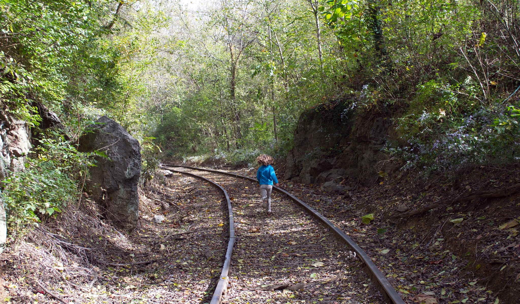
This is a flight log so I'll leave out the details of the time I spent in Knoxville with Colleen and Jerry, except to say it was great to see Colleen, and a pleasure to finally meet Jerry and hang with them and their 7 year-old granddaughter, Ruby, for a couple of days. Colleen left for the New Mexico early Friday morning and Jerry, Ruby, and I visited the airplane, then spent a few hours at the Ijams Nature Center and Mead's Marble Quarry.
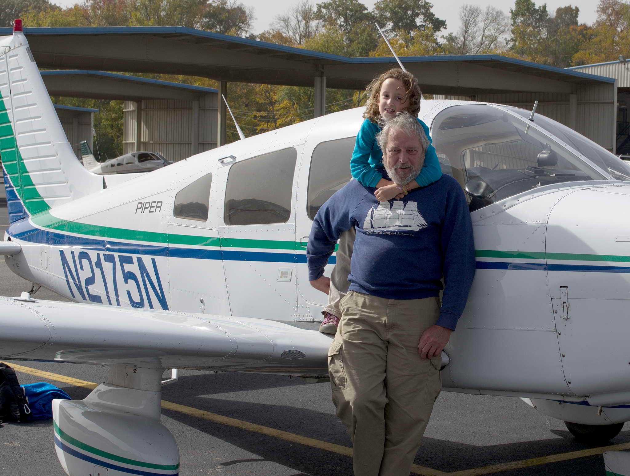
Daddio and Ruby and 2175N
Ruby at the quarry
I stayed an extra day in Knoxville due to forecasted widespread thunderstorms across Florida. When I tried to extend my stay at the hotel for another night, there were no rooms available. Apparently, the next day, Saturday, was the "Big Game", University of Tennessee versus staunch rivals Alabama. Every room in the city was booked. Luckily, I had done my laundry at the self-service laundry near the pool and work-out room the night before. Jerry graciously put me up for my last night in town. Other notable events were lunch at THC, chats on the porch, Spy Kids 2, a limp frisbee, a trip to Taco Bell, crepes, dinner at neighbors Steve and Rebecca's with family, friends, and Amazon Sheila.
Jerry drove me to the Knoxville Island Home Airport (DKX) in the morning, and upon arrival I found my plane - missing. Where it was carefully, tautly tied down, blue covered, and cowl-plugged, was - nothing. Jerry and I looked around. It was nowhere in sight. I burst into the office as much as one can "burst" dragging a pile of luggage through a sequence of a couple of narrow swinging doors, and asked, in what I thought was a polite and restrained manner, "Where's my plane?!"
The receptionist recoiled a bit, and all but said calm down.
They had moved it. The day was the day of the "Big Game". University of Tennessee at home vs. historic rival Alabama. They moved my plane to make room for the anticipated game fly-in crowd. It was their busiest day of the year. Why The fly-in crowd couldn't park where they had moved my plane is unknown and unasked. I was just glad to have found the plane.
Did I mention these folks take their college football SERIOUSLY?
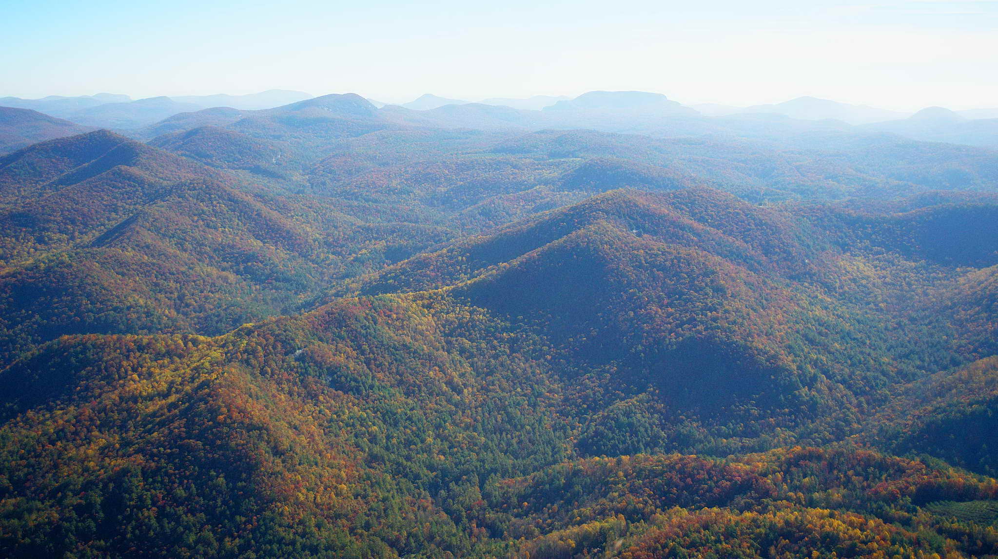
Knoxville had an overcast cloud ceiling at 4800 when I took off at 10am. My route took me over a 5000+ ridgeline of the Smokey Mountains which was not going to work, so I diverted a bit west then turned south looking for a way through or around the ridge the to south. I climbed to 4500 MSL and continued south clearing the ridgeline of the Smokies by about 1000' a couple of NMs west of Gregory Bald Mt. over the Little Tennessee River Valley.
Here is the day's route south, an approach to Macon County, a landing at Clemson, and then a final stop at Stuart FL.
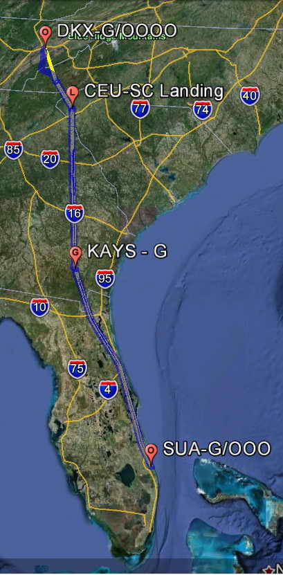
The Smokey Mountains of Tennessee and North Carolina.
I turned east southeast around the mountain and followed the river/lake about 15 NM, then turned southeast to start my search and descent to Macon County airport (1A5), my planned North Carolina pin-in-the-map landing. I found the airport nestled in a beautiful valley surrounded on three sides by hills 800-1000' higher than the runway. As I descended the air got bumpy, spilling into the vales, then rushing up the slope of the hills. While the runway was level the brisk winds strongly favored a takeoff into the rising terrain of a boxed valley. This was to be my NC landing, but the conditions were not worth just another pin on a map, so I pressed on, now under clear skies. After the Smokies the terrain leveled out and again became FLAT. A layer of haze trapped below an inversion make for limited visibility and I cruised at 5500 until Clemson.
I did make the planned landing at non-towered Clemson Airport, which is very near Clemson University on the shores of spidery Hartwell Lake. I came in from the northwest and made a left crosswind entry to the pattern for runway 25. I was directed to grass parking in a line of small prop planes across the taxiway from a line of small jets, Citations and Gulfstreams. Like UT playing their historic rivals Alabama at home, the Clemson Tigers were playing their rivals, the Virginia Tech Hokies at home. For me this was not a fuel stop, but I did take the opportunity for a bio-break. The area outside the entrance to the FBO had tables set up welcoming the fans, and the lobby was packed with folks sporting the Orange and Purple of the Clemson Tigers. Did I mention these folks take their college football SERIOUSLY?
Clemson Alumni aircraft for the Tigers vs. Hokies game. Go TIGERS!
I made my way back out to the plane, taxiied to runway 25, took off, then turned south climbing to 7500 toward my fuel stop at Waycross, GA. This put me somewhat above the haze layer. Looking down through the haze gave farther visibility than looking through the haze.
In southern GA 200 NM south of Clemson I descended toward my fuel stop, the non-towered, attractive Waycross-Ware County Airport (AYS), made a left downwind entry, and landed on runway 31.
There is no self-service fuel, but the truck was fast, and the FBO was very nice with a bit of a history corridor lined with photos of planes and businesses in the area. The winds were light and northerly so I taxiied to the nearest northward runway and took off on runway 36 and departed the area from a left downwind climbing to 7500 toward Florida. The haze lightened as I headed south, ending up about half as thick in southern Florida as in TN through GA. For the most part at cruise the air was smooth.
Somewhere around Jacksonville, FL I realized that the blue haze I was seeing to the left was actually the Atlantic Ocean. Then it hit me that I had flown all the way from the Pacific Ocean to the Atlantic Ocean, and, ... I was going to fly back.
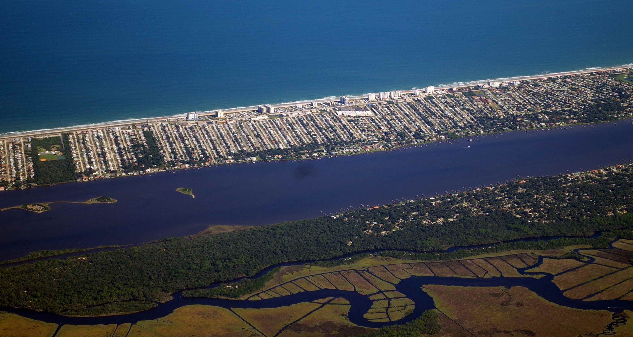
Much of the eastern Florida coast has barrier islands creating a protected intercoastal waterway. Prime Redfish territory.
At Daytona Beach I picked up victor airway 3, V-3. Victor airways are highways in the sky, and are most often defined by a straight path between VOR navigational aids. Generally they are 8 NM wide, 4NM on each side of the centerline. Victor-3 extends from the Ormond Beach, FL VOR (OMN) 8 NM north-northwest of Daytona Beach Airport (DAB), 75 NM to Melbourne International Airport, and provides a well-known route through the multiple restricted zones along the coast.
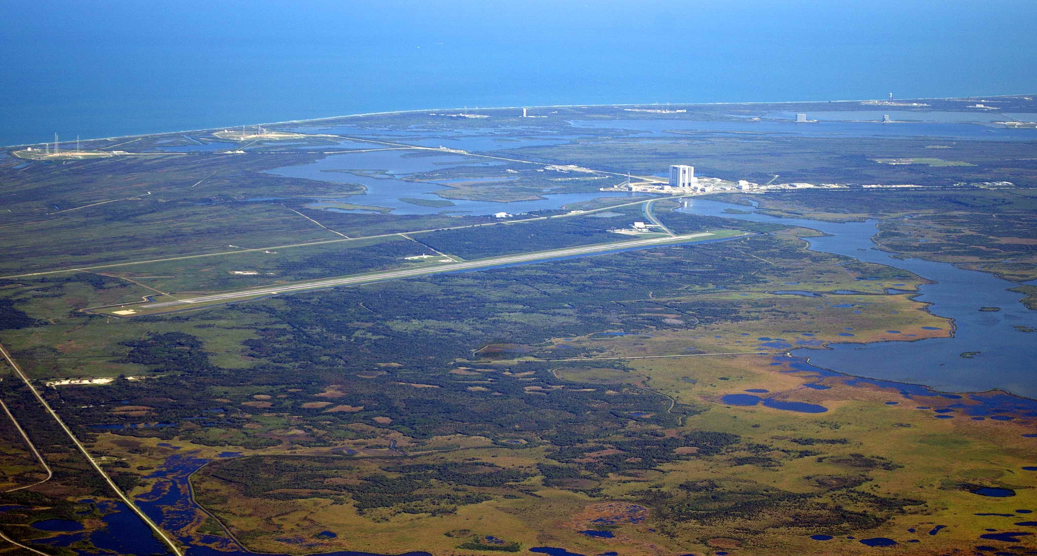
Though ATC would not clear me through R-2934, NASA Cape Canaveral restricted zone I got a few photos of the area from 7 NM away over the mainland. The Space Shuttle landing runway is 15,001 feet long and 300 feet wide. On a day when the numerous restricted zones are not active ATC will allow small planes to make a low pass down the length of the runway, however, if you land you lose your aircraft to the feds.
I approached the towered Witham Field, Suart, FL (SUA) from the north-northwest and was cleared to a left downwind for runway 34, then cleared to land at about 17:15 local daylight time. This was as far east as I was going. Actually it was as far east as I could go without getting wet.
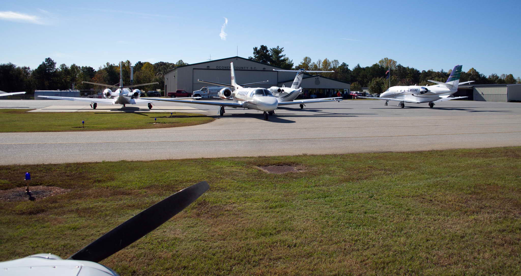
After I landed the tower had me choose between two businesses on the airport to which to take the plane. They were careful to NOT make a recommendation and I was forced into a blind choice of an FBO (Fixed Base Operator). Galaxy Aviation is a small chain of six FULL SERVICE FBOs geared toward the kerosene crowd. When a jet taxis in the ramp-rats run out with a soft red carpet and unroll it at the bottom of the stairs, so the passengers' first steps off the plane are not onto uncomfortably hard cement. The pilots then toss the keys (figuratively) to the ramp rat and walk off. When they come back the plane has been serviced as requested.
It was nice and warm. About 80F and a bit humid. It felt good. Knoxville was a bit chilly at times and with my mediterranean genetics I am a bit thin-blooded. The ramp-rat had me park a hundred feet behind a Cessna Citation jet, and placed tall orange road cones at my nose and wingtips. I looked warily toward the ass-end of the jet and the yawning engine nozzles pointed directly at me. This did not look like a good idea. While I was bedding down the bird and getting organized for my 3 night stay, the jet started up, blew away the orange cones the rat had placed around my plane, and filled the air with the smell of burning kerosene. 10 minutes later they spooled up the jet engines to taxi and started my plane rocking and bucking in the hot spray of burnt kerosene scented cement grit. I then made them move my plane to the "back lot" away from the jets. I offended the ramp-rats when I untied their ropes and their lackluster tie-down jobs, and replaced them with my own ropes and a nice taut tie-down. The folks in the office were polite, but seemed a bit at a loss with someone who wanted no services and wanted no one to wait on them. They did call me a cab to take me the 8 NM north to the Port St. Lucie Holiday Inn.
What is it with Floridians and air conditioning? It was a pleasant 80F outside with just a bit of humidity when I threw my luggage in the backseat of the taxi and hopped in the front passenger seat to be accosted in the face by an air conditioning system set to ARTIC BLAST. By the time I exited the cab seemingly 20 miles later the tip of my nose and earlobes were numb. I warmed my cold stiff joints on the trip from the cab to the hotel lobby to my room, where again I was assailed by an A/C system set to HEAVY FROST. My first act was to set the A/C to OFF. It took an hour for the icicle on the bathroom faucet to melt and 12 hours for the room to return to room temperature.
Dinner was at Sonny's BBQ as recommended by the taxi driver and conveniently in the parking lot of the hotel. Sweet & smokey ribs with green beans (cooked fully into gray submission) cob corn, corn bread (not nearly as good as at last night's dinner with the neighbors Steve and Rebecca), washed down with a Michalob Ultra (who knew it was a light beer) and then a regular Budweiser. I missed out on the Tennessee BBQ, and this was definitely subpar.
After dinner I called my friend, Dick, and we made arrangements to meet at 9AM his church services the next morning, Sunday. Coincidentally, Dick's Church holds its services in a retirement home right next to the hotel.
I stayed in Port St. Lucie for 3 nights, and got to hang out with Dick for most of that time.
Shortly after I sat down and throughout my oatmeal and assorted fruit, a group of 8 GOB co-workers dribbled in and sat at the tables next to me. The entertainment/interesting coefficient of hotel clientele is inversely proportional to the cost of the lodging. No interesting folks at the Embassy Suites in Norman, OK at $225/night (unless you count the fat women with their handbag dogs and their hubbies in tow - but I don't). But very interesting folks at the Cimarron Inn in Klamath Falls, OR at $62/night (railroad workers), and these crane assembling and operating good ol' boys were quite entertaining at the Holiday Inn here at $82/night.
Took Dick flying in the afternoon. Dick is an ex-pilot having earned his certificate decades ago, then accumulated a few hundred hours, then drifting away from flying for good. It is an all-too-often story, particularly today, when it seems that instant gratification trumps hard work and hard goals, gas prices are high, and aviation seems to have lost the glamour it once had. In reality my plane cost less than most SUVs, the hangar costs less than most car loans, and while gas is expensive one simply does not fly as much as one drives. Sadly, the future of general aviation in the USA seems clear. The year I started my flight training, 2001, there were about 245,000 private pilots in the USA. Just eight years later, 2009, the number had declined to about 211,000 private pilots. If this trend continues within 50 years there will be virtually no private pilots left in the USA. General aviation will die a slow death of disinterest and subsequent rising costs. In the end the situation in the USA will be little different from the situation in Europe, where gas is exorbitant, airfields rare, and flying consists of a myriad of individual costs.
The flight with Dick was great and he recorded the entire thing. We left Stuart Field in the early afternoon and flew 30 NM north to Vero Beach, FL (VRB), a famous location in the history of general aviation. The tower cleared me to a 3 mile base for runway 4, I called it, then was cleared to land. I was still a mile off the runway when the tower forcefully instructed to turn left NOW! I whipped her around instantly to the left assuming we had some sort of impending traffic conflict, though I had been listening carefully to the radio and I was the only plane communicating with the tower. The actual issue was that I had passed the centerline of runway 4. Oops. I had set up for an intersecting runway rather than 4. I apologized profusely, made a right 360, a right base entry to runway 4, and landed uneventfully.
Vero Beach has been the home of the Cherokee line of aircraft built by the Piper Aircraft Company since 1961. The history of Piper Aircraft is a long story, starting as the Taylor Brothers in 1927 in Rochester, NY. The company moved to Lockhaven, PA in 1937 and was renamed to Piper Aircraft. It operated out of Lockhaven through the 1940s, 1950s, 1960s, until hurricane Agnes heavily damaged the facility in 1972, when production was moved to Lakeland, FL.
In 1961 the Cherokee line (P-28) of Piper Aircraft was the first models to be manufactured at the Vero Beach, FL production facility. My Cherokee Warrior was manufactured in 1978 at Vero Beach and designated a 1979 PA-28-161 model. In the 1980s and 1990s Piper came upon hard times and in 1991 sold off its Lakeland facilities and consolidated to the southeast corner of Vero Beach.
Unfortunately, we visited on Sunday and the Piper facility was closed. However, like a salmon returning to its home stream, after 33 years, my little Warrior had returned to the site of its birth. It's a heart-warming story.
As we taxied to the self-service fuel pumps we passed the center ramp which was covered by single engine and twin engine Piper planes.
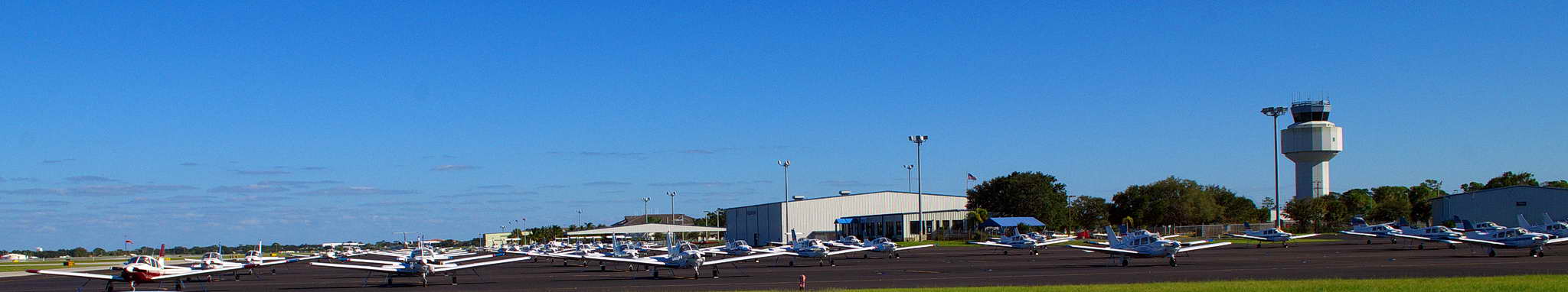
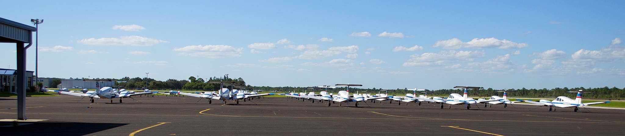
I had waited to fuel up at Vero Beach because the cost of self-service fuel at VRB was $1.50/gal cheaper than the full-service fuel at Galaxy Aviation at SUA. Here is my friend Dick after we fueled up with that nice cheap avgas.
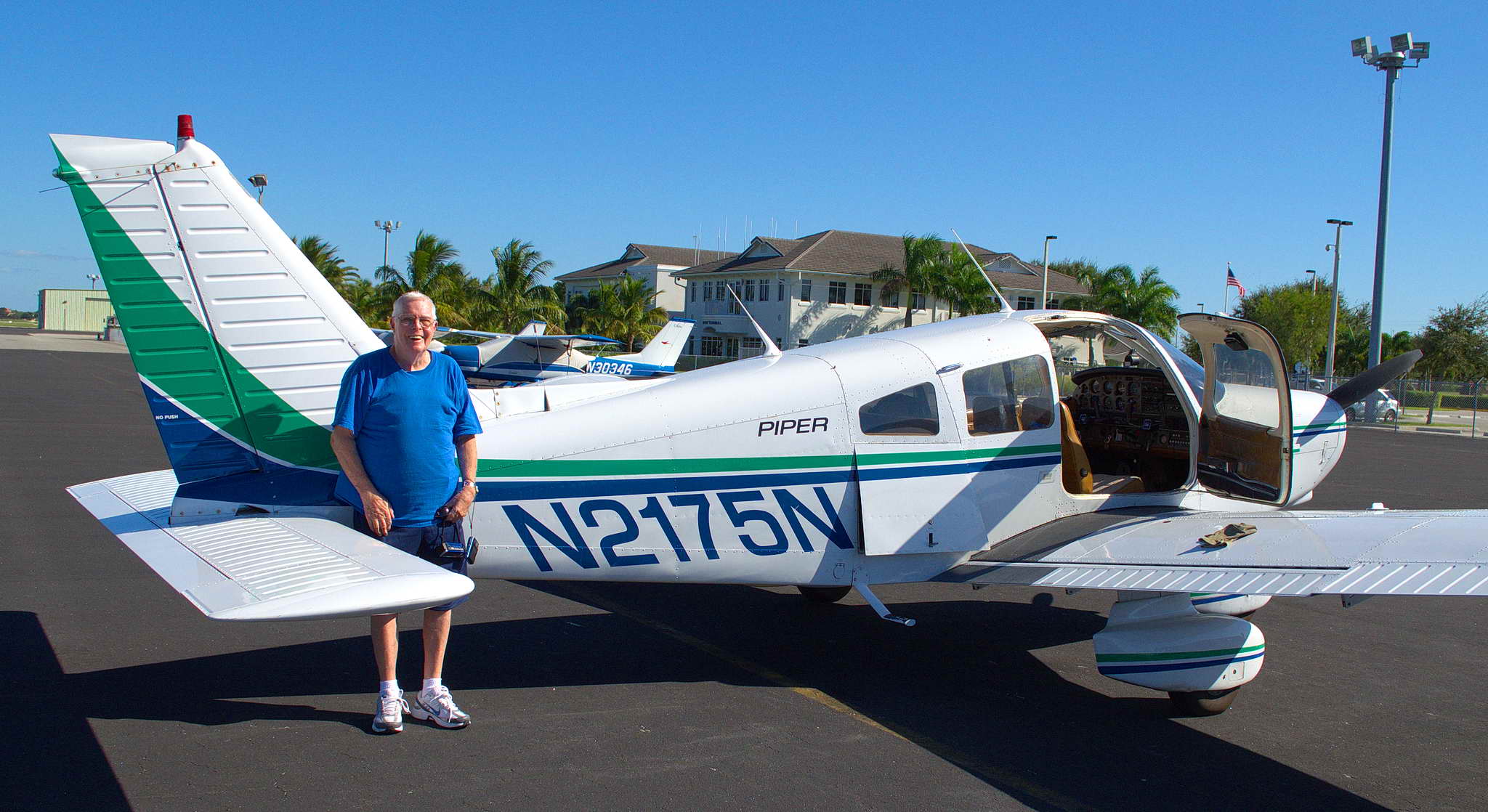
I spent another day in Port St. Lucie hanging out with Dick, visiting a couple of Florida beaches, where the blustery wind was whipping up the surf and clouds were rolling in from the ocean. This was the leading edge of a huge weather system being fueled by tropical storm Sandy which at that moment was bringing wind, rain, and destruction to Jamaica and Cuba. To me the coming clouds seemed aimed specifically at me, and I was becoming nervous about waiting until the next day to depart southern Florida. In the next couple of days 43 people would die in the Caribbean.
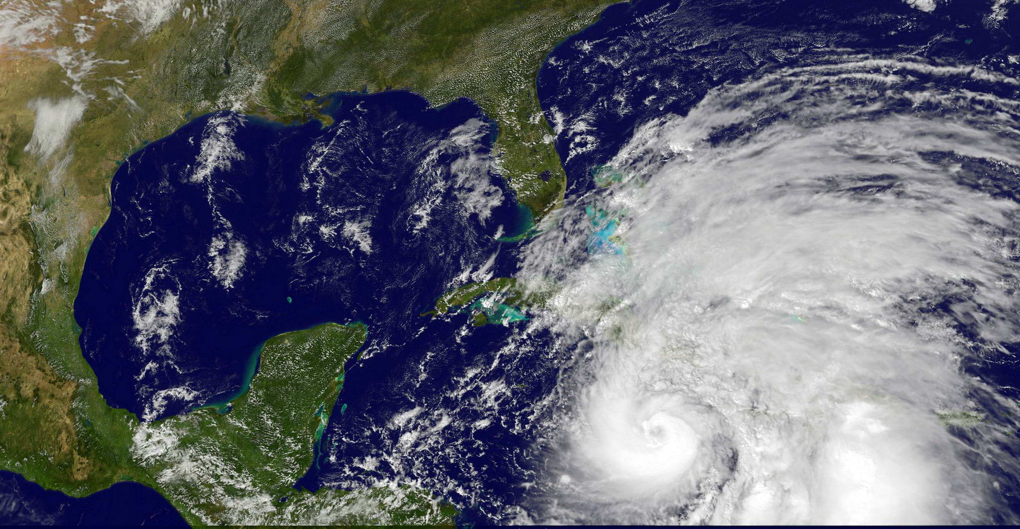
The large cab driver who took me to the airport was an APA player (American Pool Association) and had won one trip to Vegas, was very close to winning another, and had a chance for 2 others. He looked to be in his late 30s, with ample baby fat on his ample frame and had flown for the first time in his life last year going to Vegas. His wife was flight training when they had met and because he was afraid he nagged her until he crushed her dream of flight and she quit. What a cowardly wuss. He redeemed himself just a bit when I learned they had a couple of kids together and a couple more they had adopted. Still, it was hard to wish him luck with his pool dreams.
The young, attractive, yes, female, receptionist at Galaxy Aviation graciously waived one day of fees, charging me for only three days tie-down and "facility fees", so I was able to buy my plane back from Galaxy for $86. Such is a "Full Service" FBO. I didn't even use their ropes.
Lifted off from Stuart airport, Port St. Lucie, FL (SUA) at 9:55 AM EDT expecting 6 hours and 50 minutes of flight time to Lafayette, LA with one fuel stop, and one landing each in Alabama and Mississippi. Sunset at Lafayette was 6:30 CDT, but I gained back an hour heading west. The day's route took me northwest up the Florida peninsula, to a fuel stop 50 NM past Tallahassee at Marianna, FL (MAI). Thence to quick landings at airports in the southern stubs of Alabama and Mississippi, ending the day at Lafayette, LA.
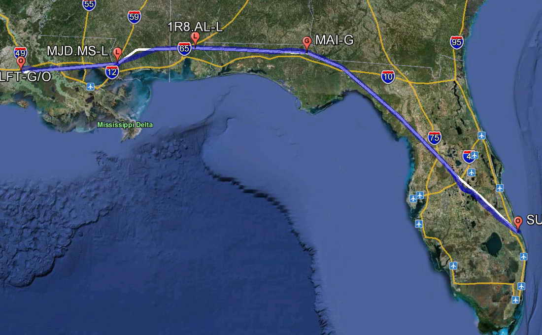
One of the presidential debates had taken place in Boca Raton, FL the evening before and a VIP/presidential Temporary Flight Restriction (TFR) was in effect for a 30 NM radius around Palm Beach International Airport (PBI). PBI was 30.5 NM from the Stuart Airport, so all takeoffs had to occur to the east or the north on runways 7 or 34, and all landings had to occur to west or the south on 25 or 16. Whenever the president, whoever it is, travels around the country, they have a 30 NM radius TFR around them. This creates no end of disruption and grief to general aviation. For security reasons these TFRs pop up with short notice, and the FAA's system for disseminating TFR information to general aviation pilots is poor and unreliable at best. This is why, many, many times a year you hear of private pilots busting these TFRs. In every case they have been inadvertant incursions. Presidential TFRs are simply a part of our useless "security theater" and should be either done away with entirely or shrunk to a more reasonable 10 NM radius. But, that is as likely to ever happen as a balanced federal budget.
Took off to the east on runway 7 and climbed out over the beach and the ocean into a pretty solid ceiling at 3500', then turned inland to the northwest. The land was flat and green. To the east and to the north heavy rain squalls could be seen moving shoreward and across the peninsula. These ominous, gray, wraith-like squalls crawled across the landscape, trailing gray veils of rain in their wake. At their leading edges could be expected updrafts and in their wake strong downdrafts as the rain carries the atmosphere downward. Annoying and potentially dangerous.
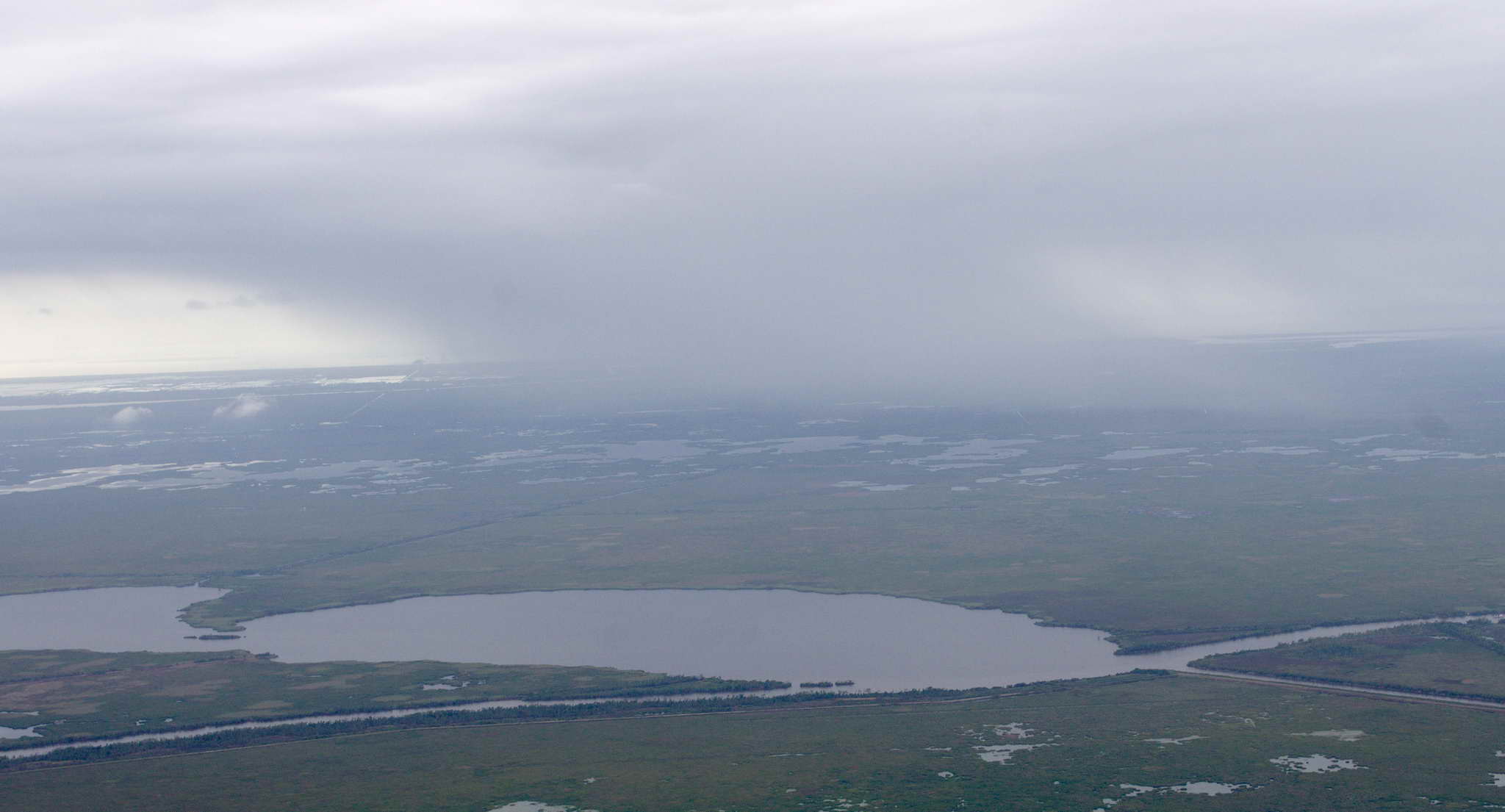
I cruised at 2500' dodging a few of these squalls, and not dodging a few others. Warrior 2175N got a much needed shower. I hoped it softened the dried bugs on the front cowling. Maybe I should have saved them, as they were imported from every state I'd crossed. For a short time I descended and cruised at 1500' to clear a chunk of lower cloud that looked like it was just aching to produce rain.
Florida and the Gulf states are FLAT and LOW. This means water is virtually everywhere. Running down the center of the Florida peninsula is a series of lakes, and about 70 NM northwest of Port St, Lucie is Lake Kissimmee, big enough to have a number of islands.
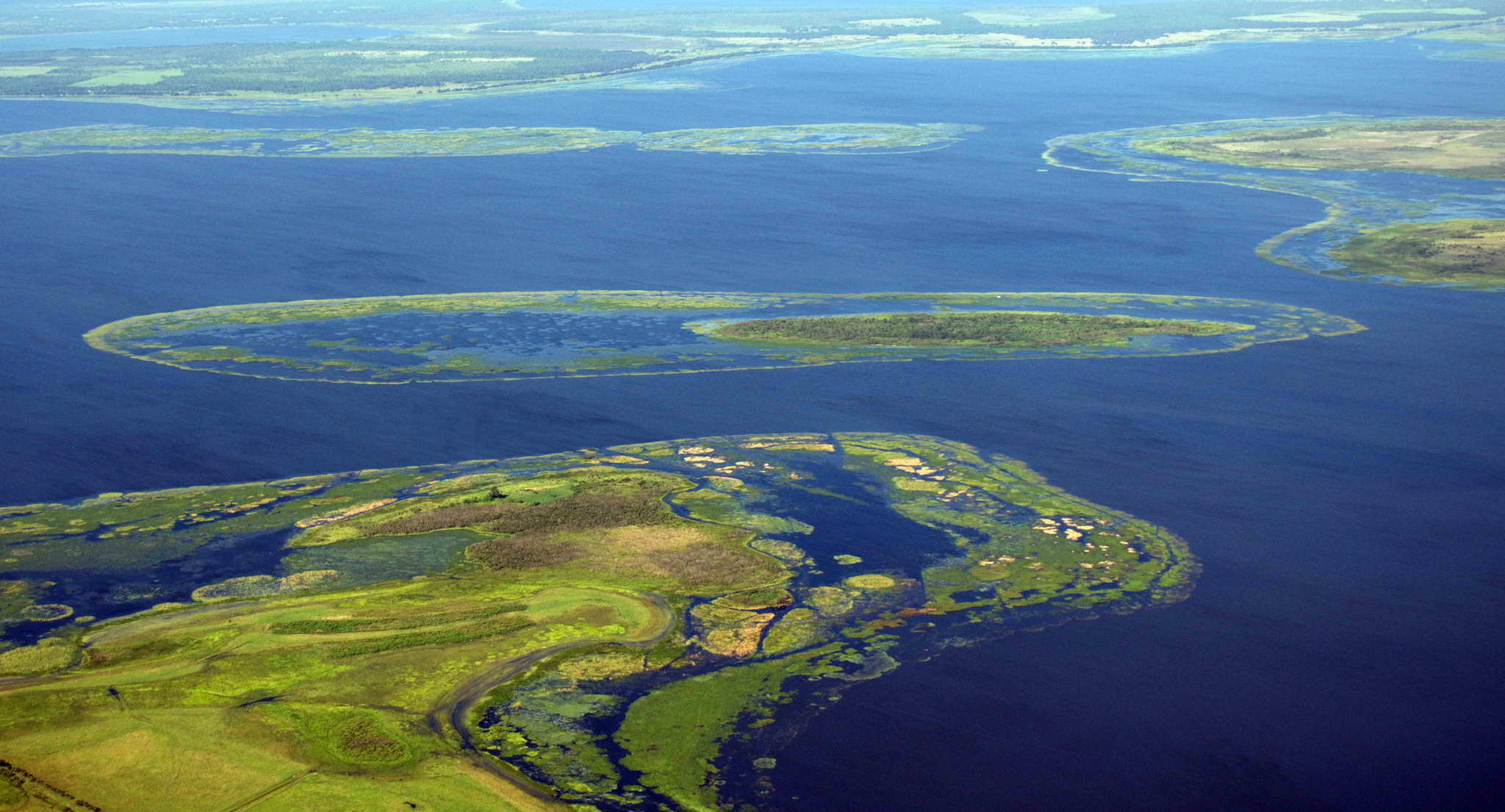
While Florida and the Gulf states are flat and low this does not mean they are obstacle free. Every year tall radio towers and their supporting cables claim a few small planes. Some of these towers are immense. Think of them as malevolent giants, reaching into the sky to ensnare their prey. Alabama has two 2000' towers, one at Windham Springs and the other at Pensacola. Louisiana has one 2000' high southwest of New Orleans. Mississippi has one 2000' tall, and numerous ones at 1500'. Texas has seven all 2000' tall. Florida has one at 1900' at Bonifay. On this day's flight I'd be passing within 4 NM of the one in Bonifay, Florida, and within 3 NM of three in Mississippi, and on the next day's flight I'd be passing close to three in Texas near Galvaston Bay.
Here is a section of the New Orleans sectional chart showing a 50 NM wide area between Mobile, AL at the left to Pensacola, FL on the right. All the 'M's and upside-down 'V's are towers. In parens are the heights above ground level (AGL), and parenless are the heights above mean sea level (MSL).
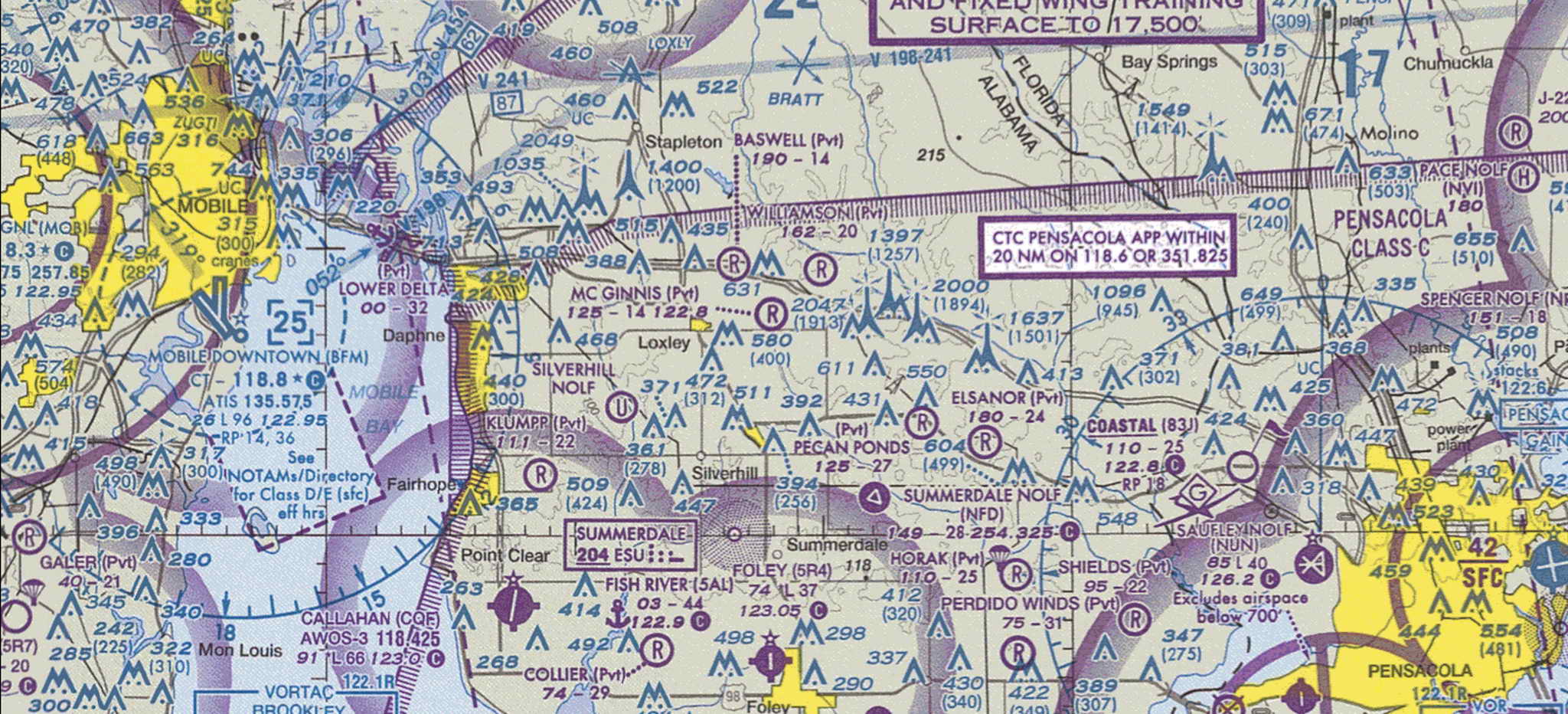
Later in the day after my fuel stop as I curised at 2500' MSL past the towers near Gulfport, MS ATC asked me if I was familiar with them. They drolly suggested I not descend in the area. I said I was aware of the towers though in Seattle we just stuck them on mountains.
After about 100 nm of this low cruise I was able to climb to 4500' which was just above a puffy broken to scattered cloud layer. I dodged a large controlled burn which was sending a trailing plume of smoke to my altitude where it fanned out into a faux thunderhead.
Three and a half hours after taking off from Stuart, FL, I landed for fuel at an old military base in the eastern end of the panhandle, Marianna, FL (MAI). It looked deserted when I landed straight in on a cracked, flaking, uneven runway 26, but the office was manned and the fuel was delivered quickly by truck. Marianna was formerly Graham Air Base (Army) with an interesting history.
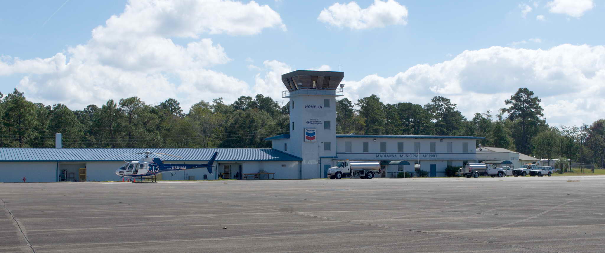
A very nice guy named Bill, ex-marine, topped off my tanks and we chatted for a few minutes. I walked in the office and followed the scent of popcorn to the pilot's lounge - a hard floored room with a microwave, a popcorn machine, a couple of folding chairs, a beat up easy chair, and doors to the bathrooms. 4 guys were in the pilot's lounge and we exchanged nods of greetings. Bill got up from the easy chair and we went up to the office counter to sign in. I asked for a top off and said, "I'll be right out after I find the head." He stopped and said, "Why'd you say that? Use that word." I said I guess it was because my father was in the navy and because I'm from Seattle and I've been around a lot of boats. He said, "Ah, it caught my ear, I'm ex-marine." Thanks for your service. Hoo-rah.
For some reason aviation, pilots, and popcorn seem to go together. At a number of airport offices and FBOs around the country I found hot popcorn machines. I wonder how this got started?
In April 2011 an F-1 tornado hit the airport.
A number of planes were damaged or destroyed in the tornado and a couple of sad remnants are still laying on the ramp. One is a flipped Cessna 150 with one main gear, nose gear, and the tail ripped off, though it is tied down. The other is just, literally, just the cockpit of some high wing. Seeing these elicited a weird, unsettled feeling.
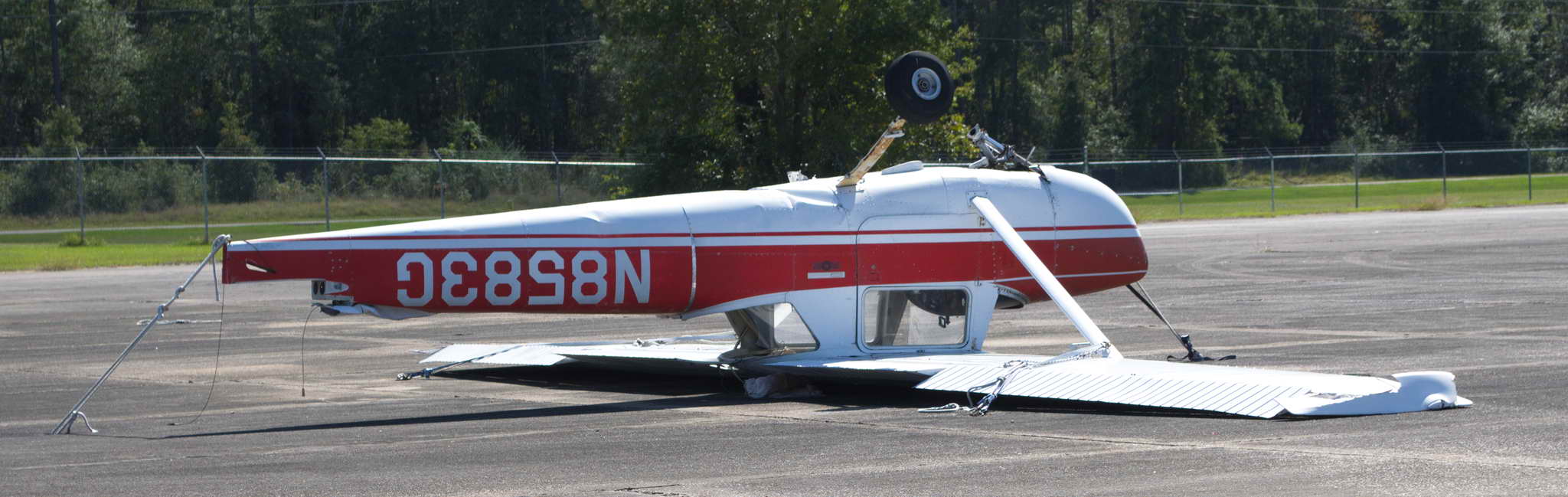
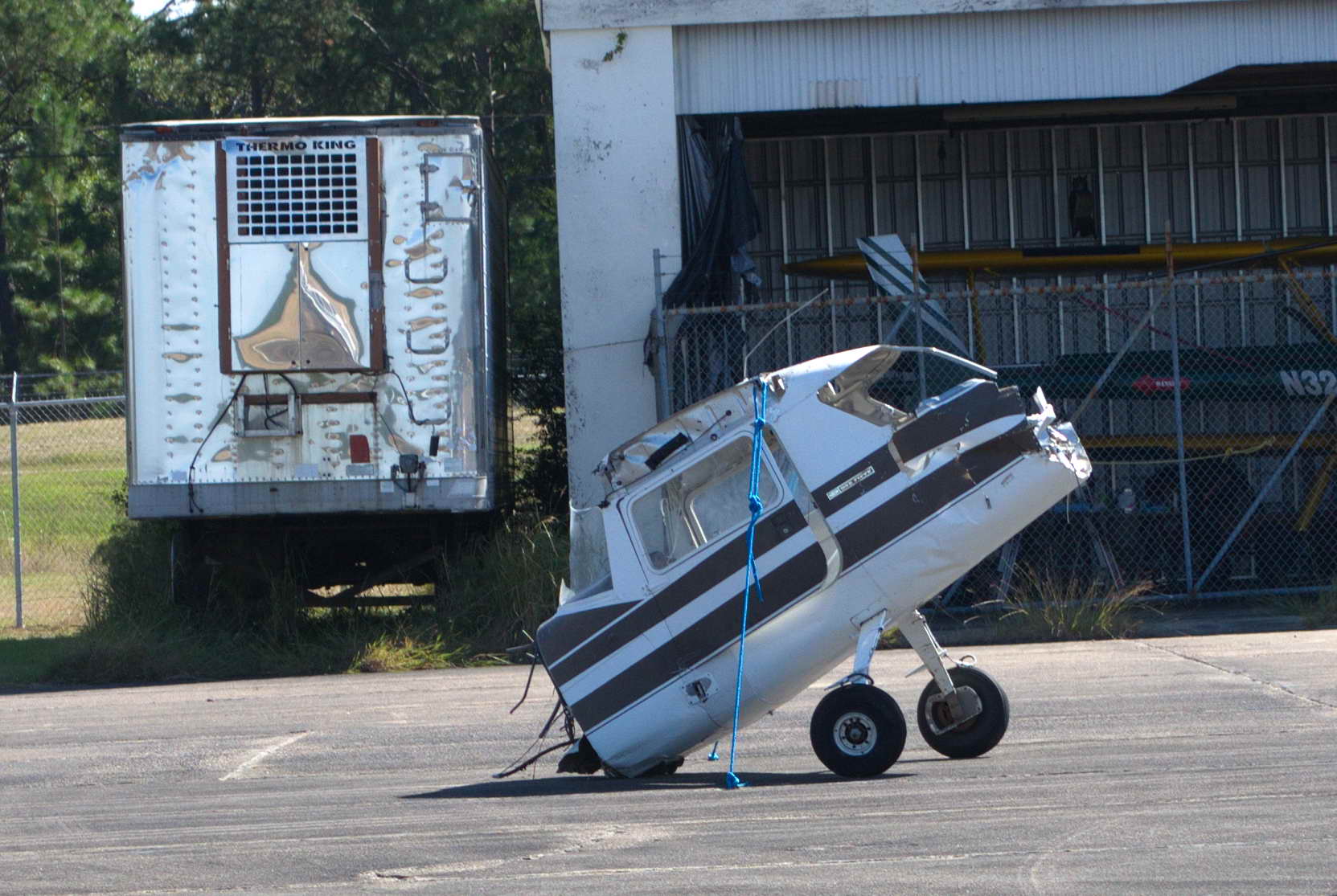
If you zoom in on my Google Earth ground track at Marianna, you'll see I first traveled northeast up the ramp to photograph the airplane remnants, then turned around and taxied to the first taxiway looking for runway 36. That was a mid-field taxiway and didn't give me enough runway length to takeoff, so I turned around, went back to the ramp, and traveled past another taxiway down to the last taxiway only to find it blocked by construction. Then it was back up to the taxiway I had skipped to back taxi on the runway to the 36 end. I never got lost in the air on this trip.
Runway 36 at MAI is 4900' long. My plane will lift off within 1000' and clear a 50 foot obstacle within 1500'. My home field is only 2700' long, so why obsess over the end of a 4900' runway?
Bear with me. This is a perfect spot for a long, boring digression, but I will bring the narration back home at the end.
There are hundreds of aviation sayings, imparting wisdom and humor. My favorites give a sense of my philosophy toward my personal flying.
These three sayings embody much wisdom which I take to heart. First, whatever is happening fly the damn plane. Even if your feet are on fire you still need to fly the plane. I do everything I can to mitigate risk - I can proudly say I am a chicken pilot. As corrollaries to risk mitigation, I tend to fly higher than most, I fly with full tanks even on short trips, and I start my takeoff rolls from the end of the runway regardless of how long a runway. These sayings which I encountered early in my training got me curious as to how and why small planes crash. Every 2 years (the odd ones), the Airplane Owners and Pilots Association (AOPA) Air Safety Foundation publishes The Nall Safety Report which is an extensive examination of the aviation accidents which occurred over the last time period.
The chart below shows a statistical summary of the 1181 (233 fatal) accidents of 2009, which occurred during 18 MILLION flight hours. The accidents are broken up into 6 different phases of flight, and 3 more general categories. The first 7 categories represent "Pilot-related" causes, that is, the ubiquitous "Pilot Error", though in reality it is nearly always the pilot's fault in one way or another. We pilots are very tough on other pilots.
The parenthetical numbers after each accident category are the total number of accidents in the category and the percentage this number represents. The green bar and label represents the number of non-fatal accidents in the category and the blue bar and label are the number of fatal accidents in the category. The percentage in the orange box is the lethality of the category, that is, the percentage of accidents within the category which were lethal.
The "Unknown" category's 12.6% of the accidents could not be attributed to any cause by the National Transportation Safety Board (NTSB) investigation. We assume for whatever reason these are distributed evenly among the other causes. While these accidents are included in the overall total, all the other category percentages are calculated based on 1181-149=1032 accidents. This assumption does not change the story.
The first obvious fact from the 1181 accidents in 18 million flight hours is that fixed-wing non-commercial aviation is SAFE. This is a rate of 6.6 (1.3 fatal) accidents per 100,000 flight hours. You are much more likely to get into a serious accident on your way to the airport than you are during your flight. To give a sense of proportion, in 11 years I have accumulated less than 700 flight hours. A private pilot with 2000 hours is rare. In general, if you don't do anything stupid the odds are definitely with you. The catch is knowing what is "stupid".
The chart has some notable features. Two-thirds of all accidents are due to mechanical issues, landings, and takeoffs. Dangerous mechanical problems are rare in airplanes that are well-maintained, so keep your plane maintained. Landings represent the largest number of accidents by far, yet very, very few are fatal. While the number of takeoff accidents are less than half of the number of landing accidents, 16.3% are fatal. In raw numbers takeoffs are 4 times as lethal as landings, and in normalized numbers takeoffs are nearly 10 times more lethal than landings. Yet, much, much more time is spent in training on landings than the comparatively more simple and straight-forward takeoffs.
Why are takeoffs more lethal than landings? Basically, a takeoff consists of setting the airplane into takeoff configuration (a bit of flaps, electric fuel pump on, mixture rich, elevator trim neutral), then going full throttle and keeping the plane going straight down the runway while accelerating until the plane lifts off by itself. The goal for a takeoff is to go fast and go high as soon as possible. Takeoffs stress the engine more than any other phase of flight and should the big fan stop at 50 feet during a takeoff, or should a goose suddenly burst through the windshield, you are going fast with only 50 feet of options on where to put it down. If you are still over the runway ...
When landing you are low and slow, the goal being to put the wheels on the tarmac at the same time the plane slows to a point where it stops flying. Landing accidents occur at 45 mph and slowing; takeoff accidents occur at 70+ mph and accelerating. Simply do the math. Takeoffs need the same level of care and attention as landings. More metal is bent during landings, but much more blood is shed during takeoffs.
It is shocking to me that pilots continue, year after year, to simply run out of gas. To me this is perhaps the most embarrassing thing you can do as a pilot, yet 7.2% of accidents are due to fuel starvation. DOH! The problem is pilots trust their fuel gauges. Every Pilot's Operating Handbook (POH) has published fuel usage numbers and charts. For example the POH fuel usage numbers for my plane is 9 gallons per hour. The tanks hold 48 usable gallons for a total theoretical endurance of 5.3 hours. I have tracked my fuel usage for every flight I have taken and I have NEVER seen a fuel consumption as high as 9 gph. Rarely do I see numbers in the 8's and generally the number is in the 6's or 7's depending on the type of flight. Yet, I always plan for 9 gallons per hour and I completely ignore my fuel gauges. Also, luckily, I suppose, my bladder is smaller than my fuel tanks. I plan my fuel stops between 3.5 and 4 hours.
Maneuvering and weather related accidents, while not particularly common combined at only 10.6% of the total, have a lethality of 60%, and represent 30% of ALL lethal accidents. Why are these phases of flight so dangerous?
Basically, "maneuvering" is a "hold my beer and watch this" kind of moment. Buzzing the girlfriend's house and not pulling up soon enough. Flying between a couple of trees and not seeing the long branch or hammock. Flying at tree top level and brushing a gear on a taller tree, or following the course of river and being snagged by a cable. In short, low and fast stupid stunts. Don't do them. Personally, I don't fly as a source of adrenaline. If I wanted flying to provide adrenaline I'd take up aerobatics and get a different airplane. Or take up skydiving and leave the plane behind. I love to fly. I get joy from flying, but it's not an adrenaline rush.
While all pilots deal with weather on every flight, instrument rated pilots (IFR) willingly fly into obscuring weather and tend to survive. Imagine flying through hours of clouds when the world simply ends at the white windows and windshield just a few inches from your face. No thanks, but IFR pilots have the training and the tools to turn this type of flying into a routine. Visual flight rules (VFR) pilots do not have these skills and/or the inclination, and a VFR pilot who flys into instrument conditions has an average survival time of just a few minutes. Then there are thunderstorms which claim a few IFR and VFR planes every year. The physical forces inside a thunderstorm are so violent they literally tear little airplanes apart. Avoid them.
So, the keys to accident avoidance are simple, maintain your plane, don't do stupid stunts, do not fly into adverse weather, and take your takeoffs seriously.
Now we come back to the old aviation adage, "there is nothing more useless than altitude above you, runway behind you, or gas in the truck." This reminds one to stay high (avoid maneuvering accidents and increase your emergency landing options), do not run out of gas, and plan to use the entire runway when taking off.
This is why I taxied to the end of Marianna's 4900' long runway 36, took off, and turned westward.
The states of Alabama and Mississippi are land locked but for two adjacent southern stubs stuck between the panhandle of Florida and the foot of the 'L' of Louisiana. Alabama's 40 NM wide stub provides the gulf port of Mobile, and Mississippi's 65 NM wide stub provides the ports of Biloxi and Gulfport. Luckily, there are airports in both stubs suitable for a quick landing and getaway in order for me to stick landing pins in both states.
From Marianna I cruised at 2500' below a scattered to broken cloud deck at 3500'. Clouds do interesting things. A single cloud in an otherwise clear sky will most likely have a mild down draft under it. This is because the air under the cloud is shaded, hence cooler, hence denser, hence sinking, than the air around it rising up from the hot earth. What goes up must come down and rising air expands, hence cools, leading to condensation and the creation of a clouds and a column of sinking air. The atmosphere above such a low scattered cloud deck becomes a field of rising and descending air columns, making for a roller coaster of a ride. I rode the roller coaster for about an hour until entering a left downwind for runway 8 at Bay Minette, AL (1R8), just 10 NM north of Mobile Bay. Named after some sort of kitten, Bay Minette is quite pretty, surrounded by an expanse of green grass, and then southern pine. I pulled off the runway onto the ramp because I saw a military prop plane (single engine tandem 2 seater, Beechcraft T-6 Texan II, http://en.wikipedia.org/wiki/Beechcraft_T-6_Texan_II ) and it looked like they wanted to take the runway.
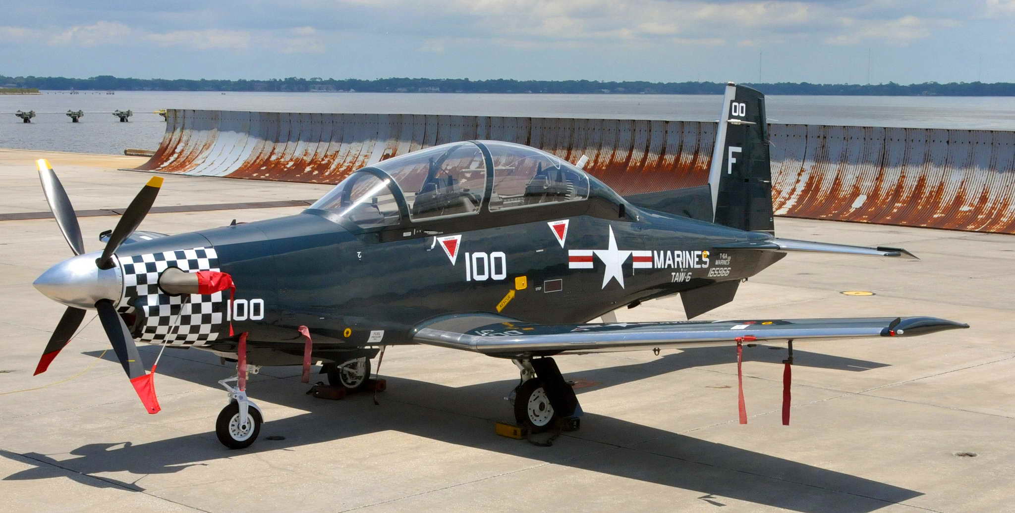
Bay Minette has no taxiways, so one must use the runway as the taxiway - it is termed a "back taxi" and you call it like any other runway operation. As I pulled off, the T-6 made a radio call (Bay Minette is not towered) and back taxied to the end of runway 8. There were two other similar planes parked and unoccupied on the ramp. When the first plane pulled off the runway I called for their intentions. They were doing a runup, so I back taxied and lined up behind them, far behind their very big 4 bladed propeller. Shortly thereafter they took off. Then a similar plane called a base entry to a low pass and about 30 seconds later passed down the runway at about 50 feet and 150 kts. When he and his wake turbulence had passed I took off runway 8 and departed from a left downwind, climbing to and cruising again at 2500' under a 3500' scattered to broken cloud deck with the same results - up and down, throttle and elevator. Shortly I left the southern stub of Alabama and entered the southern stub of Mississippi.
45 minutes after leaving Bay Minette I landed on runway 18 at Picayune, MS (MJD), just spittin' distance from Louisiana 2 NM farther west. I had trouble across agricultural country picking out the airports. The land is a patchwork of various shades of green and the airports look just like another patch of green. I didn't find Picayune until I was only 1/2 NM northeast and at an altitude too high to shed for a landing so I made a steeply descending right 360 and rolled immediately out onto a short final. Taxied off the runway and returned to the end of runway 18 and took off immediately turning to the west. Picayune too was pretty, surrounded by a number of cultivated fields. I passed into Louisiana about 30 seconds after liftoff.
In the 1990s and early 2000s I went to Louisiana often, New Orleans to be specific. I had a very good friend and business partner with whom I was building a real estate empire in the NOLA area. I had not been to Louisiana since November 2006 to attend his jazz funeral and I had not missed it a bit. Hurricane Katrina wiped out our real estate empire and a year later my friend and partner had worked himself to death at 55 years of age. I certainly have missed Keith, but not New Orleans, rotting, decrepit, dependent, and completely corrupt from top to bottom. Everyone had their hand out from the building inspectors, to the city council members, to the zoning board, to the county assessor's office, to the state and federal representatives, to the governor's mansion. The only reason the government works at all is through bribery and payoffs. However, the food and fishing is good.
After Picayune I passed over the north edge of Lake Pontchartrain which is north of New Orleans. It is crossed by the longest bridge over water in the world, the Lake Pontchartrain Causeway at 25 miles long.
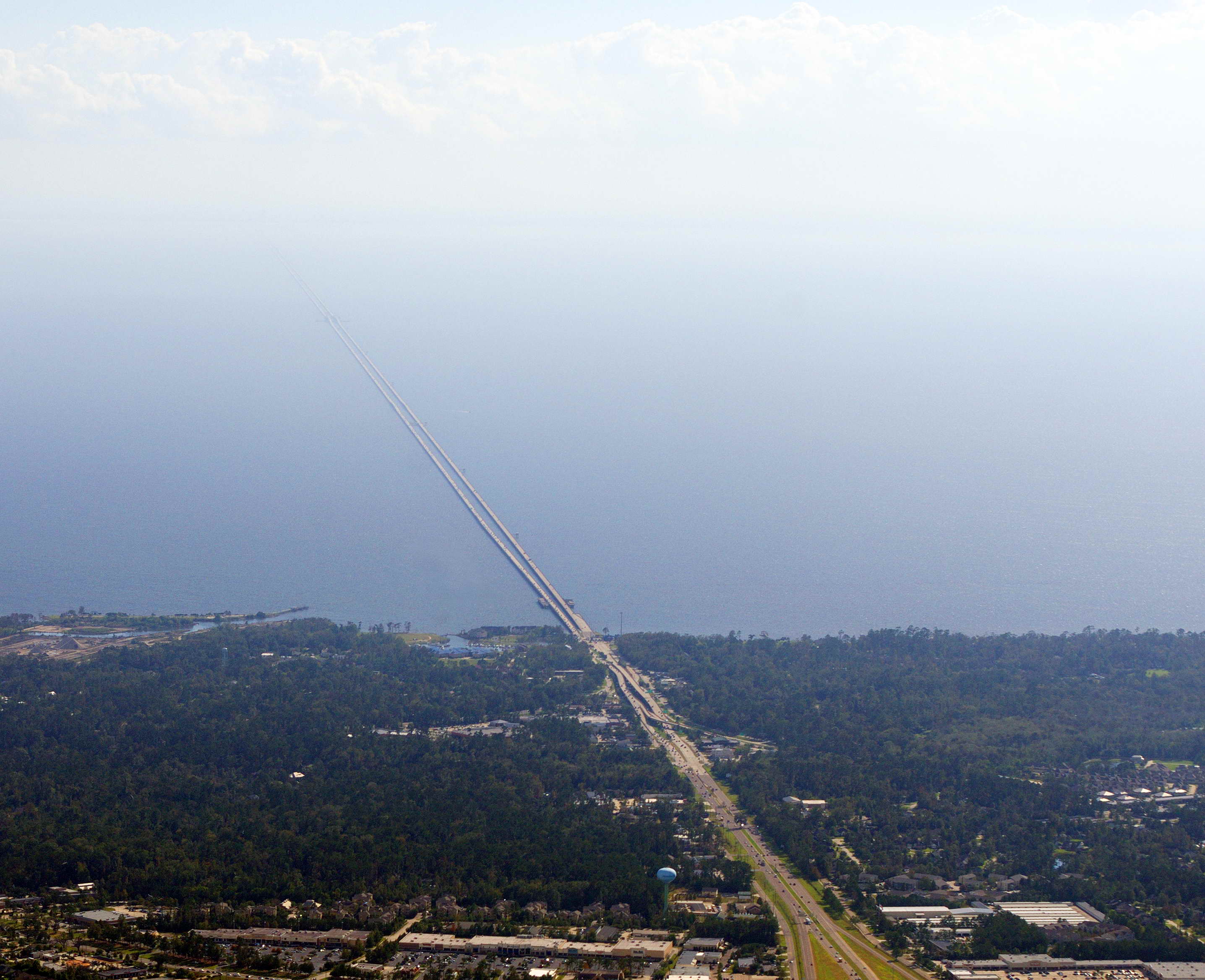
About 40 minutes after leaving Picayune I crossed the Mississippi River again. This time westbound and about 350 NM south of where I'd crossed it eastbound. Surprisingly it looked very similar.
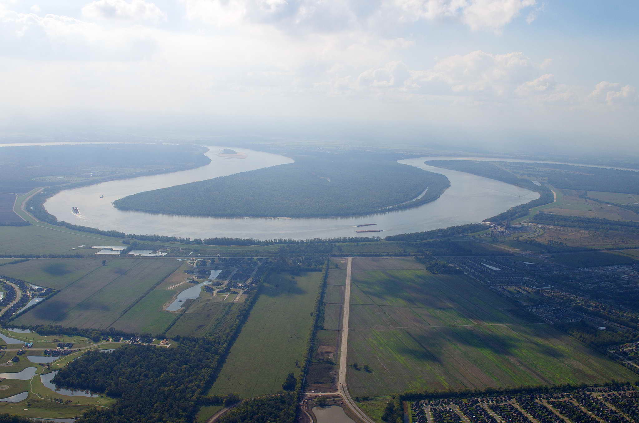
30 minutes later ATC was again very helpful. The sun was in my eyes as I headed west, and the haze was very bright. Even at only 5 NM I could not find the Lafayette, LA (LFT - Laugh-'A'-yet) airport. ATC gave me course vectors until I realized I was looking down runway 22R from about 3 NM out on a straight in approach. I landed on runway 22R about 4 PM CDT with an elapsed flight time of 7:10 (h:mm). I gained back an hour I had lost on the way east.
Taxied to the only FBO on the airport, Landmark Aviation, another very large chain of FBOs with 49 locations worldwide, most in the USA, 2 in Canada, and 7 in France.
I really HATE full service FBOs that cater to the kerosene crowd. They expect you to open the door, walk down the stairs and simply walk away. They want to do EVERYTHING, and in their own time. It took me an hour to simply get my plane to a tie-down where I could put the beast to bed. No, please, I'll tie it down. No, please, I'll clean the windshield. No, please, I'll put on the cover. Please, just top it off. All the tie-downs are for planes with MUCH longer wing spans than my little spam-can and I had to use their ropes tied to my ropes to make the distance. The tie-down ropes looked pretty silly anchored to the tarmac a few feet OUTSIDE my wing span. I guess I'm just a self-service sort of guy.
The FBO called me a cab and I got picked up in a filthy yellow cab driven by a black woman talking on a cell phone. I threw my bags onto the dirty back seat and climbed in. Another woman was in the front seat. The driver tore through parts of town that looked a lot like parts of NOLA where white tourists were warned not to venture. I knew where the hotel was and this was NOT a route to the hotel. We stopped at a cleverly disguised bus station in a residential neighborhood, and the woman in the passenger seat got out with a few disagreeable words for the driver. In an act of defiance she left the trunk open after retrieving her bag. I closed it. We then tore back along part of our previous route and made our way to the hotel. We chatted and she bitched about the earlier passenger, about half of which I understood. I told her I liked the way she drove and asked for a card to call in the morning. Her name was "Chance". She thought I was "good people". I hope she's right.
Exiting the cab at the hotel I noticed Lafayette smelled a lot like New Orleans - like something dead and ripe. The guy working the desk at the Best Western told me not to venture out after dark, so I should go for food soon. There was a Shoney's on the other side of the "Evangeline Throughway", and to get to it I crossed a two-lane road, a ditch, 4 south bound lanes of the Throughway, a wide ditchy divider, 4 north bound lanes of the Throughway, another ditch and into the parking lot of Shoney's. No food within safe walking distance on the Best Western side of the Throughway. While I was making this perilous crossing I thought, "Wouldn't it be ironic if ..."
Chance was not available to take me to the airport so I was driven by a guy who had fueled jets for the Air Force when he was enlisted. He worked around aircraft a bit after his discharge, and somehow ended up driving hack.
I drove for Green Top Cab in the 1970s in Seattle for a few years, and I like to hop in the front seat to chat up the driver when I get a cab. Always ask permission first, and I've never been refused. It was a wild time in the 1970s driving a cab. No union. Yellow Cab was the only behemoth cab company in town. The one rule was you had to have a Port of Seattle operating permit to pick up fares at Sea-Tac International Airport. Drivers had to be certified by the city or county and be fingerprinted, take a written navigation test, have a physical exam, and an chest X-ray looking for signs of tuburculosis. One also had to speak english. I passed all of them.
Green Top Cab was based out of the second floor of the Black Front store at 23rd South and East Yesler Way in Seattle's Central District. The name "Green" had nothing to do with its current environmental meaning which has cheapened a noble color. It was the black community's answer to the now defunct White Front stores. I was one of few token white boys and drove before I was 21 until shortly thereafter. Mama and Pa were the dispatchers and their 2 or 3 sons drove the lucrative night shifts, so I was a day driver hanging out at Fredrick & Nelson (defunct), Nordstroms, I. Magnin (defunct), the ferry terminal, and a few other spots. In the morning when the day shift showed up to pick up our cabs, Mama would have breakfast ready. We would eat while we got our briefing and scheduled pick ups, then turned loose on an unsuspecting city. I had a long black ponytail, moustache continuously, a beard intermittently, and wore an light brown plaid english cap. I still have it. The cabs ran, and we gassed up at the intersection of Yesler and Boren where a BBQ joint is now. I got half the day's fares plus tips which amounted to about $20-30 a shift, which at the time was barely enough to live on. My rent was $75 a month, and electricity was free since the previous tenants had cancelled the service, but the power company had never disconnected. All I had to cover was heating oil for the furnace in the chronically flooded basement. The house was in the first swamp I had lived in.
Typically I'd start the day at the cab stand at the Seattle ferry terminal where we had a standing deal to "steal" a box of donuts from the front seat of a Hostess truck which delivered to the terminal restaurant each morning. We drivers would eat donuts and drink coffee all morning, taking breaks to ferry secretaries, lawyers, and bankers uptown, the occasional criminal for a court date downtown, and elderly, retired folks from the islands to the hospitals and doctors on "Pill Hill" - a nickname for Seattle's First Hill. It was a great score to pick up an airport fare at the ferry terminal. You had to deadhead back, but with the lighter traffic back then, the higher speed limits, and the leeway the cops gave us hackers, one could be back downtown in 15 minutes.
After the morning arrivals at the ferry terminal I would head uptown to the shopping district cab stand along side Frederick & Nelson department store and hope to pick up laden old ladies off the red carpet. Tips were good particularly if you helped them up steps with their packages. When was the last time a cab driver in Seattle even helped with bags?
Mid-afternoon I would head up to Volunteer Park on the top of Capital Hill, eat my bagged lunch, and if any other cabbies were up there we would race back down to the ferry terminal for the homeward commute to the islands.
I only remember a few specific fares. The first was an old lady I picked up at her doctor's and who I carefully helped up the steps leading to her apartment. I had one arm and she was leaning on me heavily as she very slowly labored up one stair at a time. At the top of the stairs she opened the door, gave me a five dollar bill, looked me in the eye, and said, "getting old is a terrible thing", turned, walked inside and closed the door. I saw a flash of her younger self stuck behind old eyes in an aging frame and it has stuck with me all the years. Another fare I remember well was a couple of gay guys in the back of the cab with a bouquet of flowers in a vase. They dropped it and spilled the water all over the seat. They started arguing over who was to blame like a couple of bitchy girls and stiffed me on the tip, leaving me with a wet back seat and a few hours to go on shift.
The cab dropped me off at Landmark Aviation where the plane was as I left it except it had been topped off. I unchocked, unplugged, uncovered, and untied the bird, then completed my routine preflight. All was well and I boarded and readied for startup.
The day's flight plan was short, about 3-1/2 hours and 330 NM. Continue around the gulf passing south of Houston and landing on Mustand Island, a barrier island across the intercoastal waterway east of Corpus Christi, TX.
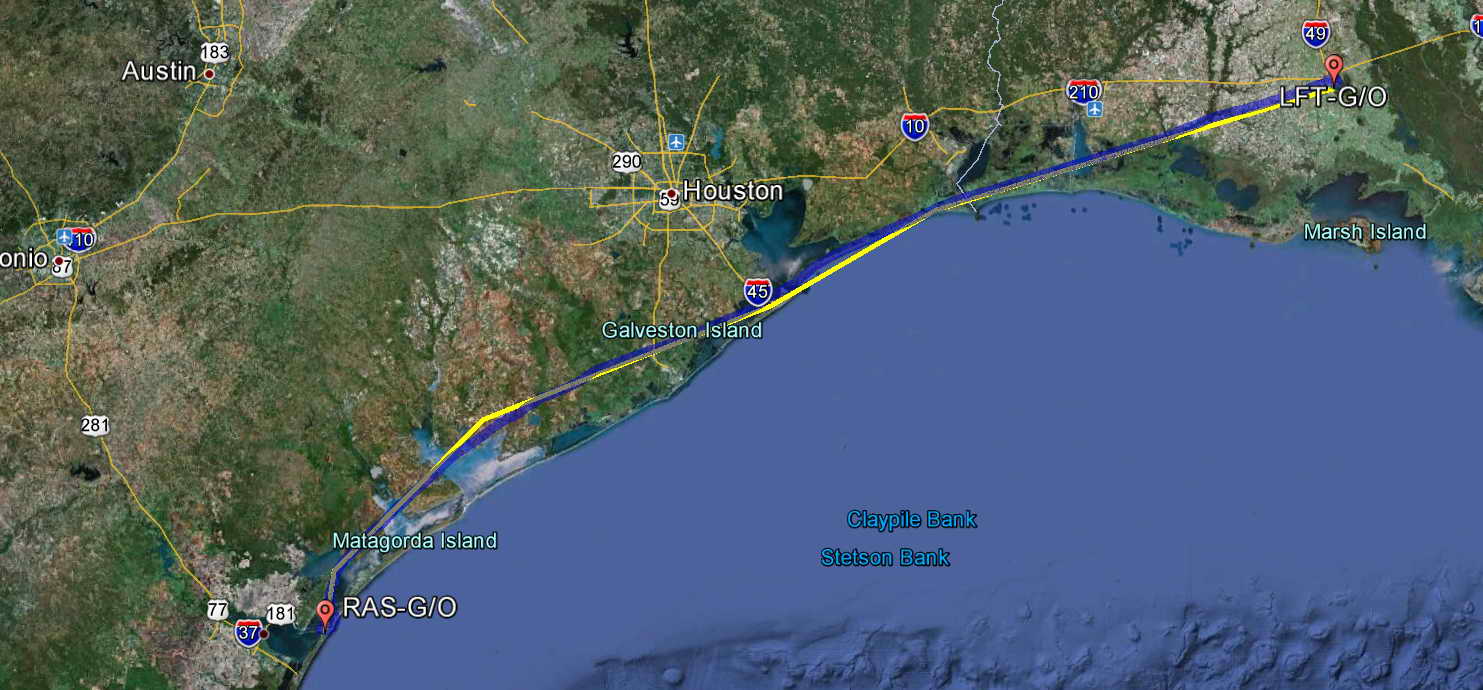
Departed Lafayete on runway 7 about 11:40 AM taking off over the water then turning out to the left and making a southwest course. Ground control was a bit of a butthead. The airport advisory directed pilots to contact clearance delivery (in retrospect to get a squawk code), state their destination, target altitude, and route of flight, to gorund control. Yeah, yeah, whatever. When I taxied to the edge of the ramp and called ground control he was miffed that he had to query me for the information, then assign a squawk code, so he left me sitting in radio silence with the engine idling at the edge of the ramp for more than 5 minutes with no activity at the airport. I had to gingerly call him back and ask again for taxi clearance to the runway. Not sure why I needed a squawk code to simply take off, but it was similar to the clearance delivery in the Hawaiian islands.
Initial cruise altitude was 2000 until approach control let me take 2500, then 4500, then 2500, then 1500, then 2500, then ... Dodged some rain squalls, took what altitude I could and gave it back when I had too. It looked like I would have to turn back just southeast of Lake Charles, LA, but the haze, the rain, and the clouds just made it look closed. Visibility was down to about 10 NM, but the ceiling was stable, and it opened up into broken sky in another 35 NM. The air was warm, 22C (72F) at 2500, and again, under the pretty puffy clouds the air was an annoying roiling mass of up and down drafts.
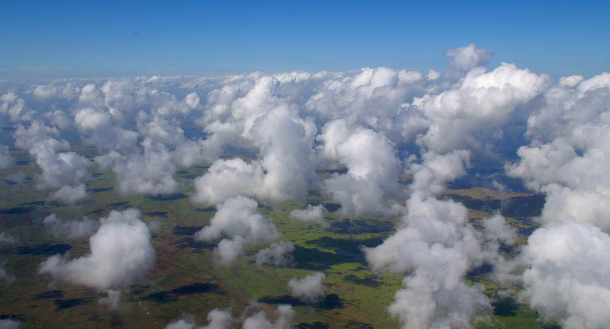
At 4500' the air, and hence the cockpit was a bit cooler. Just above the cloud tops in calmer air I tried to stay at the altitude by dodging some higher clouds, but was forced to descend under and between the clouds at times.
Clouds are magical. They form out of nothing, exist for just a moment, or travel thousands of miles and survive for days and days. They blanket the ground or filter sunlight from 10 miles above. They create sunbows and moonbows, rain, snow, hail, and lightning, always eventually returning to nothing. They are a few feet thick to towering behemoths miles high. Flying among them is like flying with the gods.
I like clouds.
The last hour was spent bumping along at about 3000. After repeatedly receiving my altitude change reports, ATC allowed me my own altitude determination simply saying, "... altitude at your discretion" meaning, "you can shut up - I don't care". I did not see a single plane after leaving the immediate area of Lafayette, LA.
The gulf coast is of course flat. Many refineries, and they are huge. If you drive, use electricity, or heat your home, it all comes from some place like this Galveston refinery.
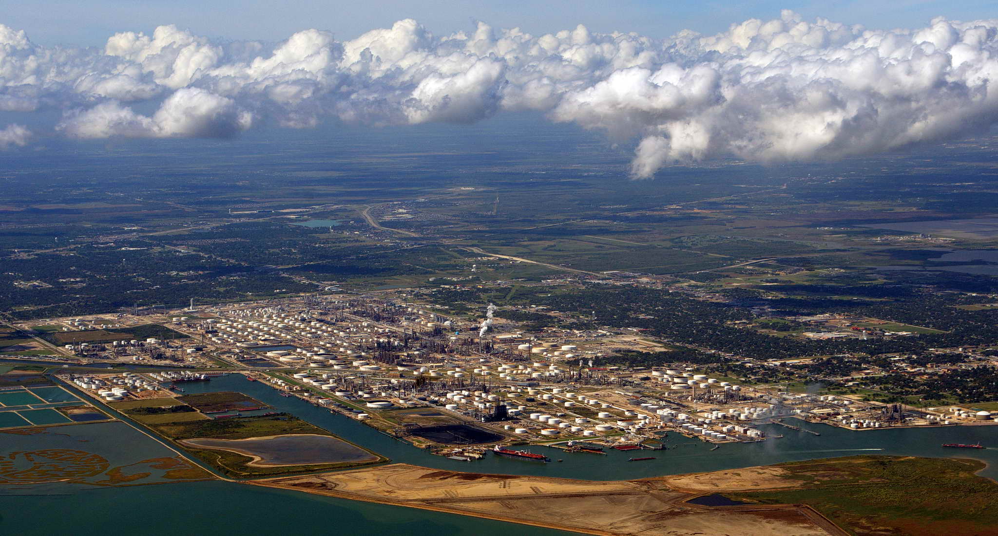
Many, many shipping canals cut across the landscape to admit boats and ships to the inland lakes and ports. Offshore about 25 miles in the gulf, at least 55 (I counted) cargo ships and oil tankers were anchored simply waiting for moorage and pilots to guide them into port. With GPS one would think the need for pilots would be diminished. I suppose it is a remnant of the past, and perhaps a union thing.
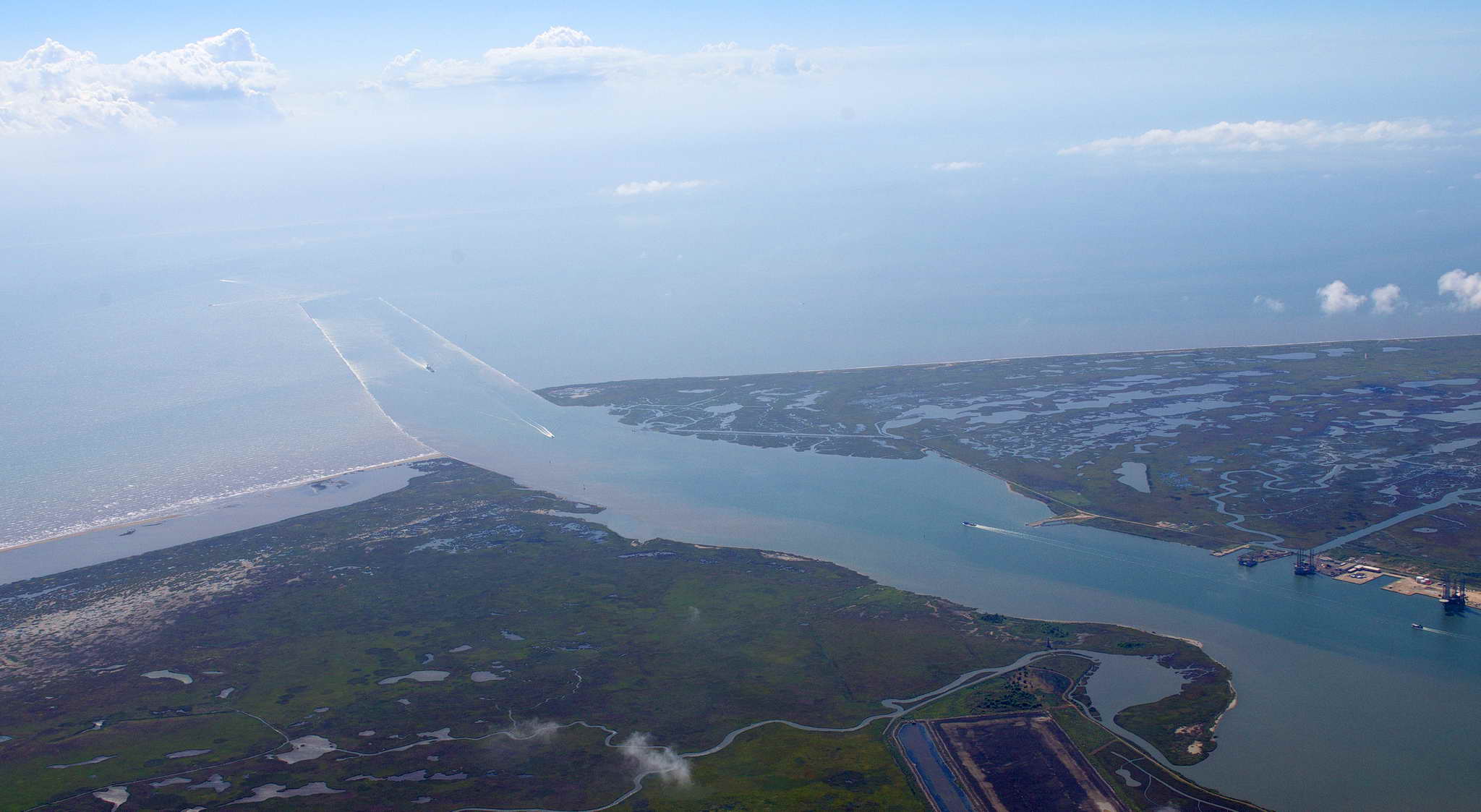
Saw a few big, black soaring birds at 4500' in various locations, perhaps turkey vultures. Saw a few miles ahead a flock of about 60 large, white birds at 2500. I prepared for evasive action as they were milling about randomly in a ball, then, suddenly, they were in an organized migratory line headed to the south and out of my path. My thoughts turned to Captain Scully and US Airways flight 1549 which hit a flock of Canada geese at 2900' over Manhattan and ditched in the Hudson river. I doubt my outcome would have been as successful.
Landed at Mustang Beach Airport (RAS), Port Aransas, TX about 3:15 PM. I approached the airport by GPS, but couldn't pick it out until I was on a 3 NM 45 degree approach to runway 12. Winds were stiff, well aligned with the runway, and it was one of the better landings of the trip. Generally in the PNW airports are easy to see, they are the big brown spots in a sea of green. Not so everywhere. Down here in the south rather than use asphalt which gets soft in the sun and heat, they sometimes use a tan colored cement which is often the same color as the surrounding dried grass.
This is the view from the 45 degree approach to a left downwind to runway 12. There is a marina adjacent to the airport, and the town of Port Aransas is behind us a mile or so on the road which leaves the bottom of the frame. In the distance at upper right is another source of all your energy needs, the Ingleside Refinery, and on the horizon, largely hazed out is Corpus Christi, TX.
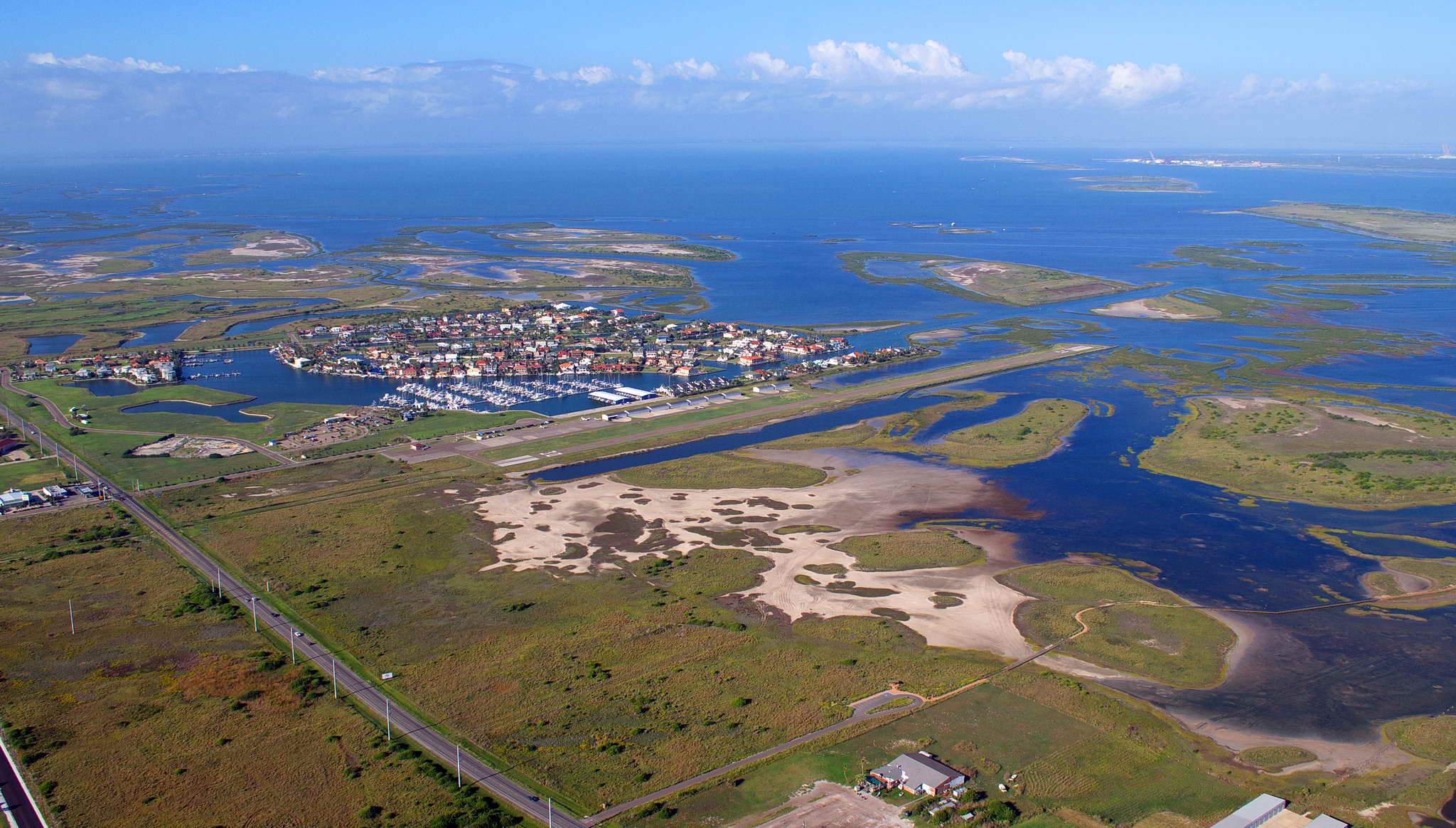
I taxied toward the office and the self-serve fuel passing by a line of hangars where a couple of guys were working and they waved. The office was spartan but clean with a vending machine, large work table, small office for the manager and restrooms. It was raised off the tarmac and surrounded by a retaining wall and a wall of sandbags filled with concrete. I think more for torrential rain runoff than for tidal flooding.
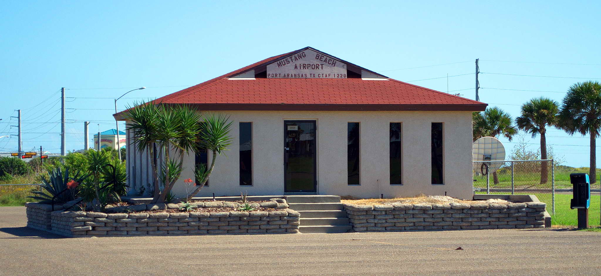
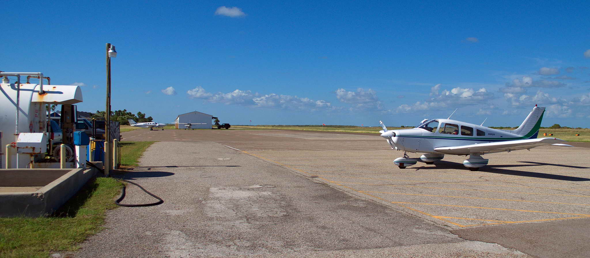
As I was gassing up at the self serve, Jay Honeck drove up in his truck, introduced himself and suggested I come down to his hangar once I had the plane settled. Putting the bird to bed was certainly faster at a completely self-service facility than one in which you have a lot of help. Jay had emailed me that the keys to the courtesy car they kept at the airport was under the mat, so I bedded down the plane, loaded up the van, and drove down to his hangar.
We sat and drank a couple beers relaxing on canvas folding chairs until after 5PM. Watched a Cessna take up and drop a tandem jump. It was good. It was pleasant. We talked flying and life. Jay is very welcoming and has a nice Piper Cherokee 6. I followed him to his and his wife's, Mary, Hotel, Amelia's Landing, where I settled into the Airplane Movie room watched over by Tom Curise, Kelly McGillis, James Franco, John Wayne, and Hilary Swank.
I am NOT a fan of having my picture taken, but Jay graciously laid on the ground and shot this photo, proving that headset hair is a real and tragic malady.
After I settled into the room, that is threw my bags on the bed, we loaded up some stuff and headed for the beach. We drove out past the berm and onto Port Aransas Beach Road, a sand road 100 yards from the surf. We traveled a few miles down the sand road to where it narrows and met a few other folks for grilled hot dogs, beer, and a bonfire. It was good. I left early, about 8:30, tired, and to shower.
Jay and Mary were perfect hosts.
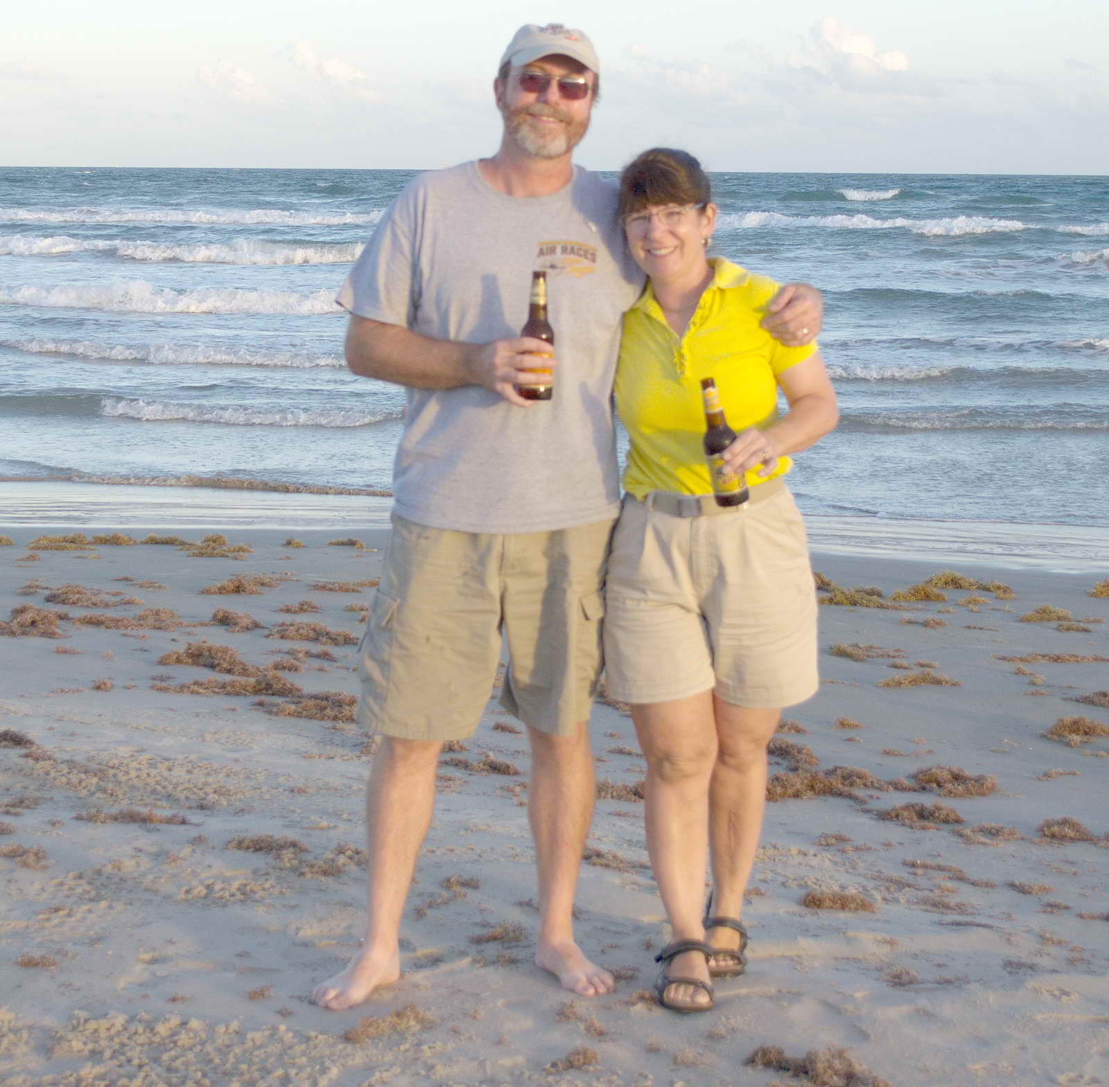
Jay was right. In retrospect, I should have damned the incoming weather and stayed longer. Originally I had wanted to do some redfish fishing along the intercoastal, but by that time I was feeling a pressure on my back pushing me onward. I was barn sour, burned out, weary, and looking forward to getting home to my honey. I should stayed longer. A redfish BBQ on the beach would have been grand.
The weather had me spooked. Hurricane Sandy was in the Caribbean and many other such storms had defied prediction and tore across Florida and into the Gulf. The actual forecast was predicting a 180 degree wind switch to a very stiff headwind and low ceilings for 4-5 days, maybe a week. I didn't want to stay for an indeterminent time while a huricane was milling about the Atlantic. For the day the prediction was for good weather except for some lower ceilings for about 100 miles around San Antonio, lifting in the afternoon. In north TX the winds switched to a light head wind, but with an initial tailwind they would balance out. The 625 NM, 6 hour 10 minute flight plan had a fuel stop in Fort Stockton, TX or Pecos, TX depending on actual flight time and bladder condition with a final stop in Deming, NM. The original flight plan developed a month before called for an overnight near Tucson, AZ, but Colleen was visiting her folks in Truth Or Consequences, NM just 60 NM from Deming, NM.
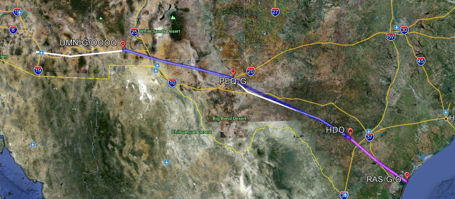
While driving the Amelia's Landing Hotel van back to the airport in the morning I was surprised to see a huge shark off the side of the road.
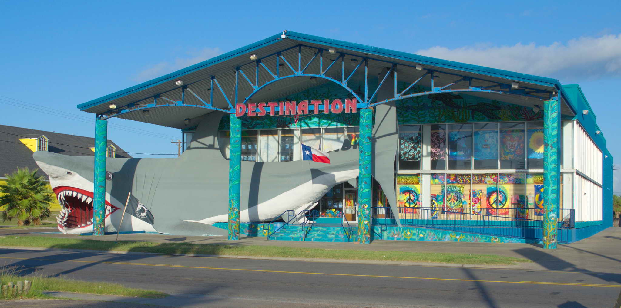
Yesterday the oil temperature gauge was sluggish. Based on the oil level this morning more oil than expected is being consumed.
At 9 AM it was 90F and high humidity and I had already sweat through my tee-shirt. It was either time to hit the beach or hit the road. After the preflight inspection, I completed my cockpit preparation with the door open to help stay cooler. Engine start blew the door closed and I taxied to the 12 end of the runway, completed a final check, firewalled the throttle and started accelerating down the runway. Loud wind noise, louder than usual, caught my attention and I realized I had not latched the door. Damn! I looked down what remained of the 3500' runway. She flies fine with the door ajar, but it is tough to close in flight, so continue with the takeoff or abort? I was not yet at rotation speed which takes about 1000 feet of runway, so I had 2500 feet left which was plenty of time to stop, so I pulled the throttle to idle, retracted the flaps to put more weight on the wheels, and firmly applied the brakes. She came to a stop just beyond the mid-field taxiway so I had to taxi to the 30 end and come back around.
What's that old adage about altitude above, fuel in the truck, and runway behind? Old adages and cliches have staying power because they embody some element of truth. I was glad I had started my takeoff roll at the end of the runway and into the wind. I finally departed Mustang Beach Airport (RAS), Port Aransas, TX about 9:40 AM (1440Z) with the door fully closed.
The forecast low ceiling around San Antonio, 125 NM to the northwest, was in my thoughts as I climbed out of RAS and cooled the engine in level flight for a few minutes at 2500', then step up to 4500'. I flew with ATC in smooth air with a light tailwind above a scattered layer of puffy clouds. The day was off to a good start. There were clouds far, far in the distance, the ground was flat, the air smooth, and visibility was over 100 NM. The afternoon's route took me over some higher ground, slowly rising from sea level to 1000' at Hondo (HDO) to 2300' at Rocksprings (ECU) to 3000' at Ft. Stockton (FST) to well over 5000' between Pecos (PEQ) and El Paso (ELP). In a few hours I'd be over ground higher than my current altitude, or I'd be flying through rocks.
A weather reporting station at Pleasanton, TX (PEZ) was reporting, winds calm, visibility greater than 10 miles, sky clear (SKC), and HEAVY RAIN. Seemed weird to be raining hard out of a clear sky, but then there are verified reports of fish and frogs falling out of a clear blue sky. I looked ahead squinting in the direction of Pleasanton about 50 NM ahead and only about 6 NM off my course. I didn't see anything that looked like HEAVY RAIN, and when I was abreast the airport things were just as described except no rain. Maybe someone was running a sprinkler that was drenching the sensor.
I may have mentioned I like clouds and feel like I am among giants when flying near. Just beyond Corpus Christi there was a lovely broken to scattered layer about 1000' below. Charming.
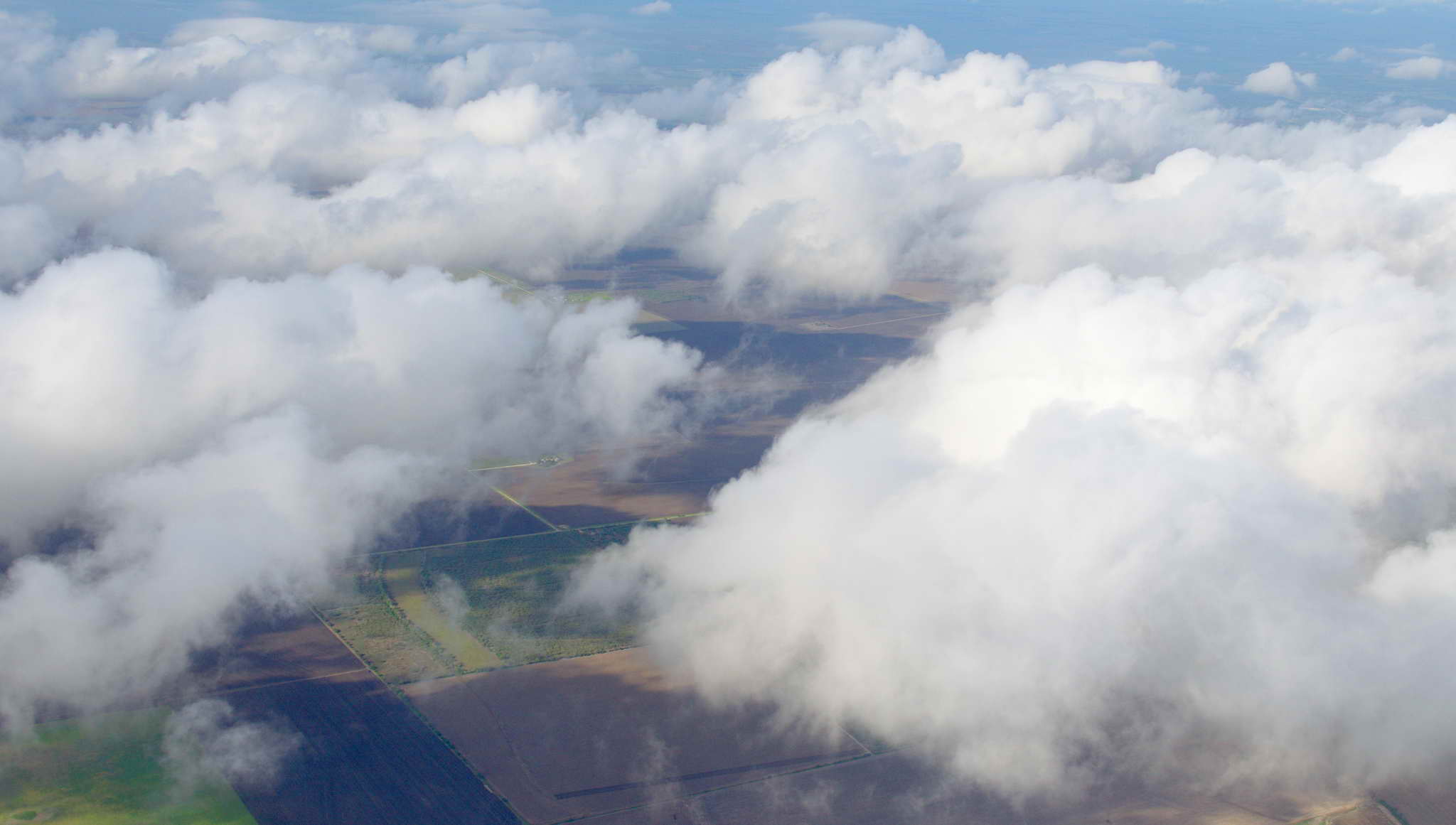
Somewhere around Three Rivers navigation beacon (THX) I started to see dots on the landscape glowing in the sunlight. They looked like large dirt or concrete pads. Perhaps oil and gas wells, but couldn't see any pipelines nor holding tanks, though this is an active and productive of portion of the Eagle Ford Shale oil and gas boom. This is a huge oil and gas resource with widely ranging estimates indicating decades of productive output. The USA has about 70% of the world's known oil shale and in May 2012 the Government Accounting Office estimated that just one of these regions, located around the area where Wyoming, Utah, and Colorado meet, has as much recoverable oil as the world's entire proven reserves. Unfortunately, much of this valuable resource lies under federal land which at this time is hostile to hydrocarbon energy production.
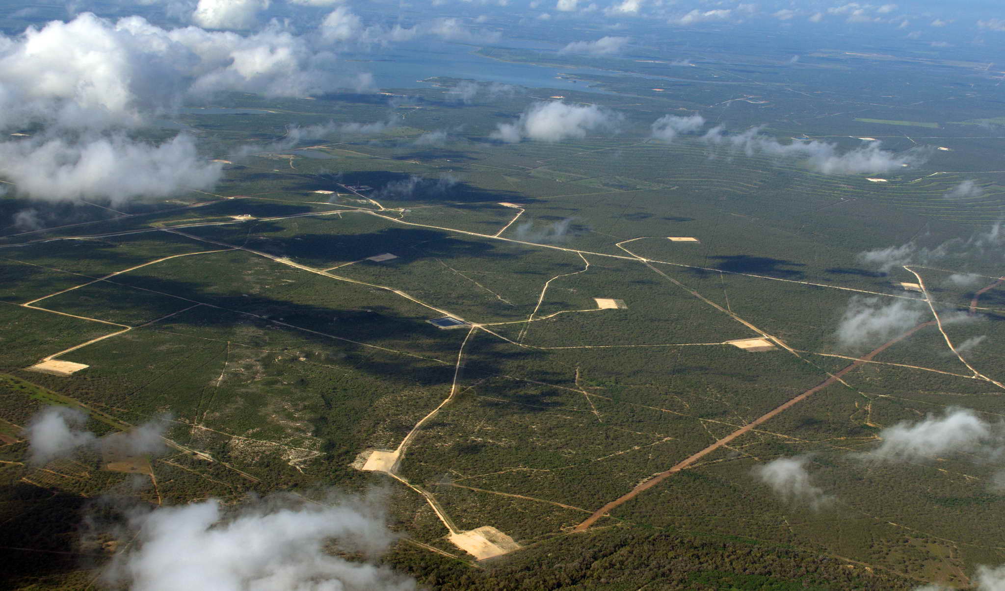
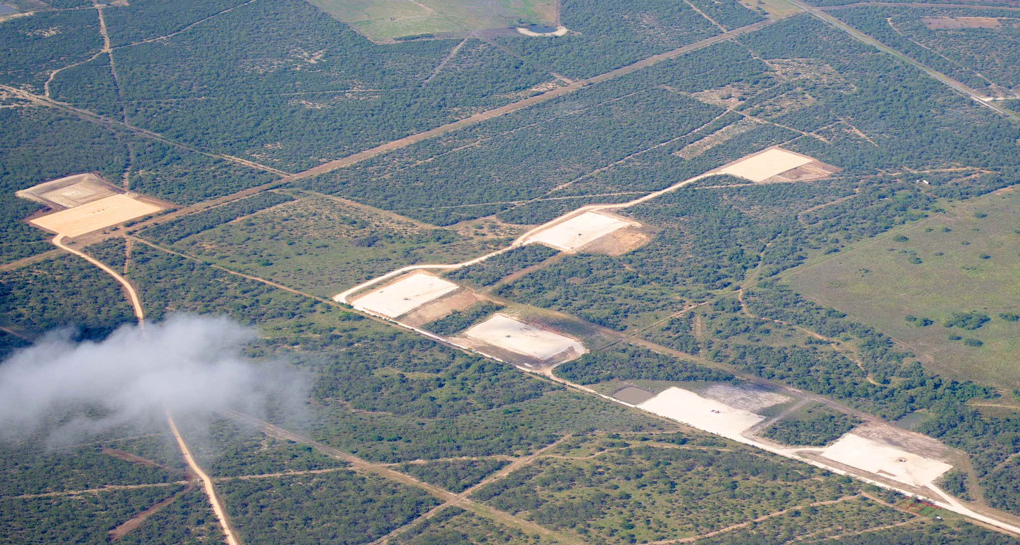
I flew over a whole lot of interesting nothing that day. From Hondo to Ft. Stockton, 220 NM, there were only two airports, and those were close together near Rocksprings. The rest of the route was deserted or sparsely dotted with ranches. Then again from Pecos, TX to El Paso, NM, 146 NM without a single airport, and over the highest ridge lines of the route.
At Hondo, TX (HDO) the scattered ceiling started to close up. I could ascend and fly VFR over the top, but if I had to descend I would have to pass through clouds without knowing what was under them. I chose to descend and fly under the ceiling - at least I could see the ground. 10 NM west-northwest from Hondo, TX (HDO) I was down to 2500' MSL over terrain at 1000' leaving me only 1500' AGL with haze and still rising terrain ahead. ATC asked if I could climb, but I could not, and since I was too low for their radar they terminated their flight following service. It always feels like you are being abandoned when ATC drops their services mid leg. Clouds above, clouds and haze to the left, the right, and straight ahead, suddenly, I felt very much alone.
Automatic weather reporting stations, termed AWOS (Automated Weather Observing System) and ASOS (Automated Surface Observation System), are present at many, many airports. They run continuously and unattended, reporting weather conditions by radio with a synthesized voice, satellite network to generate text reports, or generally both. They even have phone numbers. There was only one directly on my course, and it and the two about 30 NM off my course were not reporting good news. Ceilings ahead were down to less than 1000 AGL. There is a classic accident scenario in which a pilot presses ahead over a floor of rising terrain under a low ceiling. Eventually, the ceiling and floor meet. I turned back and landed at Hondo, TX (1615Z) to wait out the weather. It was sunny and warm at Hondo under a scattered sky.
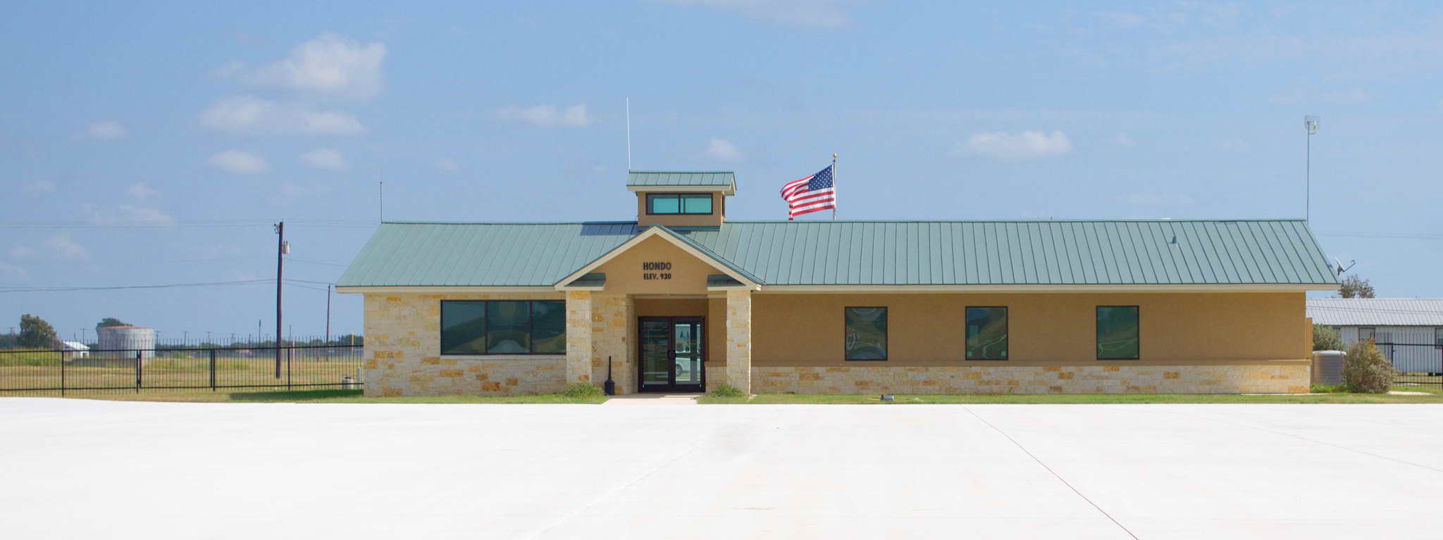
I waited about 2 hours at Hondo for the weather reports to improve. I filled up with the cheapest gas of the trip, $4.84/gallon! Unfortunately, I only needed 13 gallons. When the conditions ahead had improved to my comfort level I lifted off from Hondo about 2:30 PM CDT (1830Z). Sunset at Deming, NM, my desired end-of-day destination was at 6:30 PM MDT (0030Z). I had 6 hours to fit in a 4-1/2 hour flight with one more fuel stop.
I was a little anxious climbing out of Hondo that I might have to return sometime in the next 70 NM. I climbed to 4500 out of Hondo and about 10 NM from Hondo I decided to continue to 6500 to get over the scattered layer. Needed to weave through broken spots, but at 6000 it was obvious that the scattered layer was closing up so I descended through a break and cruised in the murkiness under a hazy, barely broken layer at 3500' MSL giving me about 1500-2000' AGL.
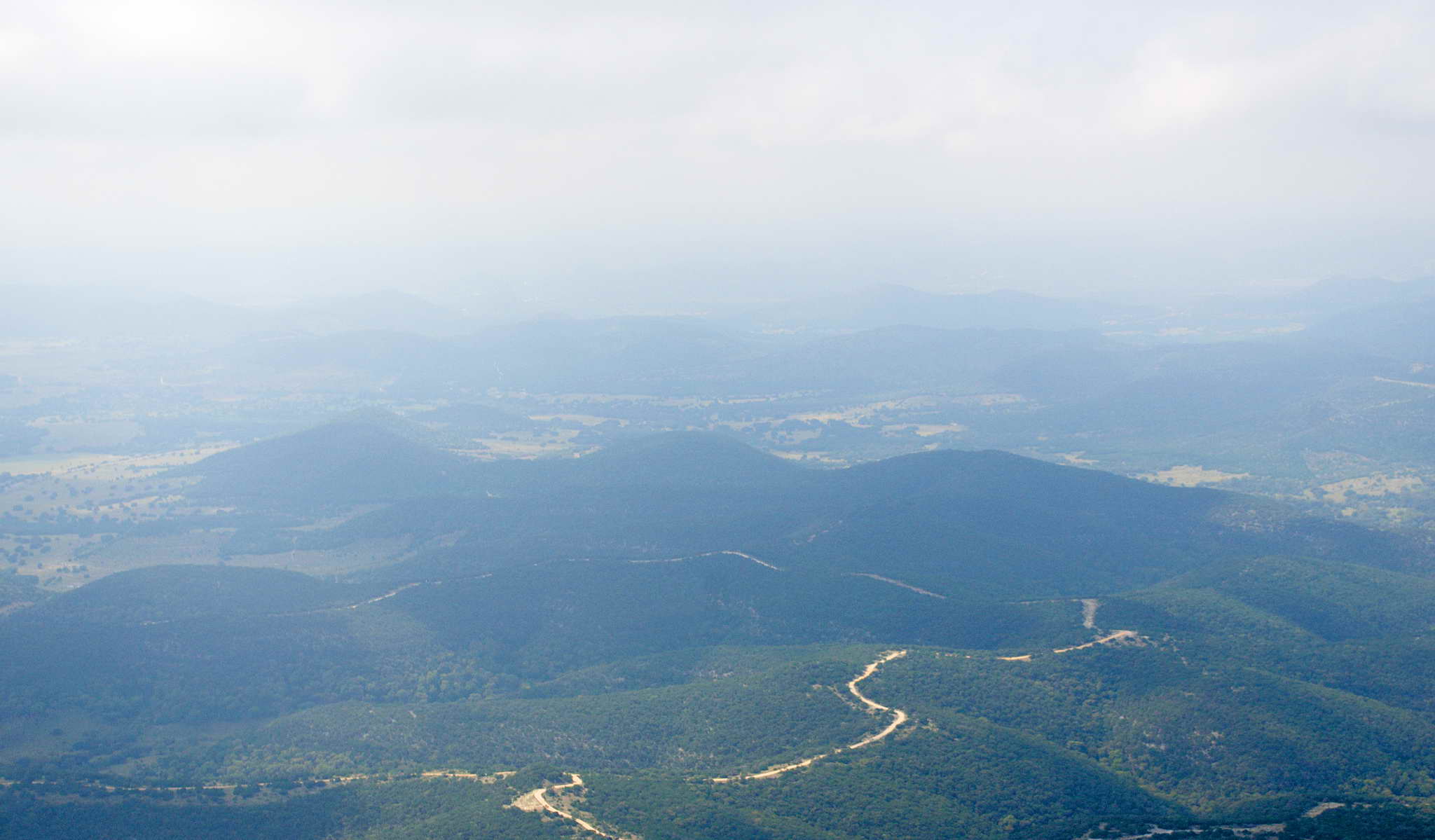
ATC hung with me this time until 25 NM later I could climb to 6500' and cruise in cooler air well above the rising terrain where ATC radar could see me. It was a little bumpy and I was picking up a headwind slowing my progress over the ground. Again it was very hazy despite the desolation and no industrial development. It must just be dust, but at times the haze was so thick there was no horizon. The ground just faded away evenly into the sky.
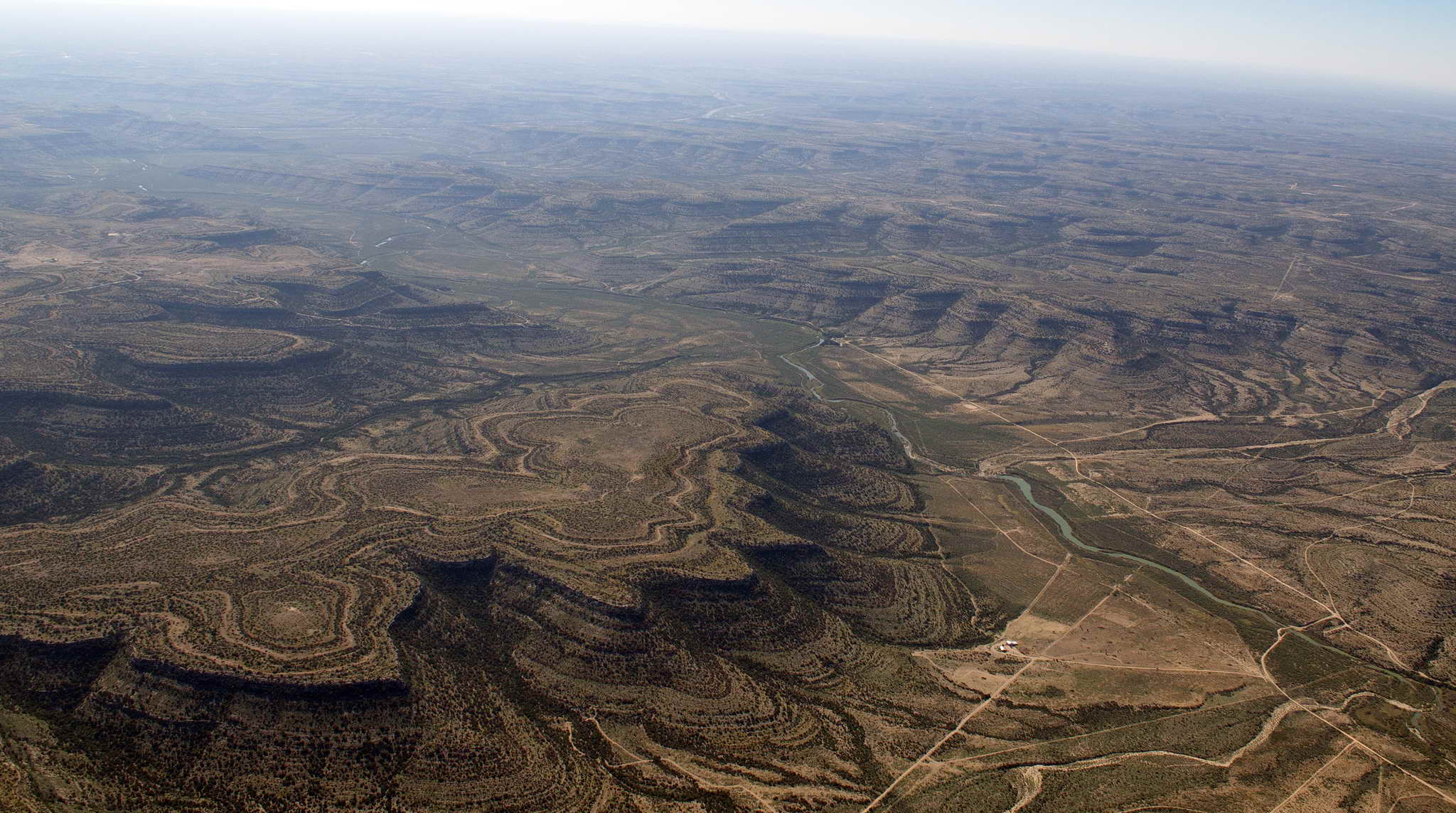
Landed straight in on runway 32 at Pecos, TX at 4:30 PM local time (2130Z), later than hoped due to the headwind. A very efficient, friendly, and weather-worn couple directed me to parking, had me topped off in about 20 minutes, and I was again on my way. I would have liked to hang around Pecos to chat up the folks for an hour, but I was racing the sunset to Deming. Sunset at Deming was at 0026Z, less than 3 hours from my takeoff time and with no headwind I had a 2 hour 10 minute flight ahead. It would be close, but I knew I could make El Paso and could be on the ground before dark, so I pressed on.
Between me and clean sheets was the highest ground of the route. This was over a whole lot of beautiful desolation, an occasional ranch, dirt roads, and radio antennas were about it. Again the headwind and haze. This is haggard and tortured country and I climbed to 8500' to try and get out of the ground chop caused by all the steep canyons and cliffs, but I was rocking and rolling pretty good the entire leg, updrafts, downdrafts, and gusts. It was 2 hours of constant yoke, throttle, and trim adjustments. The air was warm at altitude and the density altitude was over 11,000, so engine performance was a little anemic. The updrafts were good to surf and gave me a few extra knots of speed, the downdrafts had to be fought and slowed me down. Surfing the updrafts is just like surfing a wave. A cork will float up and over a wave, never making any net forward motion. A surfer too is lifted by the wave, but the surfer points themself down the face of the wave, balancing gravity, trying to pull them into the trough, and the wave trying to lift them up. As a consequence if the surfer can balance these two forces they move forward. Same for surfing an updraft, one points the nose down a bit, gains some additional airspeed, and still maintains altitude.
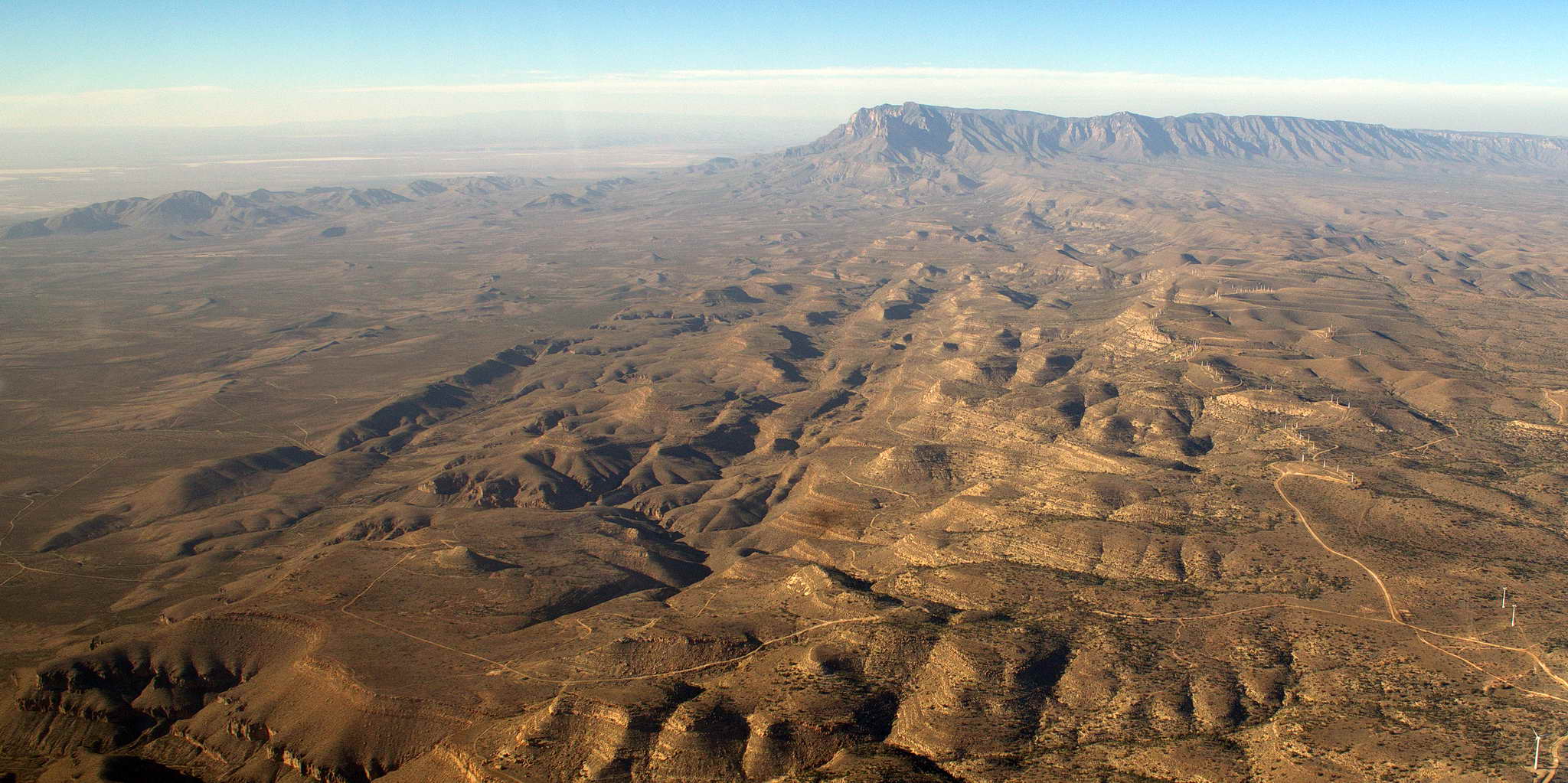
The ground rose to about 5000 and a bit more over a few ridges. The sun was getting low on the horizon and the western haze was shifting the landscape to a red hue. You can see why this is called "El Capitan".
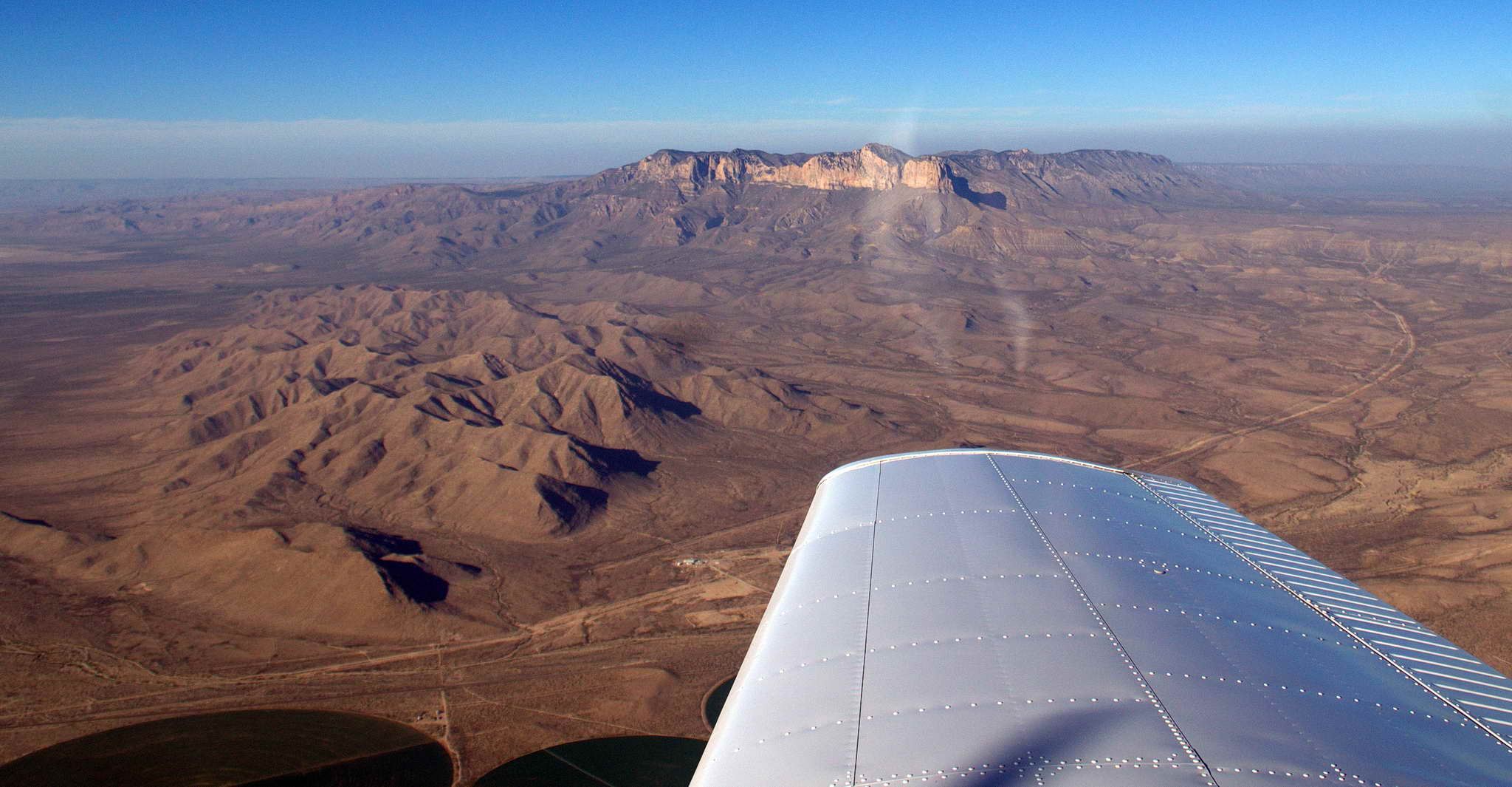
Wind Mountain 50 NM east-southeast of El Paso.
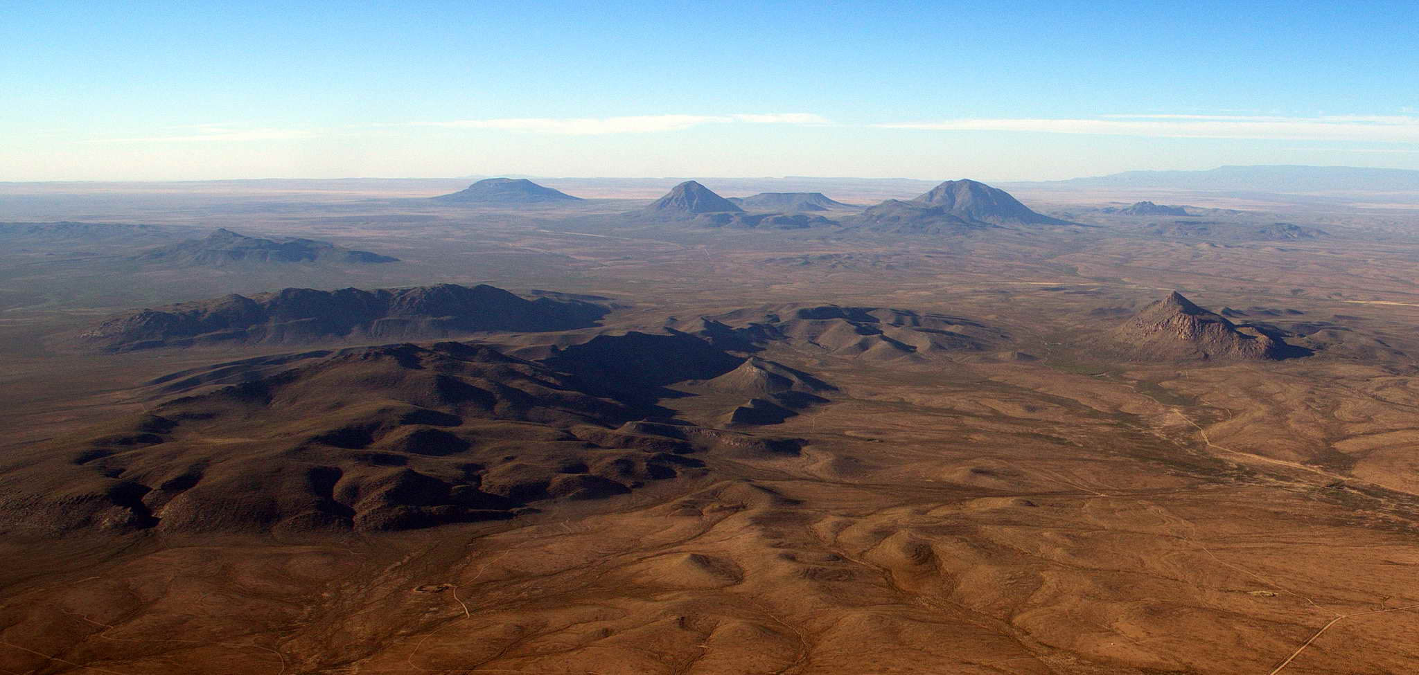
Cerro Alto Mountain about 25 NM east-southeast of El Paso.
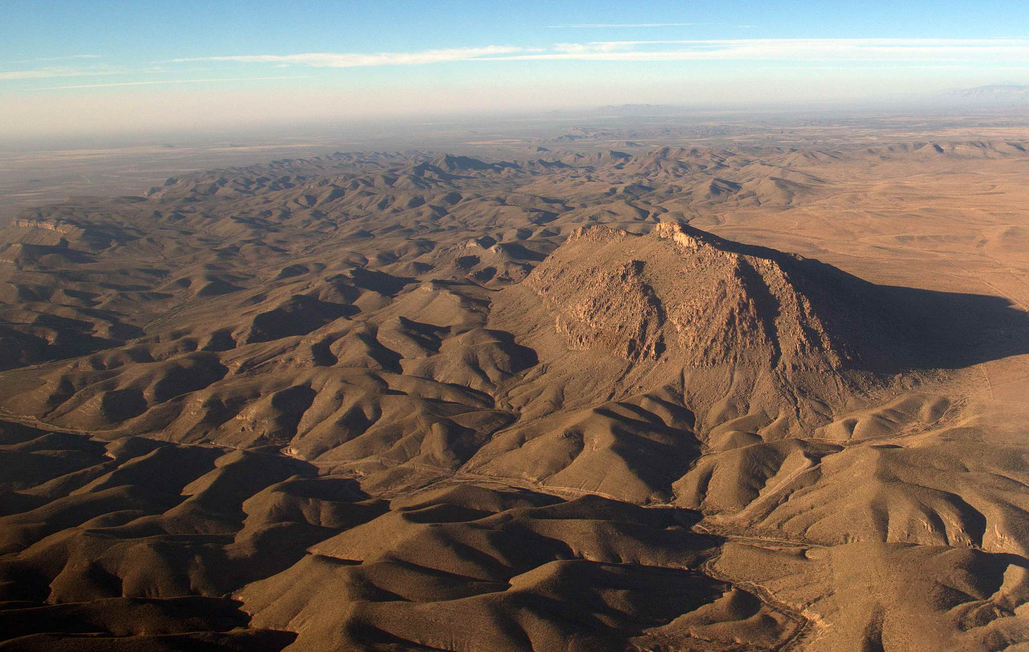
Rattlesnake Ridge 30 NM due north of El Paso.
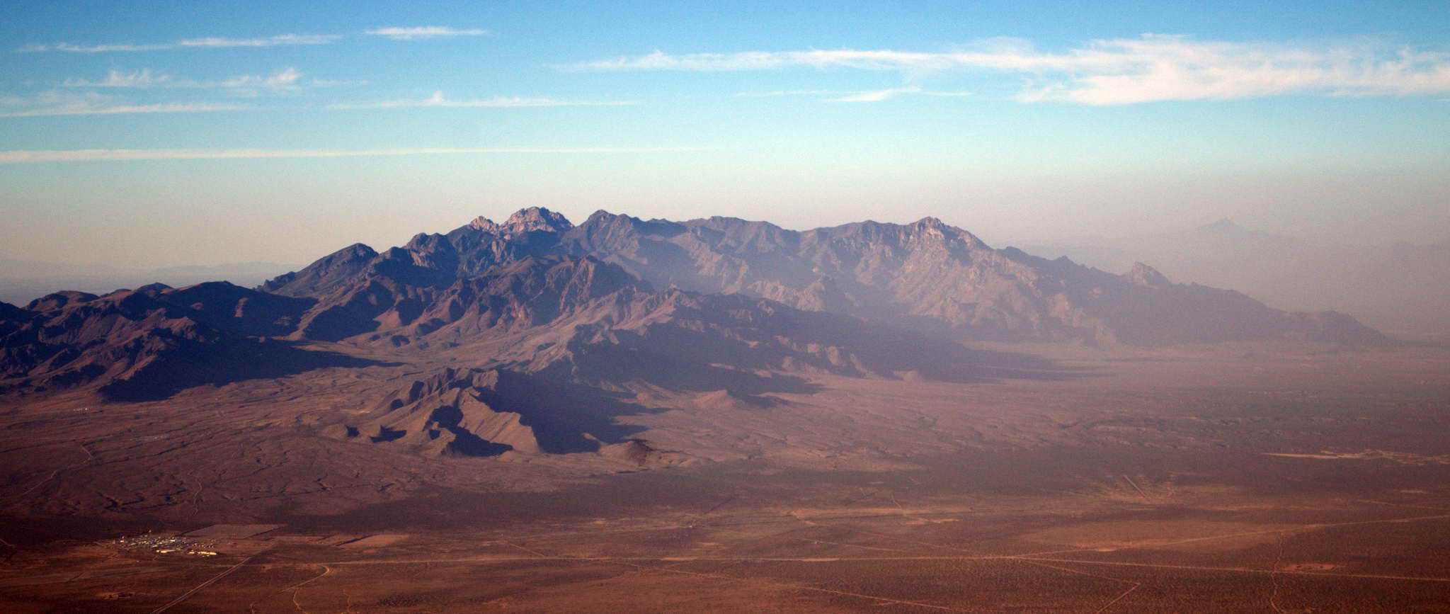
The haze cleared somewhat before El Paso, but then descending into the valley it increased again. Picked up a highway about 60 NM from El Paso so was able to not-so-closely watch my heading/course as I could just pick a straight line north of the highway. Once I made El Paso I knew I would be able to make Deming with about 30 minutes to spare. I'd not want to fly around this hazy area in the dark. At El Paso I picked up a powerline, then a railroad and a highway joined, providing a nice path to follow right into the Deming airport.
Landed at Deming into the setting sun on runway 26 at almost exactly 0000Z which was about 6:00 Mountain Daylight Time. Again, with the sun and the haze and the ground color I couldn't pick out the airfield until I was just 5 NM away and starting to pass it on my left.
I gained another hour by moving from central daylight time to mountain time. The place was totally deserted, so I picked a tie-down spot and bedded the plane down. No self-service fuel so she was down some. Just as the sun was touching the horizon I took this.
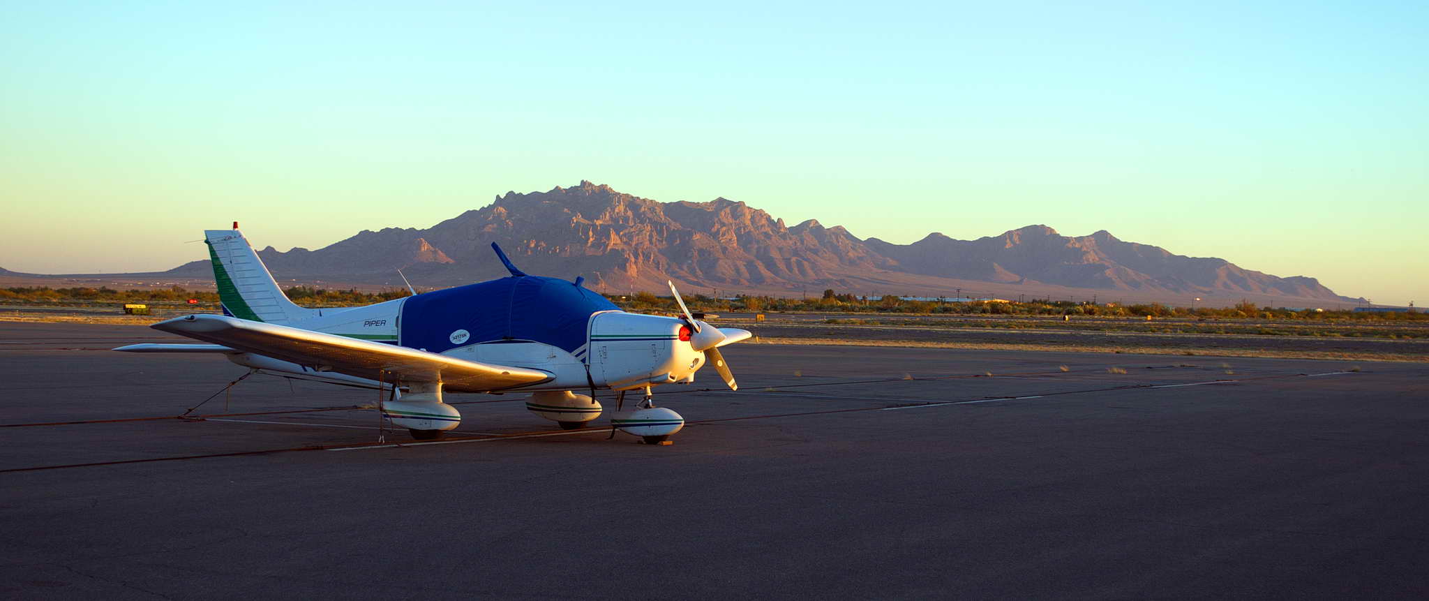
This was a tough day, bouncing along for hours over hundreds of miles of headwinds, updrafts, downdrafts, and bumps, had to turn back due to weather and submit to a long ground delay, then racing the sunset and dense haze west. I was tired and planning a couple or a few nights in Deming, warm dry days and cool nights. The Holiday Inn was less than a mile away and they sent a car to get me.
For the next 2 days I was a slug, breakfasting in the dining room about 7AM, retiring back to the room to catalog photos and work on my log notes. I'd walk around the local area. Unfortunately the Holiday Inn is not particularly close to the actual city of Deming, so I never saw it, and walked around a trailer park and a truck stop. I napped in the early afternoon, awakened, brewed a cup of coffee, then retired to a gazebo-like thing near the pool on the courtyard lawn to enjoy a book with the coffee and a cigar. An early dinner in the dining room or bar, a beer, then back to the room to watch the World Series. The weather was pleasant with a harbinger of the colder winter weather to come, cool, near freezing mornings, clear, sunny skies, mid-70s, and a little breazy in the afternoon.
On Saturday I did laundry and on Sunday I walked 20 minutes to the airport to visit the plane and pay the fuel bill for an unencumbered departure the next morning. The walk took me past a large, well-groomed, cemetery and I examined the holes along the bottom of the wall hoping to find a rattlesnake or horned toad. No luck. It would have been a nice place for a cigar. A red brick state patrol office was next to the cemetery with an impound yard and city utility services parking behind, adjacent to the airport.
As I had landed at the airport a few days before I noticed a small airship (blimp) moored at the southwest corner of the airport. After paying the fuel bill a convoy of white MetLife pickups and vans came in the airport gate and headed for the airship. It was the MetLife Snoopy II. One of three Snoopy A60+ airships traveling about the country providing aerial coverage of sporting events. Each 128' long, 36' diameter airship has 2 80HP engines, a 55mph cruising speed, and requires 2 pilots, 12 ground personnel, plus 5 vehicles. They roam homeless about their operating area living in hotels and following the blimp from location to location. I watched it takeoff, then a half hour later the vehicle convoy pulled out, headed to parts unknown.
I unpacked the plane's baggage area and removed my large tool kit. The oil temperature gauge started acting up on the last leg, reading extremely low. This caused me to baby the engine which is probably not a bad thing. I pulled the pilot seat and crawled under the panel looking for a reason the gauge was reading low. No reason was found. All the connections look good. Wiggled stuff. It was probably the sending unit. I continued to baby the engine on climbs.
The oil was very black and oil consumption had increased from pre-voyage values. It may have simply been that I was running the engine at higher power than just putting around the GPNW. I had added 5 quarts of oil in 47.58 hours which is about 10 hours/quart. My records show the rate has been stable since leaving Home, so it's good news that there was no sudden increase. There was 56 hours since the last oil change and while we typically change the oil every 50 hours, by this point I had almost replaced all the oil it had started with so I felt okay waiting until I got home in another 14 hours of flight time. There was 6.5 hours to Visalia, CA, then 7.5 to Chico then home.
I reinstalled the pilot seat, repacked the plane, and cleaned the windshield before replacing the cover. I'd run out of plexiglass cleaner, and all I had was water and wipes to clean the new windshield. It worked well except for a couple of oily bug gut streaks.
I wanted a ride to the airport the next morning since I had taken the suitcase to the hotel, so I asked the guy at the airport office for the number of a cab. NO CABS IN DEMING. Oops. If the hotel can't give me a ride my fallback is to use carabiners to clip the small knapsack and the laptop to the larger pack to carry on my back. This frees my hands to drag the rolling suitcase. It's only a little over a mile. I'll be tired and sweaty by the time I get to the airport, but I'll get there.
Weather throughout the next few days was forecast to be perfect all the way to the north end of the CA Central Valley. Northward, beyond that it sucked until perhaps Friday. The plan was to make Chico on Tuesday, then I would wait for my weather window home.
Took off on runway 26 at about 9:20 AM (1520 Z) into calm, clear, blue, skies. Climbed in steps to 4500, 6500, then 8500 to keep the engine cool. The air was flat with nary a bump or wobble. Seemed like a little headwind. Little to no haze out of Deming, NM. Visibility was 100+ NM.
The flight plan for the day was revised to leave Deming eastward pass over lower elevation and gaps in the mountain ranges and ridgeline to the San Simon VOR. I would pass just north of Tucson, AZ, turn west-northwest to the Gila Bend VOR, and fly the southern border of the Mojave Desert to fuel up in Blythe, CA just a few miles from the CA-AZ border in a long, but lonely green valley along the Colorado River. Then I would continue west-northwest passing north of Palm Springs and south of Apple Valley and Edwards Air Force Base to cross the mountains again over Tehachapi to enter the south end of the Central Valley to Visalia.
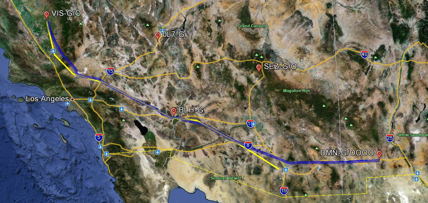
In the 165 NM between Deming and Tucson, NM the desert was starkly beautiful. The harsh landscape was a series of flat wide valleys punctured by nobby hills of eroded cinder cones, ridges of mountains, and tiny mounds. Some of the relief was black, some tan, some red. The mountains are distinct entities. They abruptly sprout from the sand, rise to their rocky heights, and return abruptly into the sand on the other side. I found it fascinating and snapped a lot of photos.
The pop up Red Mountain on the outskirts of the town of Deming.
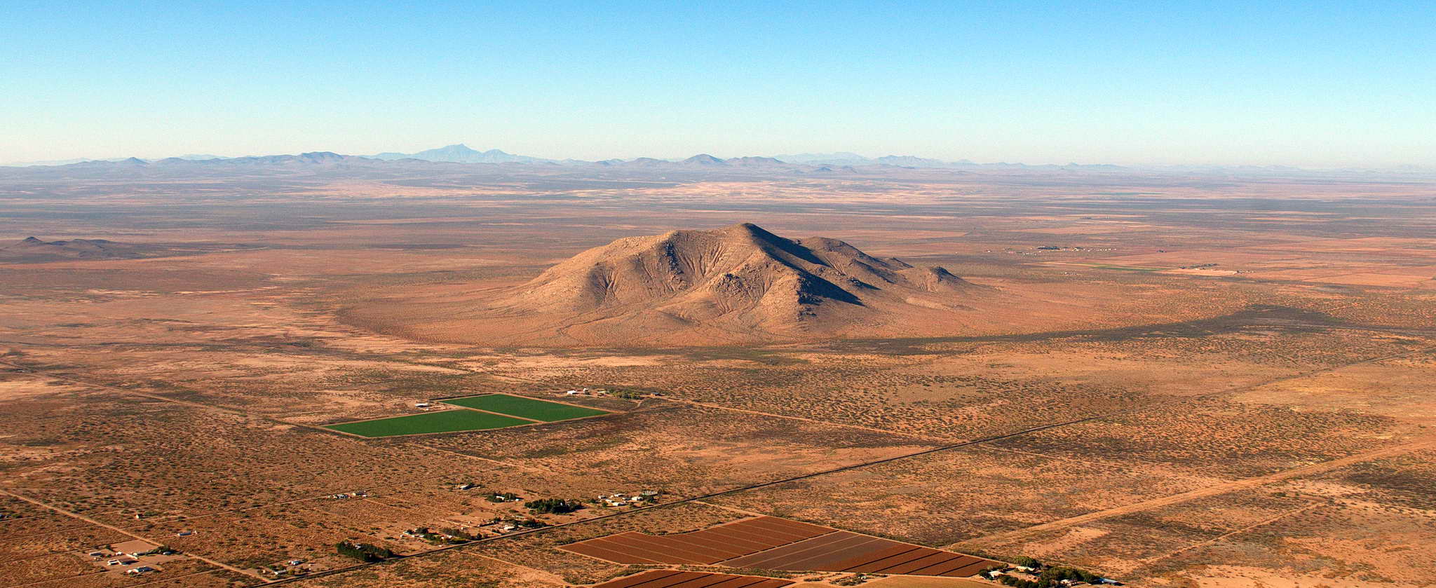
Another 10 NM east are the dark cinder cones of the abrupt Victorio Mountains. Interstate Highway 10 in the foreground. I-10 travels from Los Angeles east then east southeast across the southern Mojave Desert, through Blythe, CA to Phoenix where it turns south to Tucson then east to Las Cruces, NM. There it turns south, crosses El Paso, NM and continues across Texas, to San Antonio, then east all along the Gulf Coast to terminate in Jacksonville, FL. It had been my companion off and on for much of my trip west.
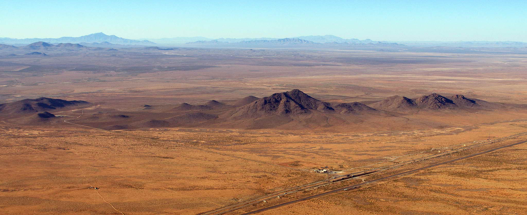
The Interstate Highway 10 pass through the Peloncillo Mountains right on the New Mexico - Arizona border.
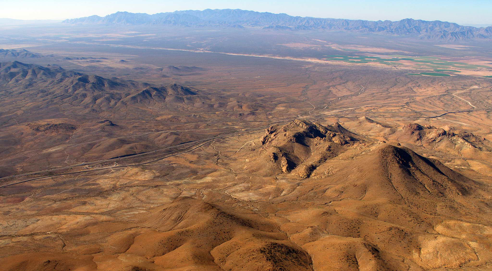
45 NM east of Tucson, AZ are the Mae West Peaks and Mount Glenn just west of Willcox, AZ. At this location I found an interesting landmark on the sectional chart, "underground pipeline". Can you see it?
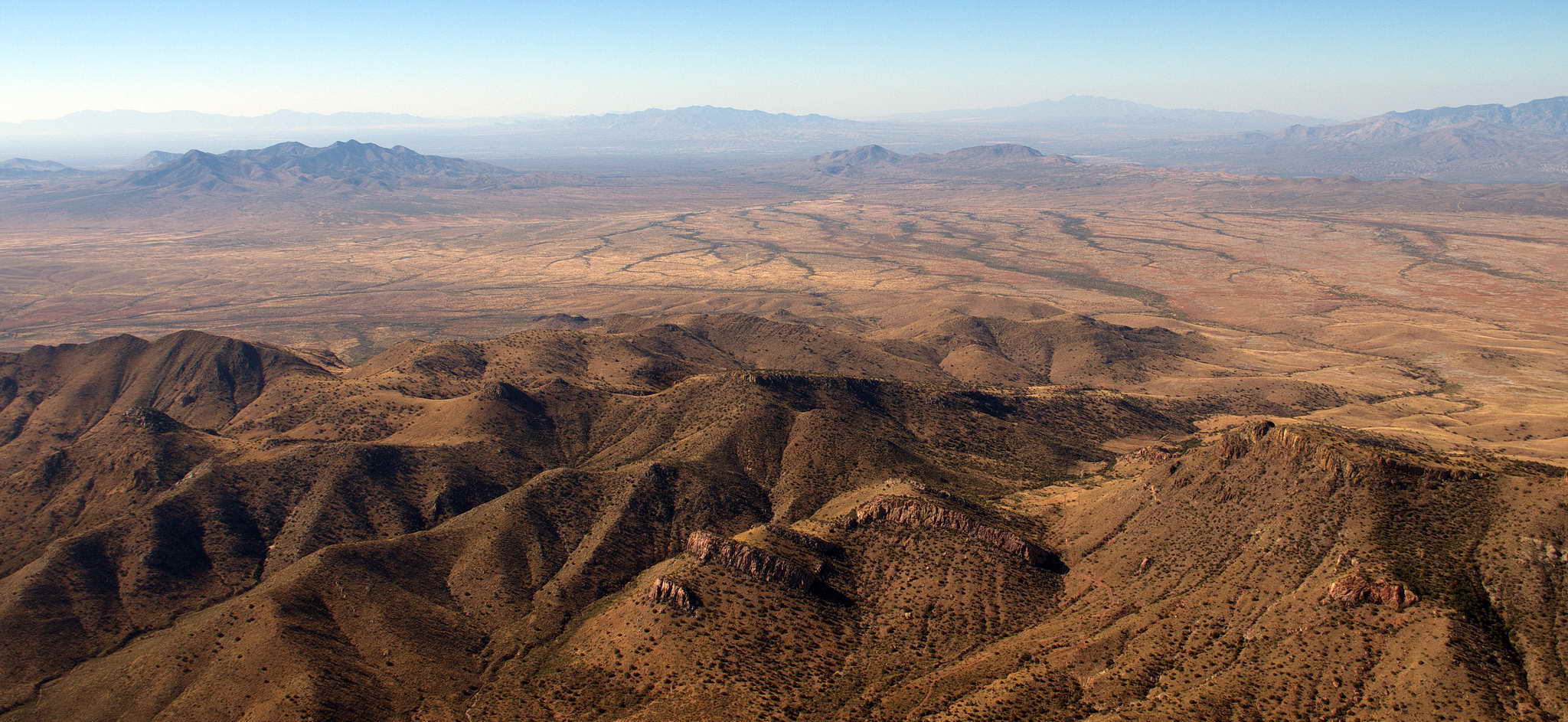
Just a few more miles west of Mae West is the gnarly, contorted Paige Canyon formed by the San Pedro River flowing from the north.
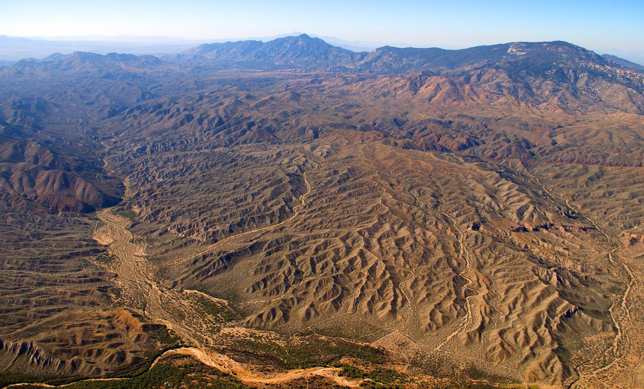
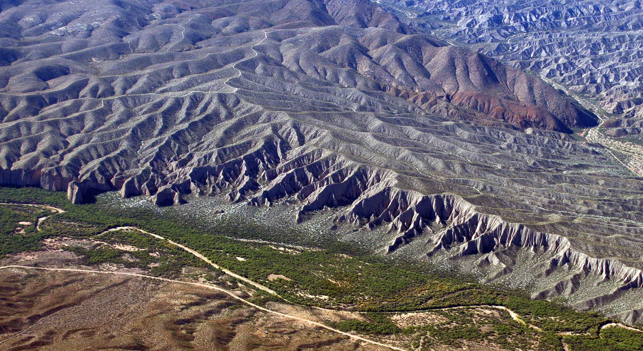
Tucson, at an elevation of about 2500', lies in a valley bordered on the north by 9100' high Mount Lemmon, on the east by 8500' high Rincon Peak in the Saguaro National Park, and on the southwest by 6200' high Keystone Peak in the Sierrita Mountains. I usually avoid or crop out of frame portions of the aircraft but I like the juxtaposition of the right wing and 9100' high Mount Lemmon in this photo. Tucson itself was somewhat of a disappointment. I expected a smaller, quainter Phoenix, but Tucson is much smaller, shorter, and sparser than Phoenix. I can't imagine surviving a summer there.
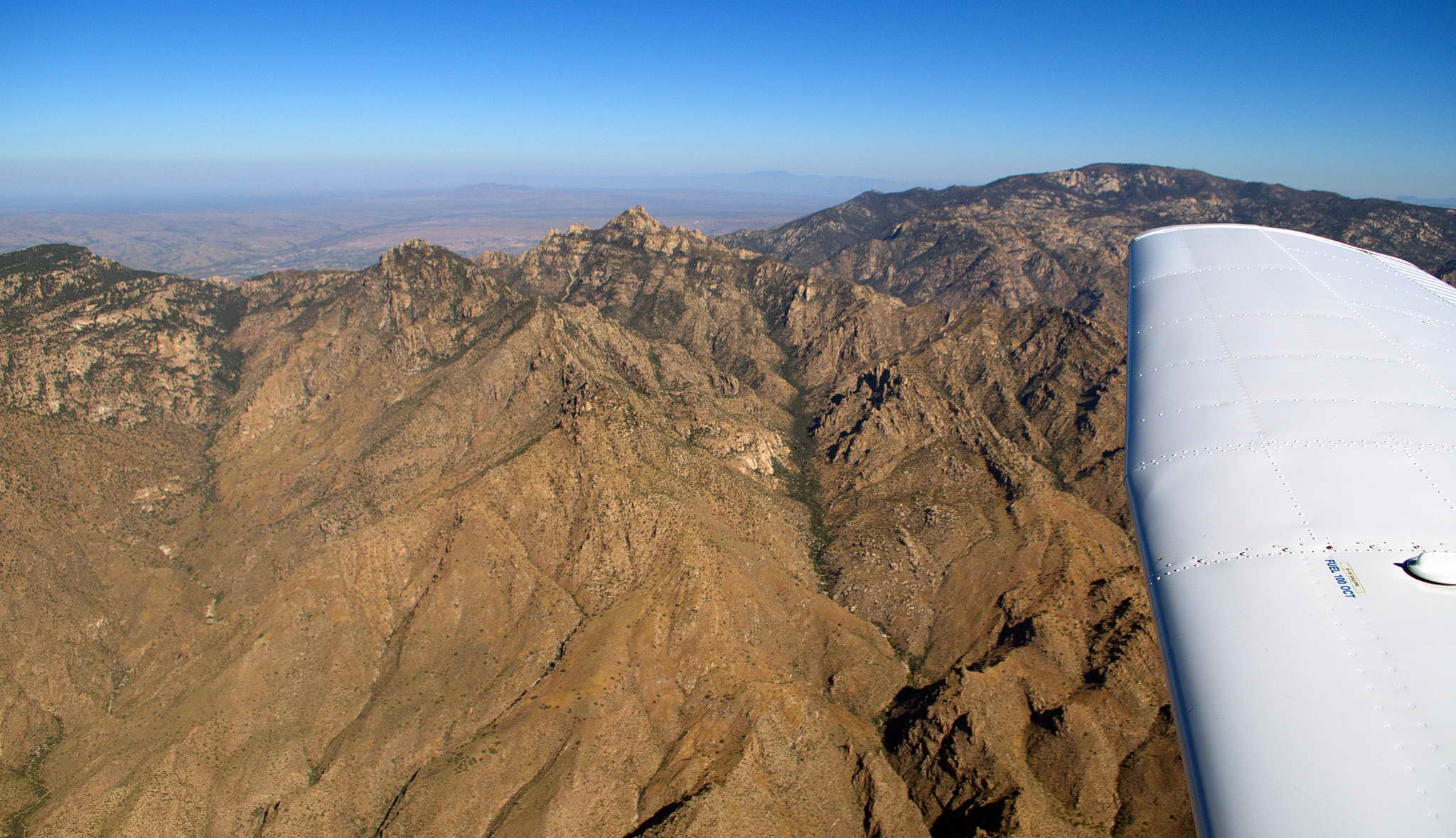
Out of Tucson I aimmed for the Gila Bend VOR (GBN) and followed the edges of a few Restricted Zones to the west-northwest until at the VICKO intersection I was able to round the north end of the string of R-Zones and turn more eastward to land at Blythe, CA for gas.
Just 15 NM northwest of the edge of Tucson is the CalPortland Rillito Quarry which produces crushed rock for cement.
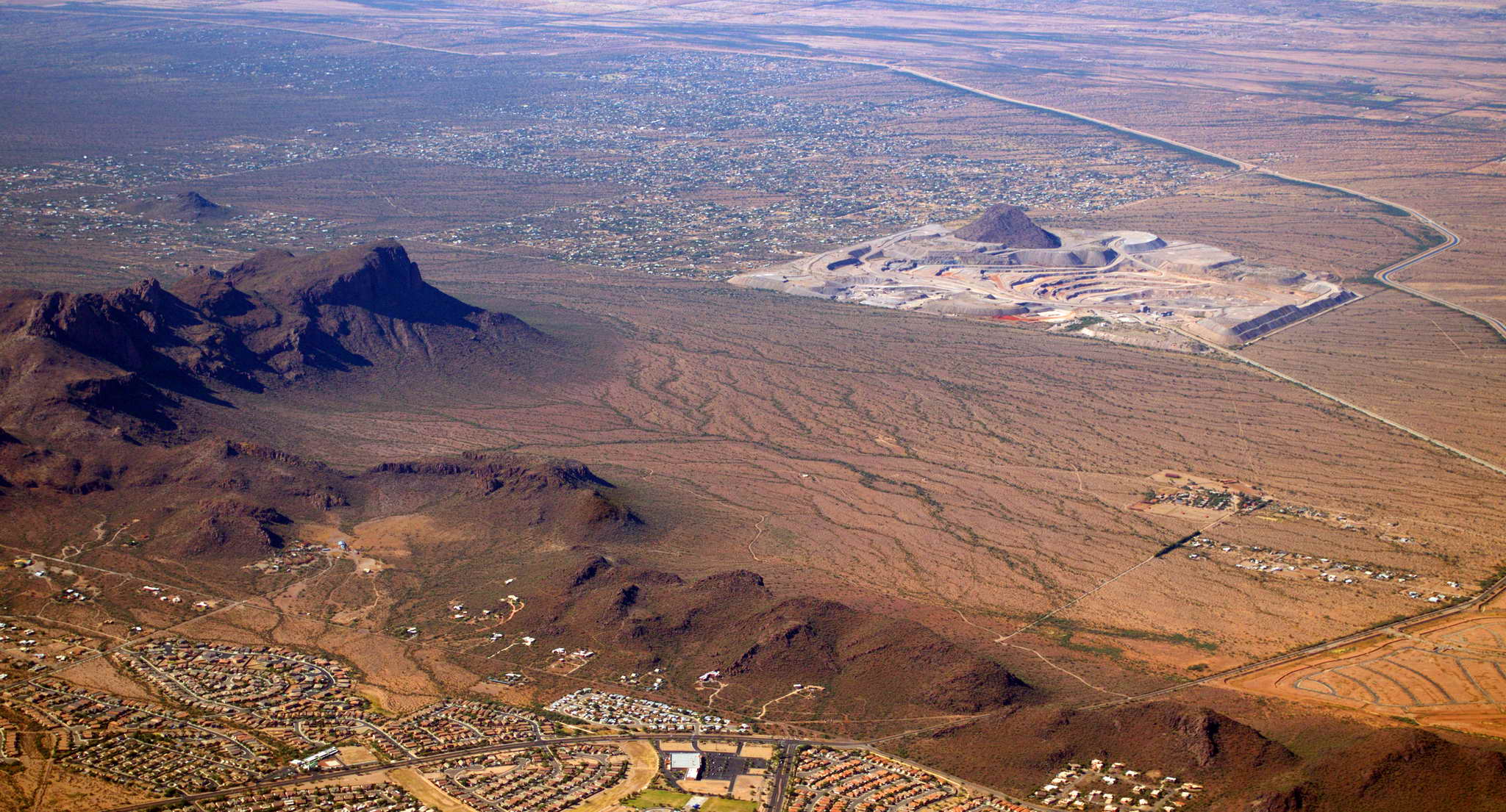
30 NM past Tucson is the Asarco Silver Bell Mine dug into the Silver Bell Mountains. The craggy peaks right-center are Ragged Top (right) and Wolcott Peak (left), and the rounded Samaniego Hills are in the foreground.
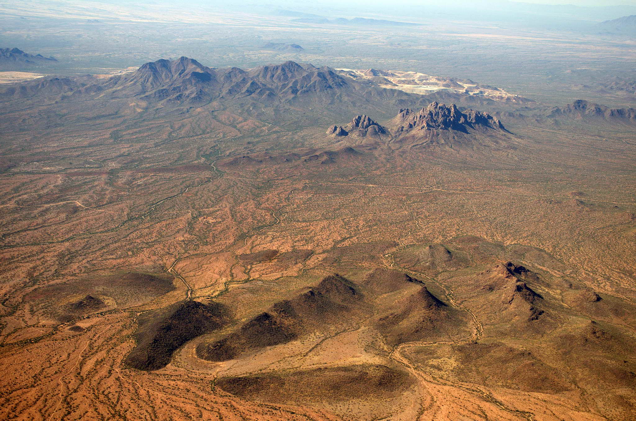
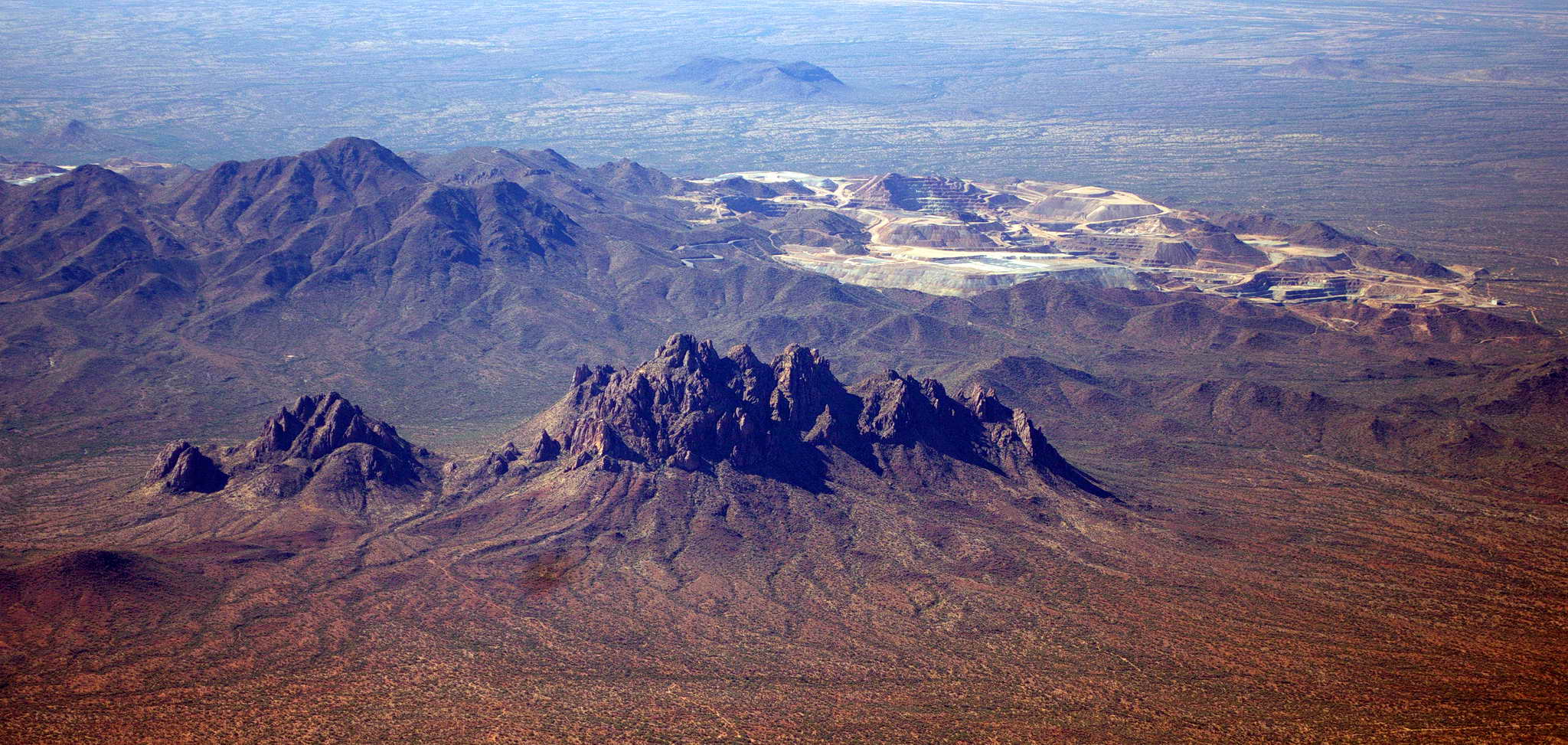
Solo Peak in the Santa Rosa Mountains near Arizona City, AZ.
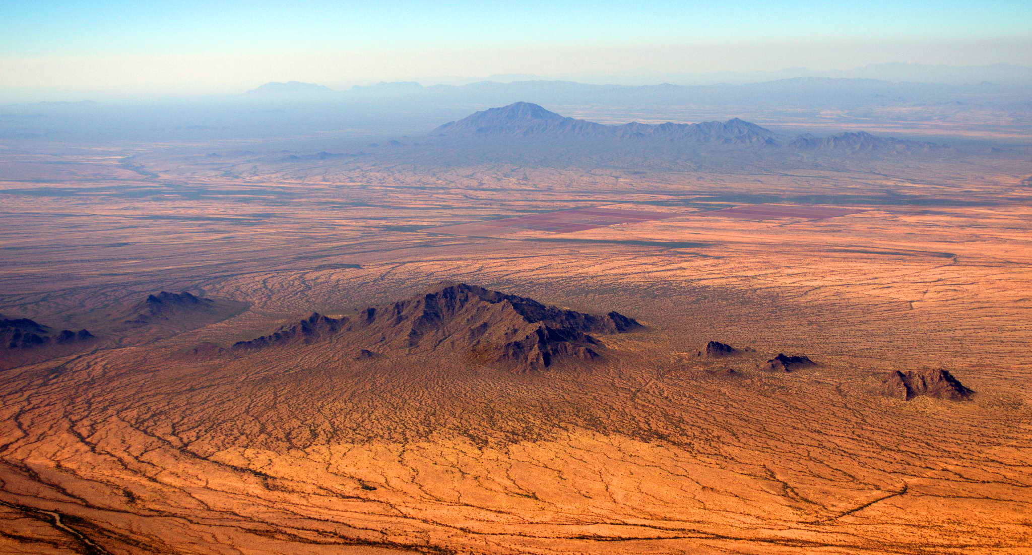
Wild Cat Peak 50 NM northwest of Tucson with a melted cinder cone behind.
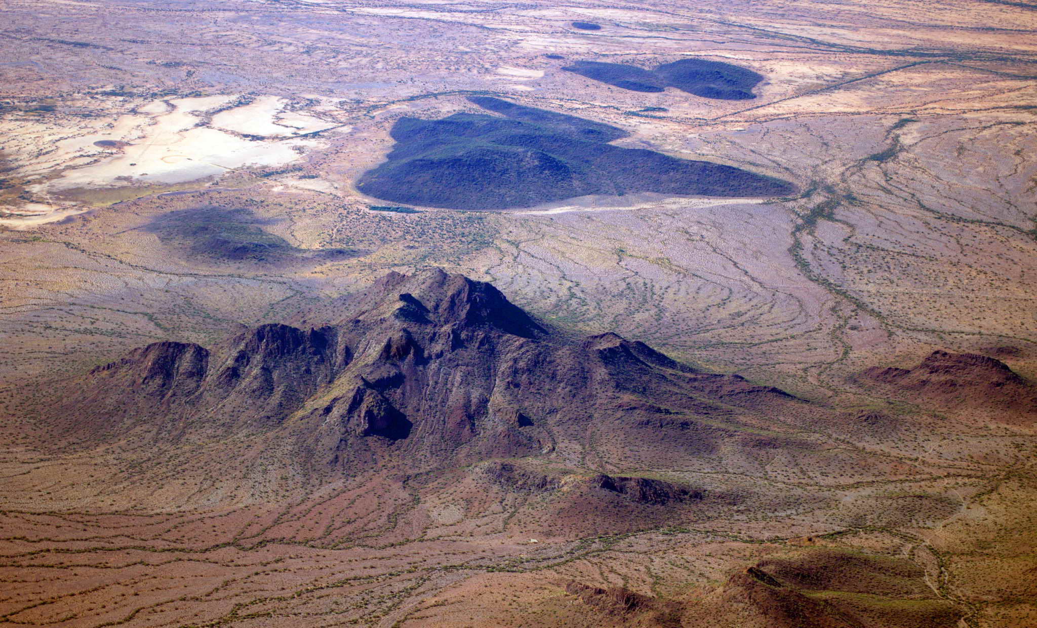
It felt like negative humidity at altitude. The air was bone dry on the ground, and even drier at 8500'. I could feel my lips chapping. The desert scrub brush below hangs so precariously to life that the plants run in thin lines following any hint of water in minute drainage channels. The Table Top Mountains seem to have a sparse green veil crawling up their sides from the valley floor.
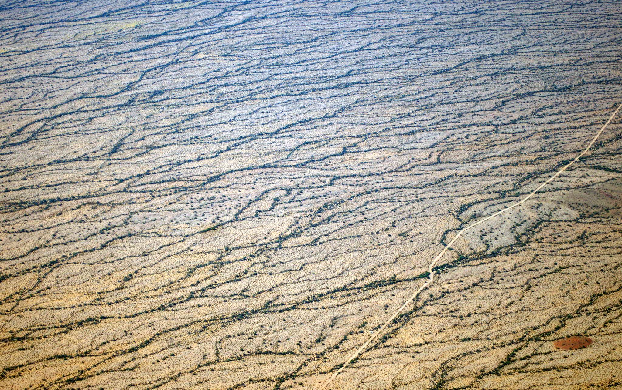
Just before Gila Bend, AZ I found Squaw Tits and the Blue Plateau. Guess which is which.
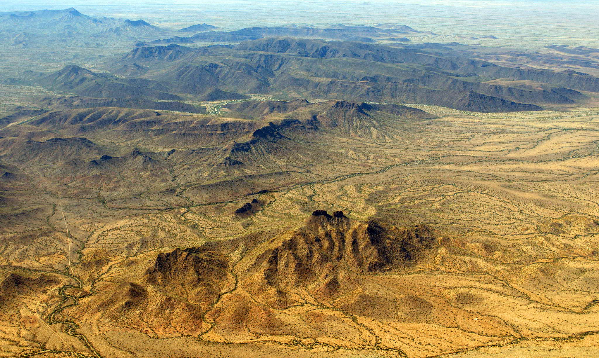
Blythe lies along the California Arizona border in a 60 NM long, Colorado River valley - a narrow, lonely stretch of green in the middle of hundreds of miles of Mojave Desert. I crossed the Dome Rock Mountains and immediately was in California and over the lush agricultural green of the Colorado River valley. It was a sudden, long green emerald in a sea of sand. The southern extent of the Colorado River starts at Hoover Dam flowing from Lake Mead south 100 NM into Lake Havasu, thence 20 NM south to the head of the Blythe agricultural valley. It continues south past Yuma, AZ into Mexico to empty out into the Sea of Cortez, that body of water between the Baja peninsula and the mainland of Mexico.
My fuel stop at Blythe was relaxed. I landed straight-in on 26, a runway replete with spidery lines of asphalt crack sealant, some running the entire length of the 6500' runway. The asphalt softens and flows in the relentless heat constantly forming cracks. Blythe has two perpendicular runways, north-south and east-west, and a single ramp on the south side. The scars of two other runways and their parallel taxiways were still visible. Two large orphaned cement ramps were abandoned on the northeast and northwest sides of the field along side the taxiway scars. The scars spoke of better, more active times in the past. It is a story I saw repeated around the country. General Aviation, private piloting, is dying. In an instant gratification culture of hundreds of TV channels and ever more realistic and sophisticated video games, aviation has lost its appeal to the young.
I had plenty of time to make Visalia so I chatted with the two guys in the office about old cars and motorcycles for about 15 minutes, took a bio-break, then took off 26 and continued to the west.
After Blythe I cruised at 6500' along the southern end of the Mojave Desert which is much more populated than the northern portion I flew over 2 weeks ago. About 30 minutes out of Blythe, between Twentynine Palms and Joshua Tree, ATC dropped my flight following because they had lost me on radar due to mountain shadowing. They asked if I wanted to climb, but the air was smooth, the engine was happy, and the air was comfortable. They let me keep my squawk code so when I re-emerged from the radar shadow I would still be in the system.
About 100 NM out of Blythe I passed the San Bernadino mountains at about 7500'. Along the north slope of the San Bernadino Mountains there are a number of mining operations.
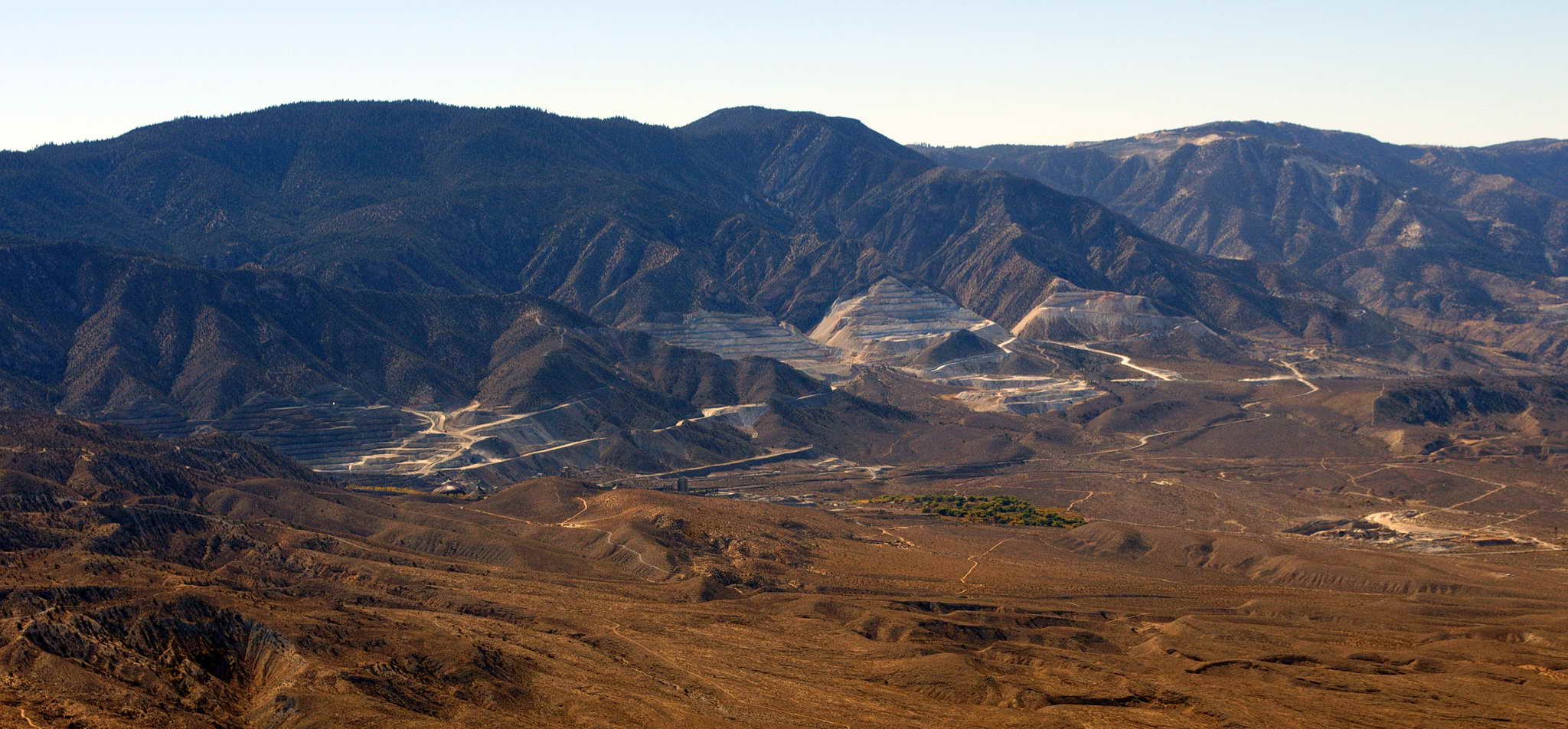
The San Bernadino Mountains kicked up some turbulence and I started bouncing around a bit so I climbed to 8500 and got out of the downwind turbulence. The increase in altitude allowed ATC radar to re-acquire me so I was back on flight following.
This part of the Mojave is home to a number of Air Force Bases and Restricted Zones many of which were hot that day, so I needed to route around them. ATC had me hold my west-northwest course around Victorville about 10 NM farther than I wanted to allow for traffic separation. I was then able to thread my way between Palmdale and Edwards Air Force Base, zig-zagging a bit into Tehachapi, CA. I then straighten out and took aim at Visalia, CA 85 NM away. The southern CA haze, a persistent feature, was about half as thick as it was weeks earlier.
The Bakersfield area is a minor oil producer and about 10 NM northeast of Bakersfield is the Round Mountain Oil Field.
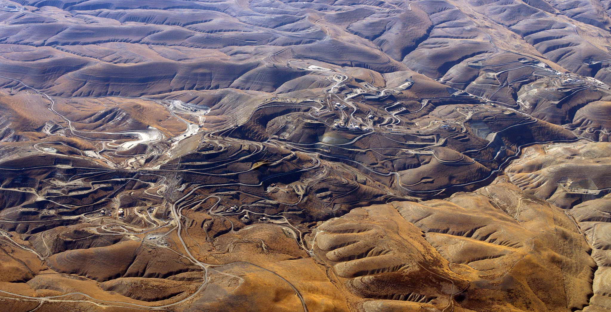
I landed at Visalia (VIS) about 3:23 PM (2223Z) on runway 30 touching down about halfway and exiting at the north taxiway to avoid a long taxi to self-service fuel and tie-downs. Fueled up and bedded down the plane, then hoofed it to the Comfort Inn where I had stayed 3 weeks before. Had dinner in a bar at the adjacent Holiday Inn Conference Center. Checked the next day's weather and figured to head up the central valley as far as possible.
For the pilots, METAR and TAF: (Meteorological Aviation Report and Terminal Aerodrome Forecast)
KMFR 301553Z 00000KT 1/4SM R14/1400V2200FT FG BKN003 OVC010 10/09 A3001 RMK AO2 SLP162 T01000094

KMFR 301342Z 3014/3112 00000KT P6SM BCFG BKN010 OVC100
	FM301900 VRB03KT P6SM SCT020 BKN150
	FM302300 15010KT P6SM SCT040 BKN150
Left Visalia at a relaxed 11:10 AM PDT (1810Z) with a short 4 hour flight ahead. Skies were calm and clear, but the air was hazy with the damned permanent Central Valley inversion. Took off southward on runway 12 and departed out of north downwind rather than taxi a mile to the 30 runway to take off to the north. The temperature on the ground at VIS was 20C (68F). The temperature at 2500 was 20C (68F). The temperature at 4500 was 20C (68F). The temperature at 6500 was 15C and I was somewhat above the inversion haze layer.
I followed the reverse course I did 3 weeks ago. The more boring the terrain the longer the flight seems. It seemed a slow flight northward up the valley. The reported weather was fine at take off all the way up the Central Valley to Redding, CA.
As I proceeded northward up the valley my airspeed remained more or less constant at 110 kts, but my ground speed slowly increased from about 110 kts to 135 kts. A 15-ish kt headwind had turned into a 10-ish kt tailwind.
The 913 MW Pressurized Water Reactor at the Rancho Seco Nuclear Power Plant, located about 25 miles south of Sacramento, is owned by the Sacramento Municipal Utility District and was in operation from April 1975 to June 7, 1989. It was closed by public referendum which raised electricity rates in the state and necessitated more out of state purchases of electricity which in turn raised rates in the neighboring states.
![]()
15 NM northwest of Yuba City is a long slough on the Sacramento River, the Sanborn Slough, a very popular duck hunting destination.
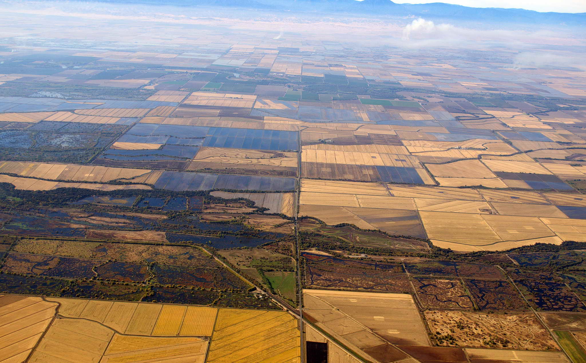
Nearing Chico, CA I could clearly see Mt. Shasta 100 NM north and the Sacramento River mountain pass exiting north from the Valley along I-5 was sporting puffy white clouds indicating fair weather.
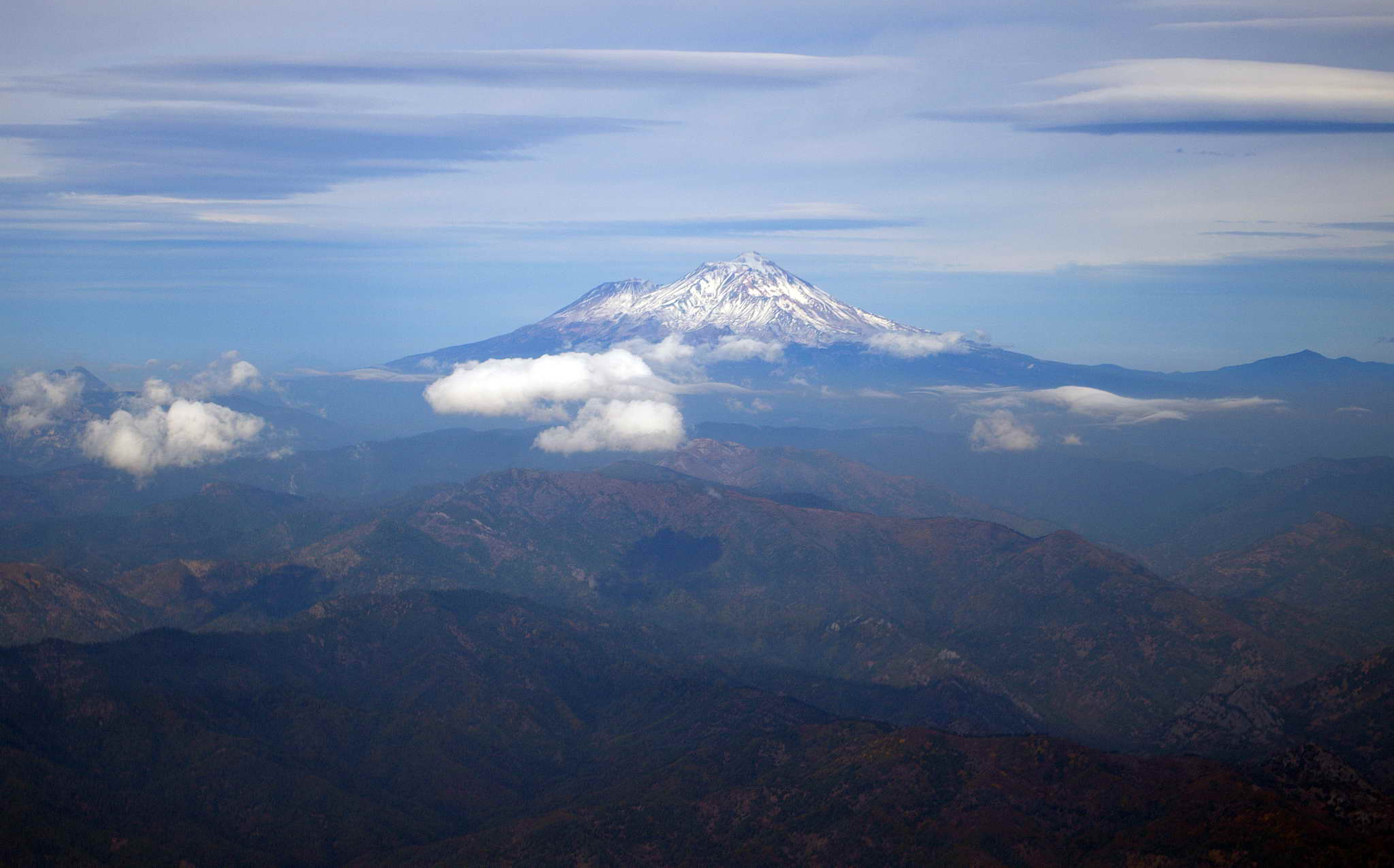
The air had been smooth without a single bump when at Chico I started a slow climb to 8500. At Redding ATC provided a weather report for Medford - clear skies. Shasta lake was showing a red-brown belt where the bank had been exposed by the summer's drawdown.
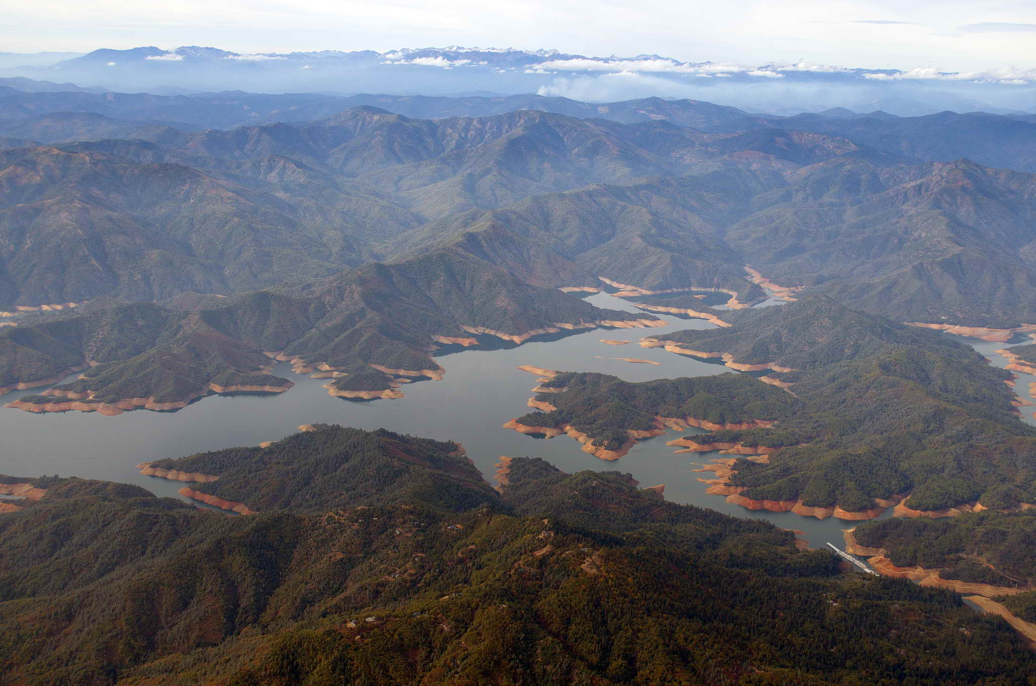
I had been slowly angling more and more north as I traveled up the central valley until after Shasta Lake I was headed almost due true north and I roughly followed I-5 through the mountains. Except for an occasional bump and updraft, the air remained smooth across the pass to Weed, CA making for easy photographs of the Castle Crags and a 3-tiered lenticular cloud off Mt. Shasta.
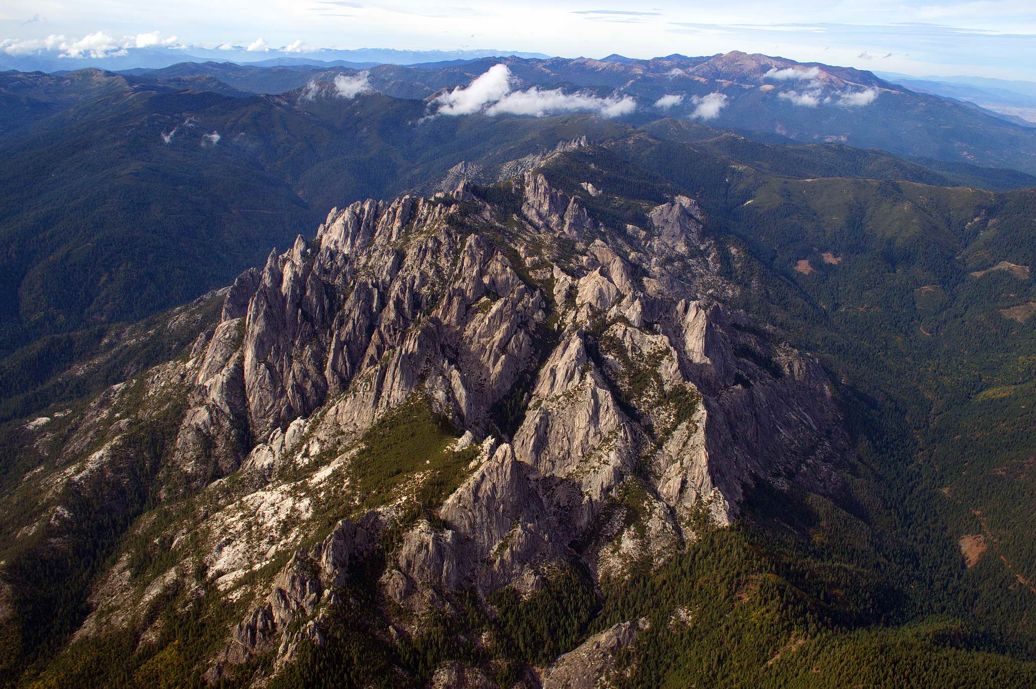
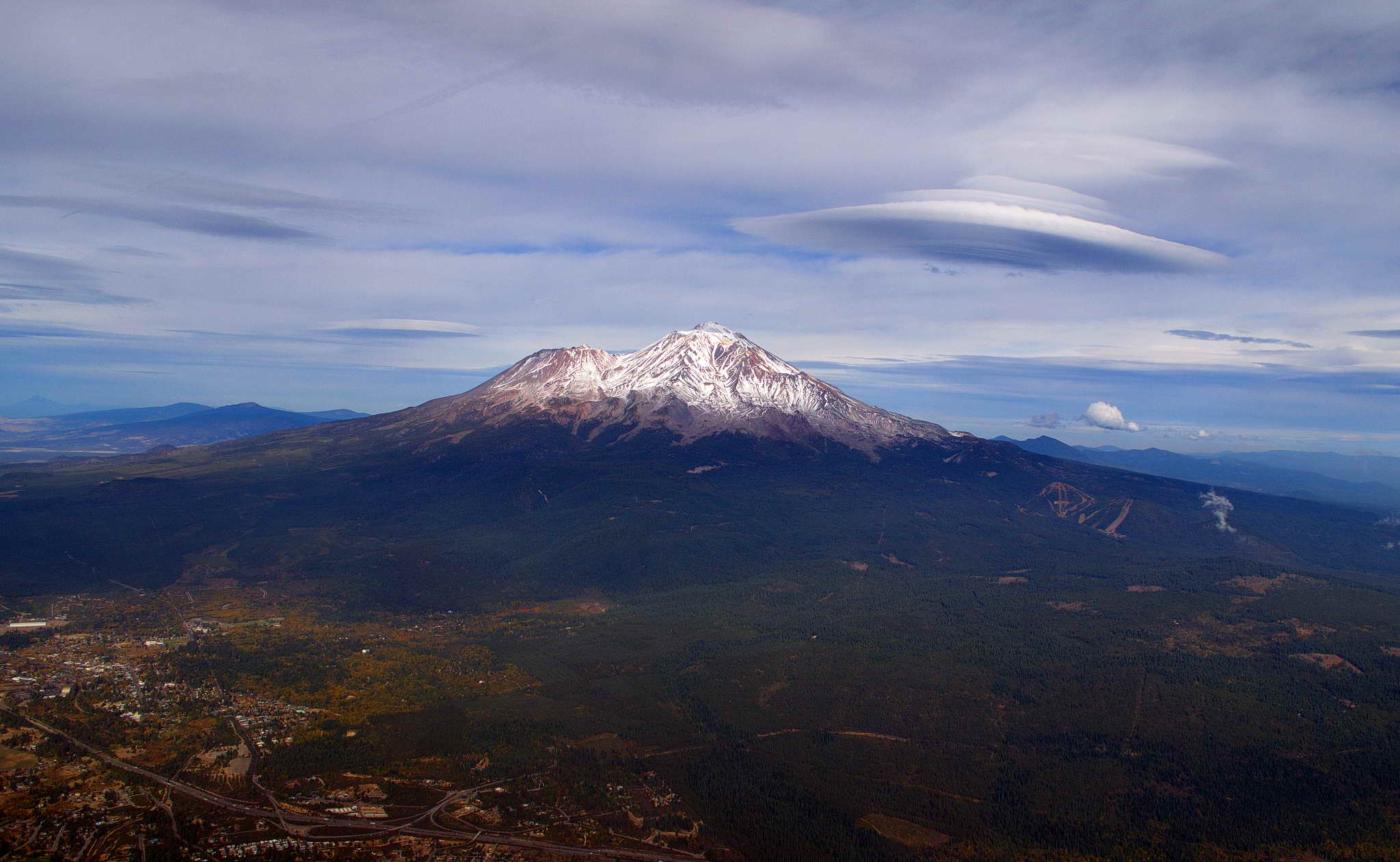
Just beyond Weed, CA in the high valley west of Mt. Shasta things started rocking and rolling. The south wind spilling over the mountains into the shallow Rogue valley swirled into a mess of updrafts, downdrafts, and windshears. It was fun for the short time it lasted.
Just east of Ashland, OR I started a descent from 8500 to 4500 in preparation for an approach to Medford 15 NM to the northwest. Once below the height of the surrounding peaks the turbulance was passing over me and the air smoothed out. As I covered the ground between Ashland and Medford I could see that fall had come to the valley. Splotches of reds and yellows and greens crawled down the valley walls.

The tower cleared me to a straight in on runway 32 at 2:40 PM (2140Z). Ground control directed me to self-service fuel (Million Air) on the north ramp, then directed me to their transient parking. Although a dreaded full-service FBO catering to the kerosene crowd, the ramp guy directed me to a "permanent" tie-down spot and offered to help tie her down, then backed off and left me alone when I politely declined. As such I was done in only about 30 minutes. The receptionist offered to have one of the ramp guys drive me to the Holiday Inn Express on Penninger Road, and they also offered to let me return at any time and borrow the crew car (a Mercedes sedan) for a couple of hours, and call them for a pick up when I was leaving. All this complementary with buying their self-service fuel.
Since I knew the weather had me trapped for a few days I took all my luggage.
The hotel was next door to a large Petro truck stop which was across the street from a Shari's restaurant. The main town was across the freeway and I never was ambitious enough to walk the couple of miles to town. On All Saints Day I took a WSJ, water, coffee, a book, and a camera, and found an out-of-the-way spot in the sun sitting against a large green electrical junction box. Did I mention a thick bath towel to cushion my tender butt? I sat basking in the November sun, reading and smoking a cigar next to something I had only seen once before - a Clean Energy Compressed Natural Gas (CNG) fueling station. This one was still under construction. Compressed gas requires a pressure fitting to transfer from the pump to the vehicle and I pondered for a bit how such an inherently dangerous operation was idiot-proofed. While I was sitting there a clean white pickup with "CLEAN ENERGY" emblazoned on the side drove by my little corner of the world and stopped. The guy smiled and said, I looked like I'd found a nice warm spot. I responded with some pleasantry and asked when the station would be open. He shared that the facility was finished and simply waiting for a final inspection. We wished each other luck and he drove off.
When the cigar was finished and my butt was sore despite the towel, I got up and wandered over to the CNG station to see how it was that consumers were supposed to fill their pressurized tanks with cryogenically stored CNG. I read the instructions on the pump, then took out my camera to take a photo of the instructions. A blue pickup which had been sitting across the lot, raced toward me on a beeline. A youngish guy stopped the truck next to me and asked what I was doing. I said I'd never seen a CNG filling station and was wondering how one filled one's tank. Thought I'd take a photo. I added that I was staying at the Holiday Inn waiting for a weather window to take my small plane into the Seattle area after traveling around the country. He said you're on surveilance camera and the owners would prefer I not take photos. I responded it was no problem and put away the camera. Whatever. No need to prod the paranoid and self-important. I took a long walk instead. But, just to stick it to him, here's a photo of the entire station.
There is another one of these operational CNG fueling stations in Factoria, WA on the same road as the transfer station.
The day dawned clear and cloudless. At 6:30 AM I was heartened when I walked outside and saw clear skies and bright, shining stars. I was allowing a generous 4 hours to complete the flight from Medford, OR to Snohomish, WA and I had about 11 hours of daylight in which to fit it. I had a lot of wiggle room, but I was anxious to get going. Unfortunately, as I ate breakfast fog started to form and by 8AM it was thick. The airport was reporting less than a mile visibility and a ceiling of 100' AGL. I was not going anywhere soon.
Fog has a way of either lingering hours beyond the forecast or suddenly dissapating. I could wait at the hotel or I could wait at the airport for a quick getaway, so at 9AM I called the Million Air office at the airport and a few minutes later got picked up and we drove the couple of miles to the airport. The kid driving had gone off to college in electrical engineering, then returned to Medford where he wanted to settle down. It is a nice place.
At the airport the fog lingered past the 10 AM forecasted clearing. I prepared and preflighted the plane, got my flight plans, weather aids, and navigation aids in order. In 10 minutes I could be off the ground. Then, I sat down to hurry up and wait. Every 30 minutes I walked across the ramp to the end of a long multi-bay hangar and looked to the north assessing the weather. My flight window was slipping and afternoon inclement weather was being forecast for the northern half of the Willamette valley.
Just before noon I looked to the north and could see the fog was breaking up with blue sky appearing. It looked like the weather was willing and I hopped in the plane, started it up, and taxied to the edge of the ramp where I radioed Medford ground control. I asked for taxi instructions to runway 32, and ground control cleared me to the taxiway. The control tower was just 100 yards to my left when the controller said, "garbled-garbled, hold your position". Immediately I braked to a stop, and responded, "2175 November holding position." Then another plane responded that he too was holding position. The controller said laughing, "What's up this morning? I only asked one of you to hold position. 2175N please proceed." The tower squeezed in my takeoff at 12:05 PM while a 737 was on final.
As I climbed out straight out to the north, the vestiges of the ground fog were still blanketing the area to the northwest of the airport around the Table Rocks.
The cloud ceiling to the north looked stable (it was relatively flat as opposed to uneven) and the weather at Roseburg and Eugene was good enough. Climbing to 6500' MSL I picked up a persistent 20 kt tailwind and crossed the low 4000' mountains between Medford and Eugene along a course about 15 NM east of the path of I-5. Shortly after takeoff I started seeing smoke ahead crossing my path. 50 NM north of Medford and east of Roseburg I came across a large active forest fire near the tiny town of Tiller. Mine was the first report ATC had received on the fire and I never did discover if it was a controlled burn, though it did not look like one.
About 1PM I entered the south end of the Willamette Valley at Eugene, OR. The cloud ceiling was over Eugene was a couple thousand feet higher than my cruise altitude, but the view north was not encouraging. It fogged up to the northwest with what looked like heavy rain and lower ceilings. To the northeast the sky was brighter. Ground fog was lingering to the northeast along the eastern foothills which define the Willamette valley. The mountain just right of center on the horizon is Mt. Hood.
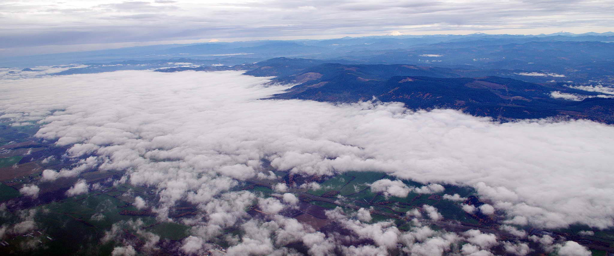
Weather observations from airports ahead were of concern. The ceilings were significantly lower than my cruising altitude and low clouds and rain were moving in from the west. I could make Salem so I pressed on past Eugene. As I headed north the ceiling above me slowly lowered and the weather to the northwest became dark and ominous with ground obscuration due to heavy rain. I was listening continuously to weather observations on my second radio (COMM 2). Weather at Salem was acceptable, but a few miles northwest at McMinnville not so much. Everything looked like it was under water. The thick cloud cover and rain squalls cast varied darkness across the landscape which gave it a look like the under water murkiness of Puget Sound.
I passed almost directly over Salem's McNary Field and continued north concerned that weather would move in behind me and block a retreat to Salem should I need it. A gray wall crossed my course ahead and to the west it was dark with visibilty quickly decreasing. Rain started rattling against the airframe. While at Eugene I had 100 NM visibility beneath the overcast, the visibility had decreased to about 20 NM near Salem. I quickly descended to 4500 in an attempt to see more ground.
It didn't help much so 10 NM north of Salem I continued my descent through 4000'. Visibility was still quickly decreasing, heavy rain straight ahead was obscuring the ground, and worse weather was moving in quickly from the west. As badly as I wanted to get home I turned out tightly to the left having made the decision to return to Salem and wait it out or be stranded. As I made the descending turn I was glad to see Salem was still visible, and I informed ATC of my intentions. The controller offered the observation that radar showed the precipitation only extended about 20 miles north. 6 miles east he saw no precip. He also added he had a VFR plane southbound on "victor airway 25" (V25 - an official "highway" in the sky) that was reporting no precip, high ceilings, and 10+ visibility. The controller was VERY careful NOT to make a recommendation but simply to offer his observations. I continued my intended 180 turn into a 360 and turned out to the east climbing back to 4500 toward a less gray sky. Within a few miles the rain had eased and I started a slow turn to the north. By the time I was 13 NM east of my intended course I was out of the rain under a 7000 foot ceiling and 35 NM visibility. During my diversion to the east I heard another VFR plane reporting deteriorating conditions about 30 NM west of me. The pilot sounded tense and the female controller was giving him vectors to the McMinnville airport to land. At one point she was reporting the airport 5 NM straight ahead and he still did not have it in sight. I was holding my breath, when he finally said, "runway in sight." I could hear the relief in his voice.
I crossed over Portland International airport and angled for Kelso airport with the plan to hop from airport to airport should I need to land due to worsening conditions. From Kelso I aimed for the Toledo airport. Chehalis was reporting moderate precip, and while Chehalis was obscured I was east of Chehalis and could see much lighter terrain ahead after the gray patch. The plane got a bit of a rocking and rolling shower passing east of Chehalis, then broke into 100+ visibility with a 7000 foot ceiling. Passed over Olympia, then Bremerton where I cancelled ATC services. Descended over Puget Sound to stay under the Sea-Tac airspace, circled my house once, then proceeded to Harvey to an uneventful, and welcome landing home.
While fueling up, my hangar neighbor, Dennis Bowman, drove up on the General Lee (bright red lawn tractor with an 01 stenciled on the side) and welcomed me home with a promise of libations. It was good to be home.
| Flight hours: | 67.7 | |
| Distance flown: | 6610.5 NM | |
| Gallons AvGas: | 501.45 | |
| Cost of AvGas: | 3071.58 | |
| Avg. GPH: | 7.407 |