The next day I headed out for halibut to Mutiny Bay which is the first large bay south of Bush Pt. bounded on the south by Double Bluff. It was a nice day, light winds, mostly clear skies, and about 65F. I launched from the Mutiny Bay boat ramp and headed out to join the boats anchored north to south from 1 NM to 1.5 NM out. I geared up with an 18" spreader bar with a 10 oz ball and a Z2 White Glow Squid. Dropped it to the bottom and drifted south with the wind/current. Made 0.67 NM drifts one after the other (6) maneuvering between the anchored boats. Saw nice bottom relief, seemingly humped, overlaping plates. Had 3 hard hits, but nothing stuck. Probably NOT halibut, but other bottom fish who found the bait too big to handle. Saw none of the boats get fish, no hollering, no gunshots, no splashing.
Here is a Google Earth link to my Mutiny Bay track. It shows my track for the 5 hours I was out.
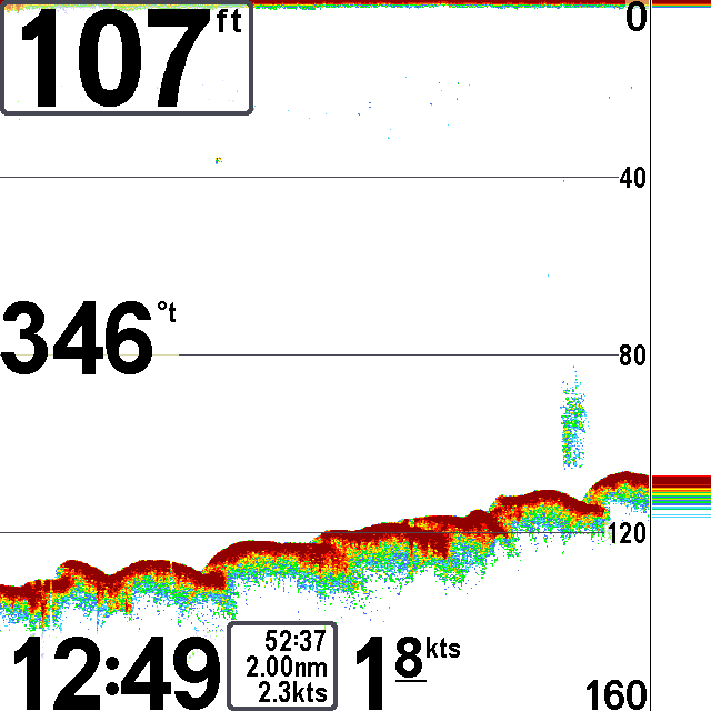
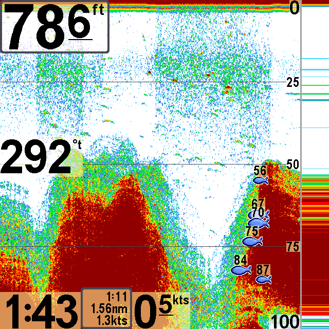
And here is a a screen shot from my sonar showing some interesting bottom relief.
The reason the bay holds halibut is that the fish like to position themselves right under the lip of one of the plates and as the current comes in, it washes food over the lip and they can ambush it. I didn't figure that out until later, so this area should be fished on the incoming current (southbound) with a southward drift. Next year perhaps.
When I got back to shore it was low tide and was loading my gear back up, a guy got his truck stuck in the sand past the concrete boat ramp. He was not the brightest bulb in the package and I ended up towing him out with my truck.
The next day the weather was too windy to take out the kayak so I hung around the house, read, drank coffee and beer, and smoked a fine cigar on the deck.
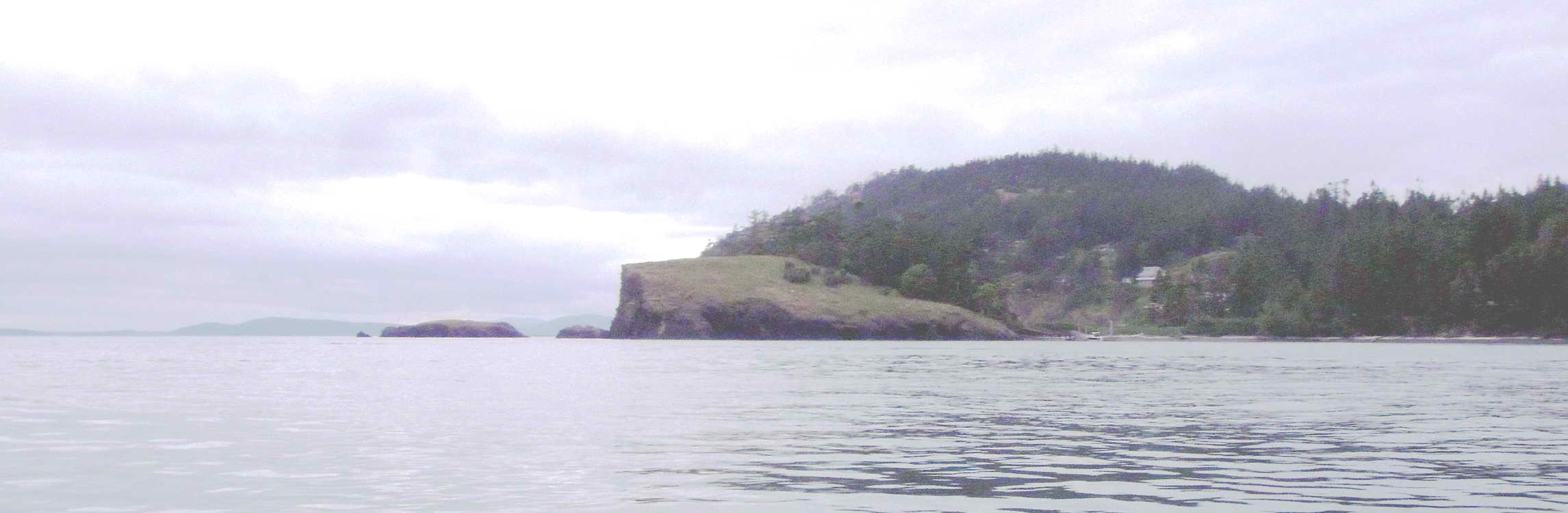
On the 19th I decided to try a well-known lingcod area, Useless Bay. This bay is just south of Mutiny on the south side of Double Bluff. My partial track is show in the KML file above. My phone lost its GPS tracking while fishing. Weather was nice, light winds, blue sky, and 60F.
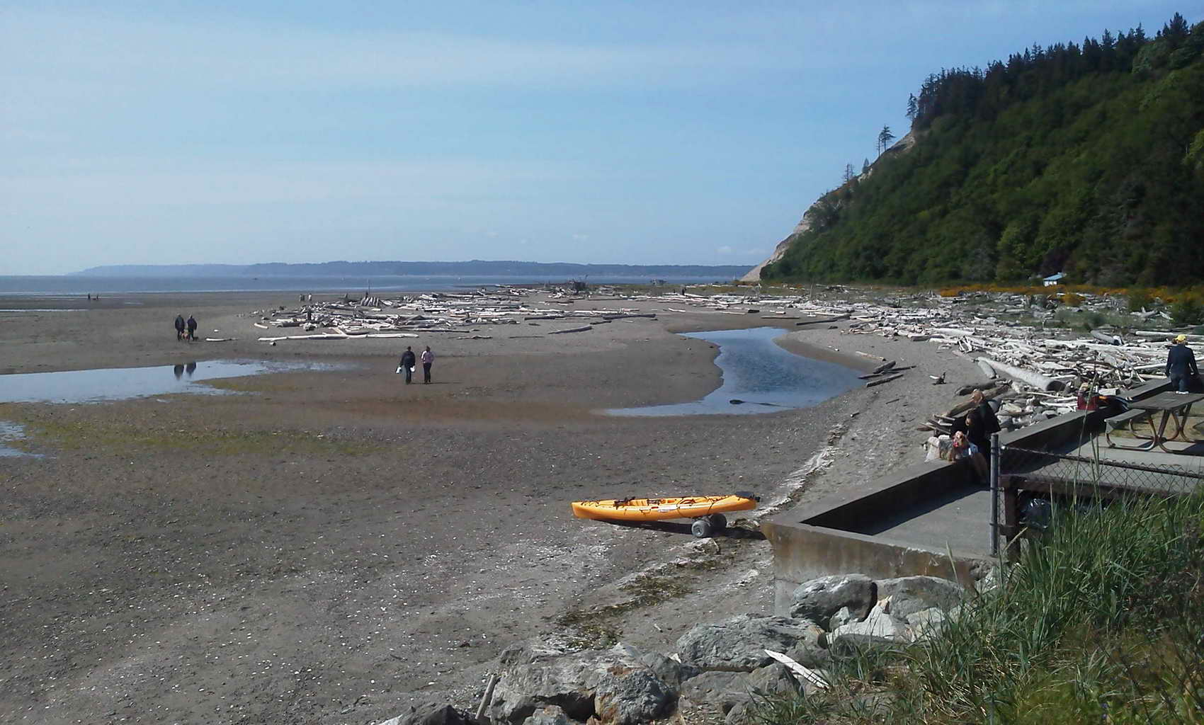
I arrived at the small park at the end of Double Bluff Road. There were three narrow stairs and a bulkhead to deal with, but there was a 3' wide pathway between the bulkhead and the drift logs. The stairs were easy going down backwards on the Wheelez cart, but the turn onto the narrow path was a bit of a problem. Pulled the kayak clear of the logs and carried all the gear and piled it onto the bulkhead. Loaded up the yak, then went back to the truck and got into the drysuit. The tide was out and the bay is called "Useless Bay" because of the huge expanse of shallow sand. It was a 1/4 mile drag across the sand flat to the water. I was huffing by the time I got to the water. Pulled the wheels off the Wheelez and stashed them in the front hatch, with the frame lashed under the front bungie lacing. Here is a photo of my kayak at the top of the beach at Useless Bay. There is nothing loaded on the yak yet.
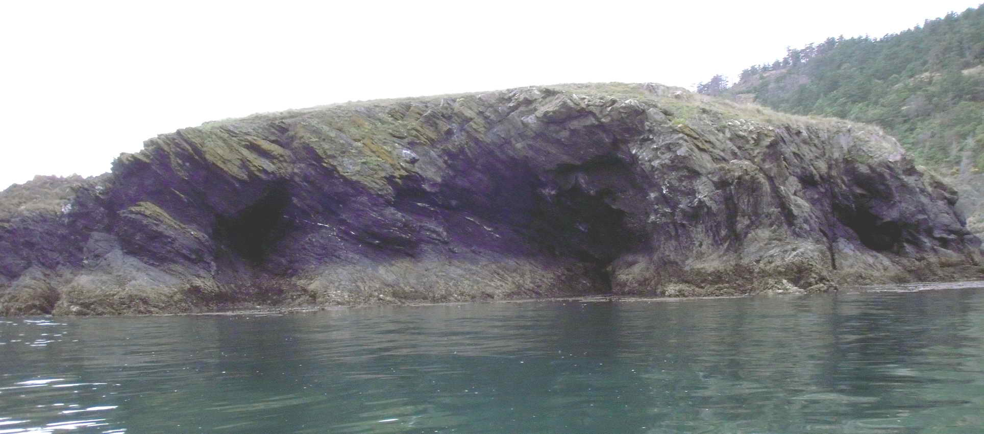
Pedaled 1.5 NM to the 'V' in the bluff. Hence the name, Double Bluff.
Fished water from 30-140' deep. The bottom structure did not look ling like. A number of boats were anchored in the same general area. I wandered about and got a few hits, but nothing stuck and nothing felt like a ling. Again I was banging the bottom with a 6 oz leadhead with a 8" white, glow, Berkley Powerbait Grub.
When I came in the water had risen and the issue was dragging the boat around or through the incurring ponds of salt water. Unfortunately, I had not stowed the bungies in the front hatch with the wheels, but had left them laying on the rear deck. Luckily one remained. I was able to attach the cart well enough to work on the relatively flat sand.
The next day, Sunday, the weather was iffy, so I packed up and headed home.
The first week of June, the 4th, I headed up to Rosario Beach, just north of Deception Pass to fish for lingcod. I was not sure where I was going to launch as the information I had conflicted with what I saw on Google Earth, so I checked into the motel in the morning, then I went and scoped out the situation. People had advised me to launch from Rosario Beach proper - walk out on the path from parking to Rosario Head. North would be Rosario Beach and south is Sharpe's Cove and Bowman Bay. Launching at Rosario Beach was going to require me to lift my kayak and carry it across a large number of drift logs. Launching at Sharpe's cove was going to require me to negotiate a narrow walkway down a steep ramp to a floating boat dock. From the Google Earth view it seemed that launching at the Bowman Bay boat ramp was the way to go. It was. I guess some people are more reluctant to paddle/pedal an exta mile than risk broken bones and torn tissue. The afternoon launch from Bowman Bay was trivial.
The place is very interesting and beautiful. I fished the face of Rosario Head, and all around Northwest Island. I saw fish on the fishfinder, and had a few nibbles, but nothing stuck and nothing was caught. I think I was out for about 5 hours.
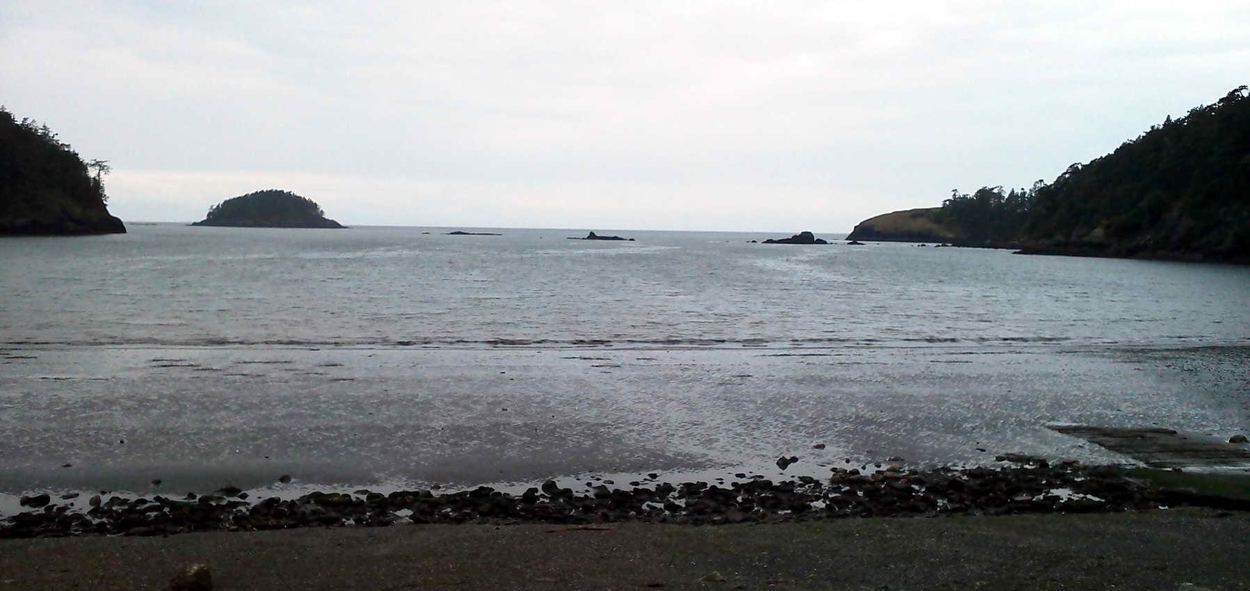
Here is the view from the just to the left of the boat ramp on Bowman Bay. Deception island is to the left, Rosario Head is to the right, and a few rock piles are inbetween.
I concentrated my fishing around Rosario Head and NW Island which is around the Head to the north. Here is a photo of the Head and NW Island beyond.
Here is the side of NW Island.
I did see fish, likely rockfish, but couldn't get anything to stick. Got a couple of nibbles and a jerk or too. Here is a school of fish, hanging out along a dropoff beside a kelp bed.
So once again, skunked. The next morning the winds were whipping, well over 30 knots and while I had planned on fishing decided to head home instead.
The weather sucked for the next few days, and I used them to fish my home water with no results, but the last day of Lingcod season for the yeared loomed large on 15 June.
On 13 June I headed out of my home launch location to try again for another 2012 ling. I fished a few hours, then the rockfish started hitting, and hitting, and hitting. I landed 8 or more that day, but of course, rockfish are rare and endangered in Puget Sound so they are CLOSED for retention. They all were released. Here's the best photo of the day's rockfish.
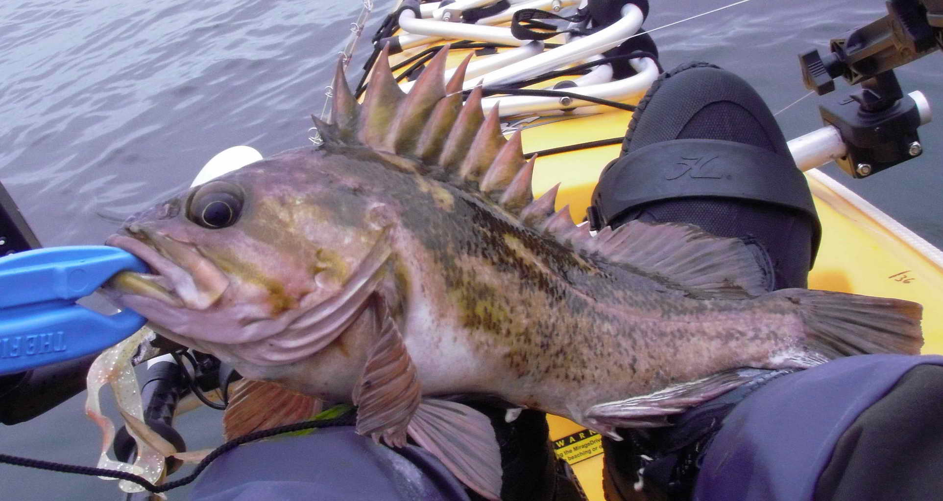
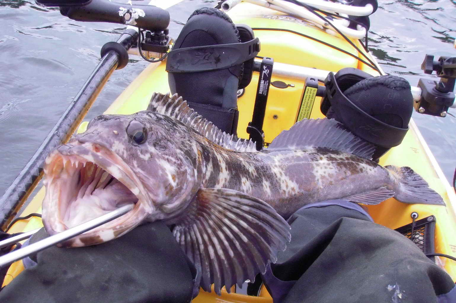
I did get one keeper ling that day, and here it is, smiling for the camera.
I went out the next day and caught 11 rockfish, but no lings. Then the season ended.
Here is a GPS track of my movements on the water over the two days.
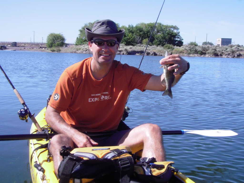
Here was the sole result of our combined 24 hours of fishing - a very smallmouth bass. Nevertheless, we did have a good time.
14 May I left Snohomish Harvey Field (S43, 2671'x36') about 11AM bound to bag 5 new airports. Generally, I try to photograph each new airfield at which I land, but on this trip I simply forgot.
On 11 June I flew up to Friday Harbor on San Juan Island and had lunch with my hangar neighbors at Ernie's Cafe. My hanger houses 6 planes, 3 on each side, and all three of us "same-siders" happened to be there at the same time, so we decided to have lunch. Ernie's was started by a friend of Ernest K. Gann's with permission from his wife to name it after Ernest.
On 25 June I squeezed a flight inbetween a couple of days of bad weather and bagged another new airport. Silverdale Apex Airpark (8W5) is a 2500'x28' residential airpark on the east shore of Hood Canal. Very nice looking place. I had a hard time discerning the wind direction on the ground and set up for one end of the runway, then changed my mind and went for the other, then changed it again, so the GPS track is a bit confused. After Apex I headed up to Mt. Vernon Skagit Bayview (BVS), then back home to Harvey. I took some photos of the mud flats on the way to BVS. Fly it with this link. Cloud Ahoy Flight Log